

Photo: Yaarahmadd, with thanks · CC BY-SA 4.0 · via Wikimedia Commons · temporary stand-in photo

Shakarparian
A low hill and park near Zero Point in Islamabad. Its terrace at the Pakistan Monument gives easy views over the city to the Margalla Hills, best near sunset.
Overview
Shakarparian is a hill and park beside the Zero Point interchange in Islamabad, and part of Margalla Hills National Park. Before 1947 members of the Gakhar tribe lived here. The clan was moved in 1960-61 to make a park for the new capital (Wikipedia). It is a short, low viewpoint rather than a high one. Wikipedia does not give an altitude and there is no known reliable figure, so we give none.
Plan your visit
- Nearest town
- Islamabad
- Getting there
From central Islamabad it is about 11 km and 9 minutes by car to the Pakistan Monument (OSRM, 16 Nov 2026). Taxis and ride-hailing cars are the simplest way. More
Best months
Feb – Apr, Oct – Nov
- Shakarparian
- Related places nearby: Pakistan Monument Museum, Islamabad, Margalla Hills National Park
Pakistan Monument
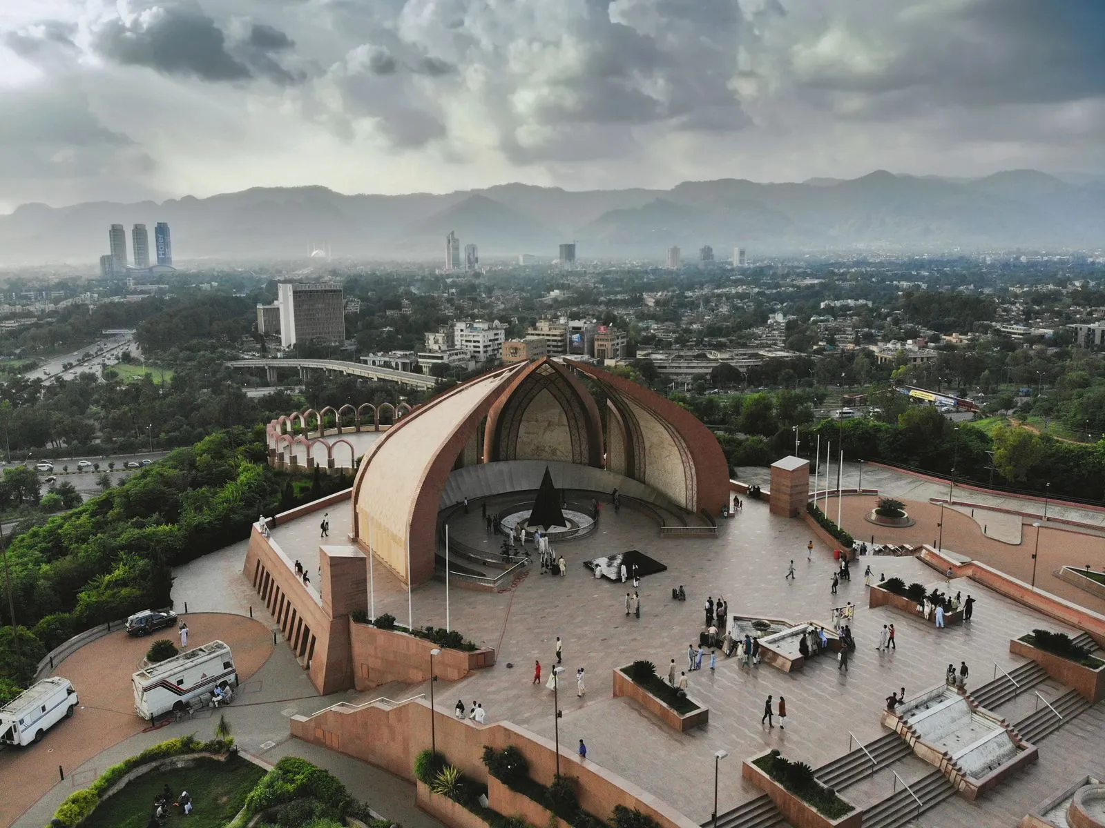
The monument is on the western slopes of Shakarparian. Its design was approved in 2003, the foundation stone was laid in 2004 and President Pervez Musharraf inaugurated it on 23 March 2007. Arif Masoud designed it. It is 18 m tall and covers 2.8 hectares.
Seven granite petals rise like an opening flower, drawing on the muqarnas (stacked-niche) forms of Mughal architecture. The four large petals stand for the Punjabi, Baloch, Sindhi and Pashtun cultures; Wikipedia says they are not meant to stand for the four provinces, despite a common belief. The three smaller petals stand for minorities, Azad Kashmir and Gilgit-Baltistan. Seen from the air, the petal walls form a crescent moon. Inside, a stainless-steel crescent carries writing by Muhammad Ali Jinnah and Allama Iqbal, and a black granite star with golden stars honours those who died for Pakistan. Murals on the inner walls show landmarks such as Lahore Fort, Badshahi Mosque, the Khyber Pass and Minar-e-Pakistan, as well as independence-movement figures. Wikipedia reports 514,944 visits in 2018.
Lok Virsa's Pakistan Monument Museum is on the same site. It has a wax museum on the Pakistan Movement, a reference library, an audio-visual archive and a 62-seat Panorama Hall. See also Pakistan Monument.
What to see and do
- Pakistan Monument terrace. A circular terrace beside the monument gives open views over the city towards the Margalla Hills. Lok Virsa's museum is on the same site; see our museum page for hours and ticket prices.
- Parade ground. The Pakistan Day Parade is held here every 23 March (Wikipedia).
- Star and Crescent monument near the park entrance.
- City views. Wikivoyage calls Shakarparian a wild, hilly area south of sectors G-6 and G-7, good for an evening walk.
- Walks. The Capital Development Authority is replanting with indigenous pine and replacing paper mulberry, which causes allergies (Wikipedia). Short paths run around the hill.
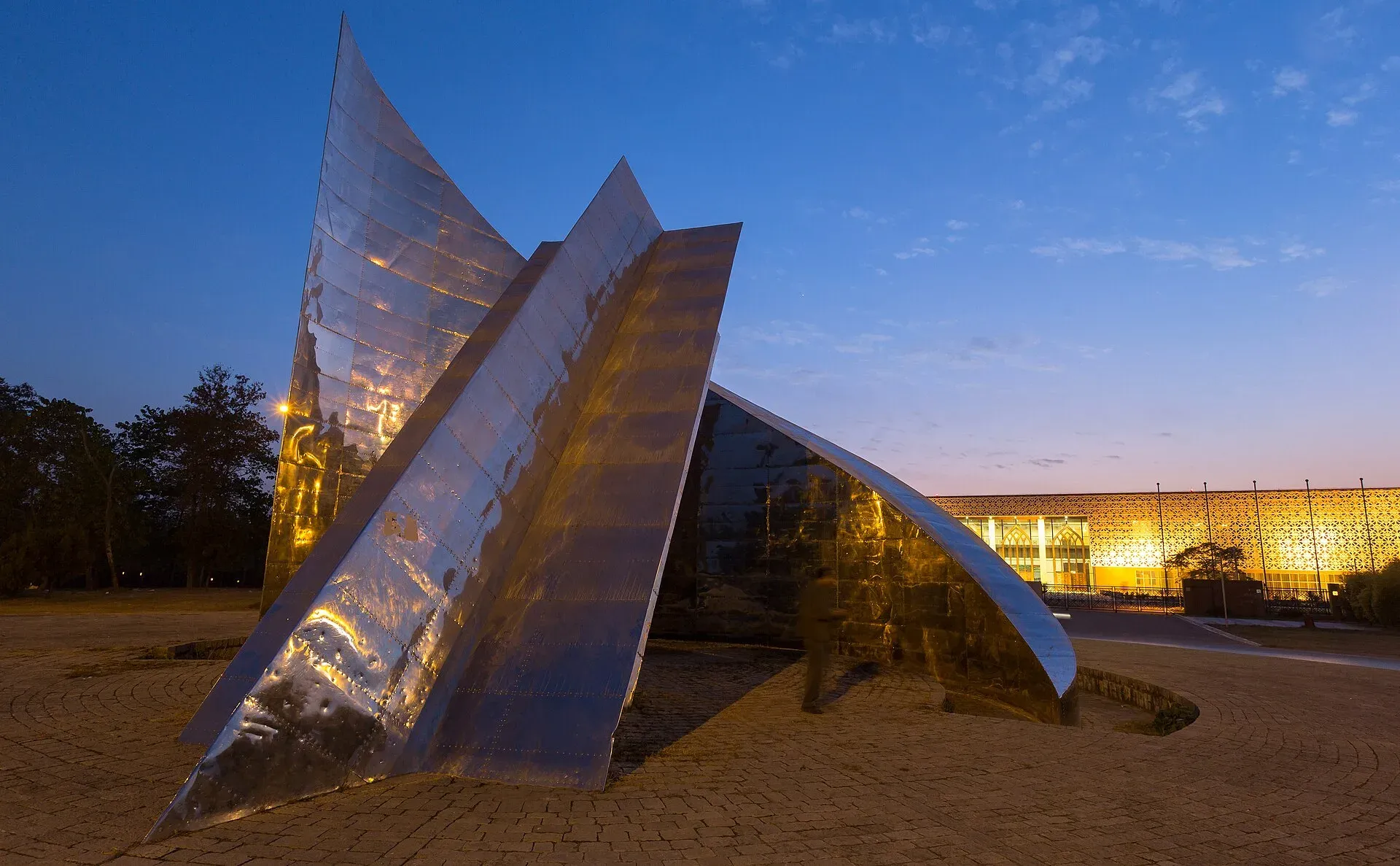
Photo: Ahmed Sajjad Zaidi, with thanks · CC BY-SA 3.0 · via Wikimedia Commons · temporary stand-in photo

When to visit
Our general advice, not an official figure: the last hour before sunset is the most popular time, and it is also the busiest at weekends. October to April is cool and clear. Summer afternoons are hot and exposed. The 23 March parade rehearsals and day itself may close roads and areas.
Getting there
From central Islamabad it is about 11 km and 9 minutes by road to the monument (OSRM, 16 Nov 2026). Taxis and ride-hailing cars drop you at the entrance. The monument is a short drive from Zero Point and Faisal Avenue.
Where to stay and eat
Hotels and restaurants are in the Blue Area and nearby sectors. We have no verified business names.
Good to know
- Park opening times are given differently by different guides, so confirm on the day.
- The Pakistan Monument Museum's own hours are on its official page, which we checked on 16 November 2026.
- Entry to the museum has fixed ticket prices listed on our museum page; entry to the park grounds is not confirmed here.
- Safety. For foreign visitors: the UK FCDO Pakistan page (updated 27 October 2026, checked 16 November 2026) does not name Islamabad Capital Territory.
Highlights
- Easy city views from the Pakistan Monument terrace
- Good sunset spot, close to Zero Point
- Pakistan Monument Museum on the same site
- Site of the 23 March parade
Tips
- Visit in the last hour before sunset for the best light
- Expect crowds on weekends and holidays
- Confirm park opening times on the day
- Wear a hat in summer; the terrace has little shade
Facilities
- Monument terrace
- Museum
- Parade ground
- Parking
Photos we still need: the parade ground and the park's walking paths. Send us yours
Sources and last checked
Last checked Confidence medium6 sources3 still to check
- Last checked
- Method
- Desk research from published sources
- Confidence
- medium
- Checked by
- trek.pk research team
Researched from published sources; not yet checked on the ground by our team. Spot something out of date? Report a mistake.
Sources
- Shakarparian (Wikipedia) · Wikipedia · checked
- Pakistan Monument Museum · Lok Virsa · checked
- UK FCDO Pakistan travel advice · UK Foreign, Commonwealth & Development Office · checked
- OSRM public routing service (road distances and times, 16 Nov 2026) · OpenStreetMap / Project OSRM · checked
- Pakistan Monument · Wikipedia · checked
- Islamabad · Wikivoyage · checked
Still to be checked on the ground (3)
- Park opening hours
- Altitude of the viewpoint (not in Wikipedia)
- Park entry charges
Nearby and related

Pakistan Monument Museum
A history museum beside the Pakistan Monument on Shakarparian Hill, Islamabad, run by Lok Virsa. It tells the story from ancient civilisations to the creation of Pakistan.

Islamabad
Pakistan's green, planned capital at the foot of the Margalla Hills: Faisal Mosque, hillside trails, cafes and the gateway to the north.

Margalla Hills National Park
The green hills above Islamabad: hiking trails, viewpoints, leopards and goral, a few minutes from the city centre. Established in 1980 and covering about 174 square kilometres.