

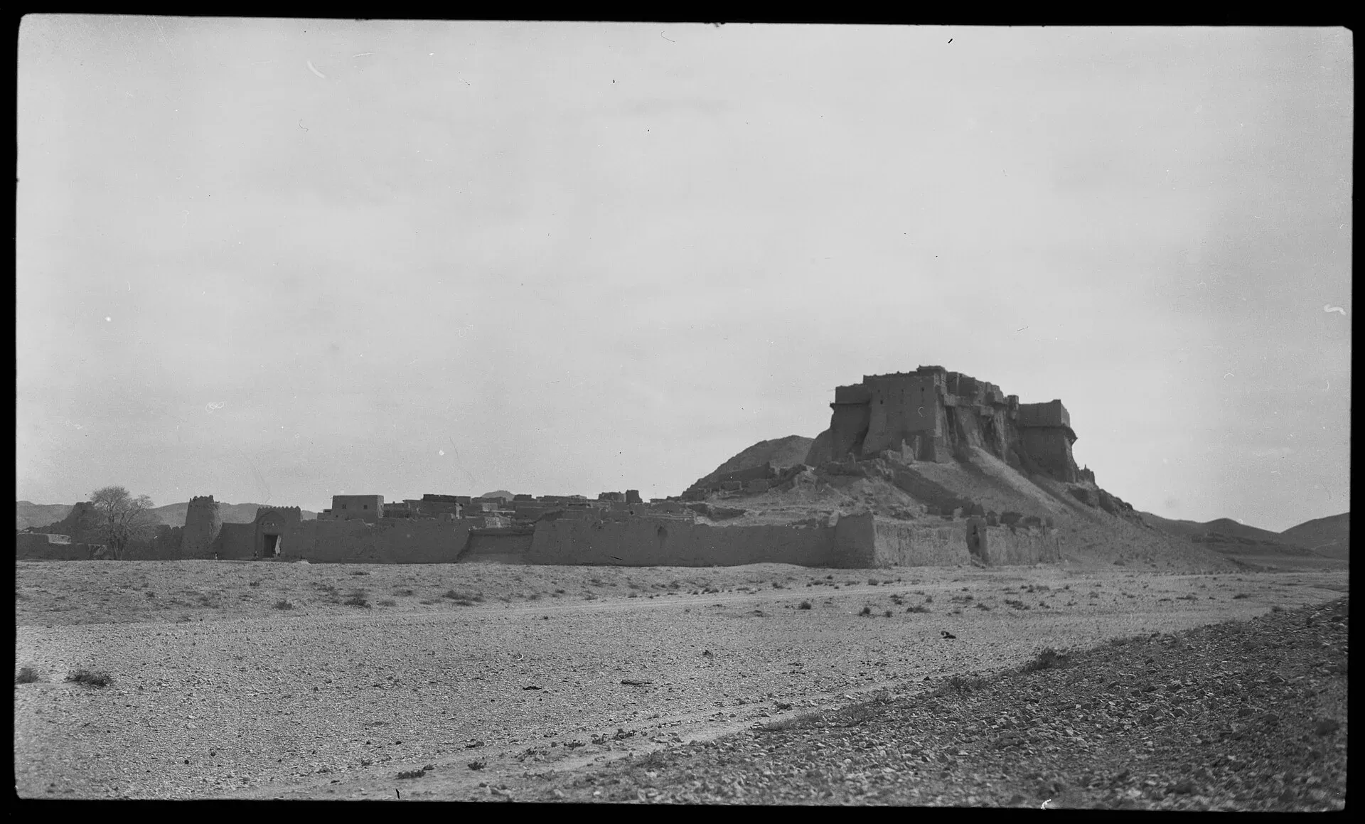
Photo: Georg Morgenstierne, with thanks · Public domain (CC0) · via Wikimedia Commons · temporary stand-in photo

Kalat
Historic capital of the Khanate of Kalat in the Central Brahui Range, now headquarters of Kalat District and Division.
Overview
Kalat (also Qalat) is a town in the Central Brahui Range, at about 2,007 m (Wikipedia), and the headquarters of Kalat District and Kalat Division. Its name comes from the Arabic word for fortress. It was the capital of the Khanate of Kalat from the 17th century to the mid-20th. The 2023 census counted 44,440 people (CityPopulation.de). Kalat sits on the N-25 highway between Quetta and Khuzdar.
Plan your visit
- Getting there
Road: Quetta about 142 km (about 1 hour 50 minutes); Khuzdar about 164 km (about 2 hours) (OSRM, checked 16 November 2026). Rail and air: none. More
Best months
Apr – May, Sep – Oct
The Khanate of Kalat
The khanate, also called the Brahui Confederacy, formed in 1666 from a union of nomadic Brahui tribes under the Ahmadzai dynasty. Its first ruler was Mir Ahmad Khan I, who ruled to 1695. Wikipedia's Kalat page says the Mirwari clan took the town in about the 15th century, and local tradition says an earlier Hindu ruler named Sewa held it, which is why the town was also called Kalat-e-Sewa.
The best-remembered ruler is Mir Nasir Khan I, known as "The Great" (ruled 1749 to 1794). He fought 25 campaigns, made the Talpur dynasty of Sindh pay tribute, set up a central administration and issued his own currency. At its mid-18th-century peak the khanate stretched from Kerman in the west to Sindh in the east, and from the Helmand River in the north to the Arabian Sea.
British forces besieged and sacked Kalat in 1839, during the reign of Mehrab Khan. A treaty with the British agent Robert Sandeman, dated 1876 in most sources, made Kalat a self-governing state in a subsidiary alliance with British India. In August 1947 Kalat declared independence. It acceded to Pakistan on 27 March 1948 under the last khan, Ahmad Yar Khan, and Governor-General Muhammad Ali Jinnah accepted the accession on 31 March. Historians disagree on whether it was willing or coerced. The state merged into West Pakistan's One Unit on 14 October 1955. The title of Khan is still claimed by his descendants.
What to see and do
The history above is the reason to know Kalat. A 1908 source describes a citadel where the Khan resided, and Wikipedia says a Hindu temple to Kali, said to predate Islam in South Asia, stands at the foot of the old fort. The current state and visiting rules are unverified for the fort, the palace and the temple, so ask the district administration before you plan around them.
People and climate
Brahui is the main language, spoken by 83.9% of people at the 2023 census, followed by Balochi at 12.9%. About 97% of residents are Muslim and about 3% Hindu. Many Hindu residents are Hindkowan merchants who regard Kalat as their homeland.
Kalat has a cold desert climate. Annual precipitation averages about 163 mm. January averages about 3.4 °C and July about 24.8 °C, and the lowest temperature on record was minus 17 °C in 1978 (Wikipedia).
When to visit
Spring and autumn are most pleasant. Winters are cold; summers are mild.
Where to stay and eat
Services are those of a district headquarters: expect a government hospital, pharmacies, fuel stations, banks or ATMs and basic guesthouses or hotels in the main bazaar. There is no verified list of facilities or businesses, so confirm before you rely on any of them, and carry cash and fuel.
Good to know
Quetta is about 142 km (1 hour 50 minutes) and Khuzdar about 164 km (2 hours) by road (OSRM, checked 16 November 2026, optimistic), on the N-25. Buses and vans use this road. Surab, the next district town to the south, is covered on its own page.
Ask the district administration or local police about current conditions before you go. Safety: For foreign visitors: the UK FCDO advises against all travel to Balochistan, including Quetta and Ziarat (page updated 27 October 2026; checked 16 November 2026). We do not recommend visiting as a tourist. If you live here or have essential business, follow current guidance from the provincial authorities and your embassy, expect checkpoints, and do not rely on this page for planning. The FCDO also notes an ongoing risk of terrorism across Pakistan.
Highlights
- Capital of the Khanate of Kalat
- Headquarters of Kalat Division
- On the N-25 between Quetta and Khuzdar
Getting there
Road: Quetta about 142 km (about 1 hour 50 minutes); Khuzdar about 164 km (about 2 hours) (OSRM, checked 16 November 2026). Rail and air: none.
Stay, eat and essentials near Kalat
Within 8 km of Kalat, nearest first.
Essential services fuel stations and hospitals and clinics
Fuel
- Kabir Jan Petroleum Service KalatCall Kabir Jan Petroleum Service KalatMap of Kabir Jan Petroleum Service Kalat in Google Maps
- Adil PetroleumCall Adil PetroleumMap of Adil Petroleum in Google Maps
- Malik Petroleum Service ️Map of Malik Petroleum Service ️ in Google Maps
Hospitals and clinics
Listings come from Google Maps data and are unverified: phone numbers, opening months and prices may have changed. Report a problem · Own one of these? Claim it
Tips
- Dress warmly in winter.
- Ask local authorities about the old fort before you plan around it.
- Check road conditions on the N-25.
Photos we still need: Kalat old fort and town. Send us yours
Sources and last checked
Last checked Confidence medium5 sources4 still to check
- Last checked
- Method
- Desk research from published sources
- Confidence
- medium
- Checked by
- trek.pk research team
Researched from published sources; not yet checked on the ground by our team. Spot something out of date? Report a mistake.
Sources
- Kalat, Balochistan · Wikipedia · checked
- Balochistan: major cities, municipalities and towns, 2023 census (from Pakistan Bureau of Statistics) · CityPopulation.de · checked
- OSRM driving routes (road distances and times) · Project OSRM / OpenStreetMap · checked
- Pakistan travel advice (updated 27 October 2026) · UK Foreign, Commonwealth & Development Office · checked
- Khanate of Kalat · Wikipedia · checked
Still to be checked on the ground (4)
- Current state and access of the fort and palace (Wikipedia mentions only a Kali temple below the old fort; no visitor rules found)
- Road conditions and security on the N-25 (no official source opened; FCDO advises against all travel to Balochistan)
- Fort, palace and Kali temple access (no visitor information found)
- Treaty date: Wikipedia gives both 1875 and 8 December 1876
Nearby and related

Balochistan
Pakistan's largest and least populated province: Quetta's high valleys, Ziarat's juniper forest, the Makran coast, Hingol and Gwadar. Security and permission rules need checking first.

Quetta
Balochistan's high-valley capital, the Fruit Garden of Pakistan: bazaars, sajji, orchard valleys and the base for Hanna Lake and Ziarat.

Khuzdar
The main city of central Balochistan, once the Jhalawan capital of the Khanate of Kalat, at about 1,237 m on the road between Quetta and Karachi.