

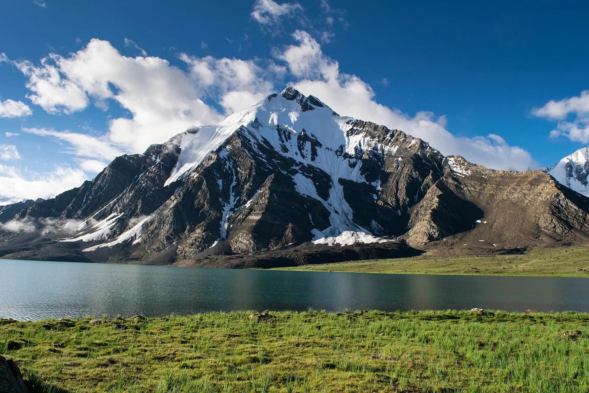
Photo: Talha Mahin Mir, with thanks · CC BY-SA 4.0 · via Wikimedia Commons · temporary stand-in photo
Karambar Lake
A large, very clear glacial lake at about 4,272 m at the top of the Karambar valley in Ishkoman, near the Afghan border. It has no road and is reached on multi-day treks over or beside the Karambar An.
Overview
Karambar Lake, also called Qurumbar Lake, is a high alpine lake in the Ishkoman Valley, Ghizer District, close to the Wakhan border. Wikipedia gives its height as 4,272 m; an older trekking guide gives 4,260 m. It is about 3.9 km long and up to 2 km wide, with a surface area of about 2.6 km2, which makes it the second largest lake in northern Pakistan after Attabad Lake. It is fed by glacier melt, and a study reported unusually high water clarity. Wikipedia lists it as the 33rd highest lake in the world.
The lake sits on the boundary between the Ishkoman valley of Gilgit-Baltistan and the Broghil valley of Chitral, near the gentle Karambar An (an, a pass).
Plan your visit
- Nearest town
- Ishkoman
- Getting there
No road reaches the lake. From the Ishkoman side, drive to Bort and walk up the Karambar valley (about five days). More
Best months
Jul – Sep
Qurumbar National Park
Since 2011 the lake has been inside Qurumbar National Park, about 738 km2 of alpine steppe and meadow in Ghizer District, next to Broghil Valley National Park in Chitral. Wikipedia lists snow leopard, Himalayan ibex, lynx, wolf, brown bear and Marco Polo sheep among its mammals, and golden eagle, bearded vulture, griffon vulture, peregrine falcon and chukar among its birds. These are listings from a reference work, not sightings to expect. On the trail, the animals most visitors see are the herders' yaks and cattle.
How to reach it
There is no road. Two main routes reach the lake, and both are multi-day treks.
- From the east (Ishkoman). The Karambar trek leaves Bort (2,728 m) and follows the Karambar River. The stages on the Karambar An and Darkot An trek page run through Maturamdan (2,895 m, the highest year-round village), Waraghut (3,300 m), Sokhter Rabot (3,420 m) and Shuyinj (3,930 m) to the lake at about 4,260 m. The route crosses the tongue of the Karambar Glacier and the Chattiboi Glacier, which change from year to year, and high water often blocks the Karambar road at Bilhanz in summer.
- From the west (Chitral). One operator's blog, describing a 2015 trip, drives by jeep from Chitral to Mastuj and on to Ishkarwaz (3,300 m), then walks through Lashkargaz to the lake. It reports about 15 to 20 km from Showrsheer to the lake with "no major climbs", and a camp at Laleerabad if the day is split. See Broghil and Karambar An.
The same blog reports that landslides and flooded nalas (seasonal streams) on the return road forced long walks, and that jeep access beyond Kishmanja depends on river levels. Plan spare days. Most operators schedule a rest day at the lake.
The lake and its meadows
Karambar Lake lies in one of the largest alpine meadows in northern Pakistan, grazed in summer by Gujar herders on the Karambar side and Wakhi herders in Broghil. The water is opaque turquoise, fed by glaciers, and ringed by peaks. The ground around it is grass and stony pasture, with small streams to cross. Weather changes quickly and the blog reports rain even at the lower stages.
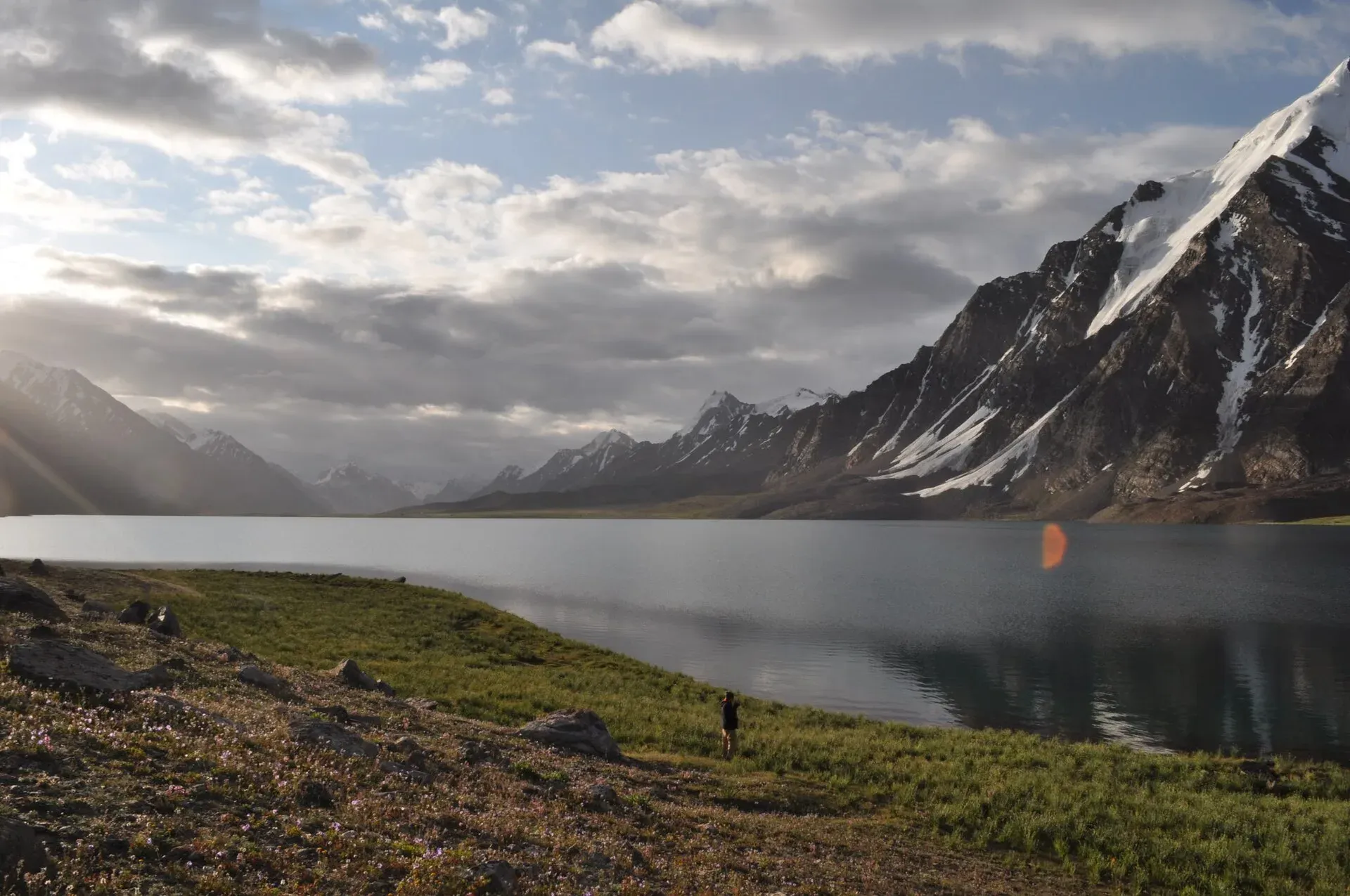
Photo: Omarfarooqhamid, with thanks · CC BY-SA 4.0 · via Wikimedia Commons · temporary stand-in photo
When to visit
July to September. Outside this period the lake is frozen and the passes are snowed in.
Where to stay and eat
No accommodation at the lake. Trekkers camp, usually near the west end, and carry food. The blog mentions small local hotels at Lashkargaz. The villages of Ishkoman and Chitral have guesthouses.
Good to know
- Permits: this is a restricted zone near the border. A permit and licensed guide are required. The Express Tribune (6 May 2026) reports that foreign tourists must get an NOC (no-objection certificate) before visiting Chitral district; it does not mention Broghil or Karambar separately. On the Gilgit-Baltistan side, Dawn (29 April 2025) reported that permits were on hold while a court case on higher trekking fees continued; there is no known later update. The operator blog reports ID and NOC checks by soldiers and Scouts near the border. Check with the Gilgit-Baltistan Tourism Department (Karambar side) or KP Tourism and the DC Office in Chitral before you plan. Current fees will be added soon.
- Altitude: the lake is above 4,000 m. Climb slowly, rest here and sleep lower if you feel unwell.
- Weather: cold nights and sudden storms even in summer.
- Rescue: very slow. Carry a satellite messenger and tell your guide your exit plan.
Highlights
- About 4,272 m, second largest lake in northern Pakistan
- Part of Qurumbar National Park since 2011
- Reached on the Karambar An traverse
- Very clear glacial water
Getting there
No road reaches the lake. From the Ishkoman side, drive to Bort and walk up the Karambar valley (about five days). From Chitral, drive by jeep via Mastuj to Ishkarwaz (3,300 m, according to one operator) and trek through Lashkargaz to the lake. River levels and landslides can stop vehicles short of the road end. See the two trek pages for stages and camps.
Tips
- Go up slowly and rest at the lake.
- Arrange permits and a guide well ahead.
- Carry full supplies; there are no shops above the last villages.
- Check recent route reports for river and glacier conditions.
Photos we still need: the Karambar valley trail or Ishkarwaz camp (terrain on the approach); herders or yaks in the Karambar or Broghil meadows. Send us yours
Sources and last checked
Last checked Confidence medium7 sources5 still to check
- Last checked
- Method
- Desk research from published sources
- Confidence
- medium
- Checked by
- trek.pk research team
Researched from published sources; not yet checked on the ground by our team. Spot something out of date? Report a mistake.
Sources
- Karambar Lake · Wikipedia · checked
- Pakistan Tourism Guide 2021 · TDAP (Trade Development Authority of Pakistan) · checked
- Broghil and Karambar An; Karambar An and Darkot An (trek.pk pages) · trek.pk / Lonely Planet · checked
- Senate panel flags hurdles to Chitral tourism · The Express Tribune · checked
- GB tourism stakeholders trade blame as permit fees remain undecided · Dawn · checked
- Trek to Karambar Lake: the complete guide · Destination Pak · checked
- Qurumbar National Park · Wikipedia · checked
Still to be checked on the ground (5)
- Lake altitude: 4,272 m (Wikipedia infobox) vs 4,260 m (older guide); no official figure found
- Current permit/NOC rules for the Karambar (Ishkoman) approach and for Broghil (Chitral NOC needed per Tribune, 6 May 2026; GB permit fee litigation reported April 2025)
- Days from Bort to the lake (our Broghil trek page schedules about five days for the reverse leg; no independent source found)
- Depth: Wikipedia's summary box says average 52 m but its text says maximum 55 m and mean 17.08 m; unresolved
- Current jeep road end on the Chitral side (the 2015 blog describes Kishmanja and Ishkarwaz; not recently confirmed)


