

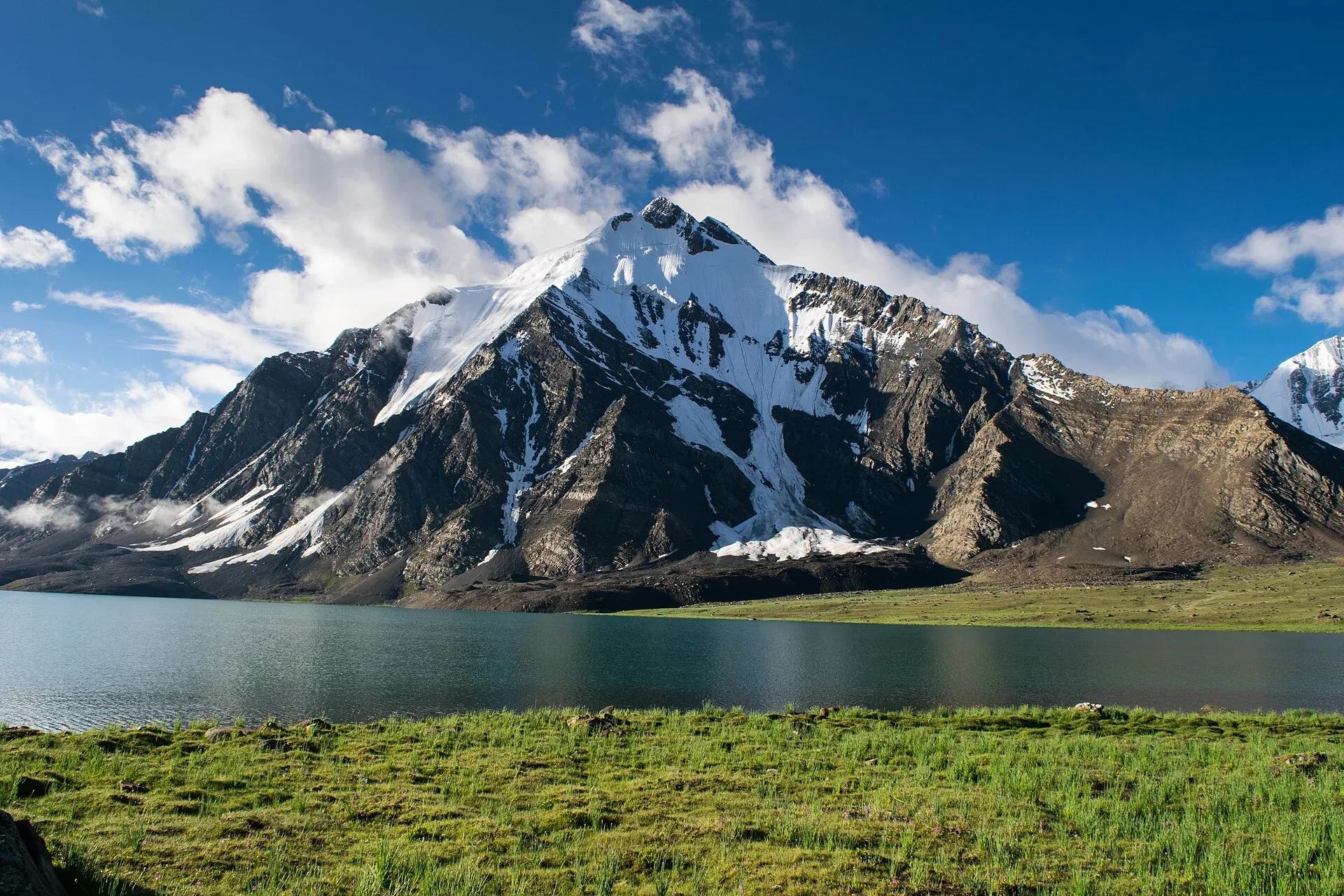
Photo: Talha Mahin Mir, with thanks · CC BY-SA 4.0 · via Wikimedia Commons · temporary stand-in photo

Karambar An and Darkot An
- Duration
- 11–13 days
- Distance
- 123.5 km
- Grade
- Technical
- Max altitude
- 4,650 m
- Season
- Jul – Sep
An 11-day technical traverse from Bort in Ishkoman up the Karambar valley, over the Karambar An by Karambar Lake and across the glaciated Darkot An to Darkot in Yasin. Restricted zone.
Overview
This long trek goes up the Karambar valley in Ishkoman, crosses the gentle Karambar An (about 4,320 m) beside Karambar Lake, drops into Broghil in Chitral, and then crosses the glaciated Darkot An (about 4,650 m) to Darkot at the head of the Yasin valley. In 11 days you cross the border between Ghizer in Gilgit-Baltistan and Upper Chitral twice, between the Hindu Raj and the Karakoram.
The Karambar valley is rugged and has some of the largest alpine meadows in northern Pakistan, grazed by Gujar herders in Karambar and by Wakhi herders in Broghil. It may have been a pilgrim route from Afghanistan's Wakhan to Gilgit. The Darkot crossing is historic too. A Chinese army is said to have crossed it in AD 747 to conquer Gilgit.
Who it suits
The trek is technical and demanding. You must be fit, able to cope with 11 days of mostly 4 to 7 hour walking days and a 25 km pass crossing that gains 1,080 m and drops 1,890 m between Chikar and Darkot. You must also be ready to use rope, harness and ice axe on a crevassed glacier. Crampons are optional. Experience on glaciers is needed. The Chattiboi and Karambar glaciers change from year to year, so a local guide who knows them is essential. Hire a herder from Sokhter Rabot for the Chattiboi Glacier, and someone from Chikar for the Darkot An.
When to go
July to September. Snow on the Darkot An softens by mid-morning, so cross before 9 am. High water often blocks the Karambar road at Bilhanz in summer.
The route
Days 1 to 3. From Bort (2,728 m) the trail follows the left bank of the Karambar River. Cross the Karambar Glacier's tongue, which has blocked travellers in the past, then continue to Maturamdan (2,895 m), the highest year-round village. On day 2 cross the footbridge at Piyakhin to Waraghut (3,300 m). On day 3 climb to the cable crossing at Chilinj, where the Chilinji An route from Chapursan arrives, then reach Sokhter Rabot (3,420 m), a settlement of Uzbek families.
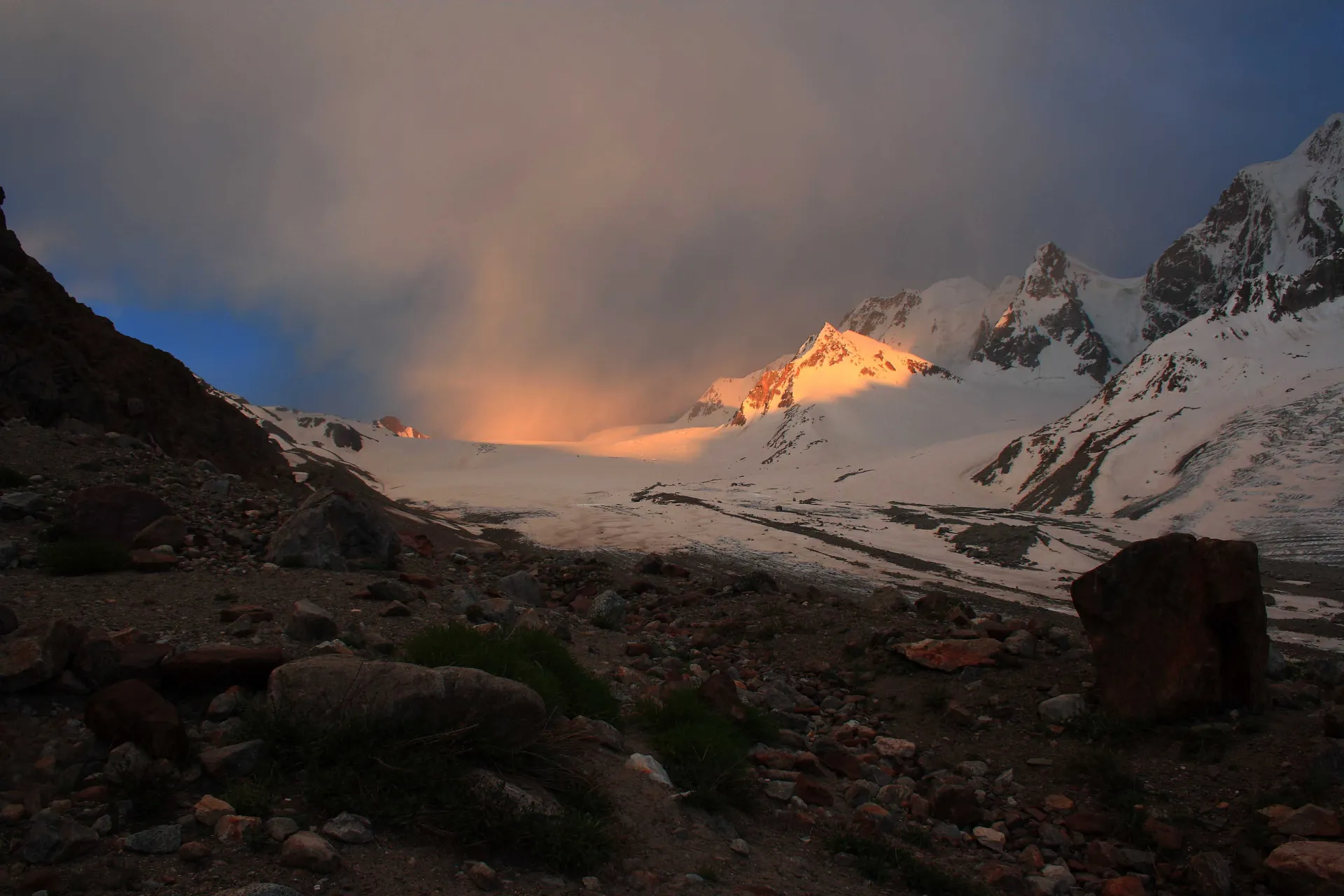
Photo: Abdul.wasiq, with thanks · CC BY 3.0 · via Wikimedia Commons · temporary stand-in photo

Day 4: Sokhter Rabot to Shuyinj. The route crosses the Chattiboi Glacier, which fills the valley for about 4 km, with the Karambar River running beneath it. Go up the middle of the ice and keep right of the main icefall. Leave the glacier near polished granite cliffs and look for cairns on the left bank. Camp near Shuyinj (3,930 m), in a large meadow with marmots.
Days 5 to 6: to Karambar Lake. Follow the river through grassland and over the broad pass to Karambar Lake (4,260 m), an opaque turquoise lake. The Karambar An (4,320 m) is a short way west of the camps. Zhui Sar rises above the south shore, and its glacier falls into the lake. Take a rest day.
Days 7 to 8: to Ishkarwaz. This is the Broghil leg, described in the broghil-and-karambar-an page in reverse. Camp at Tir-e-Dasht (3,480 m) on day 7. On day 8 you reach Ishkarwaz (3,510 m), where there is a Chitral Scouts post. A ridge about 45 minutes further leads to the meadows of Chikar (3,570 m), with small shops.
Day 9. Walk to Darkot An Base Camp (4,140 m). The first possible camp is 1.5 hours up from the spring beyond Chikar. A better camp lies 30 minutes further, at the upper limit of scrub willow.
Day 10. The 6.5 km ascent to the pass takes 2.5 to 3 hours. Walk up the lateral moraine, then onto the Darkot Glacier. Travel roped. Climb a steep section west of the rock outcrop, then traverse right to the level upper pass. Cross the Darkot An (about 4,650 m). The descent of 5.1 km and 1,500 m starts west of the pass and goes down the west edge of the Zindikharam Glacier. The slope may be icy. Below the snout are stone shelters, a boulder carved with a stupa and a Tibetan inscription from about the 8th or 9th century, and finally the herders' settlement of Rawat (3,100 m).
Day 11. Cross a footbridge, climb over the Darband moraine, and walk a jeep road to Darkot (2,760 m).
Karambar Lake
The rest day at Karambar Lake is built in for acclimatisation, and it is also the scenic centre of the trek. Wikipedia gives the lake's height as 4,272 m (the older guide gives 4,260 m). The water is an opaque turquoise, the camp is on the north shore beside a large boulder with a cairn and stone shelters, and Zhui Sar's glacier falls into the far side. Use the day to drink, rest and walk the meadows rather than climbing higher.
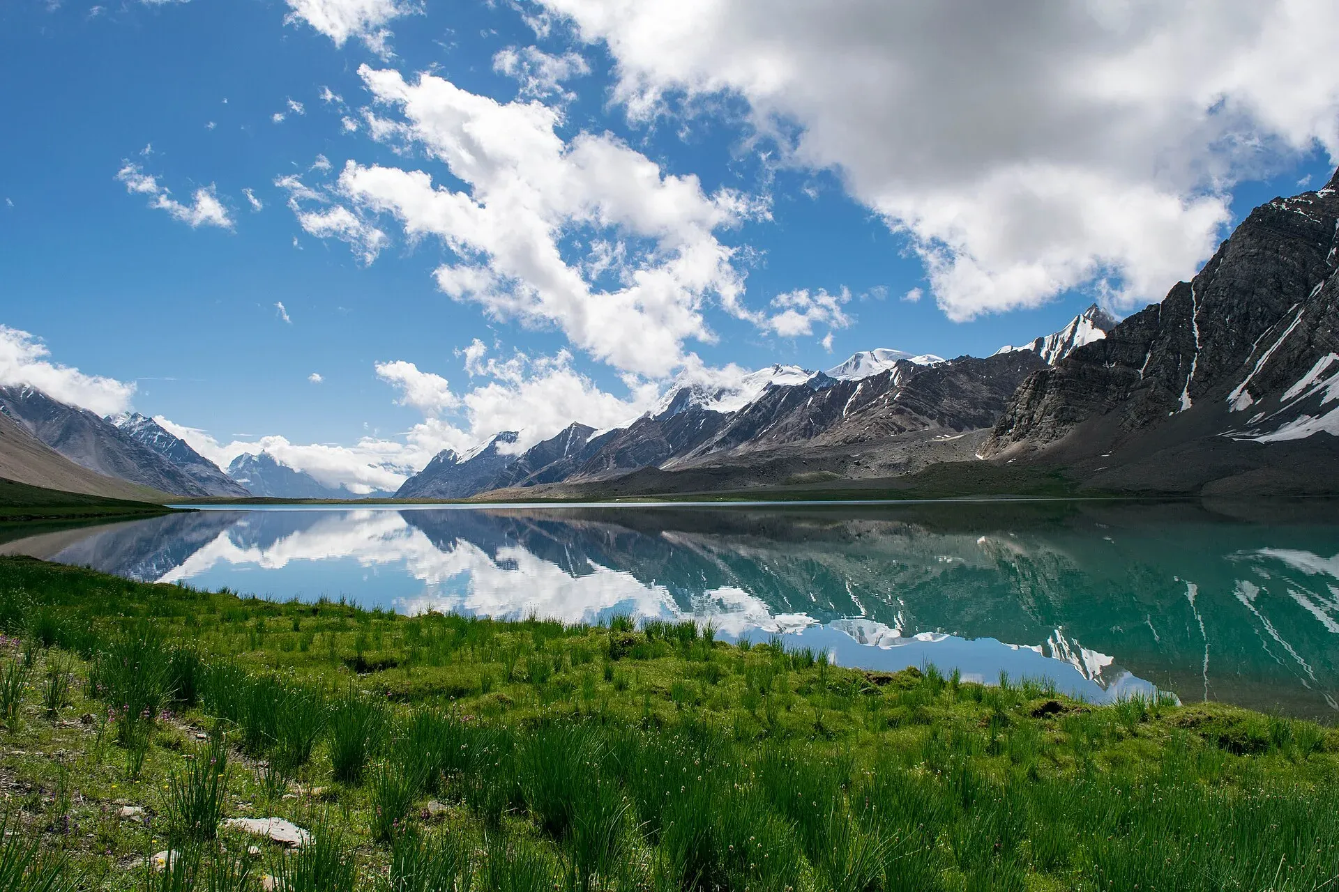
Photo: Talha Mahin Mir, with thanks · CC BY-SA 4.0 · via Wikimedia Commons · temporary stand-in photo

Terrain underfoot
The first days are river valley: left-bank trail, footbridges and cable crossings, a glacier tongue at Karambar and a glacier stream near Chilinj. The Chattiboi Glacier fills the valley for about 4 km with the river running beneath it, and the line through it changes each year. Above Shuyinj the ground opens into grass, old terminal moraine (rubble left by a retreating glacier) and large meadows to the lake. The Broghil leg is broad, grassy valley walking. The Darkot An day is lateral moraine, then a roped glacier with a steep section, an icy descent beside the Zindikharam Glacier, then boulders, stone shelters and scrub down to Rawat and a jeep road.
Preparation
- This is a trek for people with glacier experience, not a first big trek. A local guide who knows the Chattiboi and Darkot glaciers is essential.
- Carry rope, harness and ice axe. Crampons are optional.
- Cross the Darkot An before about 9 am, while the snow is firm.
- Allow spare days for high water at Bilhanz on the access road.
- Rest at Karambar Lake before the pass.
Culture and people
Karambar's Gujars, Uzbek settlers at Sokhter Rabot, Wakhi herders in Broghil and Burusho families at Rawat all live here. At Rawat the women tend the herds, which is rare among the Burusho and normal among the Wakhi. A hot spring near Rawat is said to ease aching joints. Expect camping fees at Darkot and Chikar.
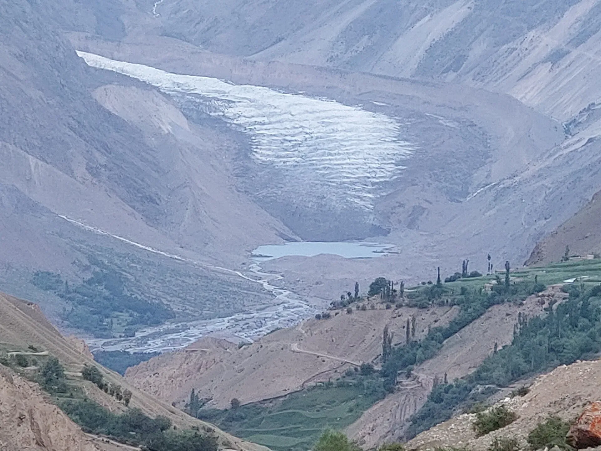
Photo: Shakeelgilgity, with thanks · CC BY-SA 4.0 · via Wikimedia Commons · temporary stand-in photo

Practical information
- Maps. US AMS 1:250,000 sheets Baltit (NJ 43-14) and Mastuj (NJ 43-13). Trails across the Chattiboi Glacier are drawn wrongly, and the Karambar lakes are not shown. Bort appears as Bhurt.
- Guide and porters. The stage system is not fixed but is starting. In Karambar, the fixed stages are Bort to Yazben and Yazben to Maturamdan. Most porters count three stages between Chikar and Darkot.
- Permits. A restricted zone. See below.
Highlights
- Karambar Lake (about 4,272 m) and one of Pakistan's largest alpine meadows
- Chattiboi Glacier and Karambar glacier route-finding
- Wakhi herders and meadows in Broghil
- Historic Darkot An glacier crossing with a Tibetan inscription on the far side
- Rawat, a remote herders' settlement with a hot spring
Day by day
| Day | Camp | Altitude |
|---|---|---|
| 1 | Maturamdan | 2,895 m |
| 2 | Waraghut | 3,300 m |
| 3 | Sokhter Rabot | 3,420 m |
| 4 | Shuyinj | 3,930 m |
| 5 | Karambar Lake | 4,260 m |
| 6 | Karambar Lake | 4,260 m |
| 7 | Tir-e-Dasht | 3,480 m |
| 8 | Ishkarwaz (or Chikar | 3,510 m |
| 9 | Darkot An Base Camp | 4,140 m |
| 10 | Rawat | 3,100 m |
| 11 | Darkot | 2,760 m |
| Day | Route | Hours | Distance | Ascent / descent | Camp and altitude |
|---|---|---|---|---|---|
| Day 1 | Bort to Maturamdan | 4–5 h | 13 km | +167 m | Maturamdan, 2,895 m |
Day 1 notesFollow the left bank of the Karambar River to Yazben. Cross the Karambar Glacier, which pushes into the valley and has blocked travellers before. A side route leads to Kampir Dior Base Camp. Continue upriver to Maturamdan, the highest year-round village. | |||||
| Day 2 | Maturamdan to Waraghut | 5–6 h | 12 km | +405 m | Waraghut, 3,300 m |
Day 2 notesCross a footbridge to the west bank at Piyakhin and continue up the river to Waraghut. A harder trail stays on the left bank over the Chilinj Glacier. | |||||
| Day 3 | Waraghut to Sokhter Rabot | 4–5 h | 10 km | +120 m | Sokhter Rabot, 3,420 m |
Day 3 notesWalk three to four hours up the valley to the cable crossing at Chilinj, where the Chilinji An route joins. Continue on the west bank, ford a glacier stream and cross moraine to the broad plain of Sokhter Rabot. Camp near the upper huts, with willows and a meadow. | |||||
| Day 4 | Sokhter Rabot to Shuyinj | 5–6 h | 14.6 km | +510 m | Shuyinj, 3,930 m |
Day 4 notesReach the Chattiboi Glacier in about 1.25 hours. For 4 km the river runs beneath the ice, which fills the valley. Follow the black medial moraine, then white ice, and keep right towards polished granite cliffs. Leave the ice onto the left bank and look for cairns. Continue to Shuyinj and cross the stone footbridge to a meadow with marmot burrows. | |||||
| Day 5 | Shuyinj to Karambar Lake | 4 h | 12.4 km | +330 m | Karambar Lake, 4,260 m |
Day 5 notesThe river is clear above Shuyinj. Go up through grassland to an old terminal moraine, and over immense meadows with wild onions, ram chukor and marmots. Walk along the north shore for 1.25 hours to a large boulder with a cairn and stone shelters. Camp here. The Karambar An is 1.2 km west. | |||||
| Day 6 | Rest day at Karambar Lake | not given | not given | not given | Karambar Lake, 4,260 m |
Day 6 notesRest and explore the lake. Zhui Sar rises above the south shore and its glacier tumbles into the water. | |||||
| Day 7 | Karambar Lake to Tir-e-Dasht | 6–7 h | 17 km | +60 m / −840 m | Tir-e-Dasht, 3,480 m |
Day 7 notesCross the Karambar An and descend Karambar Chhat past Rabot, Boree Mergich, Thur Mergich, Qul Quldi and Top Khana. Continue through Broghil settlements to Tir-e-Dasht. See the Broghil page for details in the opposite direction. | |||||
| Day 8 | Tir-e-Dasht to Ishkarwaz and Chikar | 6–7 h | 17.7 km | +30 m | Ishkarwaz (or Chikar, 3,570 m), 3,510 m |
Day 8 notesPass Lashkargah Goz, Garhil and Chilma Rabot to Ishkarwaz, where the Chitral Scouts have a post. You may continue over a ridge, 45 minutes and 2.8 km further, to the meadows of Chikar, where small stores sell basic supplies. Camping fees apply. | |||||
| Day 9 | Ishkarwaz or Chikar to Darkot An Base Camp | 3.25–3.75 h | 7.9 km | +630 m | Darkot An Base Camp, 4,140 m |
Day 9 notesThirty minutes beyond Chikar is a good spring. Camp at the upper limit of scrub willow, about 6 km from Chikar, with space for three or four tents. Water flows from a side valley above the camp. | |||||
| Day 10 | Darkot An Base Camp to Rawat | 5.5–6 h | 11.6 km | +510 m / −1,550 m | Rawat, 3,100 m |
Day 10 notesLeave before dawn. Climb the moraine onto the Darkot Glacier and rope up for a steep section west of a rock outcrop. Avoid the crevassed middle. Cross the pass, then descend the west edge of the Zindikharam Glacier, which may be icy. Below the snout, pass the stone shelter, the carved boulder, a waterfall and the hot spring trail to reach Rawat. | |||||
| Day 11 | Rawat to Darkot | 2–2.5 h | 7.3 km | +100 m / −440 m | Darkot, 2,760 m |
Day 11 notesCross a footbridge, pass Haribaris and Tokemaling, climb over the Darband moraine, and cross the river again on a wooden bridge. Follow a jeep road for 45 minutes to Darkot's west end, then 30 minutes more through the village. | |||||
Getting there
The jeep road goes as far as Bort, but in summer high water often blocks it at Bilhanz. Walking from Bilhanz to Bort takes about four hours, with side streams to ford. Bad Swat River crossings can be hard. One stage is fixed between Bad Swat and Bort, and you may pay for a partial stage between Bilhanz and Bad Swat.
Jeeps and special hires run from Wad-din Transport Service on Punial Road in Gilgit to Bort, Bilhanz and Imit. You can also take the NATCO Gilgit to Gakuch or Chatorkhand bus and find a jeep there. The trip to Imit takes about five hours.
At the end, Darkot has jeeps to Gilgit (about nine hours), but they are infrequent. Special hires run to Yasin and Gupis. You can also walk the road in two or three days to Taus or Yasin. There is a daily NATCO bus between Taus and Gilgit.
Permits and rules
- Permit needed
- Yes, Restricted zone
- Fee
- Current fees will be added soon
- Last checked
- 16 November 2026
Zone. Restricted. The old guide says a permit and a licensed guide are required, and that police at Imit and Lasht and the Chitral Scouts at Ishkarwaz may ask to see it.
Gilgit-Baltistan. The GB Tourism Department says trekking in restricted areas needs a permit and a licensed guide and porter, arranged through a licensed operator. Fees are in dispute. Ask the GB Tourism Department or your operator for the current fee. Current fees will be added soon.
Chitral. The Broghil section is in Upper Chitral, close to the Afghan border. Sources disagree on whether an NOC is required. KP Tourism launched an online NOC system in July 2025, and the Express Tribune reported on 6 May 2026 that foreigners still need an NOC for Chitral. Confirm with the DC Office Chitral or Chitral Scouts through a licensed operator.
How trekking permits, NOCs and registration work: Visa and permits.
Season
Best: Jul – Sep
Water and camps
Water is easy to find in the Karambar valley, but the Karambar River is silty below Shuyinj. Camps include Maturamdan (2,895 m), Waraghut (3,300 m), Sokhter Rabot (3,420 m), Shuyinj (3,930 m) and the stone shelters at Karambar Lake (4,260 m). Darkot An Base Camp has space for three or four tents and spring water. A more exposed camp lies on the moraine. At Rawat the herders' settlement has plenty of water.
Gear and safety
You cross two glaciers and a high pass above 4,600 m. Bring rope, harness, ice axe and crampons, and use them. The Chattiboi and Karambar glaciers move, so the line through them changes each year. The Darkot An is crevassed except for the standard line. Avoid the middle and west margin. Snow softens by mid-morning, which makes the going slow and dangerous. Rest at Karambar Lake (4,260 m) to acclimatise before the pass. Summer high water can cut the road at Bilhanz and rivers can be hard to ford. There is no phone signal for most of the route.
Variations
Chilinji An link. A harder start from Chapursan can be added by first crossing the Chilinji An and Qalander Uween and joining this route at Chilinj. Broghil. For the shorter, easier trek to Karambar Lake from Chitral, see broghil-and-karambar-an. Zindikharam. Broghil residents say the Zindikharam Glacier can be crossed in two or three days, but they prefer the Darkot route. Aurel Stein found it closed by large bergschrunds in 1913.
Tips
- Cross the Darkot An before 9 am, when the snow is still firm.
- Hire a Sokhter Rabot herder for the Chattiboi Glacier and a Chikar guide for the Darkot An.
- Carry rope, harness and ice axe, and practise glacier travel before you go.
- Expect the Karambar road to be blocked at Bilhanz in high water, and allow extra days.
- Carry all permits. Police at Imit and Lasht and the Chitral Scouts at Ishkarwaz may ask to see them.
Stay and eat in Gilgit
Gilgit is the nearest town to the trek: somewhere to sleep and stock up before and after.
Places to stay
- Indus Lodges GilgitCall Indus Lodges GilgitMap of Indus Lodges Gilgit in Google Maps
- Gilgit Serena HotelCall Gilgit Serena HotelMap of Gilgit Serena Hotel in Google Maps
- Park Hotel GilgitCall Park Hotel GilgitMap of Park Hotel Gilgit in Google Maps
- Avari Xpress Hotel, GilgitCall Avari Xpress Hotel, GilgitMap of Avari Xpress Hotel, Gilgit in Google Maps
- Gilgit Gateway HotelCall Gilgit Gateway HotelMap of Gilgit Gateway Hotel in Google Maps
- Hotel shaheen internationalCall Hotel shaheen internationalMap of Hotel shaheen international in Google Maps
Places to eat
- Pizza King GBCall Pizza King GBMap of Pizza King GB in Google Maps
- The CherryTree CaféCall The CherryTree CaféMap of The CherryTree Café in Google Maps
- Dawat Restaurant @ Indus LodgesCall Dawat Restaurant @ Indus LodgesMap of Dawat Restaurant @ Indus Lodges in Google Maps
- Abbas ali shah, Danyore, District Gilgit.Call Abbas ali shah, Danyore, District Gilgit.Map of Abbas ali shah, Danyore, District Gilgit. in Google Maps
- GB Rahat Pizza and Fast Food Gilgit, Since 2020 In GilgitCall GB Rahat Pizza and Fast Food Gilgit, Since 2020 In GilgitMap of GB Rahat Pizza and Fast Food Gilgit, Since 2020 In Gilgit in Google Maps
- GB STEAKHOUSECall GB STEAKHOUSEMap of GB STEAKHOUSE in Google Maps
Essential services fuel stations and hospitals and clinics
Fuel
- Ibex PSO Petrol StationMap of Ibex PSO Petrol Station in Google Maps
- PSOMap of PSO in Google Maps
- Pakistan State Oil (PSO) Gilgit filling station( Chilasi petrol pump)Call Pakistan State Oil (PSO) Gilgit filling station( Chilasi petrol pump)Map of Pakistan State Oil (PSO) Gilgit filling station( Chilasi petrol pump) in Google Maps
Hospitals and clinics
- Aga Khan Hospital, GilgitCall Aga Khan Hospital, GilgitMap of Aga Khan Hospital, Gilgit in Google Maps
- D.H.Q HospitalCall D.H.Q HospitalMap of D.H.Q Hospital in Google Maps
Listings come from Google Maps data and are unverified: phone numbers, opening months and prices may have changed. Report a problem · Own one of these? Claim it
Photos we still need: Sokhter Rabot, the Chattiboi Glacier crossing and Rawat. Send us yours
Health and emergency
Mobile signal is patchy on most treks, so tell someone your plan before you go. Emergency numbers
Sources and last checked
Last checked Confidence low11 sources7 still to check
- Last checked
- Method
- Desk research from published sources
- Confidence
- low
- Checked by
- trek.pk research team
Researched from published sources; not yet checked on the ground by our team. Spot something out of date? Report a mistake.
Sources
- Legacy trek.pk page (text from Lonely Planet, Trekking in the Karakoram and Hindukush, c. 2002; facts only) · trek.pk / Lonely Planet · checked
- Karambar Lake · Wikipedia · checked
- Broghil Valley National Park · Wikipedia · checked
- Darkot Pass Trek via Yarkhun · Apricot Tours · checked
- Darkot and Broghil Pass Trek · Hunza Guides Pakistan · checked
- Trek to Karambar Lake: The complete guide · Destination Pak · checked
- GB tourism stakeholders trade blame as permit fees remain undecided · Dawn · checked
- KP Tourism Department launches online NOC system for foreign tourists · Associated Press of Pakistan · checked
- Senate panel flags hurdles to Chitral tourism (6 May 2026) · The Express Tribune · checked
- File:Darkot Pass, Northern Areas of Pakistan.jpg · Wikimedia Commons · checked
- Darkot Pass · Wikipedia · checked
Still to be checked on the ground (7)
- Darkot An height: 4,650 m (old guide), 4,575 m (operators), 4,675 m (other), 4,703 m (Wikipedia, uncited); no survey figure
- Karambar Lake: 4,260 m (old guide) vs 4,272 m (Wikipedia infobox, rechecked) vs about 4,300 m (operators); Karambar An 4,320 m (old guide only)
- Permit fee (team to supply current fees)
- Whether an NOC is needed for the Chitral and Ishkoman sections (Express Tribune, 6 May 2026: foreigners need a Chitral NOC; Ishkoman rule not sourced)
- Whether the Karambar jeep road still ends at Bort and how often high water cuts it
- Current state of the Chattiboi Glacier route and the Darkot Glacier crevasses
- All daily times and distances (old guide only)
Nearby and related

Broghil and Karambar An

Khot An

Asumbar Haghost

Karambar An
A gentle pass of about 4,320 m beside Karambar Lake, between Broghil in Chitral and the Karambar valley in Ishkoman, Gilgit-Baltistan. Restricted zone near the Afghan border.
Chilinji An
A glaciated pass of about 5,160 m between the Chapursan and Karambar valleys, near the Afghan border. Roped travel, guide and permit needed.
Rawat Hot Spring (Karambar)
A hot spring near Rawat, a remote herders' settlement below the Zindikharam Glacier on the Darkot An route in Ghizer. Known only from our trek page.