

Photo: Moskenes, with thanks · CC BY-SA 4.0 · via Wikimedia Commons · temporary stand-in photo

Nanga Parbat
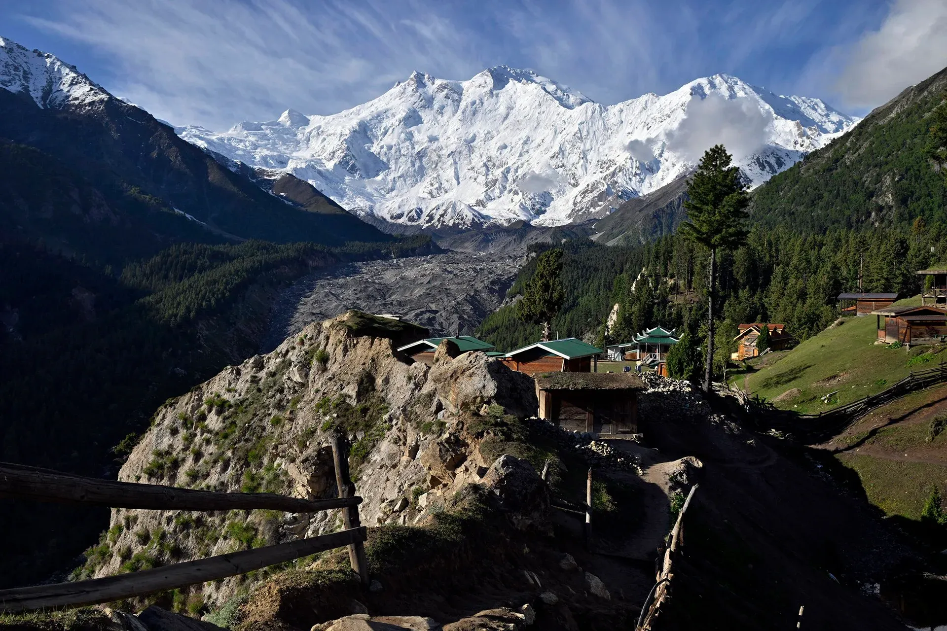
Nanga Parbat (8,126 m), the ninth-highest mountain on Earth, rises above the Indus in Diamer and Astore. Fairy Meadows and the Rupal Valley give the best treks to its north and south faces.
Overview
Nanga Parbat is the ninth-highest mountain in the world, at 8,126 m, and the westernmost of the great Himalayan peaks. It stands just south of the Indus bend in Gilgit-Baltistan, on the border of Diamer and Astore districts. The name means "naked mountain" in Sanskrit and refers to its often snow-free south face. Locally it is Diamer, "mountain of God".
It rises 7,000 m above the Indus in only about 25 km on the north (Rakhiot) side. On the south, the Rupal Face climbs about 4,600 m and is often called the highest mountain face in the world. Guinness World Records lists it as the fastest-rising mountain, at about 7 mm a year (per Wikipedia).
Plan your visit
- Nearest town
- Chilas
- Getting there
For the north face, drive to Raikot Bridge on the Karakoram Highway (about 78 km south-west of Gilgit), take a jeep to Tato and walk to Fairy Meadows. More
Best months
Jun – Sep
- Nanga Parbat
- Related places nearby: Rupal Valley, Astore Valley (with Rama), Raikot and Tatto (Fairy Meadows access), Chilas, Nanga Parbat National Park, Kutiah Lungma Glacier (Stak Valley)
The three faces
The core of the mountain is a long ridge running south-west to north-east, made of rock and ice. It has three main faces. The Rupal Face looks south and east towards Astore. The Rakhiot (north) face looks over Fairy Meadows. The Diamir (west) face looks towards the Indus side. The south-western end of the main ridge is the Mazeno Ridge, which has several lesser summits. North Peak (7,816 m) stands about 3 km north of the main summit, and Rakhiot Peak (7,070 m) lies on the ridge to the north-east.
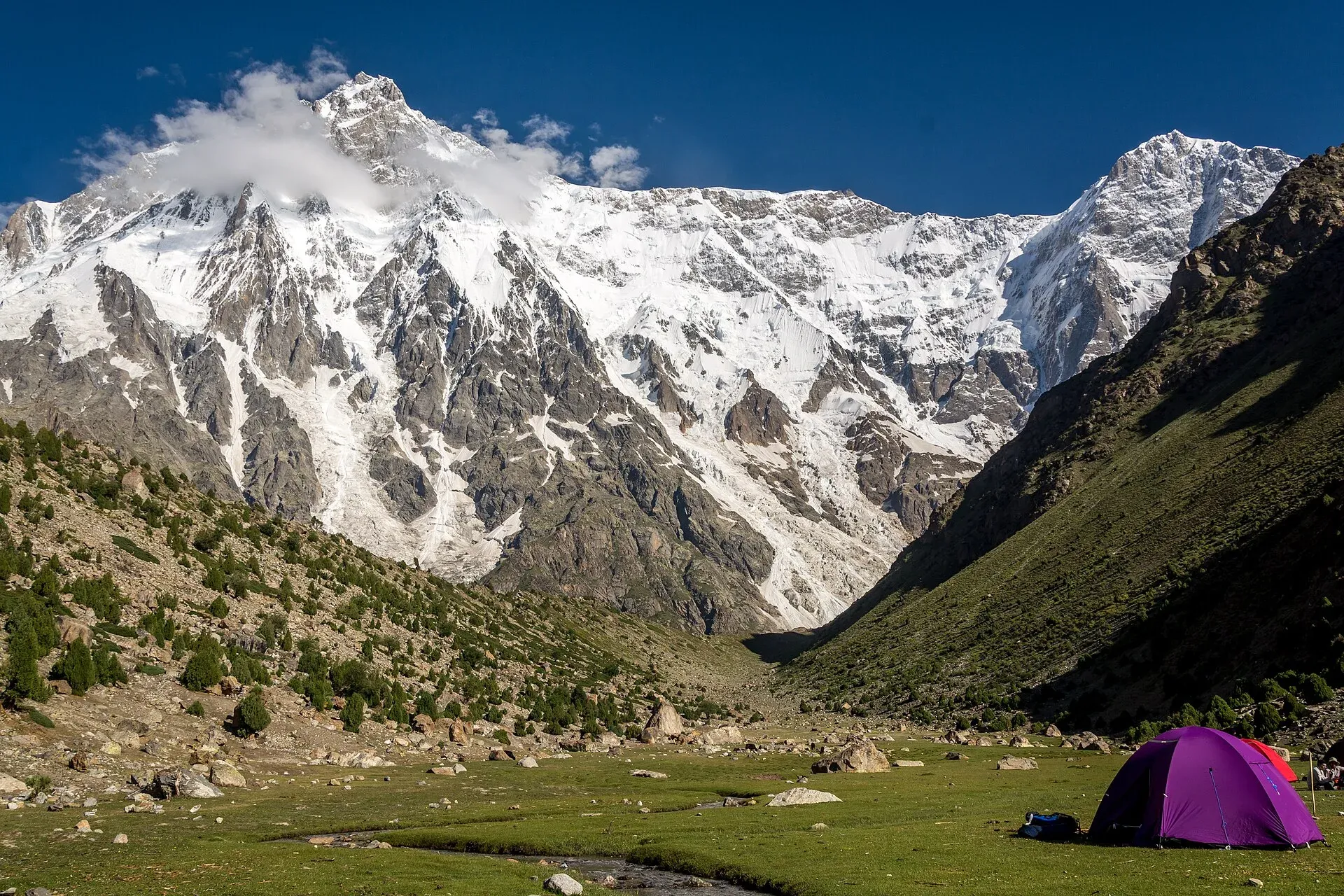
Photo: Muhammad Ashar, with thanks · CC BY-SA 3.0 · via Wikimedia Commons · temporary stand-in photo

Near the foot of the Rupal Face is a glacial lake called Latbo, above a seasonal shepherds' village of the same name.
First ascent and history
Albert Mummery led the first serious attempt in 1895. He reached almost 6,100 m on the Diamir Face, then died with two Gurkha companions while scouting the Rakhiot Face. German expeditions followed in the 1930s. Willy Merkl led parties in 1932 and 1934. In 1934 a storm trapped climbers high on the mountain and Merkl, two other Germans and six Sherpas died. In 1937 an avalanche buried Camp IV below Rakhiot Peak and killed sixteen men. By the time of the 1953 expedition, 31 people had already died on the mountain. The first ascent came on 3 July 1953, when Austrian climber Hermann Buhl reached the summit by the Rakhiot Flank on a German-Austrian expedition. He made the final climb alone from about 1,300 m below the top, reached the summit around 7 pm and spent the night standing on a narrow ledge. It remains the only first ascent of an 8,000 m peak made solo. The Kinshofer route on the Diamir Face, first climbed in 1962, became the standard route. In 1970 Reinhold and Günther Messner made the first ascent of the Rupal Face and descended by the Diamir Face; Günther died in an avalanche on the way down. In 1978 Reinhold Messner made the first completely solo ascent of an 8,000 m peak here. Scottish climbers Sandy Allan and Rick Allen first traversed the 10 km Mazeno Ridge in July 2012. Ali Sadpara, Alex Txikon and Simone Moro made the first winter ascent on 26 February 2016. The mountain's reputation for fatalities earned it the nickname "Killer Mountain".
What to see and do
- North face: the Fairy Meadows and Nanga Parbat Base Camp trek starts from Raikot Bridge on the KKH and shows the Raikot face, with the Raikot Glacier below.
- South face: the Rupal Valley trek, from Tarashing to Shaigiri, ends under the Rupal Face.
- Mazeno side: the Mazeno La is a technical glaciated pass, about 5,400 m, across the Mazeno Ridge from Rupal to Diamer. It is for experts only.
Reaching the base camps
The north-side route to Fairy Meadows is described on the Fairy Meadows and Nanga Parbat Base Camp trek page. The Rupal side is covered by the Rupal trek and the Rupal Valley page. Both are walks to viewpoints and base camps, not climbs. From Rupal, a seasonal village at Latbo sits beside the glacial lake below the Rupal Face.
When to visit
Trekking is best from about June to September. Outside summer, expect snow and cold, and ask your operator about the jeep track. Climbers mostly go in summer; winter expeditions are for specialists.
Where to stay and eat
Fairy Meadows has simple huts and camping. Chilas, Gilgit and Astore have guesthouses and hotels. Rupal has basic village stays and camping.
Good to know
Climbing context. This is a serious expedition mountain with very large faces and a long list of accidents. Trekkers to Fairy Meadows or Rupal do not climb it.
Safety. In June 2013 gunmen attacked a base camp on the Diamer side and killed ten foreign climbers and a Pakistani guide. The Fairy Meadows jeep track has seen serious accidents; Dawn reported one on 2 June 2026. Ask the district administration or local police about current conditions before you go. For foreign visitors: the UK FCDO (updated 27 October 2026) advises against all travel on the KKH between Mansehra and Chilas, so plan your route with an operator.
Permits and royalty. Fairy Meadows and Rupal are in the open zone, where foreign visitors do not need a trekking permit according to Dawn (29 March 2026). Climbing the peak needs an expedition permit and royalty. Climbing a named peak needs an expedition permit and a royalty, arranged through a licensed Pakistani operator with the Gilgit-Baltistan tourism department. Dawn reported on 1 March 2025 that the 2024 royalty and trekking-fee increases (300 percent) were suspended by the Gilgit-Baltistan Chief Court until its next hearing. In May 2025 the Gilgit-Baltistan Tourism Department notified a reduced fee schedule after a cabinet decision (The News, 25 May 2025). No official schedule for 2026 was found, so current fees will be added soon; ask your operator for the written fee list.
Highlights
- Ninth-highest mountain on Earth, 8,126 m
- Rupal Face, about 4,600 m high
- First climbed 3 July 1953 by Hermann Buhl
- Fairy Meadows trek to the north face
Getting there
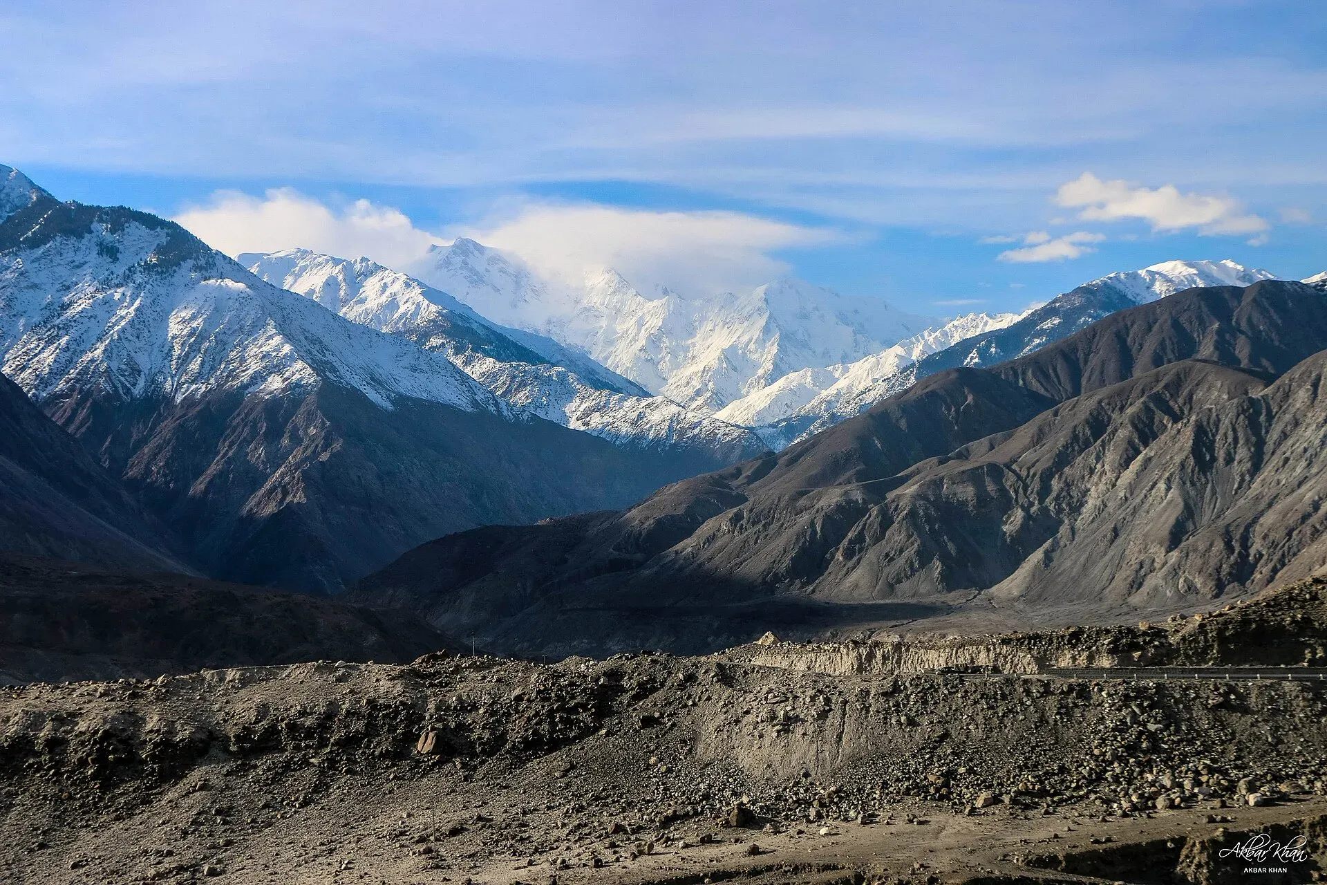
Photo: Akbar Khan Niazi, with thanks · CC BY-SA 4.0 · via Wikimedia Commons · temporary stand-in photo

For the north face, drive to Raikot Bridge on the Karakoram Highway (about 78 km south-west of Gilgit), take a jeep to Tato and walk to Fairy Meadows. For the south face, go to Astore and on to Tarashing for the Rupal Valley trek. See the trek pages for stages and times.
Tips
- For the north face go to Fairy Meadows; for the south face go to Rupal.
- Keep spare days for landslides on the KKH and the jeep track.
- Ask your operator about current security arrangements before booking.
- Do not rely on old guidebook permit rules; they have changed.
Photos we still need: Rupal Face from the Rupal side (the only openly licensed Commons image found is GFDL); Diamir (Chilas) side approach. Send us yours
Sources and last checked
Last checked Confidence medium7 sources3 still to check
- Last checked
- Method
- Desk research from published sources
- Confidence
- medium
- Checked by
- trek.pk research team
Researched from published sources; not yet checked on the ground by our team. Spot something out of date? Report a mistake.
Sources
- Nanga Parbat (Wikipedia) · Wikipedia · checked
- 2013 Nanga Parbat massacre (Wikipedia) · Wikipedia · checked
- List of mountains in Pakistan (heights and prominence) · Wikipedia · checked
- Gilgit-Baltistan tourism bounces back despite Middle East war (permit rules for open and restricted zones, 29 March 2026) · Dawn · checked
- Mountaineering royalty and trekking fee increase challenged in GB Chief Court (1 March 2025) · Dawn · checked
- Pakistan travel advice (updated 27 October 2026) · UK Foreign, Commonwealth and Development Office · checked
- GB slashes mountaineering, trekking fees to promote tourism (25 May 2025) · The News · checked
Still to be checked on the ground (3)
- Current royalty and trekking fee amounts (the GB Tourism Department notified a reduced schedule in May 2025 per The News; no official 2026 schedule found)
- Roadside viewpoints on the KKH (Wikipedia has only an unnamed KKH photo and a Latbo village photo; no sourced list)
- Current security arrangements at Fairy Meadows (Dawn 1986387 and Wikipedia give none)
Nearby and related

Fairy Meadows and Nanga Parbat Base Camp

Rupal Valley and Nanga Parbat Rupal Face
Mazeno La
Rupal Valley
The valley below the south face of Nanga Parbat, reached from Astore by a rough road to Tarishing. The Rupal Face rises about 4,600 m; an easy trek leads to the German base camp and Shaigiri.

Astore Valley (with Rama)
A forested valley south-east of Gilgit on the eastern side of Nanga Parbat, with Rama Meadows and Rama Lake, the Rupal and Rattu valleys and the seasonal road over the Deosai plateau.

Raikot and Tatto (Fairy Meadows access)
Raikot Bridge on the Karakoram Highway is the start of the jeep track to Tatto, the road-end village below Fairy Meadows and the north face of Nanga Parbat.
Raikot Glacier
A 13 km glacier below the north (Raikot) face of Nanga Parbat. You see it on the walk from Tatto to Fairy Meadows and Beyal, and it leads to Nanga Parbat Base Camp.

Chilas
Headquarters of Diamer on the Karakoram Highway and the Indus, with thousands of ancient rock carvings, views towards Nanga Parbat, and the road junctions for Fairy Meadows and Babusar Pass.
Nanga Parbat National Park
A large high-mountain park in Diamer and Astore districts around Nanga Parbat (8,126 m), taking in Fairy Meadows, the Rupal side and Rama Lake. Notified in 2020 to 2021.

Kutiah Lungma Glacier (Stak Valley)
A glacier at the head of Stak valley, north of Nanga Parbat. Known for a rapid surge in the 1950s that sent the ice about 12.8 km down the valley in 91 days.