

Photo: Obaid Hassan Qureshi, with thanks · CC BY-SA 4.0 · via Wikimedia Commons · temporary stand-in photo

Leepa Valley
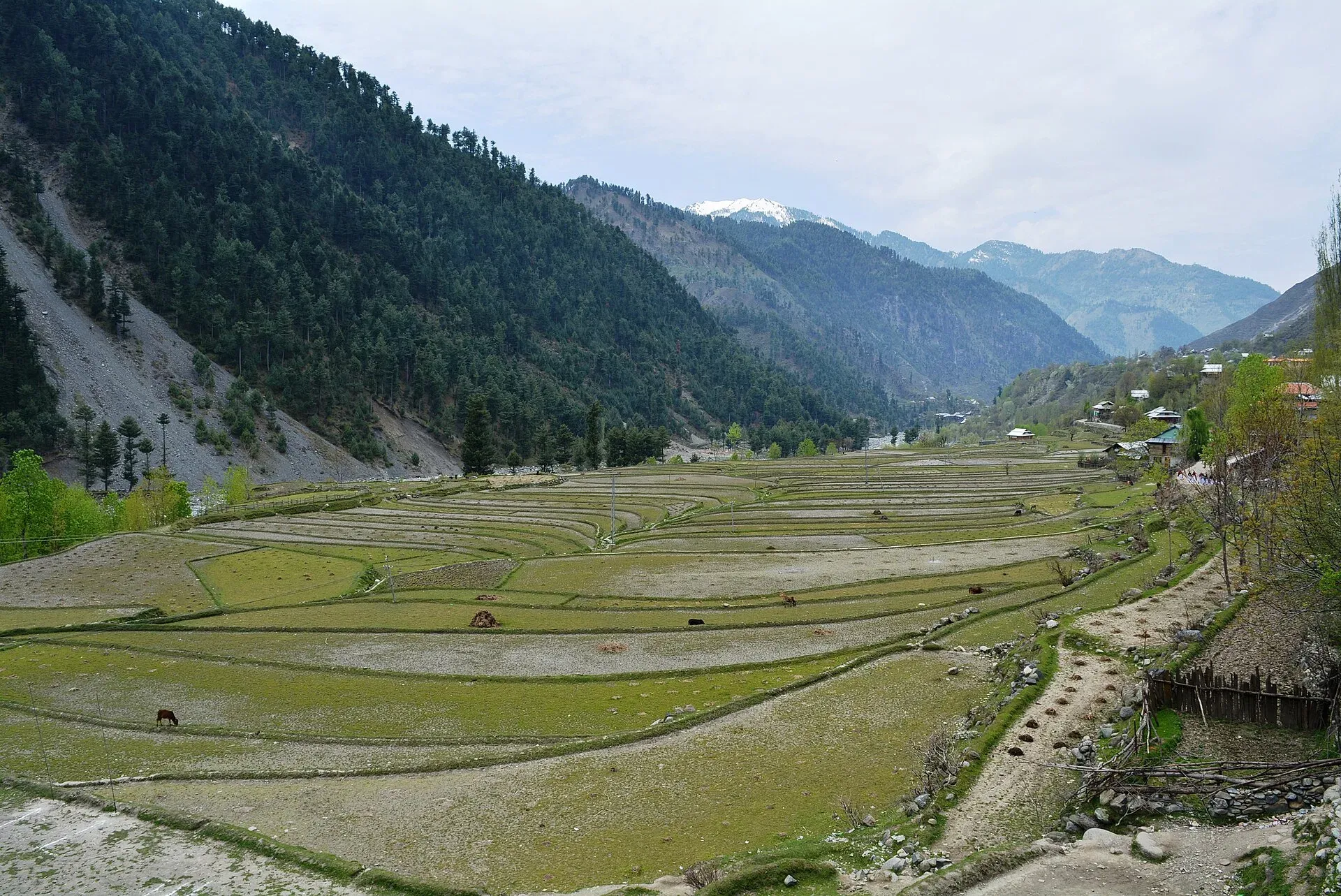
A high, quiet valley in Azad Kashmir's Hattian Bala District with rice terraces and apple orchards. The Line of Control is in sight, and the road is closed by snow in winter. Check access first.
Overview
The Leepa Valley is a farming valley in Hattian Bala District, Azad Kashmir, about 83 km from Muzaffarabad. Rice fields and apple orchards fill the valley floor, and about 50,000 people live there. It is divided into five sectors: Dao Khan, Leepa, Nokot, Kasirkot and Chananian (also spelt Channian), plus small hamlets.
Heights are given differently. Wikipedia says about 3,000 m, but The Express Tribune (22 September 2024) puts the valley at about 1,900 m, with Dao Khan at about 2,600 m, Sher Gali top at about 2,750 m and Bara Hazari at about 3,600 m. The higher figure fits the ridges better than the valley floor.
The Line of Control (LoC), which separates Azad Kashmir from Indian-administered Kashmir, can be seen from many places in the valley. This is a border area.
Plan your visit
- Nearest town
- Reshian
- Getting there
Muzaffarabad to Leepa is about 83 km according to Wikipedia, via Hattian Bala and Reshian. The road is often closed by snow in winter. Islamabad to Muzaffarabad is about 133 km (OSRM 1.6 h, optimistic). More
Best months
May – Oct
Getting there
The Tribune gives about 230 km and seven hours or more from Islamabad. The usual stages are:
- Islamabad to Muzaffarabad through Murree, crossing the Jhelum at Kohala. Islamabad to Muzaffarabad is about 133 km (OSRM estimate 1.6 hours, assuming free-flowing traffic).
- Muzaffarabad to Hattian Bala, then across the Jhelum on the Neli metal bridge and up a narrow, winding road.
- The Reshian security post, where a CNIC (national identity card) is checked.
- A fork at Reshian. The old route, the unpaved "Defence Road", drops to Nokot and needs a 4x4. The newer metalled road passes Dao Khan, Sher Gali top and Moji before dropping into Leepa, and suits all vehicles.
The Tribune writer notes that Google Maps showed the old jeep track rather than the new road. Hiring a local jeep driver is recommended for knowledge of conditions. In winter the valley is snowbound and reachable only by 4x4, and local reports describe the Reshian to Leepa road being closed by snow, avalanches and glacier collapse. Check with the police or the district administration before setting out.
Villages and sights
- Dao Khan. Meadows at about 2,600 m with an AJK Tourism guest house.
- Sher Gali top. At about 2,750 m, with views down both sides of the ridge. It is cold even in summer. On clear days the peaks above Rati Gali in the Neelum Valley and the Kaghan peaks are visible. Locals report leopards here; monkeys and birds have been seen.
- Moji. The first village after the descent from Sher Gali, where army posts of both countries face each other across the LoC. The shrine of Peer Sakhi Shahin Tootmar Khan Gali, near Treda Sharif, is in the hamlet.
- Nokot. Rice fields that are flooded in May and June and lush green in August.
- Channian. Water-powered mills for rice and wheat.
- Kasirkot. A century-old, five-storey wooden house, reportedly built without nails, where the family still lives and a small fee supports upkeep.
- Manda Kuli. Described as the last village, with meadows around it.
- Bara Hazari. At about 3,600 m, very near the LoC and reached by a full-day jeep drive. A no-objection certificate (NOC) is needed.
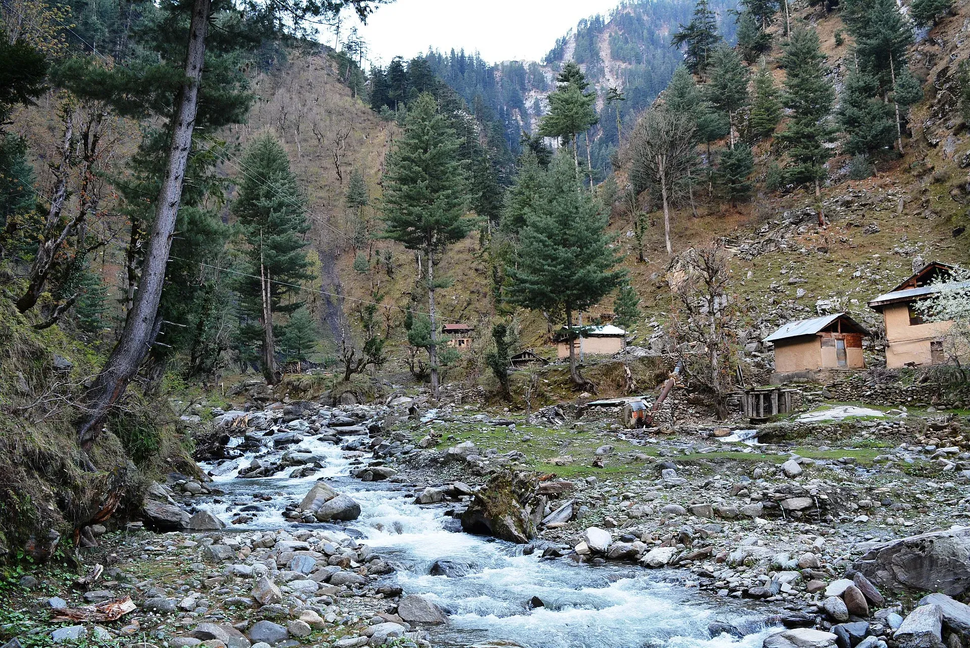
Photo: Obaid Hassan Qureshi, with thanks · CC BY-SA 4.0 · via Wikimedia Commons · temporary stand-in photo

Food and local produce
The valley is known for red rice, which one writer links to the iron in the water. Other products are red beans (lobia), wheat, walnuts, apples, apricots and honey from small bees. Meals are traditional Kashmiri home cooking.
Walks and activities
No established trekking route is published for Leepa. People walk village tracks and orchard paths, camp and cycle; a mountain-biking group from Islamabad is reported to have been the first to ride from Sher Gali to Leepa, in June. Do not walk towards the LoC, and ask residents which areas are closed. Drones are restricted near borders and military posts.
When to visit
The Tribune recommends the end of April to November. Rice fields are flooded in May and June and lush in August, and September and October are harvest time. Winters are heavy, and roads can be closed for days. Wikipedia reports snow at higher points all year.
Where to stay and eat
Options are limited. The Tribune lists an AJK Tourism guest house at Dao Khan (eight rooms) and the Spring Valley and Leepa View guest houses, the last two described as better equipped. Several local stays are converted homes without modern washrooms or hot water. Medical facilities are limited, with no proper hospital, so bring cash, warm clothing, food and any medicines.
Culture and languages
Kashmiri is the main language, followed by Pahari-Pothwari, Hindko and Gojri. Urdu is widely understood. Dress modestly and be courteous about photographs, especially near military posts.
Safety and practical points
- Line of Control. The UK Foreign Office advises against all travel within 10 miles of the LoC and against all but essential travel to Azad Jammu and Kashmir (last updated 27 October 2026, checked 16 November 2026). Leepa is inside that distance.
- Permissions. The Tribune (2024) says the valley was then open to Pakistani nationals with a valid ID, checked at Reshian, and that an NOC is needed for Bara Hazari. It does not address foreign visitors. Ask the AJK Tourism Department and the district administration.
- Winter roads. Avalanche and snow closures are common. Do not travel in forecast snow.
- Do not approach the LoC or military positions, and follow local instructions.
Highlights
- Rice terraces and apple orchards at height
- Quiet Kashmiri villages
- Views towards the Line of Control
- Few visitors
Tips
- Ask about access before leaving Muzaffarabad.
- Avoid the road in snow or heavy rain.
- Carry cash, food and warm clothing.
- Do not approach the Line of Control.
Photos we still need: the road up through Reshian and Sher Gali top; Kasirkot wooden house; red rice and local food; guest house at Dao Khan. Send us yours
Sources and last checked
Last checked Confidence medium7 sources3 still to check
- Last checked
- Method
- Desk research from published sources
- Confidence
- medium
- Checked by
- trek.pk research team
Researched from published sources; not yet checked on the ground by our team. Spot something out of date? Report a mistake.
Sources
- Leepa Valley (Wikipedia) · Wikipedia · checked
- Glaciers block Reshian-Leepa road after heavy snowfall and rain · Kashmir English · checked
- Leepa road blocked after glacier collapses, authorities urge caution · Kashmir English · checked
- Pakistan travel advice (last updated 27 October 2026) · UK FCDO · checked
- Pakistan Tourism Guide 2021 · TDAP · checked
- OSRM routing (Islamabad-Muzaffarabad) · Project OSRM · checked
- Leepa Valley: a hidden vale of Kashmir (22 Sep 2024) · The Express Tribune · checked
Still to be checked on the ground (3)
- Road time from Muzaffarabad (no source gives it; Tribune 2024 gives Islamabad to Leepa as about 230 km, seven hours or more)
- Foreign-visitor access (Tribune 2024: open to Pakistani nationals with a CNIC checked at Reshian; foreigners not addressed; no official 2026 statement)
- Current state of the Reshian-Leepa road (Tribune 2024 says the new road is metalled; no current closure notice found)
Nearby and related

Azad Jammu and Kashmir
A green, hilly region in the Himalayan foothills: Muzaffarabad, the Neelum and Leepa valleys, lakes and waterfalls. Visit with local advice on permission and the Line of Control.

Neelum Valley
A long, forested river valley in Azad Kashmir running north-east from Muzaffarabad to Sharda, Kel and Arang Kel. It runs close to the Line of Control, so check access before you go.