

Photo: Tahirkhalil, with thanks · CC BY-SA 4.0 · via Wikimedia Commons · temporary stand-in photo

Neelum Valley
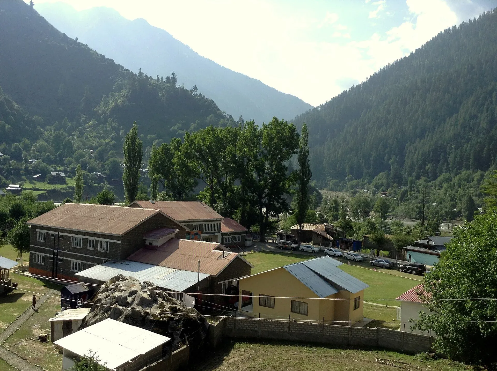
A long, forested river valley in Azad Kashmir running north-east from Muzaffarabad to Sharda, Kel and Arang Kel. It runs close to the Line of Control, so check access before you go.
Overview
The Neelum Valley runs for about 144 km along the Neelum River, in the northernmost district of Azad Kashmir. Wikipedia gives the valley elevation as roughly 1,200 to 2,300 m, with mountains rising on both sides to about 5,200 m. It is thickly wooded, and the river runs fast and green. The Line of Control follows the mountains and, in places, the river itself, so you can see Indian-administered villages across the water. The valley was among the worst hit by the 2005 earthquake.
Pakistan's Neelum Valley is a popular summer destination. The Associated Press has reported about 300,000 visitors each summer in recent years, mostly Pakistani.
Plan your visit
- Nearest town
- Athmuqam
- Getting there
Islamabad to Muzaffarabad about 133 km (OSRM 1.6 h), then the Neelum road: about 93 km to Keran and 129 km (OSRM) to Sharda. Allow a full day. Beyond Sharda the road to Kel and Arang Kel is rough. More
Best months
Apr – Oct
- Neelum Valley
- Related places nearby: Azad Jammu and Kashmir, Ratti Gali Lake, Shounter Lake, Sharda, Taobat, Ghamot National Park, Saral Lake, Chitta Katha Lake, Athmuqam, Sarwali Peak, Upper Neelum (viewpoint above Kel)
Background
Before 1947 the valley was known as Kishanganga; it was later renamed after the village of Neelam. The Neelum River rises in the Gurez valley on the Indian-administered side and joins the Jhelum at Muzaffarabad. Neelum District, with its headquarters at Athmuqam and two tehsils (Athmuqam and Sharda), was part of Muzaffarabad District until 2005. It is the northernmost and largest of Azad Kashmir's ten districts by area, at 3,621 sq km, with 191,233 people at the 2017 census. Wikipedia describes the economy as one of subsistence farming and handicrafts, with tourism growing in importance. Some villages near the Line of Control, such as Dhaki and Changnar, are Pashto-speaking, and Taobat and Karimabad (formerly Sutti) lie close to the Indian border.
Getting there
From Islamabad, OSRM gives Muzaffarabad at about 133 km and 1.6 hours (optimistic; allow 3 to 4 hours). From Muzaffarabad the Neelum road runs up the valley. OSRM gives Muzaffarabad to Sharda at about 129 km and 2.4 hours, which is optimistic. Sources give about 93 km from Muzaffarabad to Keran, then Athmuqam about 12 km on, Sharda about 38 km beyond Keran and Kel about 54 km beyond Keran. Allow a full day to Sharda or Kel.
The road is paved to Sharda. Beyond it, the route to Kel, Arang Kel and Taobat is a rough jeep track in places, and some sections suffer from landslides, rockfall and washouts. Rain and cloudbursts have damaged link bridges and roads in side valleys such as Nallah Jagran, according to the Daily Times. Most visitors leave their car at Keran or Sharda and hire a local jeep.
Villages and sights
- Keran. A riverside village at about 1,524 m, with a village of the same name on the Indian-administered bank. There is no border crossing.
- Athmuqam. The district's main town and bazaar.
- Sharda. At about 1,981 m, with the ruins of Sharada Peeth, a temple and learning centre active from the 6th to 12th centuries.
- Kel and Arang Kel. Arang Kel is a hilltop village at about 2,554 m above Kel. A chairlift station at Kel starts the Arang Kel trail.
- Lakes. Ratti Gali and Shounter lakes lie in the high country of the valley and need long, hard approaches.
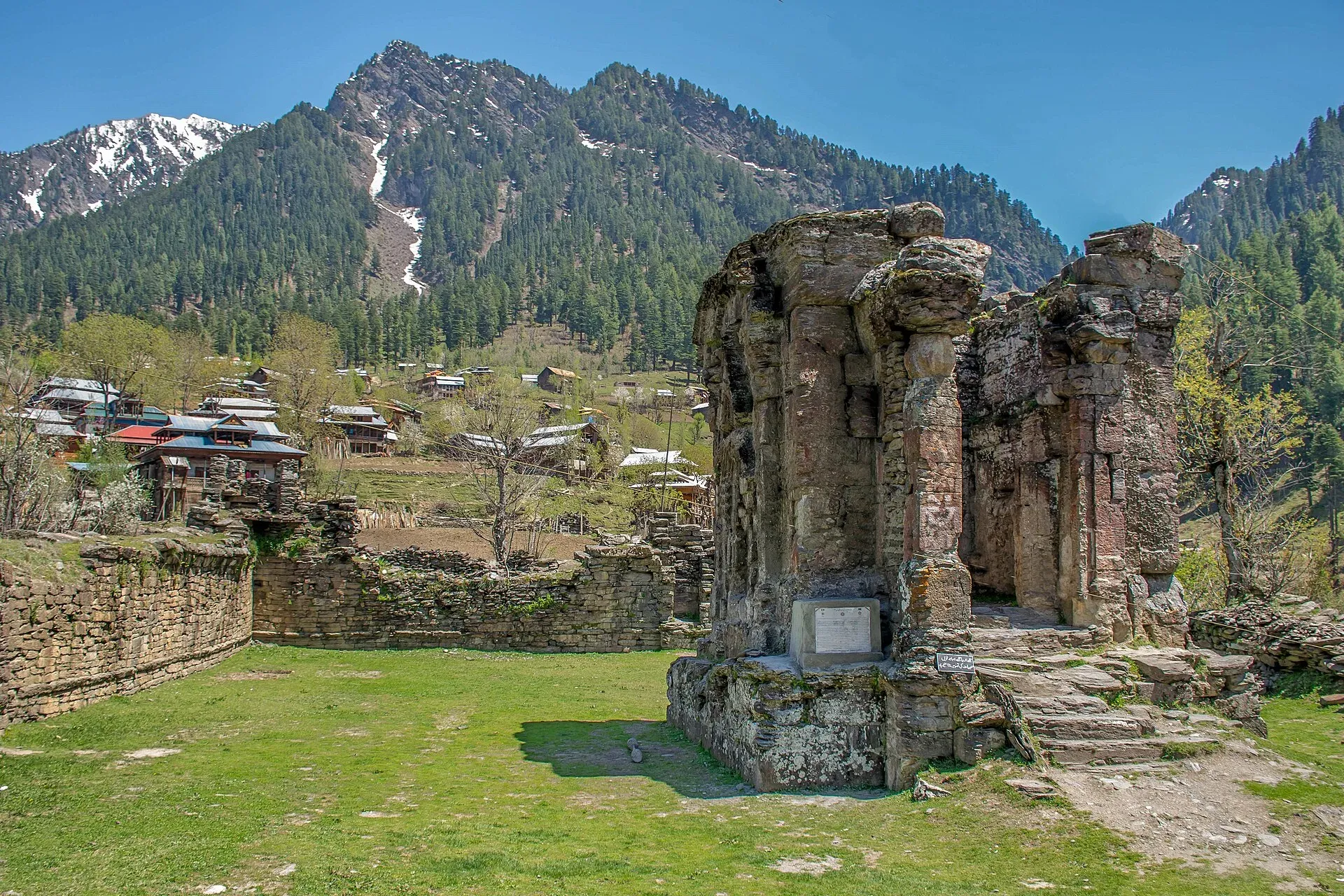
Photo: Umar Jamshaid, with thanks · CC BY-SA 4.0 · via Wikimedia Commons · temporary stand-in photo

Treks and walks
The Arang Kel Trail climbs from Kel to Arang Kel. Higher lakes such as Ratti Gali and Shounter are demanding routes that need local guides. The Noori Nar track leads from Surgan near Sharda towards the Kaghan Valley. Ask locals before any off-road walking, because some areas next to the Line of Control are closed.
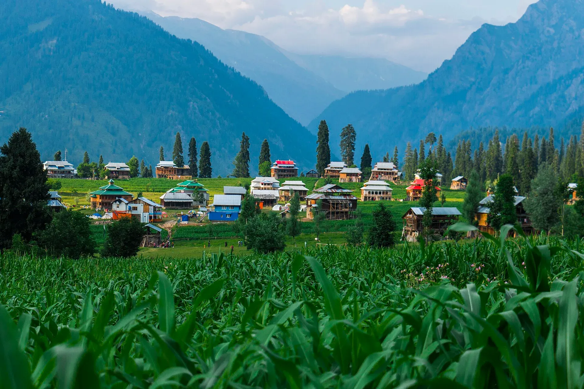
Photo: Jahanzeb Ahsan, with thanks · CC BY-SA 4.0 · via Wikimedia Commons · temporary stand-in photo

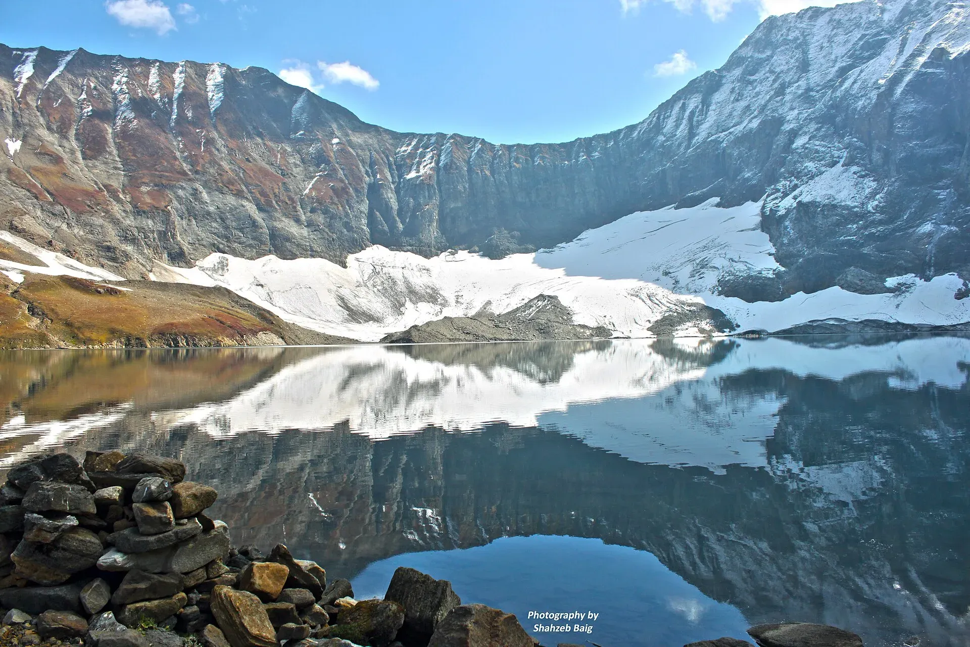
Photo: Shahzeb Baig, with thanks · CC BY-SA 4.0 · via Wikimedia Commons · temporary stand-in photo

When to visit
April to October. Mid-summer is peak season. Winters are cold, with snow and icy roads in the upper valley, and the road can be blocked after heavy snow. Monsoon rain brings landslides.
Where to stay and eat
Keran, Athmuqam, Sharda and Kel have hotels and guest houses, from basic rooms to mid-range hotels, and some campsites. The valley had about 350 guest houses in 2025. Book ahead in July and August. Food is simple: trout, rice, daal and bread, with Kashmiri tea.
Culture and languages
Hindko (locally called Pahari or Parmi) is the main language, followed by Kashmiri, with Gujari and, in the upper valley, Shina. A rare language, Kundal Shahi, is spoken near Athmuqam. Urdu is used for school and business. Dress modestly, and be sensitive when photographing near military posts.
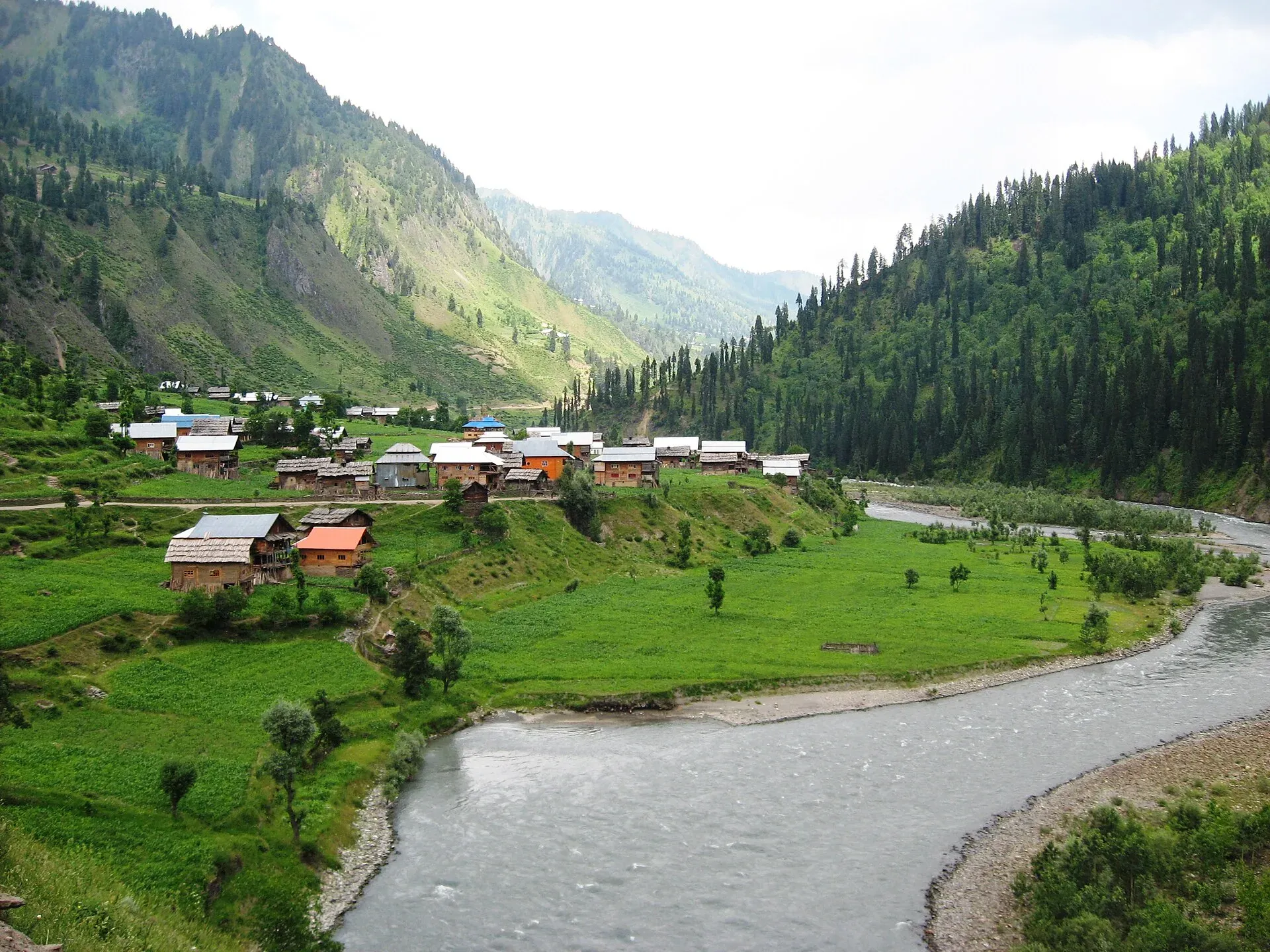
Photo: Muddusar suleman, with thanks · CC BY-SA 4.0 · via Wikimedia Commons · temporary stand-in photo

Safety and practical points
- Line of Control. The UK Foreign Office advises against all travel within 10 miles of the Line of Control, and against all but essential travel to Azad Jammu and Kashmir (last updated 27 October 2026, checked 16 November 2026). Much of the Neelum Valley is within that distance.
- Closures. In early May 2025, as India-Pakistan tensions rose, soldiers and police stopped tourists at checkpoints and turned them back to Muzaffarabad (Dawn, 4 May 2025). Access can be restricted at short notice. Check with the AJK Tourism Department and the Neelum district administration before you go.
- Foreign visitors. There is no known official 2026 statement on permits for foreign visitors. Ask the AJK Tourism Department.
- Firing and shelling. Do not approach the river bank or the Line of Control, and follow local advice.
- Roads. Landslides and rockfall are common, and travel at night is unwise.
Highlights
- Keran and the river border village
- Sharada Peeth ruins at Sharda
- Arang Kel village and chairlift
- Forested slopes and waterfalls
- A long river valley with few crossings
Tips
- Ask about checkpoints and closures before travelling.
- Leave your car at Keran or Sharda and hire a local jeep above.
- Book ahead in July and August.
- Do not approach the river bank or the Line of Control.
Photos we still need: Kutton waterfall en route, with its position on the road; guest house or river-side camp in Keran or Sharda; trout or local food. Send us yours
Sources and last checked
Last checked Confidence medium9 sources5 still to check
- Last checked
- Method
- Desk research from published sources
- Confidence
- medium
- Checked by
- trek.pk research team
Researched from published sources; not yet checked on the ground by our team. Spot something out of date? Report a mistake.
Sources
- Neelum Valley (Wikipedia) · Wikipedia · checked
- Keran, Azad Kashmir (Wikipedia) · Wikipedia · checked
- Sharda, Azad Kashmir (Wikipedia) · Wikipedia · checked
- Arang Kel (Wikipedia) · Wikipedia · checked
- Pakistan-India tensions hit tourism in AJK valley (4 May 2025) · Dawn · checked
- Neelum Valley experiences first winter snow amid reconstruction challenges · Daily Times · checked
- Pakistan travel advice (last updated 27 October 2026) · UK FCDO · checked
- Pakistan Tourism Guide 2021 · TDAP · checked
- OSRM routing · Project OSRM · checked
Still to be checked on the ground (5)
- Current access and permit rules, including for foreigners
- Condition of Kel to Sharda road and Arang Kel track
- Exact distances between villages (sources differ; Wikipedia and Herald give none for Kel, Sharda or Taobat; Herald calls the valley about 200 km long)
- Side-valley bridge and road repairs
- Neelum Valley length: Wikipedia gives 144 km and about 200 km in different places
Nearby and related

Arang Kel Trail

Azad Jammu and Kashmir
A green, hilly region in the Himalayan foothills: Muzaffarabad, the Neelum and Leepa valleys, lakes and waterfalls. Visit with local advice on permission and the Line of Control.

Leepa Valley
A high, quiet valley in Azad Kashmir's Hattian Bala District with rice terraces and apple orchards. The Line of Control is in sight, and the road is closed by snow in winter. Check access first.

Ratti Gali Lake
An alpine glacial lake at about 3,683 m above Dowarian in the Neelum Valley. Open in summer; the route is a rough jeep track and a walk, with strict vehicle rules since 2024.

Shounter Lake
A glacial lake at about 3,100 m in the remote Shounter valley above Kel in Neelum. A rough jeep track from Kel is followed by a hike.

Sharda
A small town in the upper Neelum Valley of Azad Kashmir at about 1,981 m, known for the ruins of the Sharada Peeth temple site. It is close to the Line of Control, and official travel advice is strict.

Taobat
The last village station in the Neelum Valley of Azad Kashmir at about 2,300 m, reached on a rough road from Kel. It is right beside the Line of Control, and official travel advice is strict.
Ghamot National Park
A protected area in Neelum district, Azad Kashmir, notified in 2004. Habitat for musk deer and Himalayan brown bear. Not set up for tourists.
Musk Deer National Park
A park of about 528 sq km in the Gurez valley of Neelum district, Azad Kashmir, created to protect the Kashmir musk deer. Few visitor facilities.
Saral Lake
A glacial lake at about 4,100 m on the Neelum and Kaghan side of Azad Kashmir, reached by a track from Sharda through Gumot National Park. A remote, high-altitude trip.

Chitta Katha Lake
A high alpine lake in the Shounter valley of upper Neelum, Azad Kashmir, reached by a jeep track from Kel and then a short walk. Remote and close to the Line of Control.
Athmuqam
The headquarters of Neelum District in Azad Kashmir, at about 1,350 m in the Neelum Valley. UK advice is against all but essential travel to AJK.
Sarwali Peak
Sarwali Peak (6,424 m) is described as the highest point in Azad Jammu and Kashmir. It stands in the Shounter valley area on the Astore-Neelum border near the Line of Control, and has no recorded ascent.

Upper Neelum (viewpoint above Kel)
A village and viewpoint area in the upper Neelum Valley above Kel, Azad Kashmir, very close to the Line of Control. Little is documented; foreign visitors are advised against travel within 10 miles of the line.