

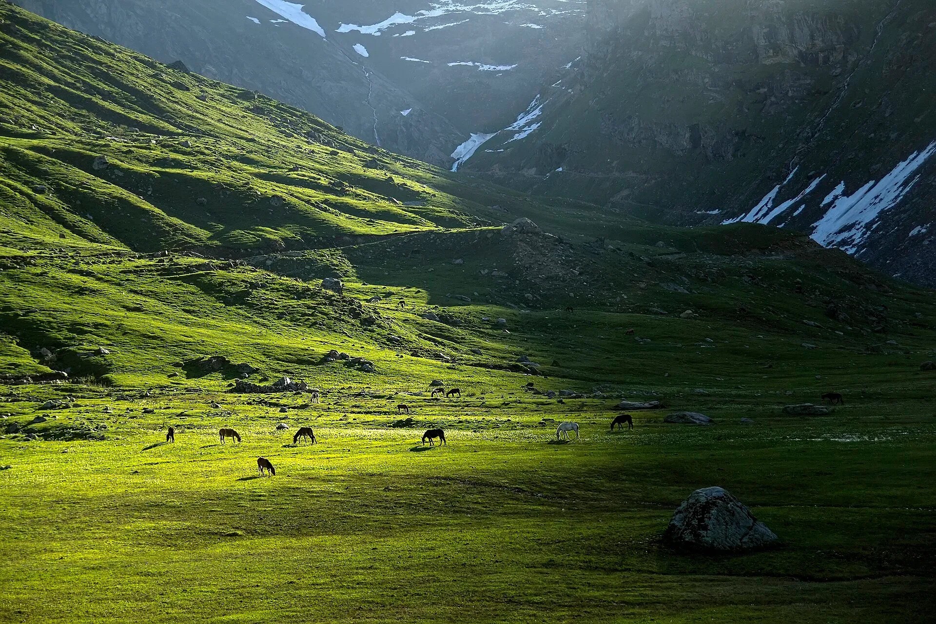
Photo: Zahidgenio, with thanks · CC BY-SA 3.0 · via Wikimedia Commons · temporary stand-in photo

Azad Jammu and Kashmir
A green, hilly region in the Himalayan foothills: Muzaffarabad, the Neelum and Leepa valleys, lakes and waterfalls. Visit with local advice on permission and the Line of Control.
Overview
Azad Jammu and Kashmir (AJK) is a self-governing region of about 13,300 square kilometres (13,297 km2), administered by Pakistan, with Muzaffarabad as its capital. It had 4.33 million people in the 2023 census (4,333,467, preliminary results) and ten districts. It sits in the western Himalayan foothills along the Jhelum and Neelum rivers. The north is mountainous, with peaks above 4,000 m (Sarwali Peak in the Neelum Valley, at 6,326 m, is the highest), and the south drops to low hills around Mirpur, Bhimber and Kotli. Pakistan and India each have claims over the wider Kashmir region, and this guide describes only what visitors can see and do in the part administered by Pakistan.
Plan your visit
- Getting there
By road. Muzaffarabad is about 3 to 4 hours from Islamabad via Murree, Kohala and the Jhelum valley road, or via Abbottabad and Mansehra. More
Best months
Apr – Oct
- Azad Jammu and Kashmir
- Related places nearby: Muzaffarabad, Neelum Valley, Banjosa Lake, Machiara National Park, Bagh, Azad Kashmir, Sudhan Gali, Throchi Fort, Gulpur Waterfalls (Kotli), Rawalakot, Pathika (Patikka)
Divisions and what each is known for
AJK has three divisions.
- Muzaffarabad Division (Muzaffarabad, Hattian Bala and Neelum districts): the capital, the Neelum and Leepa valleys, and most of the high-country sights. Muzaffarabad is about 138 km from Rawalpindi and Islamabad. Its Red Fort stands beside the Neelum River; see Muzaffarabad Red Fort. Pir Chinasi, a hilltop shrine about 30 km east of the city (Wikivoyage), gives views over the valley. The Neelum Valley runs north from Athmuqam through Keran, Sharda, Kel and Taobat, with Arang Kel as the best-known village above the river. The Leepa Valley is a separate side valley about 105 km south-east of Muzaffarabad.
- Poonch Division (Poonch, Haveli, Bagh and Sudhanoti districts): forest hills and lakes around Rawalakot, including Banjosa Lake and Toli Pir; Bagh, with Sudhan Gali, Ganga Choti and Panjal Mastan National Park; and Palandri in Sudhanoti, at about 1,372 m.
- Mirpur Division (Mirpur, Kotli and Bhimber districts): the low southern hills. Mangla Dam, completed in 1967, makes the large Mangla Lake, and Ramkot Fort stands on a hill above it.
What it is best for
- River valleys and forest: Neelum is the best known.
- Alpine lakes and meadows for day hikes and short treks.
- Easy, green escapes from Islamabad at any time of year.
- Local culture: wooden houses, orchards and small bazaars.
Top places
- Muzaffarabad: Red Fort (Muzaffarabad Fort), Domel confluence and the Pir Chinasi shrine and viewpoint.
- Neelum Valley: Keran, Sharda, Kel, Arang Kel, Taobat.
- Leepa Valley: terraced fields and forest drives.
- Ratti Gali, Banjosa and Shounter lakes.
- Machiara National Park.
- Mangla Dam and Ramkot Fort.
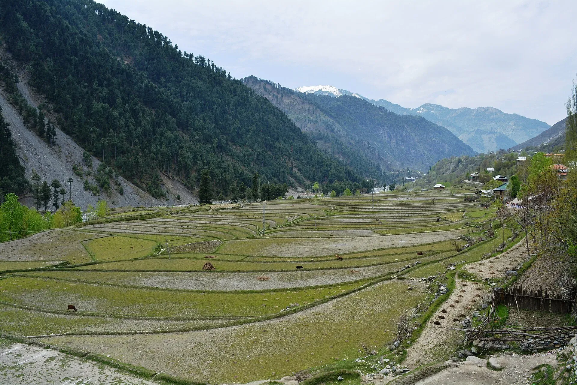
Photo: Obaid Hassan Qureshi, with thanks · CC BY-SA 4.0 · via Wikimedia Commons · temporary stand-in photo

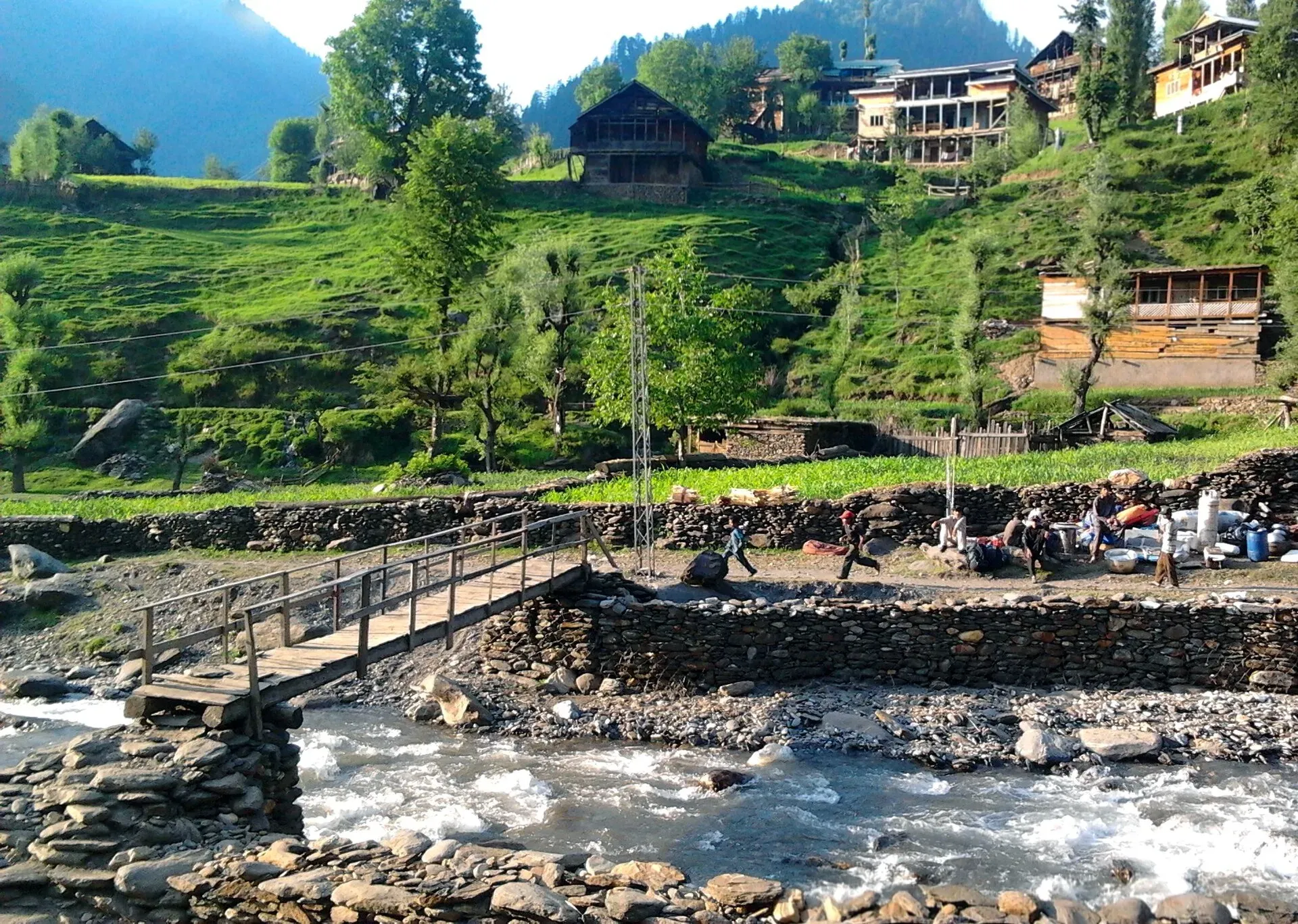
Photo: Asif Shimshalee, with thanks · CC BY-SA 3.0 · via Wikimedia Commons · temporary stand-in photo

When to go
April to October is the main season. Spring and autumn are clear and mild, and summer is cooler than the plains but wet. Rain falls in both winter and summer, and the territory averages over 1,400 mm a year. Muzaffarabad is among the wettest areas in the country, with about 1,800 mm of rain in a typical year, but it gets no snow. Snow falls in the north in December and January, and many high roads close. The south is hot in summer, and the monsoon brings landslides and flash floods.
Getting around
Access is by road only. There is no railway, and Wikivoyage says the Muzaffarabad and Rawalakot airports are closed to civilian traffic, so the nearest major airports are at Islamabad. Buses run from Islamabad and Rawalpindi to Muzaffarabad, commonly via Murree. Main roads in Muzaffarabad, Mirpur and Kotli districts are paved. Neelum is narrow and winding, with landslides and a single road for much of its length. Shared jeeps run to Kel and Arang Kel, and private cars with a driver are the most flexible option.
Permits and rules for visitors
- Pakistani visitors may enter freely, but should carry ID and check for any permission needed at checkpoints in Neelum and Leepa.
- Foreign visitors: the March 2019 Ministry of Interior notification (Dawn, 26 March 2019) ended the NOC requirement for foreigners in Azad Kashmir except for a 5-mile strip along the Line of Control. The UK FCDO now says foreigners may not travel within 10 miles of the Line of Control, and that you need advance permission for several Azad Kashmir districts; no official AJK page describes a rule for Neelum Valley (as of November 2026). Local practice for Neelum and Leepa may differ, and there is no known later notification. Check with the AJK Tourism Department or a registered operator before you go.
- Access to some border-area villages may be restricted. Follow police and army instructions.
- Any fees for sites or parks will be added soon.
People, culture and food
The most widely spoken language is Pahari-Pothwari (about 68 per cent), followed by Gojri (about 19 per cent) and Kashmiri (about 5 per cent), with Urdu as the official language. Dogri is spoken in Bhimber. The 2005 earthquake devastated Muzaffarabad and nearby towns, and rebuilding is visible. Azad Kashmir Day is observed on 24 October, and Kashmir Solidarity Day on 5 February.
Local food includes Kashmiri noon chai (pink tea, which Wikivoyage describes as slow-steeped with cardamom, almonds and pistachios), fresh river trout in Neelum, and rich meat curries. Local products include walnuts, honey, apples, cherries, mushrooms and medicinal herbs. Crafts include walnut wood carving, embroidered shawls, namdas (felt rugs), dhurrie carpets and basketry.
Safety
The Neelum road runs close to the Line of Control in places, and the area has seen shelling in earlier years, though a ceasefire has largely held since 2021. Follow local advice and do not stray from signed routes. Wikivoyage notes that protests and civil disobedience, especially in Muzaffarabad, can disrupt roads and mobile and internet services, and that the buffer zone along the Line of Control is off limits. Landslides and flash floods are common in monsoon, and winter can close high passes. The 2005 earthquake shows the region is seismically active.
Ask the district administration or local police about current conditions before you go. For foreign visitors: the UK FCDO advises against all but essential travel to Azad Jammu and Kashmir, and against all travel within 10 miles of the Line of Control (advice updated 27 October 2026, checked 17 November 2026). The advice notes ongoing demonstrations, road closures and suspended mobile and internet services in places, and says people already there are encouraged to leave. Read the live advice before you plan.
Highlights
- Neelum Valley: Keran, Sharda and Arang Kel
- Leepa Valley's terraced fields
- Ratti Gali, Banjosa and Shounter lakes
- Muzaffarabad's Red Fort and river confluence
- Mangla Dam and Mirpur
Getting there
By road. Muzaffarabad is about 3 to 4 hours from Islamabad via Murree, Kohala and the Jhelum valley road, or via Abbottabad and Mansehra. Rawalakot, Kotli and Mirpur are reached from Islamabad and Rawalpindi through Punjab. Mirpur is about 2.5 hours from Islamabad.
Neelum Valley. The road runs from Muzaffarabad to Athmuqam (about 80 km), then on to Sharda, Kel and Taobat. Beyond Kel, jeep tracks lead to Arang Kel. Allow a full day for the upper valley.
By air. Muzaffarabad Airport has no scheduled flights (Wikipedia lists it as non-operational, citing the CAA and a 2025 news report), so travellers come by road.
Tips
- Ask about permissions and check road status before heading up Neelum or Leepa.
- Stay on the main road and heed local police advice near the Line of Control.
- Carry your CNIC or passport; checkpoints are common.
- Bring rain gear; the region gets heavy rain, especially in monsoon.
- Jeep tracks to Arang Kel and lakes need local drivers and good weather.
Photos we still need: Azad Kashmir food and local crafts. Send us yours
Sources and last checked
Last checked Confidence medium11 sources4 still to check
- Last checked
- Method
- Desk research from published sources
- Confidence
- medium
- Checked by
- trek.pk research team
Researched from published sources; not yet checked on the ground by our team. Spot something out of date? Report a mistake.
Sources
- Pakistan Tourism Guide 2021 · Trade Development Authority of Pakistan (TDAP) · checked
- Azad Kashmir · Wikipedia · checked
- Neelum Valley · Wikipedia · checked
- Tourism information · Azad Jammu and Kashmir Tourism Department · checked
- 2023 census of Pakistan (provincial populations) · Wikipedia · checked
- NOC requirements for foreigners visiting Pakistan abolished (26 March 2019) · Dawn · checked
- List of airports in Pakistan · Wikipedia · checked
- Muzaffarabad Airport · Wikipedia · checked
- Leepa Valley · Wikipedia · checked
- Azad Kashmir · Wikivoyage · checked
- Foreign travel advice: Pakistan, regional risks and safety · UK FCDO · checked
Still to be checked on the ground (4)
- Current NOC rules for foreign visitors (no later notification than March 2019 found; AJK Tourism site gives no permit details)
- Whether Neelum and Leepa checkposts ask foreigners for permission, and current access near the Line of Control (FCDO advises against all travel within 10 miles of the LoC)
- Foreign visitor permits: Wikivoyage says permits from the AJK Home Department are needed outside a list of towns, which differs from the 2019 Dawn report; confirm with the AJK Tourism Department
- Current road and checkpoint conditions on the Neelum and Leepa roads
Nearby and related

Muzaffarabad
The capital of Azad Jammu and Kashmir, at 737 m where the Neelum and Jhelum rivers meet. It is the gateway to the Neelum Valley and a rebuilt city after the 2005 earthquake.

Neelum Valley
A long, forested river valley in Azad Kashmir running north-east from Muzaffarabad to Sharda, Kel and Arang Kel. It runs close to the Line of Control, so check access before you go.

Leepa Valley
A high, quiet valley in Azad Kashmir's Hattian Bala District with rice terraces and apple orchards. The Line of Control is in sight, and the road is closed by snow in winter. Check access first.

Arang Kel
A hilltop village and meadow at about 2,554 m above Kel in the Neelum Valley, reached by a chairlift across the river and a steep walk.

Ratti Gali Lake
An alpine glacial lake at about 3,683 m above Dowarian in the Neelum Valley. Open in summer; the route is a rough jeep track and a walk, with strict vehicle rules since 2024.

Banjosa Lake
A man-made lake at about 1,980 m in a pine forest, 18 km from Rawalakot in Poonch. It is reached by a paved road and freezes in winter.

Mangla Dam
A large embankment dam on the Jhelum River, completed in 1967 and raised in 2009. The lake has a recreation side open to the public, but parts of the area are restricted.

Machiara National Park
A forested mountain park near Muzaffarabad, notified in 1996, covering about 334 square kilometres between the Neelum and Kaghan valleys. An Important Bird Area with western tragopan and musk deer.

Bagh, Azad Kashmir
Bagh is the headquarters of Bagh District in Azad Kashmir, a mountain town in the Pir Panjal foothills and the base for Sudhan Gali and Ganga Choti. For foreign visitors: the UK FCDO advises against all but essential travel to AJK.

Sudhan Gali
A small hill resort at about 2,100 m on the Bagh-Muzaffarabad road in Bagh District, Azad Kashmir, and the usual start for the Ganga Choti hike. Quiet and basic. For foreign visitors: the UK FCDO advises against all but essential travel to AJK.
Throchi Fort
A hilltop fort near Gulpur in Kotli district, Azad Kashmir, thought to date from the 15th century and now used by the army. Foreign visitors face FCDO restrictions.
Baghsar Fort
A neglected Mughal-style fort in the Samahni valley, Bhimber district, right beside the Line of Control. Some parts are closed to visitors.
Gulpur Waterfalls (Kotli)
Two linked falls south-west of Kotli city in Azad Kashmir, at the junction of the Kotli-Mirpur and Kotli-Rawalpindi roads. Can be seen from a nearby hill.

Rawalakot
The main town of Poonch district in Azad Kashmir, at about 1,640 m, and the usual base for Banjosa Lake and Toli Pir. Cool in summer, with snow in winter. FCDO advises against all but essential travel to AJK.

Samahni Valley
A forested hill valley in Samahni tehsil, about 17 km north of Bhimber in Azad Kashmir, along the Line of Control. FCDO advises against travel within 10 miles of the Line.
Bandala Valley
A narrow valley in Bhimber District, Azad Kashmir, running from the Tawi River to Samahni Valley. Its last villages are close to the Line of Control.
Kas Chanatar
A low foothill valley beside Bhimber city in Azad Kashmir, at about 390 m, with farming villages and a seasonal stream. Little visitor information.
Pathika (Patikka)
A village and tehsil about 20 km from Muzaffarabad in Azad Kashmir. Wikipedia lists it among valleys, but there is little visitor information.