

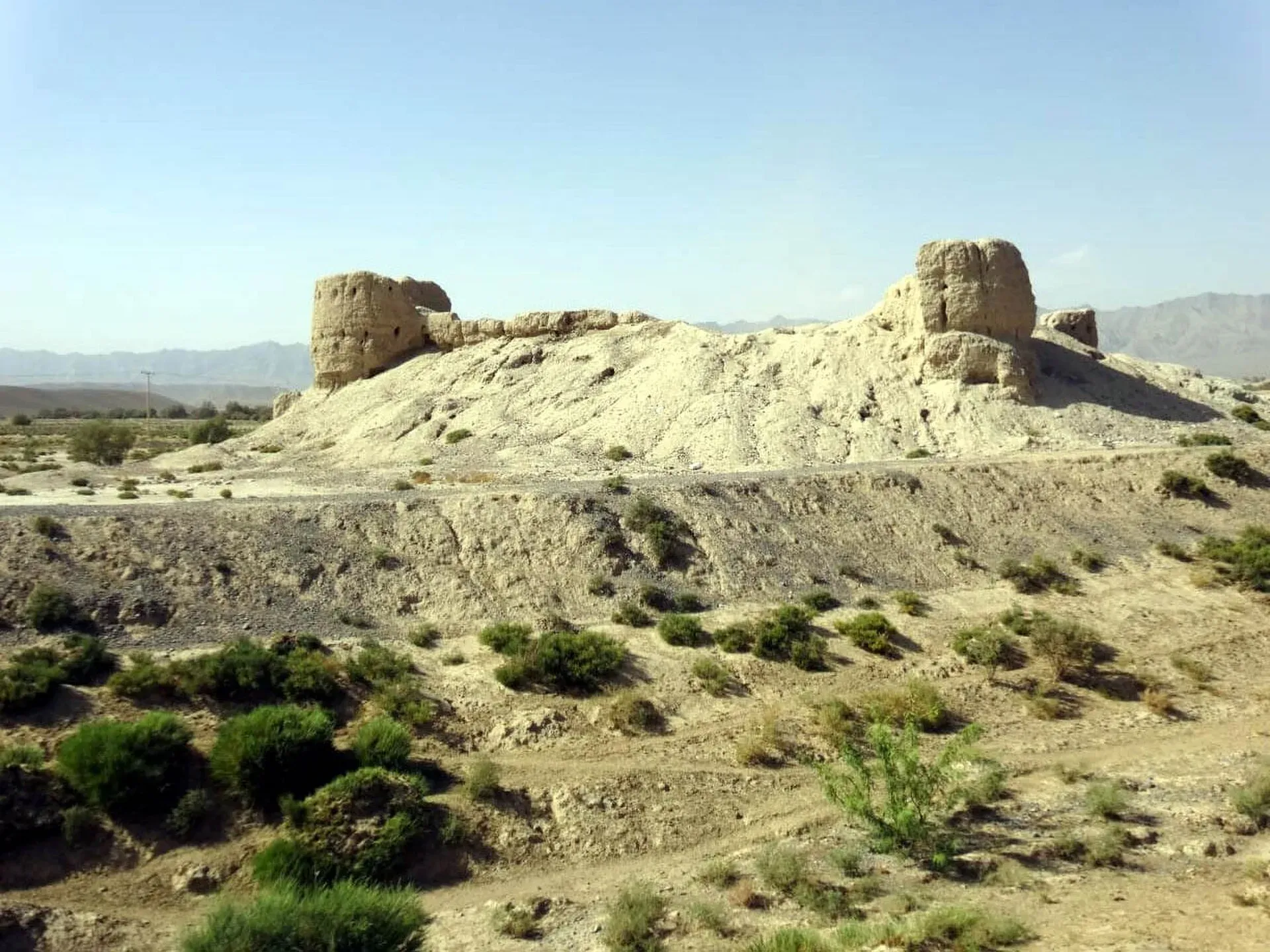
Photo: Masood Khan Khwajakhail, with thanks · CC BY-SA 4.0 · via Wikimedia Commons · temporary stand-in photo

Loralai
A Pashtun hill town at about 1,400 m in north-eastern Balochistan, headquarters of Loralai District and Division, with a 16th-century Mughal fort.
Overview
Loralai, also called Bori in Pashto, is a hill town in north-eastern Balochistan at about 1,400 m. It is the headquarters of Loralai District and Loralai Division. The 2023 census counted about 59,601 people in the city (CityPopulation.de, which gives 54,849 for 2017; Wikipedia gives 56,613 for 2023 and 47,098 for 2017, so the two sources count different areas). Pashto is the main language, spoken by about 86 percent of residents, and the population is overwhelmingly Muslim.
The elevation gives it cooler summers than the Indus plains to the east. It is a small administrative and trading town on the road system that links Quetta with the Pashtun belt and the Punjab border.
Plan your visit
- Getting there
Road: Quetta about 260 km (about 3 hours 10 minutes); Dera Ghazi Khan about 278 km (about 4 hours 45 minutes). Rail: not listed. Air: use Quetta. More
Best months
Mar – May, Sep – Oct
Growth and people
Census counts show how quickly the town has grown. Wikipedia lists 4,437 people in 1951, 10,482 in 1981, 25,450 in 1998 and 56,613 in 2023. Besides Pashto, small shares speak Saraiki, Punjabi, Balochi and Urdu. The 1941 census, which counted the municipality and the cantonment together, recorded a town that was about 46 per cent Muslim, 30 per cent Hindu and 22 per cent Sikh, a very different mix from today's. The British-era cantonment is why the town has a divisional and district role.
The district
Loralai District covers 3,785 km2 and had 398,832 people in 2023, with about 58 per cent living in urban areas. It has two tehsils (sub-districts): Bori, which includes the town, and Mekhtar. About 96 per cent of residents speak Pashto. The University of Loralai is the district's best-known institution.
What to see and do
Loralai is not a regular tourist stop and published information for visitors is thin.
- Mughal Fort (Mughal Qila): a fort dated in sources to the 16th century, standing in the town. Ask permission and check its condition before approaching.
- Chinjan: a village area about 40 km north-west of the town, shown in photographs and mentioned in Wikipedia.
- Khardazai: a rural area near Loralai that appears in photographs.
- Bazaars: local markets for farm goods, cloth and household items.
Food and bazaars
Expect Pashtun food: grilled meat (tikka and chapli-style kebabs), flatbread, rice dishes and green tea. No verified list of local specialities was found, so ask locals.
Getting there
- Road: Quetta is about 260 km and 3 hours 10 minutes by road, and Dera Ghazi Khan about 278 km and 4 hours 45 minutes (OSRM, checked 16 November 2026). Road and security conditions vary, so check before you set out.
- Rail: no rail service is listed.
- Air: no airport is listed. The nearest main airport is at Quetta.
Getting around
Local vans, rickshaws and taxis serve the town. For rural areas, use a driver who knows the roads.
Where to stay
Accommodation is limited and mostly basic. Look in the main bazaar and government offices area. Travellers on official business often use government guesthouses.
Day trips
Options are limited and security-dependent. Chinjan is the one nearby place named in sources, about 40 km north-west.
When to visit
Spring and autumn are most pleasant. Winters at this altitude are cold, and summers are warm but cooler than the plains.
Safety
Ask the district administration or local police about current conditions before you go. For foreign visitors: the UK FCDO advises against all travel to Balochistan Province, with no exceptions listed (page updated 27 October 2026; checked 16 November 2026). This page therefore does not recommend travelling here as a visitor. If you live in or have essential business in the area, follow current guidance from the provincial authorities and your embassy, and do not rely on this page for planning. The FCDO also notes an ongoing risk of terrorism across Pakistan.
Good to know
Carry identification and expect checkpoints. Visitor services are minimal.
Highlights
- Mughal Fort of the 16th century
- Cool upland setting at about 1,400 m
- Pashto-speaking Bori town
- Chinjan area to the north-west
Hotels, food, fuel and services in Loralai
Places to stay
- Tourist LodgesCall Tourist LodgesMap of Tourist Lodges in Google Maps
Places to eat
- Kababish Broast and RestaurantCall Kababish Broast and RestaurantMap of Kababish Broast and Restaurant in Google Maps
- Kashmir BakeryMap of Kashmir Bakery in Google Maps
Essential services fuel stations, ATMs, banks, pharmacies and hospitals and clinics
Fuel
- Khan Petroleum Service LoralaiCall Khan Petroleum Service LoralaiMap of Khan Petroleum Service Loralai in Google Maps
- tanha super storeCall tanha super storeMap of tanha super store in Google Maps
- Ajmal Filling Station- Total Petrol StationCall Ajmal Filling Station- Total Petrol StationMap of Ajmal Filling Station- Total Petrol Station in Google Maps
- Rahat Petroleum NizamabadCall Rahat Petroleum NizamabadMap of Rahat Petroleum Nizamabad in Google Maps
- Sher Petroleum ServiceMap of Sher Petroleum Service in Google Maps
- Sami Petroleum ServicesMap of Sami Petroleum Services in Google Maps
ATMs
- Bank AlfalahMap of Bank Alfalah in Google Maps
- National Bank ATMMap of National Bank ATM in Google Maps
Banks and money exchange
- Meezan Bank - Loralai BranchCall Meezan Bank - Loralai BranchMap of Meezan Bank - Loralai Branch in Google Maps
- MCB Islamic BankMap of MCB Islamic Bank in Google Maps
- National Bank of Pakistan (NBP)Map of National Bank of Pakistan (NBP) in Google Maps
- Bank Al Habib LimitedCall Bank Al Habib LimitedMap of Bank Al Habib Limited in Google Maps
- Habib Bank LoraliMap of Habib Bank Lorali in Google Maps
Pharmacies
- Alkareem Medical StoreCall Alkareem Medical StoreMap of Alkareem Medical Store in Google Maps
- Boori Medical and surgical storeCall Boori Medical and surgical storeMap of Boori Medical and surgical store in Google Maps
- Al shifa clinic and medical storeCall Al shifa clinic and medical storeMap of Al shifa clinic and medical store in Google Maps
Hospitals and clinics
- Al Rashid Memorial Hospital LoralaiCall Al Rashid Memorial Hospital LoralaiMap of Al Rashid Memorial Hospital Loralai in Google Maps
- DHQ HospitalCall DHQ HospitalMap of DHQ Hospital in Google Maps
- Saleh Muhammad Medical ComplexMap of Saleh Muhammad Medical Complex in Google Maps
- New Arif Lab and Arif Lab gowal mandi road loraliCall New Arif Lab and Arif Lab gowal mandi road loraliMap of New Arif Lab and Arif Lab gowal mandi road lorali in Google Maps
- Zarina ClinicMap of Zarina Clinic in Google Maps
Listings come from Google Maps data and are unverified: phone numbers, opening months and prices may have changed. Report a problem · Own one of these? Claim it
Tips
- Check security advice before any travel.
- Carry identification and expect checkpoints.
- Use a local driver outside the town.
- Bring warm clothes for winter.
Photos we still need: Chinjan or the surrounding hills; a bazaar street in Loralai. Send us yours
Sources and last checked
Last checked Confidence low5 sources6 still to check
- Last checked
- Method
- Desk research from published sources
- Confidence
- low
- Checked by
- trek.pk research team
Researched from published sources; not yet checked on the ground by our team. Spot something out of date? Report a mistake.
Sources
- Loralai · Wikipedia · checked
- City populations, 2023 census (compiled from Pakistan Bureau of Statistics) · CityPopulation.de · checked
- OSRM driving routes (road distances and times) · Project OSRM / OpenStreetMap · checked
- Pakistan travel advice (safety and security; updated 27 October 2026) · UK Foreign, Commonwealth & Development Office · checked
- Loralai District · Wikipedia · checked
Still to be checked on the ground (6)
- Population: CityPopulation.de gives 59,601 (2023) and 54,849 (2017); Wikipedia gives 56,613 and 47,098; the Pakistan Bureau of Statistics table was not opened, so the area definition is unconfirmed
- Fort age and access (Wikipedia calls it a 16th-century Mughal fort in a photo caption only)
- Chinjan distance and access (about 40 km north-west per a Wikipedia caption only)
- Hotels, food and transport (very little published)
- Population history: 1941 religious mix is from Wikipedia's census note and covers the municipality plus cantonment
- Best months: no source; spring and autumn are a general judgement from the altitude
Nearby and related

Balochistan
Pakistan's largest and least populated province: Quetta's high valleys, Ziarat's juniper forest, the Makran coast, Hingol and Gwadar. Security and permission rules need checking first.

Quetta
Balochistan's high-valley capital, the Fruit Garden of Pakistan: bazaars, sajji, orchard valleys and the base for Hanna Lake and Ziarat.

Dera Ghazi Khan
Divisional city on the west bank of the Indus in south-west Punjab, in Saraiki and Baloch country, and the gateway to the cool hills of Fort Munro and the shrine town of Sakhi Sarwar.