

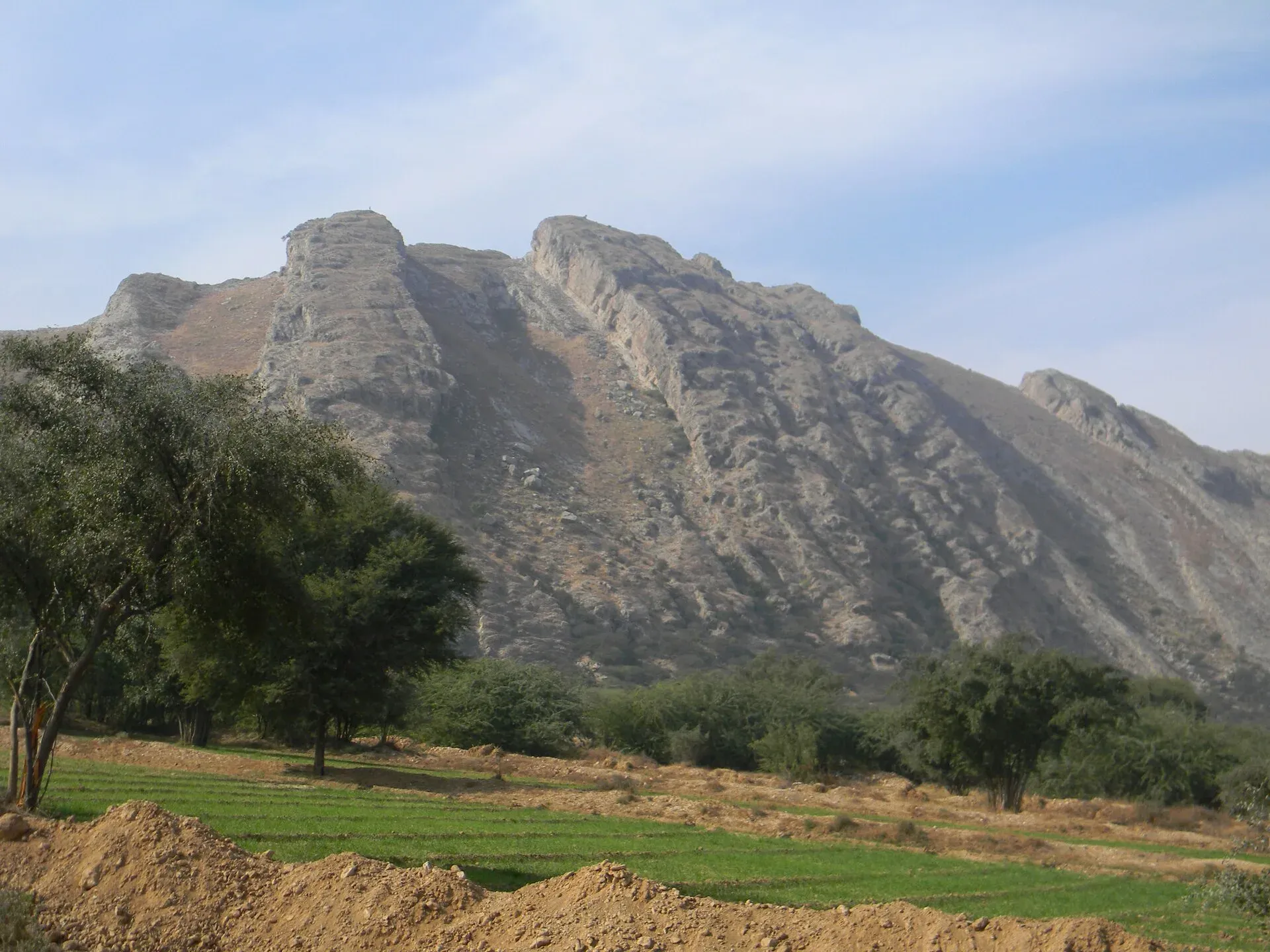
Photo: Khalid Mahmood, with thanks · CC BY-SA 3.0 · via Wikimedia Commons · temporary stand-in photo

Mianwali
District capital east of the Indus in north-west Punjab. A farm and air-force town with the Chashma and Jinnah barrages nearby.
Overview
Mianwali is the capital of Mianwali District, east of the Indus in north-west Punjab, irrigated by the Thal Canal. Wikipedia says it was founded in the 16th century by the Sufi saint Shaikh Mian Ali, from whom the name comes, and that the municipality was created in 1875. It became the district headquarters in 1901. At the 2023 census the city had 129,500 people (Wikipedia, citing the census).
Plan your visit
- Getting there
From Islamabad: about 236 km, roughly 3 hours 15 minutes (OSRM, optimistic, checked 16 November 2026). Mianwali is on the Rawalpindi to Mianwali road via Talagang. There is a railway station; More
Best months
Oct – Mar
- Mianwali
- Related places nearby: Chashma Barrage, Jinnah Barrage (Kalabagh)
The district and its landscape
Mianwali District covers about 5,840 sq km along the Indus. The north continues the Pothohar Plateau and the Salt Range, and the south is part of the Thal desert (Wikipedia). The district was formed in November 1901 and placed in Punjab, at the same time as the North-West Frontier Province was cut out. Its people speak mainly Saraiki (about 76 per cent at the 2023 census), with Pashto, Punjabi and Urdu minorities; Pashto is spoken in Isa Khel. The Niazi and Awan tribes are among the best known local groups, and Imran Khan, the former cricketer and prime minister, comes from the district.
The climate is dry. Summers from May to September are long and hot, with June averaging about 42 C, and winters from November to February are cold and dry, with average lows of 3 to 4 C in December and January. Annual rainfall averages about 385 mm.
What to see and do
Mianwali is not a sightseeing town. The district is notable for two Indus barrages, Chashma and Jinnah, which Wikipedia says is unusual for one district. Chashma Lake lies to the south-west and Namal Lake to the north-east, on the road towards Talagang. The area also has an air-force base and the Chashma nuclear power complex, which are not visitor sites. Expect bazaars, canal-side farmland and quiet roads.
- Thal Canal. The canal passes through the city, and a bridge in town gives a view of it.
- Namal Lake. About 32 km from Mianwali, among the Salt Range hills. The British built the dam in 1913 and it was opened on 2 December 1913 as the Dane Dam, to supply irrigation and drinking water. Wikipedia describes it as a picnic spot, and notes winter visits by waterfowl and cranes. The lake dried up in 2022, for the first time in about a century, so check the water level first. See Namal Lake.
- Chashma Barrage near Kundian and Jinnah Barrage: working irrigation works on the Indus. See Chashma Barrage and Jinnah Barrage.
- Salt Range. The hills north of the district are part of the range that holds the salt mines at Khewra; see Salt Range National Park.
When to visit
October to March. May to August is very hot.
Where to stay and eat
A few simple hotels and grill restaurants serve the town. We have no verified names. Visitors usually base themselves in Islamabad or Rawalpindi.
Good to know
As a district headquarters it should have a government hospital, pharmacies, banks with ATMs and fuel stations, but we have no verified details, so check on arrival and fill up and withdraw cash before heading into the countryside. Safety: The UK FCDO Pakistan page (updated 27 October 2026, checked 16 November 2026) advises against all but essential travel to Dera Ghazi Khan, the only Punjab area it lists, and against all but essential travel within 5 miles of the India border. Mianwali is not named on the page, but it borders Khyber Pakhtunkhwa districts the page lists (such as Karak and Lakki Marwat on the other side of the Indus), so stay on main roads and avoid crossing west of the river. Check the live page before you go.
Highlights
- Founded in the 16th century by Shaikh Mian Ali
- Two Indus barrages: Chashma and Jinnah
- Namal Lake to the north-east
Getting there
From Islamabad: about 236 km, roughly 3 hours 15 minutes (OSRM, optimistic, checked 16 November 2026). Mianwali is on the Rawalpindi to Mianwali road via Talagang. There is a railway station; check timetables with Pakistan Railways. The nearest major airport is in Islamabad.
Hotels, food, fuel and services in Mianwali
Places to stay
- Al Mairaj HotelCall Al Mairaj HotelMap of Al Mairaj Hotel in Google Maps
- Superior Group Of College Mianwali Boys HostelCall Superior Group Of College Mianwali Boys HostelMap of Superior Group Of College Mianwali Boys Hostel in Google Maps
- Ans Boys HostelCall Ans Boys HostelMap of Ans Boys Hostel in Google Maps
- Three 3star Girls Hostel MianwaliCall Three 3star Girls Hostel MianwaliMap of Three 3star Girls Hostel Mianwali in Google Maps
Places to eat
- Khuda Bakhsh Chai Khana, MianwaliCall Khuda Bakhsh Chai Khana, MianwaliMap of Khuda Bakhsh Chai Khana, Mianwali in Google Maps
- PAF Officers' MessCall PAF Officers' MessMap of PAF Officers' Mess in Google Maps
- Shaheen Sweets & BakersCall Shaheen Sweets & BakersMap of Shaheen Sweets & Bakers in Google Maps
- Jalandhari Chargha HouseCall Jalandhari Chargha HouseMap of Jalandhari Chargha House in Google Maps
- Data BakeryCall Data BakeryMap of Data Bakery in Google Maps
- Charsi Shinwari Tika Hotel & restaurant MianwaliCall Charsi Shinwari Tika Hotel & restaurant MianwaliMap of Charsi Shinwari Tika Hotel & restaurant Mianwali in Google Maps
Essential services fuel stations, mechanics, pharmacies and hospitals and clinics
Fuel
- Total Petrol PumpCall Total Petrol PumpMap of Total Petrol Pump in Google Maps
- Chinar CNG StationMap of Chinar CNG Station in Google Maps
- Attock Petrol PumpMap of Attock Petrol Pump in Google Maps
- Wattakhail petroleumCall Wattakhail petroleumMap of Wattakhail petroleum in Google Maps
- シェル石油Map of シェル石油 in Google Maps
- Allied PetroleumMap of Allied Petroleum in Google Maps
Mechanics and tyre shops
- Nasrullah Khan & Co. MianwaliCall Nasrullah Khan & Co. MianwaliMap of Nasrullah Khan & Co. Mianwali in Google Maps
- Mianwali Tyre CentreCall Mianwali Tyre CentreMap of Mianwali Tyre Centre in Google Maps
- Muslim Tyre and Tyre Care BranchCall Muslim Tyre and Tyre Care BranchMap of Muslim Tyre and Tyre Care Branch in Google Maps
- Al Basit tyre shopMap of Al Basit tyre shop in Google Maps
- Hamza & Co. Tire Shop MianwaliCall Hamza & Co. Tire Shop MianwaliMap of Hamza & Co. Tire Shop Mianwali in Google Maps
- Bannu Sarhad Radiator WorksCall Bannu Sarhad Radiator WorksMap of Bannu Sarhad Radiator Works in Google Maps
Pharmacies
- City Pharmaceuticals DistributorCall City Pharmaceuticals DistributorMap of City Pharmaceuticals Distributor in Google Maps
- Omair PharmacyCall Omair PharmacyMap of Omair Pharmacy in Google Maps
- Fajr PharmacyCall Fajr PharmacyMap of Fajr Pharmacy in Google Maps
- Hamza Zaka PharmacyCall Hamza Zaka PharmacyMap of Hamza Zaka Pharmacy in Google Maps
- Ghaffar Medicine CompanyMap of Ghaffar Medicine Company in Google Maps
- New Life Medical CompanyCall New Life Medical CompanyMap of New Life Medical Company in Google Maps
Hospitals and clinics
- Dr Nadia Shah Clinic and Maternity HospitalCall Dr Nadia Shah Clinic and Maternity HospitalMap of Dr Nadia Shah Clinic and Maternity Hospital in Google Maps
- Dr Nusrat Ullah Eye Specialist (Al Mustafa Laser Eye Clinic)Map of Dr Nusrat Ullah Eye Specialist (Al Mustafa Laser Eye Clinic) in Google Maps
- Khalida Nusrat Maternity HomeCall Khalida Nusrat Maternity HomeMap of Khalida Nusrat Maternity Home in Google Maps
- Major Sheikh Arshad HospitalCall Major Sheikh Arshad HospitalMap of Major Sheikh Arshad Hospital in Google Maps
- City Medical ComplexCall City Medical ComplexMap of City Medical Complex in Google Maps
- Obaid Noor HospitalCall Obaid Noor HospitalMap of Obaid Noor Hospital in Google Maps
Listings come from Google Maps data and are unverified: phone numbers, opening months and prices may have changed. Report a problem · Own one of these? Claim it
Tips
- Visit October to March.
- Stay on main roads and do not cross the Indus westwards.
- Check conditions locally before you travel.
Photos we still need: Namal Lake and the Chashma or Jinnah barrage in a high-resolution open-licence image. Send us yours
Sources and last checked
Last checked Confidence medium5 sources3 still to check
- Last checked
- Method
- Desk research from published sources
- Confidence
- medium
- Checked by
- trek.pk research team
Researched from published sources; not yet checked on the ground by our team. Spot something out of date? Report a mistake.
Sources
- Mianwali · Wikipedia · checked
- OSRM driving routes (road distances and times, optimistic) · Project OSRM · checked
- Pakistan travel advice: warnings and insurance · UK FCDO (GOV.UK) · checked
- Mianwali District (Wikipedia) · Wikipedia · checked
- Namal Lake (Wikipedia) · Wikipedia · checked
Still to be checked on the ground (3)
- Hotels and services
- Rail timetables
- Local food and bazaar specialities (no source found)
Nearby and related

Bhakkar
District capital on the edge of the Thal sandy plain, close to the Indus. A farm town with few visitor sights; useful as a stop in the Thal region.

Chakwal
District capital on the Pothohar plateau, about 125 km from Islamabad, and a base for the Salt Range sights at Kallar Kahar and Katas Raj.

Islamabad
Pakistan's green, planned capital at the foot of the Margalla Hills: Faisal Mosque, hillside trails, cafes and the gateway to the north.

Sargodha
A planned canal-colony city in central Punjab, famous for kinnow oranges, with the dark Kirana Hills nearby and easy road links to Lahore, Faisalabad and Islamabad.

Chashma Barrage
An Indus barrage in Mianwali district, completed in 1971, that irrigates land, controls floods and generates power. Its reservoir is a Ramsar wetland.

Jinnah Barrage (Kalabagh)
A 1946 barrage across the Indus at Kalabagh in Mianwali district. It feeds the Thal Canal and has a 96 MW power station.