

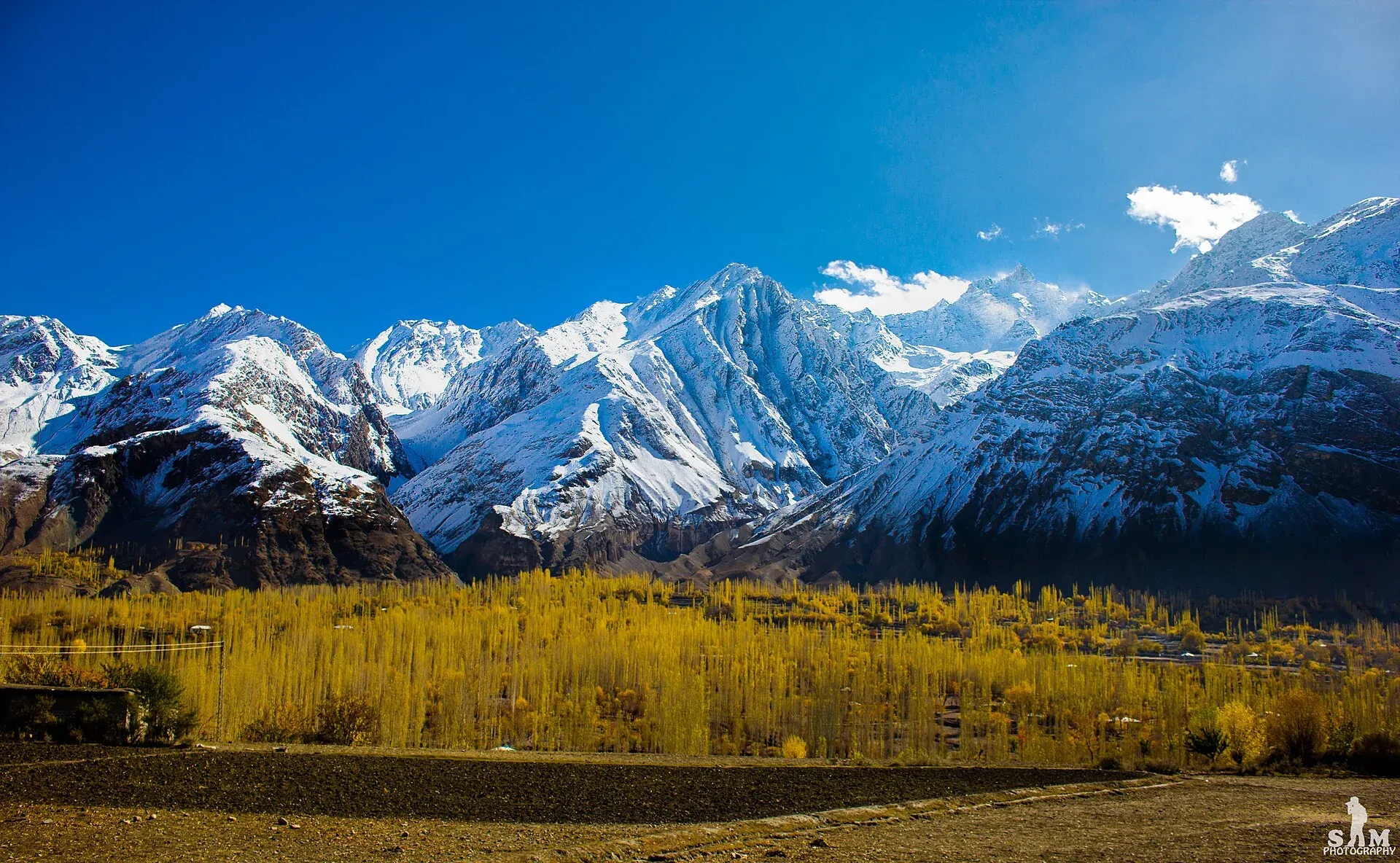
Photo: Samikhan86, with thanks · CC BY-SA 4.0 · via Wikimedia Commons · temporary stand-in photo

Naz Bar An
An unglaciated pass of about 4,980 m between the Naz Bar valley (Yasin) and the Bahushtaro Gol, with a short Class 2 scramble. For experienced trekkers with a local guide.
Overview
Naz Bar An links the Naz Bar valley, a south-western branch of the Yasin valley, with the Bahushtaro Gol, a northern tributary of the Ghizer River. (An means a pass and gol a side valley.) Locals do not use it and few trekkers do. It is a route for people who want wild, little-visited country, not for beginners or organised groups. Climbers heading for the 5,000 m peaks around the Mashpar Gol and Kano Gol in the upper Bahushtaro Gol sometimes use it to acclimatise, and it is often paired with the Zagaro An, the other hard, unglaciated pass in this country.
Height. The only published height is about 4,980 m, from a c. 2002 guidebook. One operator lists about 5,000 m. Check with your own GPS.
Plan your visit
- Nearest town
- Yasin
- Getting there
There is no road over the pass. The trek starts at Batakushi in the Yasin valley, reached by jeep, and ends at Chashi on the Gilgit-Chitral road. More
Best months
Jul – Sep
- Naz Bar An
- Related places nearby: Yasin Valley, Ghizer Valley
Getting to the start
Yasin is a high Hindu Kush valley, about 148 km from Gilgit by road. The road leaves the Karakoram Highway towards Gupis, follows the Shandur road, crosses the China Bridge over the Ghizer River and continues north-west to Yasin. Burushaski and Khowar are the main languages, and most people are Ismaili Muslims. The trek starts at Batakushi (3,400 m), reached by jeep. One operator's programme stops at Baltaring village in the Naz Bar valley to arrange guides and porters. Baltaring is also the last place to buy food.
The route in order
The standard trek takes four days from Batakushi to Chashi, on the Gilgit-Chitral road.
- Batakushi to the high camp (12.7 km, about 1,050 m up). The trail follows the Naz Bar upstream through pastures to Shuqan (3,505 m), the last Burushaski summer village. Beyond the Yaltar Bar it turns south, climbs a talus slope and follows a side stream past a rocky bluff to a grassy ridge. The pass is not yet in view. The high camp (4,450 m) is a cairned boulder with a stone shelter.
- High camp to the Ano Gol huts (6.5 km, 530 m up and 1,250 m down). A black moraine leads to the foot of the pass in 1.5 to 2 hours. The last climb is a steep reddish scree chute that takes 45 to 60 minutes. A Class 2 scramble on the north edge gets round the cornice. The pass has a small cairn that cannot be seen from below, and views in all directions. The descent crosses scree and snow, then moraine, to a cairn-topped boulder with a rock shelter. From there the stream leads to the Ano Gol huts (3,730 m).
- Ano Gol huts to Dedero Shal (12.4 km, 430 m down). The path runs down the Ano Gol past summer huts, then along the Bahushtaro Gol to Dedero Shal (3,300 m).
- Dedero Shal to Chashi (22 km, 679 m down). A long, quiet walk down the Bahushtaro Gol to Chashi. Combined with the Zagaro An, the route continues to Chapali in Chitral.
Terrain underfoot
Day 1 is pasture, a talus (loose rock) slope and a grassy ridge. Day 2 is black moraine, then the scree chute at 45 to 50 degrees, with a small permanent cornice and no glacier. Rock fall is the main hazard, so wear a helmet. One 2026 operator listing also mentions glacier sections and soft snow on the pass day, so conditions may differ from the old guide's description of an unglaciated pass. Wind is strong on the pass. The route is not marked, and the US AMS 1:250,000 sheet Mastuj (NJ 43-13) is too coarse to navigate by.
Preparation
- Acclimatisation. Day 1 gains about 1,050 m. Spend nights in Yasin or lower before you start.
- Guide. A guide is essential. Naz Bar and Yasin porters usually do not know the way, so ask the herders at Batakushi. One operator describes a licensed guide as a government requirement.
- Kit. A helmet, a trekking pole and, early in the season, an ice axe.
- Food. Carry what you need from Baltaring. Do not count on buying supplies later.
- Porters. Yasin porters are paid by the stage, with food included. Agree the rate in advance.
People
The herders in the Bahushtaro Gol are Khowar-speaking Ismaili Muslims from Chashi. The Naz Bar side has Burushaski-speaking summer settlements. Expect to meet few people other than herders.
When to go
July to mid-September. Rock fall is less likely late in the season, so August or early September is best.
Permits and safety
Open zone in Gilgit-Baltistan. Dawn reported on 29 March 2026 that foreign visitors to open-zone areas do not need a trekking permit, while permits from the GB Tourism Department are needed only for treks and climbs in restricted zones. Fee rules were disputed in 2025 (Dawn, 29 April 2025). Current fees will be added soon; check with the GB Tourism Department or a registered operator before you go.
Security. The UK FCDO's Pakistan page (updated 27 October 2026) does not list Ghizer among the areas it advises against, but read the live advice before you plan.
Current fees will be added soon.
Highlights
- An unglaciated pass of about 4,980 m between the Naz Bar valley (Yasin) and the Bahushtaro Gol, with a short Class 2 scramble
Getting there
There is no road over the pass. The trek starts at Batakushi in the Yasin valley, reached by jeep, and ends at Chashi on the Gilgit-Chitral road.
Tips
- Confirm the height and route with a local guide or operator before you go
- Check current permit and NOC rules before booking
Photos we still need: Naz Bar An and its scree chute; the Naz Bar high camp and the Ano Gol huts; the Bahushtaro Gol. Send us yours
Sources and last checked
Last checked Confidence low6 sources4 still to check
- Last checked
- Method
- Desk research from published sources
- Confidence
- low
- Checked by
- trek.pk research team
Researched from published sources; not yet checked on the ground by our team. Spot something out of date? Report a mistake.
Sources
- Naz Bar An (legacy trek.pk page from Lonely Planet text, c. 2002; facts only) · trek.pk / Lonely Planet · checked
- Nazbar Pass trek · Apricot Tours · checked
- Yasin Valley · Wikipedia · checked
- GB tourism stakeholders trade blame as permit fees remain undecided · Dawn · checked
- Pakistan travel advice · UK FCDO · checked
- Naz Bar An (trek.pk trek page) · trek.pk · checked
Still to be checked on the ground (4)
- Pass height: 4,980 m (2002 guidebook) or about 5,000 m (one 2026 operator page); no survey figure
- Whether herders at Batakushi still guide the route
- Current GB permit and fee rules
- Pass coordinates not found; shown at the Yasin valley centre used on this site
Nearby and related

Naz Bar An
Zagaro An
Yasin Valley
A high Hindu Kush valley in northern Ghizer, reached by road from Gupis, with Burusho villages, the Thui and Darkot routes and Darkot village at its head.

Ghizer Valley
The long upper Gilgit River valley running west from Gilgit to Shandur, with Punial orchards, Gahkuch, Gupis, Khalti and Phander lakes, trout fishing and side valleys to Yasin and Ishkoman.