

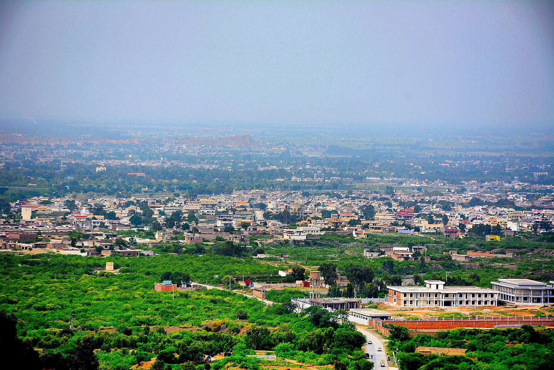
Photo: Waleed Abbas, with thanks · CC BY-SA 4.0 · via Wikimedia Commons · temporary stand-in photo

Nowshera
A Grand Trunk Road and railway town on the Kabul River, about 43 km east of Peshawar, with a large cantonment. Mostly a stop on the way between Peshawar and Islamabad.
Overview
Nowshera is the headquarters of Nowshera District, on the Kabul River about 43 km east of Peshawar on the Grand Trunk Road (Wikipedia). The name comes from the Pashto for "New City". The 2023 census gave Nowshera District 1,740,705 people (Wikipedia). Wikipedia gives the city 122,953 people at the 2023 census (83,567 in Nowshera Kalan municipal committee and 36,564 in Nowshera Cantonment).
Plan your visit
- Getting there
Road: about 45 km from Peshawar (OSRM about 50 min, optimistic) on the N-5; Nowshera Junction station is on the Pakistan Railways line. More
Best months
Oct – Mar
- Nowshera
- Related places nearby: Peshawar, Mardan, Khyber Pakhtunkhwa, Manglot National Park
History
The area developed under the Durrani Empire. The Sikhs won a battle here in March 1823, and the British took control in 1849 and developed a large cantonment, a permanent military town. A railway bridge over the Kabul River opened in 1903. Nowshera became a district in its own right in 1988; before that it was a tehsil of Peshawar.
The town and district
Nowshera is a working town with a cantonment, old British-era buildings and a railway junction. It has no major visitor sights. Pashto is the main language (about 95 per cent of the district), and the Khattak are the largest tribe. The district covers 1,748 km2 in three tehsils: Nowshera, Pabbi and Jehangira.
The wider district holds several things of local interest:
- Sufi shrines. Wikipedia lists the shrines of Kaka Sahib, Mast Baba, Bahadur Baba and Pir Sabaq among the notable ones.
- Military and education. The Nowshera, Cherat and Risalpur cantonments are here, with the PAF Academy at Risalpur, the University of Technology Nowshera and a medical college.
- Green space. Kund Park and Manglot National Park.
- Industry. The Rashakai economic zone, built under CPEC, is in the district. Agriculture remains the main source of income.
Getting there
- From Peshawar: about 45 km, OSRM about 50 minutes (optimistic).
- To Charsadda: about 30 km, OSRM about 30 minutes.
- By rail: Nowshera Junction station is on the Pakistan Railways line from Peshawar. Check the current timetable.
- By road: the N-5 and N-45 national highways and the M-1 and Swat motorways pass through the district; buses and vans run along the N-5.
- By air: Wikipedia gives Peshawar's Bacha Khan International Airport as about an hour away and Islamabad International Airport about two hours.
When to visit
October to March is better. Winters are cold from November to February and summers are hot from June to August.
Where to stay and eat
There are simple hotels and restaurants, mostly aimed at business travellers. Most visitors use Peshawar.
Basic services
A district headquarters of this size normally has hospitals, pharmacies, fuel and ATMs, but none has been confirmed for this town from an official source. Ask at your hotel, and use the business listings on this site.
Safety and good to know
Ask the district administration or local police about current conditions before you go. For foreign visitors: the UK FCDO (updated 27 October 2026, checked 16 November 2026) advises against all but essential travel to Nowshera, and against all travel to Charsadda and several other nearby areas. This is government advice, not a closure. Read it in full, and check the current position with local police.
Highlights
- On the Kabul River and the Grand Trunk Road
- Cantonment with British-era buildings
- Junction on the Peshawar rail line
Hotels, food, fuel and services in Nowshera
Places to stay
- New OD BlockMap of New OD Block in Google Maps
Places to eat
- River View RestaurantCall River View RestaurantMap of River View Restaurant in Google Maps
- HFCCall HFCMap of HFC in Google Maps
- Munchies CafeCall Munchies CafeMap of Munchies Cafe in Google Maps
- Red RoosterCall Red RoosterMap of Red Rooster in Google Maps
- Chae HojayeCall Chae HojayeMap of Chae Hojaye in Google Maps
- M BakersCall M BakersMap of M Bakers in Google Maps
Essential services fuel stations, mechanics, ATMs, pharmacies, hospitals and clinics and Rescue 1122
Fuel
- Saad CNGMap of Saad CNG in Google Maps
- Byco Nowshera Filling StationMap of Byco Nowshera Filling Station in Google Maps
- PSOCall PSOMap of PSO in Google Maps
- Askar 1Map of Askar 1 in Google Maps
- Ahmad Filling stationCall Ahmad Filling stationMap of Ahmad Filling station in Google Maps
- Pirpiai filling stationCall Pirpiai filling stationMap of Pirpiai filling station in Google Maps
Mechanics and tyre shops
- ONESTOPAUTOGARAGECall ONESTOPAUTOGARAGEMap of ONESTOPAUTOGARAGE in Google Maps
- Gul Motor WorkshopMap of Gul Motor Workshop in Google Maps
- Islamabad Motor WorkshopMap of Islamabad Motor Workshop in Google Maps
- Sardar Auto WorkshopMap of Sardar Auto Workshop in Google Maps
ATMs
- Habib Bank Ltd ATMMap of Habib Bank Ltd ATM in Google Maps
Pharmacies
- IDREES MEDICOSCall IDREES MEDICOSMap of IDREES MEDICOS in Google Maps
- Doctor IQBAL MedicosCall Doctor IQBAL MedicosMap of Doctor IQBAL Medicos in Google Maps
- International medical laboratoryCall International medical laboratoryMap of International medical laboratory in Google Maps
- Taj MedicosMap of Taj Medicos in Google Maps
- Raza MedicosMap of Raza Medicos in Google Maps
- Kamal Medicos Nowshera CanttCall Kamal Medicos Nowshera CanttMap of Kamal Medicos Nowshera Cantt in Google Maps
Hospitals and clinics
- Doctor Aneeqa Waqar ClinicMap of Doctor Aneeqa Waqar Clinic in Google Maps
- Zakir eye centerCall Zakir eye centerMap of Zakir eye center in Google Maps
- Nowshera Medical CollegeCall Nowshera Medical CollegeMap of Nowshera Medical College in Google Maps
- Muhammad Islam Surgical Hospital Urologist & Laparoscopic SurgeonCall Muhammad Islam Surgical Hospital Urologist & Laparoscopic SurgeonMap of Muhammad Islam Surgical Hospital Urologist & Laparoscopic Surgeon in Google Maps
- Combined Military HospitalMap of Combined Military Hospital in Google Maps
- Asma Arif ClinicCall Asma Arif ClinicMap of Asma Arif Clinic in Google Maps
Rescue 1122
- DISTRICT HEAD OFFICE RESCUE 1122 NOWSHERACall DISTRICT HEAD OFFICE RESCUE 1122 NOWSHERAMap of DISTRICT HEAD OFFICE RESCUE 1122 NOWSHERA in Google Maps
- Rescue 1122 NowsheraMap of Rescue 1122 Nowshera in Google Maps
Listings come from Google Maps data and are unverified: phone numbers, opening months and prices may have changed. Report a problem · Own one of these? Claim it
Tips
- Read the FCDO advice before you plan.
- Allow extra time on the N-5 and motorway.
- Travel in daylight.
- Combine with a Peshawar stay.
Photos we still need: Nowshera Junction railway station or the railway bridge over the Kabul River; a shrine in Nowshera District. Send us yours
Sources and last checked
Last checked Confidence medium4 sources2 still to check
- Last checked
- Method
- Desk research from published sources
- Confidence
- medium
- Checked by
- trek.pk research team
Researched from published sources; not yet checked on the ground by our team. Spot something out of date? Report a mistake.
Sources
- Nowshera, Pakistan · Wikipedia · checked
- Nowshera District · Wikipedia · checked
- Pakistan travel advice (updated 27 October 2026) · UK Foreign, Commonwealth & Development Office · checked
- OSRM driving route service: distances and times measured 16 November 2026 (times are optimistic, without stops) · OSRM / OpenStreetMap · checked
Still to be checked on the ground (2)
- Current train service (Wikipedia names Nowshera Junction, Kabul River and Khushal Kot stations; no timetable found)
- Hotels and services
Nearby and related

Peshawar
Khyber Pakhtunkhwa's capital and one of South Asia's oldest living cities: the Gandhara museum, Qissa Khwani Bazaar, mosques and a strong food culture.

Mardan
The second-largest city in Khyber Pakhtunkhwa, set in the Peshawar valley, and the gateway to Gandhara's Takht-i-Bahi monastery (UNESCO), Shahbaz Garhi's Ashoka edicts and the Guides Memorial.

Khyber Pakhtunkhwa
Mountains, Buddhist ruins and old bazaars in north-west Pakistan: Swat, Kaghan, Chitral, the Kalash valleys, the Khyber Pass and Peshawar.
Manglot National Park
A small scrub-forest wildlife park near Nizampur in Nowshera District, Khyber Pakhtunkhwa, set up in 1990. About 7 square kilometres, known for chinkara. Few visitor details are confirmed.