

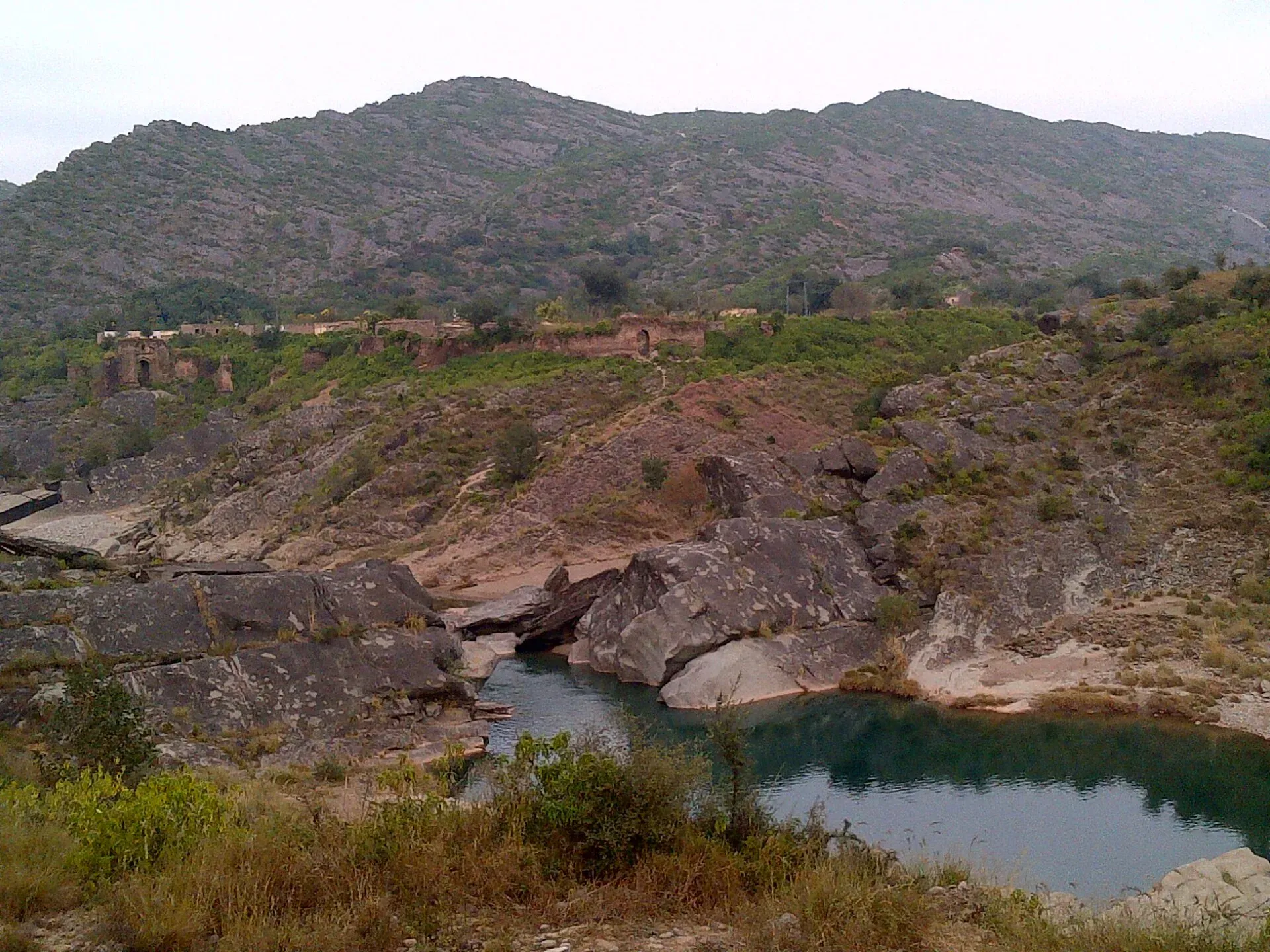
Photo: Serdol, with thanks · CC BY-SA 4.0 · via Wikimedia Commons · temporary stand-in photo

Pharwala Fort
A ruined Gakhar fort above the Soan River, about 35 to 40 km from Rawalpindi. Added to Pakistan's UNESCO tentative list in 2026. Access is rough and the site is still fragile.
Overview
Pharwala Fort stands on a hill between the Himalayan foothills and the Soan River, near Kahuta, about 40 km from Rawalpindi. It was the stronghold of the Gakhars, a Pothohar clan that held much of the region for centuries, and the former capital of the Pothohar chieftaincy. The fort covers about 1.8 square kilometres (450 acres) and is now mostly ruins. It is built of sandstone blocks.
Plan your visit
- Nearest town
- Kahuta
- Getting there
The map point is Wikipedia's fort coordinates, about 300 m from the Mai Qamro Mosque. More
Best months
Oct – Apr
- Pharwala Fort
- Related places nearby: Rawalpindi, Islamabad, Tomb of Sultan Muqarrab Khan, Islamabad, Mai Qamro Mosque, Islamabad, Kallar Syedan
History
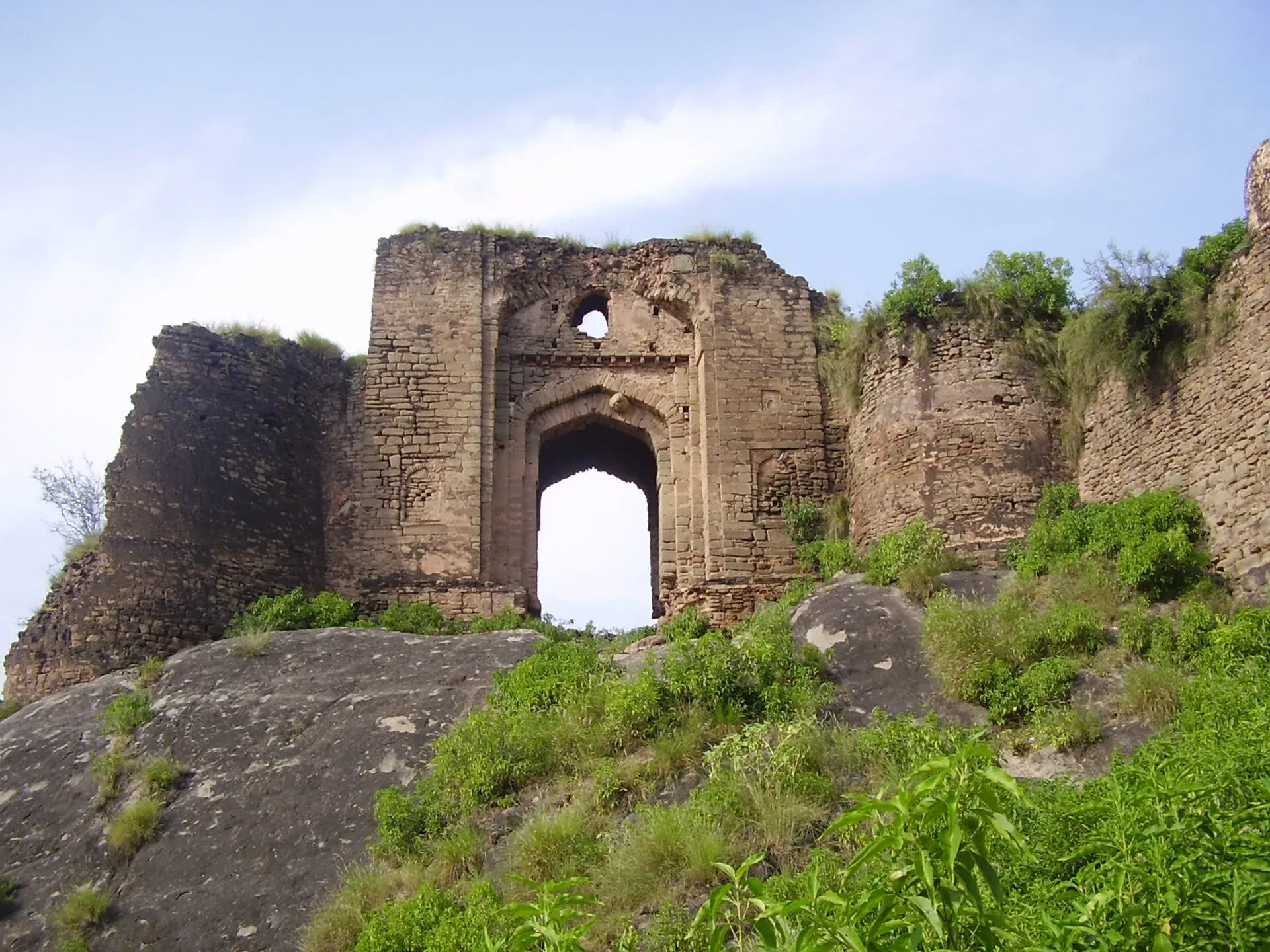
Photo: Khalid Mahmood, with thanks · CC BY-SA 3.0 · via Wikimedia Commons · temporary stand-in photo

Wikipedia places the fort in the 15th century in its summary, but its history section says Sultan Kaigohar Gakhar, an associate of Mahmud of Ghazni, reportedly built it in the 11th century. Dawn describes it as over 500 years old. Dates are uncertain for the early period, but the later history is better recorded:
- 1205 and 1207: Muhammad of Ghor and then Qutb ud-Din Aibak attacked the fort.
- 1398: Timur's invasion; the fort was held by the Gakhar chief Jasrat.
- 1519: Babur took the fort in March. Sultan Sarang Khan Gakhar then made peace with him and the Gakhars got their lands back. Dawn gives the year as 1515.
- 1540s: The Gakhars backed Humayun. Sher Shah Suri built Rohtas Fort, about 100 km to the south, to control them and attacked Pharwala in 1540. The fort changed hands several times but the Gakhars were never fully defeated. In February 1555 Humayun's army expelled the Suris and restored Sultan Adam Gakhar.
- 1765: Dawn says Sardar Gujar Singh Bhangi of Lahore defeated Muqarrab Khan, the last independent Gakhar ruler, who was then betrayed and killed by rivals. The fort stayed divided between his sons.
- 1818: Sikh forces under Maharaja Ranjit Singh took Gakhar lands and ended their hold on the fort. Some property rights were returned in 1928.
- 1857 to 1947: British rule. The Federal Department of Archaeology declared the fort protected in 1980.
Pharwala Fort, the mosque and the tomb were added to Pakistan's UNESCO tentative list in 2026 (11 May 2026, per the Express Tribune and Wikipedia). Tentative status means they have been proposed, not inscribed.
The fort today
Wikipedia says the fort could house 500 soldiers, 100 horses and 50 elephants, and that it was a defence headquarters.
- The gates. Sources differ: Wikipedia says it had six gates and that five survive, naming the Hathi (Elephant) Gate at the north-east corner, the Begum Gate at the south-west corner, and the Fort, Lashkari, Ziarat and Bagh gates. Dawn (August 2025) reports that only the main Hathi Gate remains. Expect to find fewer than the old records suggest.
- The ramparts and ruined rooms. Sections of wall and old chambers are still visible, though parts have collapsed. Dawn reports that the compound is used to pen buffalo and goats, and that houses have been built on the premises.
- Gakhar graves. About 10 to 15 graves of Gakhar rulers lie within the complex.
- Soan River views. The setting between hills and river is the main reward.
Mai Qamro Mosque and the Gakhar tomb
The mausoleum of Sultan Muqarrab Khan is intact and has a main entrance that Dawn photographed; see Tomb of Sultan Muqarrab Khan. The Mai Qamro Mosque, also called the Gakhar Mosque, is at Bagh Juggian on the west bank of the Soan, beside the fort. It dates from the early 16th century and is believed to be the oldest mosque in Islamabad. Department of Archaeology officials say Mai Qamro, wife of Hathi Khan Gakhar, built it. See Mai Qamro Mosque.
Conservation
In October 2009 the department announced plans to protect the fort from decay. Work began in September 2023: clearing dense foliage, excavating about two feet of debris and involving the local community in security. Wikipedia says the fort reopened to the public in January 2024. Dawn reported in August 2025 that no further preservation had followed on the fort, tomb or mosque, and locals fear housing schemes. Neglect has caused collapsed walls and encroachment.
When to visit
October to April is comfortable. The monsoon (July to September) can swell the Soan and make tracks slippery. Allow half a day.
Where to stay and eat
There are no services at the fort. Plan a day trip from Islamabad or Rawalpindi, bring water and food, and eat in Kahuta or the city.
Good to know
- Dawn reports there is no proper road from Aliot to the fort, so the last part may be on foot or rough track. Go with a local guide or driver who knows the way.
- Reports suggest foreigners may need permission to visit this area. Confirm with the Department of Archaeology and Museums or local authorities.
- Some houses have been built close to the walls. Respect local people's land and do not climb on unstable walls.
- No entry fee or hours were confirmed from an official source. Current fees will be added soon.
Highlights
- Gakhar stronghold above the Soan River
- Dated history from Timur's invasion (1398) to Sikh rule (1818)
- Ruined Hathi Gate and ramparts
- Nearby Mai Qamro Mosque and Gakhar tomb
- Added to UNESCO tentative list in 2026
Getting there
The map point is Wikipedia's fort coordinates, about 300 m from the Mai Qamro Mosque. From Rawalpindi it is about 38 km by road (roughly 45 minutes) and from Islamabad about 33 km (also about 45 minutes) to the mosque, which is beside the fort (OSRM, checked 16 November 2026). The fort is reached via Kahuta and Aliot; the final part is rough. Go by private car or a hired vehicle.
Tips
- Go with someone who knows the track; the road is poor near the fort.
- Check access rules, especially if you are not a Pakistani citizen.
- Allow half a day and bring water and food.
- Avoid the monsoon when the Soan runs high.
Photos we still need: the Gakhar tomb and Mai Qamro Mosque. Send us yours
Sources and last checked
Last checked Confidence medium5 sources6 still to check
- Last checked
- Method
- Desk research from published sources
- Confidence
- medium
- Checked by
- trek.pk research team
Researched from published sources; not yet checked on the ground by our team. Spot something out of date? Report a mistake.
Sources
- Pharwala Fort (Wikipedia) · Wikipedia · checked
- Pharwala Fort: a crumbling reminder of Potohar's Muslim past · Dawn · checked
- UNESCO widens Pak heritage map · The Express Tribune · checked
- Mai Qamro Mosque (coordinates) · Wikipedia · checked
- OSRM routing (road distances) · Project OSRM · checked
Still to be checked on the ground (6)
- Whether the fort is open and what access is allowed to foreigners (Wikipedia and Dawn: opened to the public in January 2024; no official notice on rules for foreigners)
- Entry fee and hours (neither Wikipedia nor Dawn gives any; no official page)
- How many gates survive (Wikipedia: five of six; Dawn, 25 Aug 2025: only the Haati Darwaza; left as a range)
- Founding date: 11th century (Wikipedia History: Kaigohar Gakhar) versus 15th century (Wikipedia lead and infobox); Dawn says over 500 years old; left as a range
- Condition of the road from Aliot (Dawn, 25 Aug 2025, quotes a resident saying there is no proper road; no later source)
- Babur's capture date: Wikipedia says 1519, Dawn says 1515 (both given in the text)
Nearby and related

Rawalpindi
Islamabad's older twin city: a busy bazaar and cantonment, the north's main rail and bus hub, and an easy base for Taxila and Murree.

Islamabad
Pakistan's green, planned capital at the foot of the Margalla Hills: Faisal Mosque, hillside trails, cafes and the gateway to the north.

Punjab
Pakistan's most populous province: Mughal Lahore, ancient Taxila and Harappa, Sufi shrines, the Salt Range, the Cholistan desert and the hills of Murree.
Tomb of Sultan Muqarrab Khan, Islamabad
The mausoleum of Sultan Muqarrab Khan Gakhar, an 18th-century ruler of Pothohar, at Bagh Jogian beside Pharwala Fort. On Pakistan's UNESCO tentative list, added 11 May 2026.
Mai Qamro Mosque, Islamabad
A small three-domed mosque of the early 16th century at Bagh Jogian, across the Soan River from Pharwala Fort. Built of local stone with tile decoration. On Pakistan's UNESCO tentative list since 2026.
Kallar Syedan
A tehsil town in Rawalpindi District with Sikh-era havelis and small forts, including Sangni Fort and Pharwala Fort nearby.