

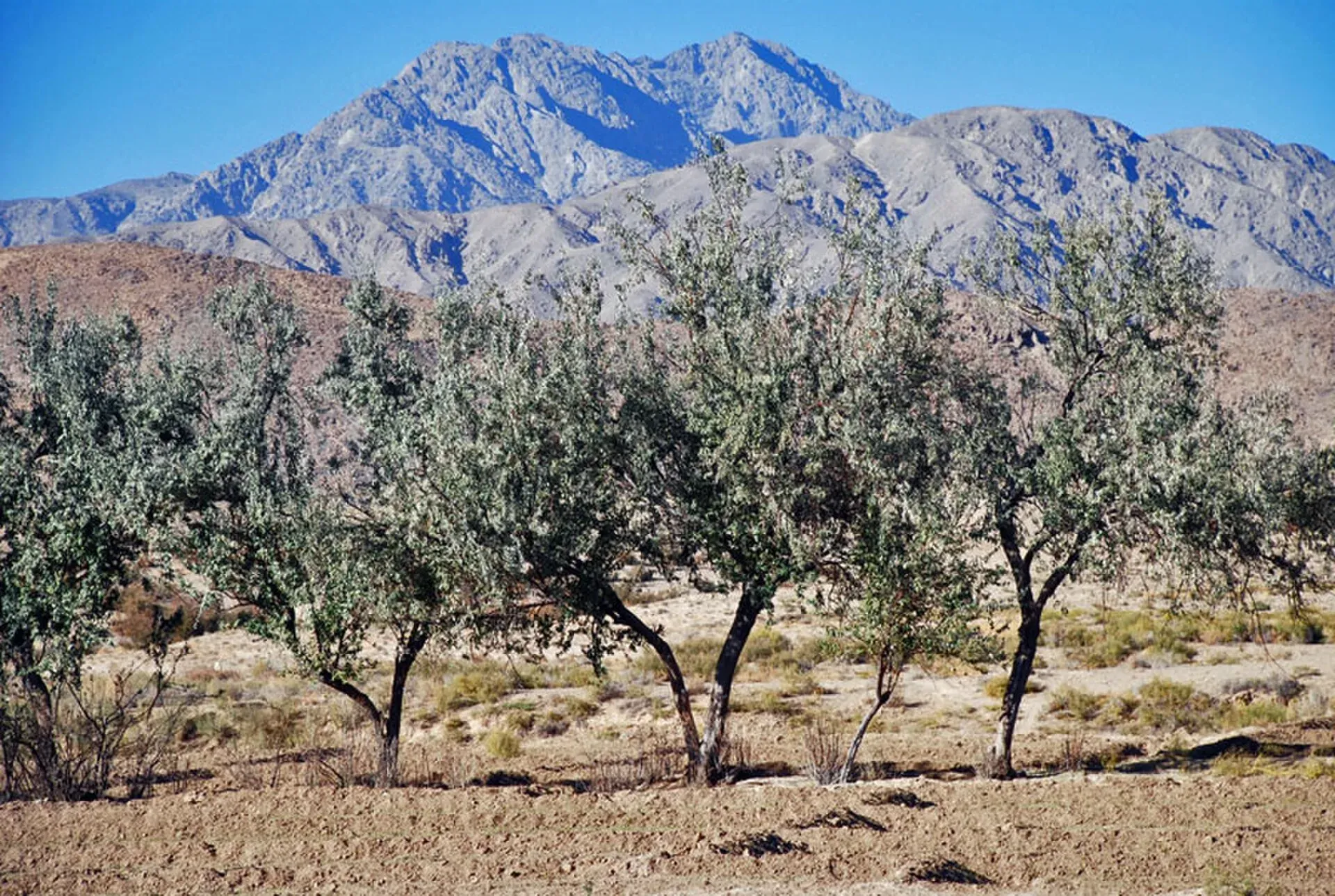
Photo: Maqsoodshah01, with thanks · Public domain (CC0) · via Wikimedia Commons · temporary stand-in photo

Quetta's Mountains: Chiltan, Takatu and Zarghun Ghar
- Grade
- Moderate
- Max altitude
- 3,550 m
Information only. The UK FCDO advises against all travel to Balochistan, including Quetta. The three high points near the city are Zarghun Ghar (about 3,550 m), Koh-i-Takatu (3,472 m) and Koh-i-Chiltan (about 3,194 m).
Travel advice first
For foreign visitors: the UK FCDO advises against all travel to Balochistan Province, which includes Quetta (advice updated 27 October 2026, checked 17 November 2026). This page is information only. It does not suggest that anyone should travel to these mountains. Read the live FCDO page before you make any plan, and ask the Balochistan Home Department and local authorities about conditions. Pakistani nationals face fewer barriers than foreigners, and local clubs climb the Quetta peaks regularly, according to our Koh-i-Chiltan page.
The mountains around Quetta
Quetta lies among ranges of the Sulaiman Mountains. Three high points are described in published sources. By Wikipedia's account, in order of height they are Zarghun Ghar, Koh-i-Takatu and Koh-i-Chiltan.
Koh-i-Chiltan
Koh-i-Chiltan is given as 3,194 m by Wikipedia, citing a Balochistan mountaineering club. Other sources give 3,050 m or about 3,200 m. It rises inside Hazarganji-Chiltan National Park, declared in 1980 and about 20 km from Quetta along the Quetta-Karachi highway. The park protects the Chiltan markhor, a wild goat. See the Koh-i-Chiltan trail page for what is known about the day climb. No verified route, distance or time exists.
Koh-i-Takatu
Takatu National Park covers about 13,525 hectares in Quetta and Pishin districts. The Government of Balochistan's public relations directorate says it was declared a national park on 13 January 2025 and is managed by the provincial Forest and Wildlife Department. Its highest point is Loa Isai Peak at 3,472 m, called the third-highest mountain in Balochistan. The same article lists more than 500 markhor and plants such as wild pistachio, wild almond and juniper.
The article describes severe drought. Most natural springs have dried up, and staff carry water to distant sites by donkey and motorcycle. It gives no visitor access, routes or rules. It mentions monitored field camping and sustainable tourism only as conservation measures. See Takatu National Park.
Zarghun Ghar
Wikipedia gives Zarghun Ghar (also Koh-i-Zarghun) as 3,550 m, citing the Chiltan Adventures Association, and places it north-east of Quetta in the Sulaiman Range. Our Koh-i-Chiltan page gives it as 3,578 m and calls it the highest peak in Balochistan, so the height is not settled. No source found for this page describes a route, access or conditions.
Getting around
The only access detail in the sources is for the Chiltan park, about 20 km from Quetta along the Quetta-Karachi highway. See Quetta for the city and its practical details.
Permits and security
Balochistan has sensitive-area access controls. Foreign visitors generally need a Home Department no-objection certificate (NOC) for Balochistan, and Levies escorts may be required. The parks are managed by the Balochistan Forest and Wildlife Department, which should be asked about access to any of them.
Gear and safety
All three areas are dry, high and exposed, with cold and wind above 3,000 m. Water is scarce at Takatu, according to the Balochistan government article. The parks protect wildlife. Do not disturb animals, and take your rubbish with you.
Highlights
- Zarghun Ghar, about 3,550 m (Wikipedia)
- Loa Isai Peak in Takatu National Park, 3,472 m
- Koh-i-Chiltan, 3,194 m, in Hazarganji-Chiltan National Park
- Markhor, the spiral-horned wild goat, in both national parks
Getting there
Only the Chiltan park has an access detail: about 20 km from Quetta along the Quetta-Karachi highway. No access is described for Takatu or Zarghun Ghar. For foreign visitors: the UK FCDO advises against all travel to Balochistan Province, which includes Quetta (updated 27 October 2026, checked 17 November 2026).
Permits and rules
- Permit needed
- Yes, Restricted zone
- Fee
- Current fees will be added soon
- Last checked
- 17 November 2026
For foreign visitors: the UK FCDO advises against all travel to Balochistan Province (updated 27 October 2026, checked 17 November 2026). Balochistan has sensitive-area access controls. Foreign visitors generally need a Home Department NOC for Balochistan, and Levies escorts may be required. The national parks are managed by the Balochistan Forest and Wildlife Department. No fee was confirmed. Contact the Department and the local administration before any visit.
How trekking permits, NOCs and registration work: Visa and permits.
Water and camps
Water is scarce at Takatu, where drought has dried most natural springs (Balochistan government article). The Chiltan park has a small water source and rest houses, according to our Koh-i-Chiltan page. No camp sites are confirmed.
Gear and safety
Security is the main issue: the UK FCDO advises against all travel to Balochistan Province. Altitude above 3,000 m brings cold and wind, and winter brings snow. Do not disturb wildlife.
Variations
- See the Koh-i-Chiltan trail page for the only single-peak entry.
Tips
- For foreign visitors: the UK FCDO advises against all travel to Balochistan Province. Read the live advice and do not plan a trip against it.
- Pakistani visitors should check access with the Balochistan Forest and Wildlife Department and local authorities.
- Nothing here is a route description; none of the sources give one for Takatu or Zarghun Ghar.
Stay and eat in Quetta
Quetta is the nearest town to the trek: somewhere to sleep and stock up before and after.
Places to stay
- Serena Hotel, QuettaCall Serena Hotel, QuettaMap of Serena Hotel, Quetta in Google Maps
- METRO HOTELCall METRO HOTELMap of METRO HOTEL in Google Maps
- Jan Luxury HotelCall Jan Luxury HotelMap of Jan Luxury Hotel in Google Maps
- BMC Complex Boys HostelMap of BMC Complex Boys Hostel in Google Maps
- Zamzama HotelCall Zamzama HotelMap of Zamzama Hotel in Google Maps
- Grand Hotel QuettaCall Grand Hotel QuettaMap of Grand Hotel Quetta in Google Maps
Places to eat
- Jaan Broast And BiryaniCall Jaan Broast And BiryaniMap of Jaan Broast And Biryani in Google Maps
- Takatu Nights RestaurantCall Takatu Nights RestaurantMap of Takatu Nights Restaurant in Google Maps
- Usmania RestaurantCall Usmania RestaurantMap of Usmania Restaurant in Google Maps
- Abdali Baba Super MarketCall Abdali Baba Super MarketMap of Abdali Baba Super Market in Google Maps
- Quetta Club LimitedCall Quetta Club LimitedMap of Quetta Club Limited in Google Maps
- Mubarak Food & Restaurant Branch 2 QuettaCall Mubarak Food & Restaurant Branch 2 QuettaMap of Mubarak Food & Restaurant Branch 2 Quetta in Google Maps
Essential services fuel stations and hospitals and clinics
Fuel
- Caltex Petrol PumpCall Caltex Petrol PumpMap of Caltex Petrol Pump in Google Maps
- ShellCall ShellMap of Shell in Google Maps
- Askari Petrol Pump (PSO Pump)Call Askari Petrol Pump (PSO Pump)Map of Askari Petrol Pump (PSO Pump) in Google Maps
- Byco Petrol PumpMap of Byco Petrol Pump in Google Maps
- Sehar CNG & PSO Fuel StationCall Sehar CNG & PSO Fuel StationMap of Sehar CNG & PSO Fuel Station in Google Maps
- ShellCall ShellMap of Shell in Google Maps
Hospitals and clinics
- Saleem Medical ComplexCall Saleem Medical ComplexMap of Saleem Medical Complex in Google Maps
- Aria Institute of Medical Sciences - AIMSCall Aria Institute of Medical Sciences - AIMSMap of Aria Institute of Medical Sciences - AIMS in Google Maps
Listings come from Google Maps data and are unverified: phone numbers, opening months and prices may have changed. Report a problem · Own one of these? Claim it
Photos we still need: Koh-i-Takatu / Takatu National Park; Zarghun Ghar (none found with an open licence). Send us yours
Health and emergency
Mobile signal is patchy on most treks, so tell someone your plan before you go. Emergency numbers
Sources and last checked
Last checked Confidence low5 sources6 still to check
- Last checked
- Method
- Desk research from published sources
- Confidence
- low
- Checked by
- trek.pk research team
Researched from published sources; not yet checked on the ground by our team. Spot something out of date? Report a mistake.
Sources
- Pakistan travel advice (updated 27 October 2026, still current 17 November 2026) · UK FCDO · checked
- Takatu National Park · Wikipedia · checked
- Takatu National Park: A Life Haven in the Balochistan Mountains (20 November 2025) · Directorate of General Public Relations, Government of Balochistan · checked
- Zarghun Ghar · Wikipedia · checked
- Our Koh-i-Chiltan trail and Quetta pages (used for consistency) · trek.pk · checked
Still to be checked on the ground (6)
- Murdar (Koh-e-Murdar / Murdar Ghar): no source found (no Wikipedia page; not covered by the Takatu or Zarghun pages); not included
- Zarghun Ghar height: 3,550 m (Wikipedia, citing the Chiltan Adventures Association) against 3,578 m on our Koh-i-Chiltan page, which names no source
- Whether Zarghun Ghar is the same as 'Zarghoon' and its distance and bearing from Quetta (Wikipedia gives 'north-east')
- Any visitor access, route, fees or permit for Takatu and Zarghun Ghar (none in the sources)
- Wikipedia's Takatu area (13,524.594 ha) matches the Balochistan government's 33,420 acres; Wikipedia's Takatu page does not give a height
- Security and NOC requirements: only the FCDO position is confirmed; no Balochistan government notice found
Nearby and related

Koh-i-Chiltan Trail

Quetta
Balochistan's high-valley capital, the Fruit Garden of Pakistan: bazaars, sajji, orchard valleys and the base for Hanna Lake and Ziarat.
Takatu National Park
A mountain park north-east of Quetta, declared on 13 January 2025 across Quetta and Pishin districts. About 135 square kilometres around Koh-e-Takatu, home to Sulaiman markhor. Not set up for casual visits.

Hazarganji-Chiltan National Park
A mountain park about 20 km south-west of Quetta, established in 1980 to protect the Chiltan ibex and Sulaiman markhor. Juniper and dry mountain scrub.