

Photo: Adrian Leslie Lobo, with thanks · CC BY-SA 3.0 · via Wikimedia Commons · temporary stand-in photo

Ranikot Fort
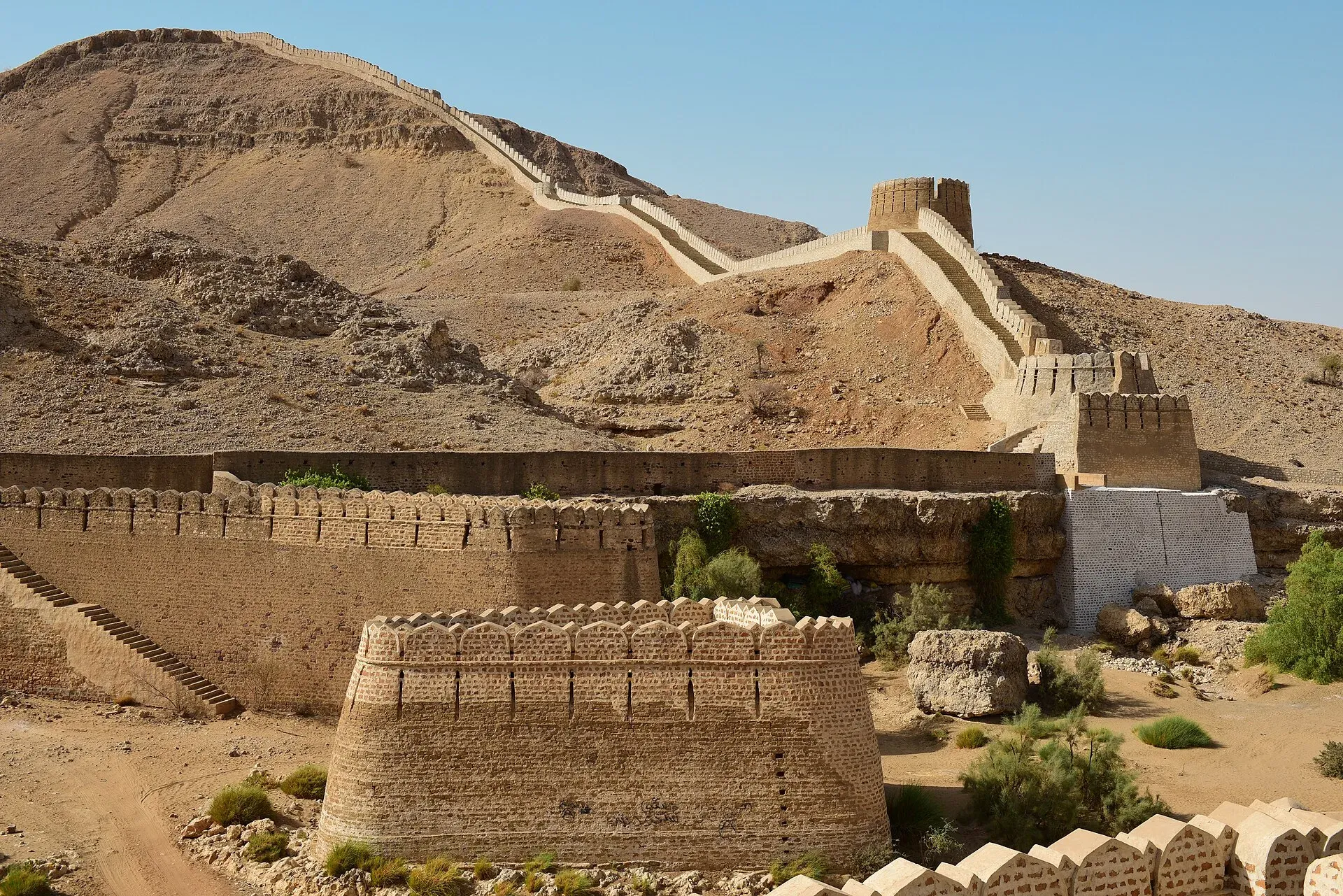
A huge hill-top wall in the Kirthar hills of Sindh, often called the Great Wall of Sindh, with four gates and a smaller inner fort. On Pakistan's UNESCO tentative list since 1993.
Overview
Ranikot Fort sits in the Kirthar hills in Jamshoro District, Sindh, near the town of Sann. Its stone-and-lime walls run along the ridges for kilometres and have been compared to the Great Wall of China, which is why it is nicknamed the "Great Wall of Sindh". Wikipedia gives the wall length as 31 km; other sources give different figures, so treat the length as approximate. The fort lies inside the Kirthar National Park.
Plan your visit
- Nearest town
- Sann
- Getting there
Ranikot is on the Indus Highway side of the Kirthar hills. From Hyderabad it is about 120 km (roughly 2 hours) and from Karachi about 259 km (around 3.5 hours) by road to the fort (OSRM, checked 16 November 2026). More
Best months
Nov – Feb
- Ranikot Fort
- Related places nearby: Kirthar National Park, Sindh
Layout of the fort
The wall follows the contours of the Kirthar hills in a zig-zag line, built of stone and lime mortar. On the north the perimeter uses a natural high ridge, and walls close the other three sides. Bastions stud the line, and three of them are semi-circular. The four gates are rhomboid (diamond-shaped) in plan. The Sann River crosses two of the gates diagonally, and the western gate is skirted by river water and is hard to reach. The southern gate has double doors, and two niches inside the gates carry floral ornament and carved stone (Wikipedia).
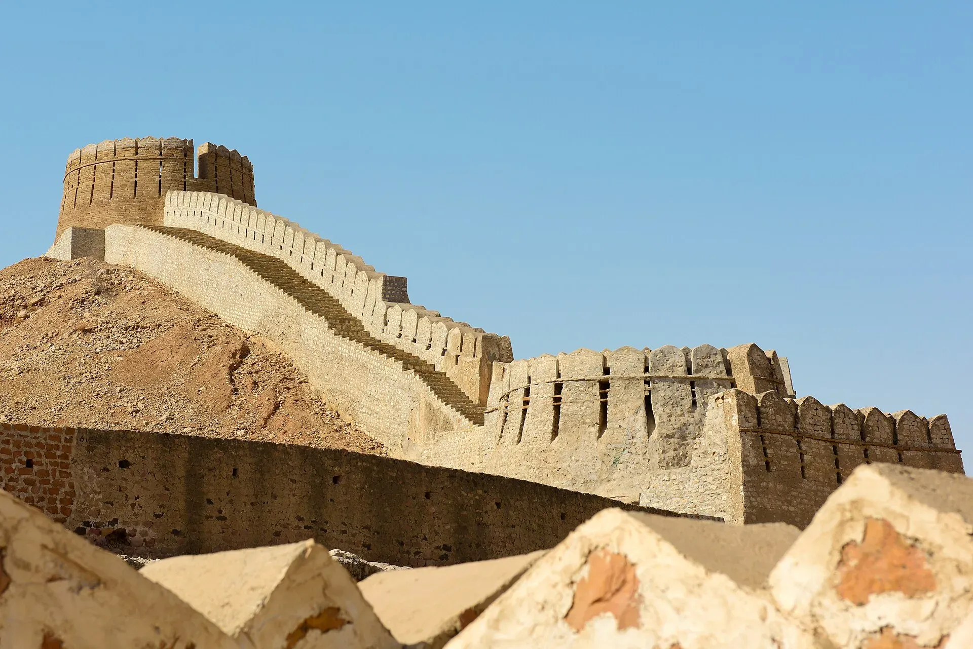
Photo: Adrian Leslie Lobo, with thanks · CC BY-SA 4.0 · via Wikimedia Commons · temporary stand-in photo

History
Nobody is sure who built it or why. Early writers linked it to Sassanian, Scythian or Greek rulers, but later evidence points elsewhere. In March 2018 inscriptions were found at the south-eastern corner, and one was read as belonging to the Gupta period, around the 4th or 5th century CE. Archaeologists point to the 17th century for the first documented construction. Radiocarbon dating of charcoal in the mortar at the Sann Gate suggests it was renovated between the early 18th and early 19th centuries. The Talpur rulers of Sindh are credited with rebuilding parts of it in 1812. Its walls later served as the last capital of the Talpur Amirs before the British took Sindh.
The fort has been on Pakistan's tentative list for UNESCO World Heritage status since 1993 (Wikipedia's tentative-list table gives the year 1993; the exact date is unconfirmed). It is protected under the Antiquities Act, 1975. Tentative status means it has been proposed, not that it has been inscribed.
What to see and do
- Sann Gate. The eastern entrance and best-preserved gate. You can climb to the top for a wide view over the hills.
- The four gates. Sann, Amri, Shah Pere and Mohan Gate. The walls zig-zag between them, with round bastions along the line.
- Miri Fort. A smaller fort inside the main wall, about 3 km from Sann Gate, said to have been the palace of the Mir rulers. It also holds a mosque.
- The wall. Even a short walk along the ramparts shows the scale of the work.
Restoration work was done on the Sann Gate, the wall, the mosque and Miri Fort. An enquiry in 2005 found it was poorly done, with cement and new stone, and further work was suspended in 2006. Some visitors find the repairs jarring.
Getting there
Ranikot is about 90 km north of Hyderabad on the Indus Highway (N-55). Sann, the nearest town and a railhead on the Kotri to Larkana line, is roughly an hour's drive from Karachi. From a short distance outside Sann a diversion road of about 21 km runs over rugged ground to Sann Gate (Wikipedia).
When to visit
Go from November to February. The Kirthar hills are very hot from April to September, and there is little shade or water inside the fort.
Where to stay and eat
Facilities near the fort are minimal. Sann and Hyderabad have hotels and restaurants. Bring food and plenty of water.
Good to know
- The last stretch is a rough road of about 21 km from near Sann to the Sann Gate (Wikipedia calls it rugged; there is no known current condition report). Use a high-clearance vehicle.
- The site is inside Kirthar National Park, so park rules may apply. Current entry fees are not confirmed; fees will be added soon. Wikipedia says the park is managed by the Sindh Wildlife Department and the fort by the Government of Sindh. Ask the Sindh Wildlife Department or the Sindh culture department before you go.
- Check local security and weather advice before leaving, and tell someone your plan. Mobile signal may be patchy.
Highlights
- Long hill-top wall nicknamed the Great Wall of Sindh
- Four gates, with Sann Gate the best preserved
- Miri Fort, a smaller fort inside the main walls
- Inside Kirthar National Park
- On the UNESCO tentative list since 1993
Tips
- Travel November to February and carry all water and food.
- Use a high-clearance vehicle for the last 21 km.
- Start early; the walls offer little shade.
- Treat restoration claims and wall-length figures with care; they vary by source.
Photos we still need: Sann Gate and the Miri Fort interior; the 21 km access road to Sann Gate. Send us yours
Sources and last checked
Last checked Confidence medium6 sources5 still to check
- Last checked
- Method
- Desk research from published sources
- Confidence
- medium
- Checked by
- trek.pk research team
Researched from published sources; not yet checked on the ground by our team. Spot something out of date? Report a mistake.
Sources
- Ranikot Fort (Wikipedia) · Wikipedia · checked
- List of World Heritage Sites in Pakistan (tentative list) · Wikipedia · checked
- Ranikot Fort, UNESCO tentative list entry · UNESCO World Heritage Centre · checked
- Pakistan Tourism Guide 2021 · TDAP Pakistan (Trade Development Authority of Pakistan) · checked
- OSRM routing (road distances) · Project OSRM · checked
- Kirthar National Park · Wikipedia · checked
Still to be checked on the ground (5)
- Entry fee and who collects it (no source; Wikipedia silent)
- Condition of the 21 km access road (Wikipedia: rugged; no current report)
- Wall length (31 km on Wikipedia; other sources vary)
- Security situation and any access restrictions in Kirthar (no source)
- Exact UNESCO tentative-list submission date (UNESCO pages return 403; Wikipedia gives the year 1993 only)
Nearby and related

Kirthar National Park
A rugged semi-desert park in the Kirthar Mountains north of Karachi, established in 1974. About 3,087 square kilometres, home to Sindh ibex, urial, chinkara and leopard.

Karachi
Pakistan's largest city and main port: colonial buildings, museums, beaches, busy bazaars and some of the country's best food.

Sindh
Pakistan's south-east: Karachi's beaches and markets, the Indus Valley city of Moenjodaro, Thatta's Makli tombs, Sufi shrines, the Thar desert and the Indus delta.