

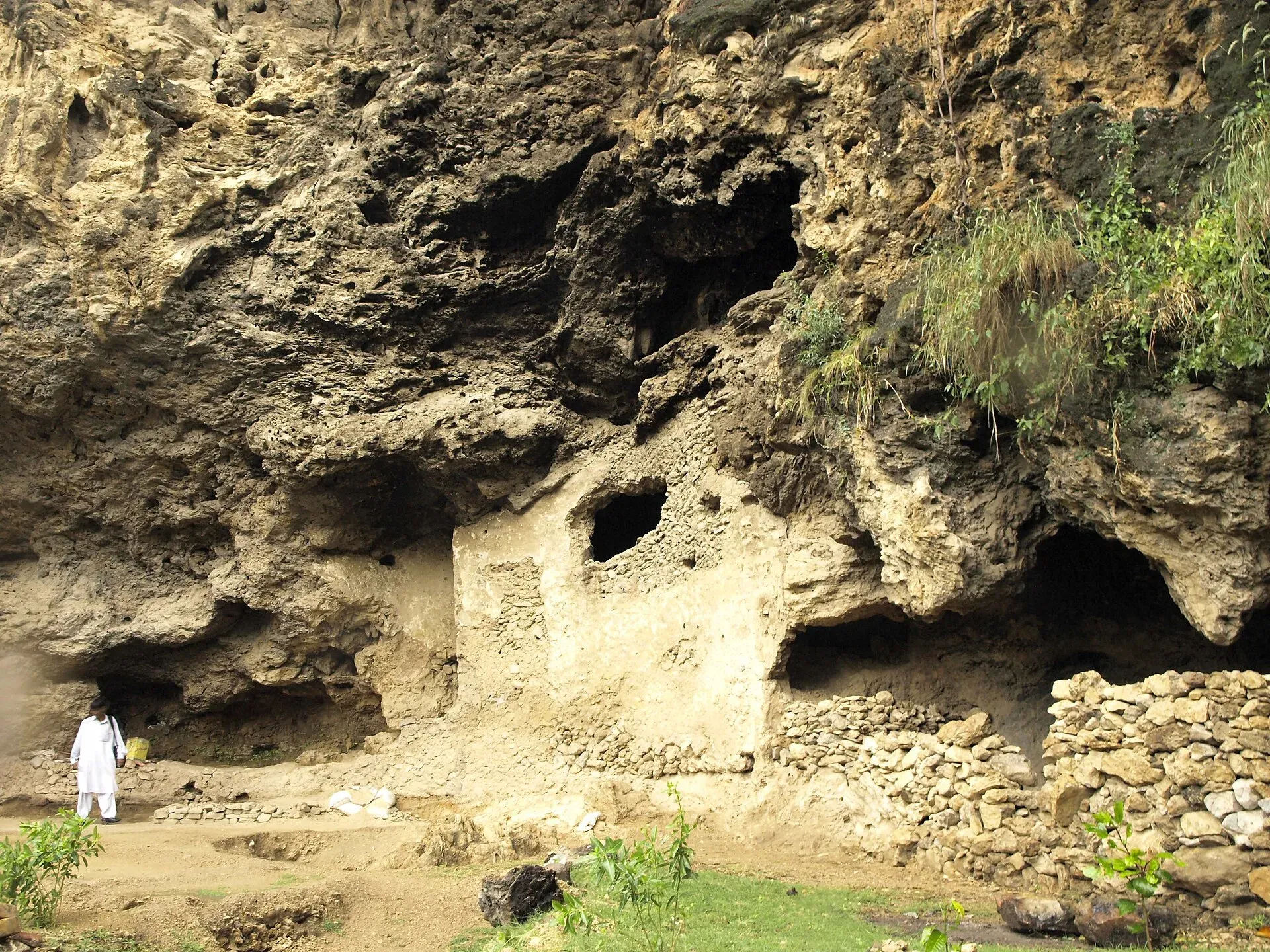
Photo: Muhammad Bin Naveed, with thanks · CC BY-SA 3.0 · via Wikimedia Commons · temporary stand-in photo

Shah Allah Ditta Caves
Rock shelters at the foot of the Margalla Hills in Islamabad, linked to Buddhist-era use and later to Hindu and Muslim ascetics. A short stop beside a small shrine and the start of the Margalla Ridge Trail.
Overview
The Shah Allah Ditta caves are rock shelters in the Margalla Hills foothills, in the village of Shah Allah Ditta beside Sector D-12 of Islamabad. The village is named after a Punjabi dervish of the Mughal era and is believed to be over 700 years old. The caves lie beside the shrine and tomb of Shah Allah Ditta, on the road towards Khanpur.
Plan your visit
- Nearest town
- Islamabad
- Getting there
The village is next to Sector D-12 on the western edge of Islamabad, about 19 km and 23 minutes by road from central Islamabad (OSRM). Taxis and ride-hailing apps work; a private car is the easiest option. More
Best months
Oct – Mar
- Shah Allah Ditta Caves
- Related places nearby: Islamabad, Margalla Hills National Park
The old road
The village sits on a route between Kabul and Taxila. Local tradition says Alexander the Great, Sher Shah Suri and Mughal rulers travelling from Afghanistan to the subcontinent all used it. Locals call it Gernaili Road, meaning Sher Shah's road, and some remnants remain. Akbar is said to have built a watering hole here for travellers. Treat the Alexander stories as legend: a marked spot nearby is where he is said to have been received by Raja Ambi of Taxila. For the wider region see Taxila.
The caves and their paintings
Reports describe small caves with traces of old wall paintings, with burnt oil lamps and trees hung with amulets around them. How old the paintings are is disputed. Wikipedia and local officials quoted by Dawn in 2016 give figures such as 2,400 years and an eighth-century Buddhist link, while Dawn in 2019 reported frescoes showing Hindu deities and archaeologists saying the shelters were first used by people in the Stone Age. The dates are uncertain. One account of the use is by Buddhist monks first, then Hindu sadhus, then Muslim ascetics in the Mughal period.
Higher up the hill
Above the caves are Losar Baoli, a stepwell (a stepped pool for water), and a mosque attributed to Shahab-ud-Din Ghori. Its walls are broken and the access road is dilapidated. The village is also the start of the Margalla Ridge Trail, opened on 3 November 2018. It runs 44 km, with 15 km in Islamabad Capital Territory and the rest through Abbottabad and Haripur districts, passing villages such as Talhar and Lora and ending at Summa. See Margalla Hills National Park.
Conservation
In October 2010 the CDA approved a preservation plan for the caves and the adjacent Sadhu ka Bagh, with Japanese funding reportedly offered. In November 2019 Dawn reported that the CDA planned to develop the caves, the Kenthala stepwell and a baradari (a pavilion), and the Evacuee Trust Property Board was named custodian. An MCI official said there had been little progress. What has been completed since is not confirmed.
When to visit
Mornings in autumn, winter and spring are best. Summer afternoons are hot, and heavy monsoon rain can make the paths slippery.
Where to stay and eat
Islamabad has many hotels and restaurants about 19 km away by road (OSRM, about 23 minutes). Nothing official operates at the caves.
Good to know
- No official opening hours, fee or ticketing could be confirmed. Ask the CDA or the Islamabad archaeology office.
- Keep clear of the shrine area at prayer times, dress modestly and ask before taking photos of worshippers.
- Do not touch or scratch the paintings or walls.
- The Margalla Hills have leopards and monkeys; do not walk alone after dusk.
- Rock near the shelters may be loose.
Highlights
- Rock shelters with possible Buddhist-era use
- Beside the shrine of Shah Allah Ditta
- Stepwell and old mosque higher up
- Trailhead of the Margalla Ridge Trail
Getting there
The village is next to Sector D-12 on the western edge of Islamabad, about 19 km and 23 minutes by road from central Islamabad (OSRM). Taxis and ride-hailing apps work; a private car is the easiest option. Ask for Shah Allah Ditta near D-12.
Tips
- Visit in the morning
- Dress modestly near the shrine
- Check access with CDA or the archaeology office
- Do not touch the wall paintings
Photos we still need: the stepwell (Losar Baoli) and the ruined mosque. Send us yours
Sources and last checked
Last checked Confidence medium3 sources4 still to check
- Last checked
- Method
- Desk research from published sources
- Confidence
- medium
- Checked by
- trek.pk research team
Researched from published sources; not yet checked on the ground by our team. Spot something out of date? Report a mistake.
Sources
- Shah Allah Ditta · Wikipedia · checked
- Three archaeological sites in Islamabad to be preserved (28 Nov 2019) · Dawn · checked
- Shah Allah Ditta caves to be preserved · Dawn · checked
Still to be checked on the ground (4)
- Age and original religion of the paintings (sources conflict: 2,400 years and Buddhist per Wikipedia and Dawn 2016; Hindu deities per Dawn 2019)
- Current conservation and access status (2010 and 2019 plans only; no recent report)
- Opening times and any fee (none published)
- Exact coordinates of the shelters (Wikipedia's 33.7208 N, 72.9144 E is the village, not the caves)
Nearby and related

Islamabad
Pakistan's green, planned capital at the foot of the Margalla Hills: Faisal Mosque, hillside trails, cafes and the gateway to the north.

Margalla Hills National Park
The green hills above Islamabad: hiking trails, viewpoints, leopards and goral, a few minutes from the city centre. Established in 1980 and covering about 174 square kilometres.