

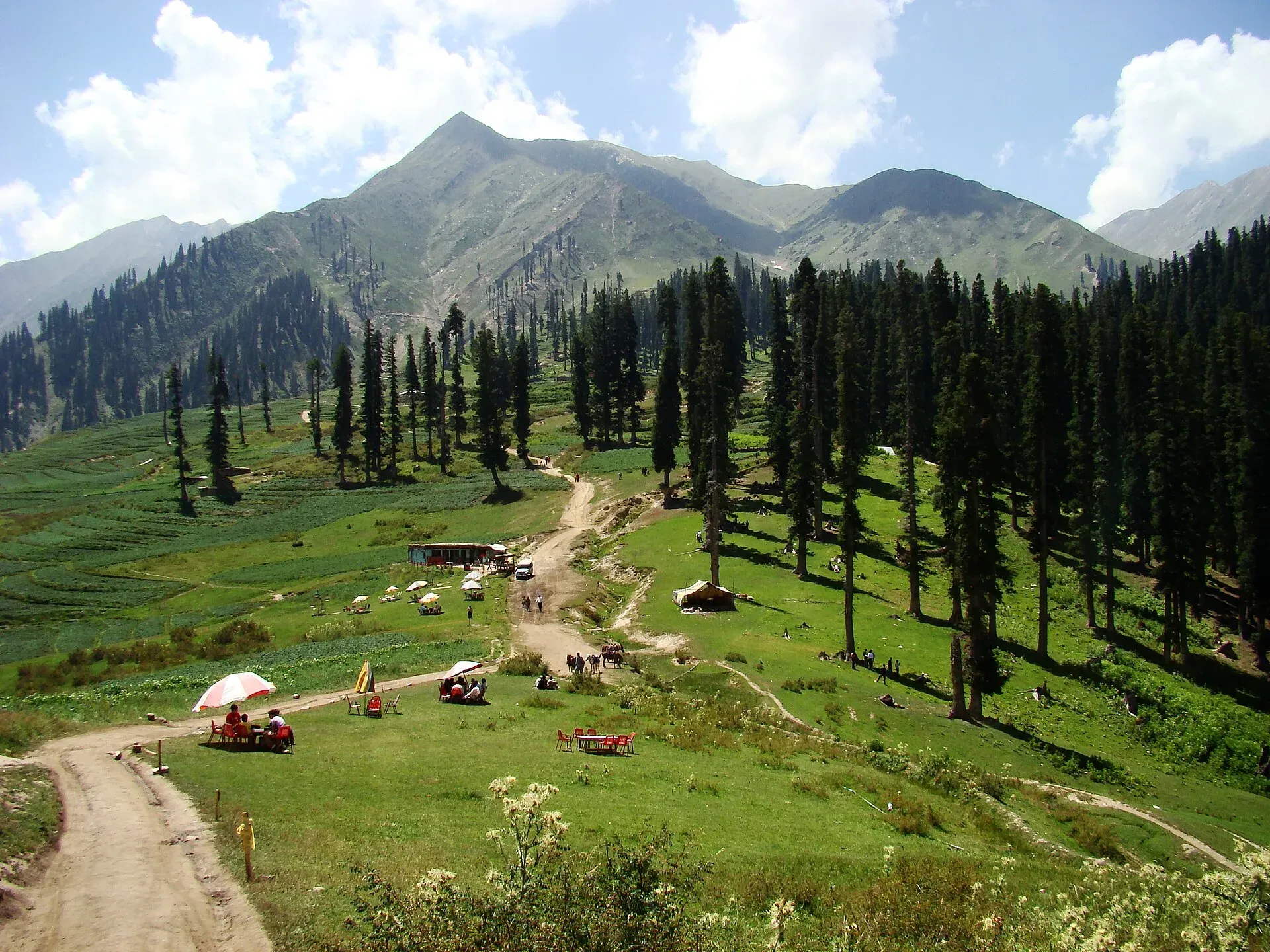
Photo: Faisal Rafiq, with thanks · CC BY-SA 4.0 · via Wikimedia Commons · temporary stand-in photo

Sharan Forest
A conifer forest of pine, fir and spruce in the lower Kaghan valley, Mansehra, at roughly 2,400 m. Known for walks and camping; area and exact status are not confirmed.
Overview
Sharan Forest is in Mansehra District, Khyber Pakhtunkhwa, in the lower Kaghan valley. Travel sources put its height at about 2,425 m (also quoted as about 2,500 m, 7,872 ft, and as a range of 2,000 to 3,000 m). No official figure has been found. One travel guide gives the forest's area as about 30 square kilometres, which is unconfirmed.
Plan your visit
- Nearest town
- Kiwai
- Getting there
Reached from the lower Kaghan valley by way of Balakot, Kiwai and Paras, with a rough 4x4 track for the final stretch. More
Best months
May – Sep
Landscape
The canopy is mainly conifers: pine, fir and spruce are named by travel sources, and deodar is also mentioned. Studies of the wider Kaghan valley say the dominant trees are Himalayan fir (Abies pindrow) and blue pine (Pinus wallichiana), with deodar. Travel guides also describe open alpine meadows, clear streams and snow-capped peaks beyond the forest, and wild mushrooms and other forest produce along the streams.
Walks and camping
The main draws are walks through tall, dense forest and the meadow clearings. Travel sources list trekking, hiking, camping, birdwatching, fishing and horse riding. It is a quieter stop than the lakes further up the Kaghan valley.
Wildlife is not documented for Sharan by any official source. One travel guide lists golden eagle, Himalayan snowcock and black bulbul, and mammals including Himalayan black bear and musk deer, and snow leopard; none of this is verified for Sharan, so check with local forest staff before counting on a sighting.
Getting there
The usual approach is from the lower Kaghan valley, by way of Balakot, Kiwai and Paras. One travel guide gives about 233 km from Islamabad (about 4.5 hours if you leave early), about 30 km from Balakot, and a final 16 km on an old mountain road from Paras that needs a 4x4 and takes about two and a half hours. These figures are unconfirmed; ask in Balakot or Kiwai. Nearby places named by that guide include Manshi Top, Manor Valley and the upper Kaghan valley. See Kaghan Valley and Balakot.
When to visit
May to September is the usual season. Snow limits access in winter. Rain turns the jeep track to mud, so allow extra time in July and August.
Where to stay and eat
Hotels and restaurants are few. Options named by travel guides are camping pods and tents, and small houses run by the forest and tourism offices. Bring food and sleeping gear. Further up the valley, Naran has more choice.
Good to know
- Ask the district administration or local police about current conditions before you go. Travel advice: For foreign visitors: the UK FCDO (updated 27 October 2026) advises against all travel on the KKH between Mansehra and Chilas, and notes KP emergency measures and Governor's Rule since 11 October 2026. Check the live page for Mansehra district before you plan.
- Forest in Kaghan is managed by the KP Forest Department. Check the current camping and fire rules locally, and ask permission before you pitch a tent.
- Cell coverage is patchy. Tell someone your plan and carry a torch, spare layers and a first-aid kit.
- Entry or camping fees are not confirmed; current fees will be added soon.
Highlights
- Conifer forest at about 2,400 m
- Walks and camping in Kaghan
- Pine, fir and spruce
- Quieter than the upper valley
Tips
- Confirm road status in Balakot
- Read the FCDO advice first
- Take warm gear
- Do not light fires
Photos we still need: Sharan Forest (the current photo showed Lalazar, a different place, and was removed). Send us yours
Sources and last checked
Last checked Confidence low3 sources5 still to check
- Last checked
- Method
- Desk research from published sources
- Confidence
- low
- Checked by
- trek.pk research team
Researched from published sources; not yet checked on the ground by our team. Spot something out of date? Report a mistake.
Sources
- Kaghan Valley forest stand structure studies · Researchers Links · checked
- Sharan Forest · Pakistan Traveler · checked
- Pakistan travel advice (updated 27 October 2026) · UK Foreign, Commonwealth & Development Office · checked
Still to be checked on the ground (5)
- Altitude (travel sources: 2,425 m, about 2,500 m, or 2,000-3,000 m; no official figure)
- Forest area (one blog says about 30 sq km; the journal study could not be opened, HTTP 403)
- Road distance and time (blog figures only, unconfirmed; no official source)
- Camping rules and fees (none stated by any source)
- Wildlife (blog list only; not verified)
Nearby and related

Kaghan Valley (with Naran)
A 155 km Himalayan valley above Balakot along the Kunhar River, with Shogran, Naran, Saiful Muluk and Lulusar lakes, and the road to Babusar Pass. Open mainly from May to October.

Shogran
A meadow hill station at about 2,362 m above Balakot in the Kaghan Valley, the start of the Siri and Paye meadows jeep trip. Landslides and snow can close the road; private cars may not go beyond Shogran.

Siri Paye Meadows
Twin meadows above Shogran in the Kaghan Valley, Siri and Paye, reached by a rough 4x4 track from Shogran and used as the base for the Makra Peak walk.

Naran
The main base of the Kaghan Valley, at 2,409 m beside the Kunhar River. Naran is the starting point for Saiful Muluk, Lulusar and the road to Babusar Top.

Balakot
The gateway to the Kaghan Valley, on the Kunhar River in Mansehra District. Balakot was destroyed in the 2005 earthquake and is the last big town before Naran, Shogran and Siri Paye.