

Photo: Uzair Wali Muhammad, with thanks · CC BY-SA 4.0 · via Wikimedia Commons · temporary stand-in photo

Balakot
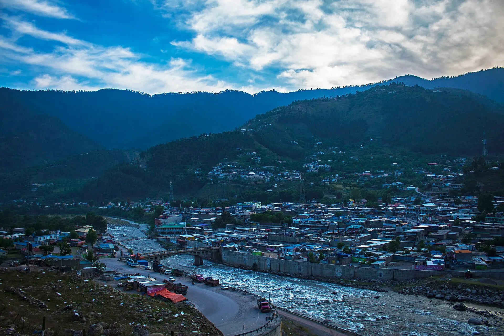
The gateway to the Kaghan Valley, on the Kunhar River in Mansehra District. Balakot was destroyed in the 2005 earthquake and is the last big town before Naran, Shogran and Siri Paye.
Overview
Balakot is a town and tehsil headquarters in Mansehra District, Khyber Pakhtunkhwa. It sits beside the Kunhar River at the mouth of the Kaghan Valley. The earthquake of 8 October 2005 destroyed the town, and tens of thousands died in the region (Wikipedia). The government recommended moving the town to a new site near Bakriyal, about 20 km away. Wikipedia noted a decade later that New Balakot City was still being built. The old town has been rebuilt as a bazaar and transport stop.
There is no known 2023 census figure for Balakot. The only figure found is about 30,000 residents before the earthquake. Most people speak Hindko and Gujari.
Plan your visit
- Getting there
Road: About 166 km from Islamabad (OSRM, optimistic 2 h); Mansehra about 41 km; Naran about 82 km north. Buses and vans from Mansehra and Rawalpindi. More
Best months
Apr – Jun, Sep – Oct
- Balakot
- Related places nearby: Naran, Saiful Muluk, Muzaffarabad, Abbottabad
History in brief
Balakot is sometimes called the Land of Martyrs because of the Battle of Balakot in 1831, when Syed Ahmad Barelvi and Shah Ismail Dehlvi were killed fighting the Sikh empire. The Swati tribe took over the Pakhli area in the early 1700s, and the Khans of Balakot have traditionally been Swati. In the 2005 earthquake the town, which had about 30,000 residents, was destroyed, and the Balakot-Bagh fault runs through the area. The government planned to move the city to Bakrayal, about 20 km away, and keep the old town as a heritage site. In 2011 many residents rebuilt in the old town regardless, and about ten years after the earthquake the new city was still unfinished.
What to see and do
- The Kunhar River: a river walk and the Ayub Bridge, built in 1965, which links Balakot and the Kaghan Valley to the rest of Pakistan. The Kunhar rises at Lake Dharam Sar in the Kaghan Valley and meets the Jhelum further down.
- Kiwai, Shogran and Siri Paye: a road above Balakot leads to Kiwai, then a jeep road to the Shogran meadows and Siri Paye. See the Kaghan route page.
- Bazaar and food stops: a last chance to buy supplies, fuel and cash before Naran.
- Nainsukh valley: the temperate area below Balakot takes this name. Above the town the Kaghan Valley is cold enough to freeze in winter.
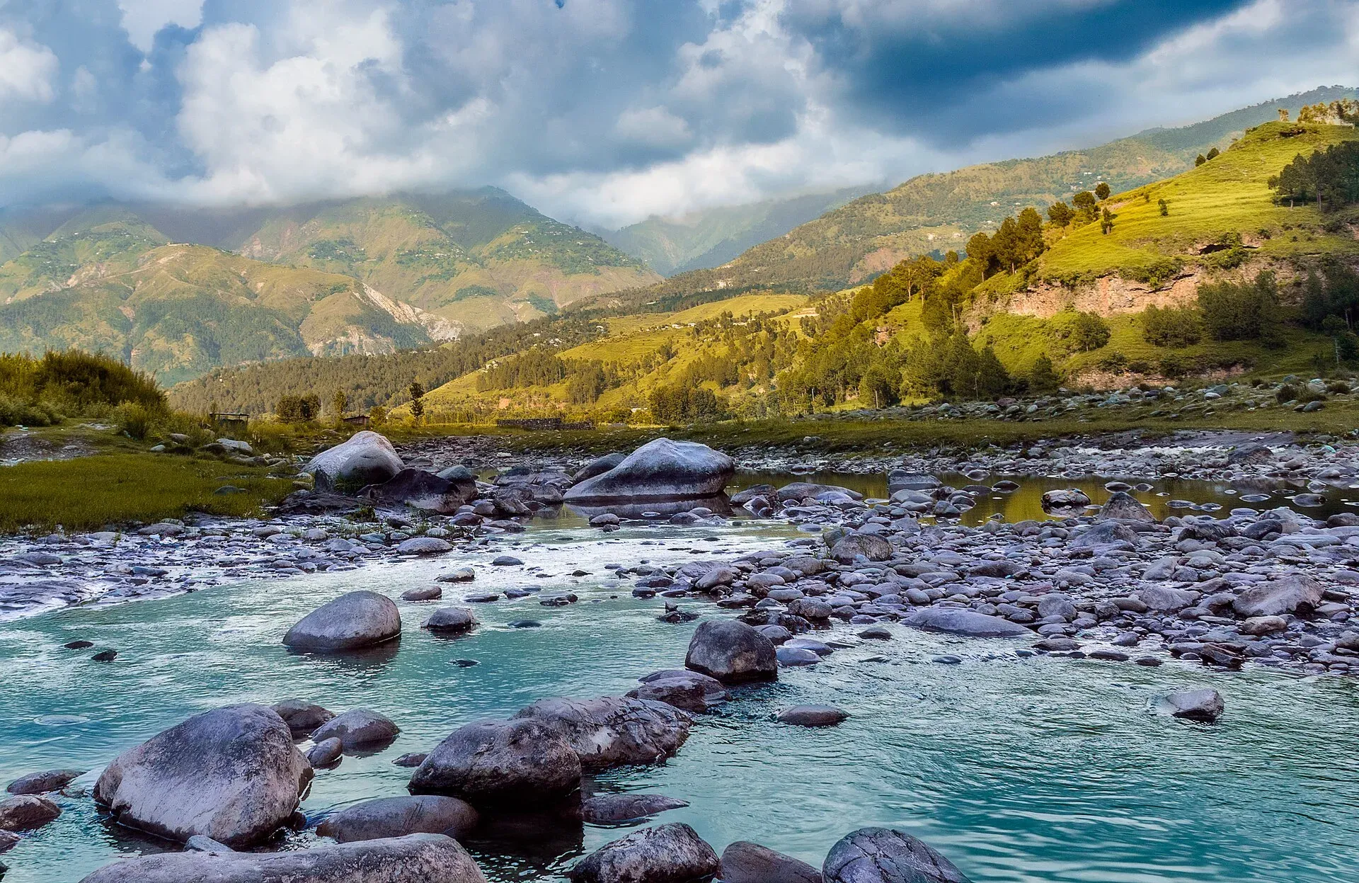
Photo: Nsmau.memoirs, with thanks · CC BY-SA 4.0 · via Wikimedia Commons · temporary stand-in photo

Getting there
- Road: Balakot is about 166 km from Islamabad (OSRM about 2 hours, optimistic) via Abbottabad and Mansehra, and about 41 km from Mansehra (OSRM about 30 minutes). Naran is about 82 km north, and Muzaffarabad is about 41 km west by road.
- Public transport: buses and vans from Mansehra and Rawalpindi.
When to visit
April to October for the valley. Balakot has a humid subtropical climate with about 1,745 mm of rain a year, a record high of 43.3 C and a record low of minus 3 C (Wikipedia). July is the wettest month (about 384 mm), then August (about 311 mm), and monsoon landslides can block the road north.
Where to stay and eat
Hotels are in the main bazaar and highway strip, and mostly serve people who leave early for Naran or Shogran. Quieter rooms are on the river side. Food is basic: chicken, mutton, rice, bread and tea. Book ahead at Eid.
Treks and day trips
Shogran and Siri Paye are the usual day trips. The Naran road continues to Saiful Muluk, Lulusar and Babusar in summer. See the Naran page for the 2026 road reopening dates.
Safety and good to know
Balakot lies in an earthquake zone, and the Kunhar River can rise quickly. Do not camp or park by the river after heavy rain. Drive in daylight and check road conditions before the climb to Naran. Dress modestly and ask before photographing people.
Ask the district administration or local police about current conditions before you go. For foreign visitors: the UK FCDO does not name the Kaghan valley, but it advises against all travel on the Karakoram Highway between Mansehra and Chilas (advice updated 27 October 2026, checked 16 November 2026). Read the live advice before you plan.
Highlights
- Gateway to the Kaghan Valley
- Kunhar River and Ayub Bridge
- Road to Shogran and Siri Paye
- Rebuilt town after the 2005 earthquake
Stay, eat and essentials near Balakot
Within 8 km of Balakot, nearest first.
Places to stay
- City View Hotel BalakotCall City View Hotel BalakotMap of City View Hotel Balakot in Google Maps
- Blue Bell Hotel And Restaurant BalakotCall Blue Bell Hotel And Restaurant BalakotMap of Blue Bell Hotel And Restaurant Balakot in Google Maps
- Hotel Gate Way BalakotCall Hotel Gate Way BalakotMap of Hotel Gate Way Balakot in Google Maps
- Hotel Shelton InnCall Hotel Shelton InnMap of Hotel Shelton Inn in Google Maps
- Midway Hotel & RestaurantCall Midway Hotel & RestaurantMap of Midway Hotel & Restaurant in Google Maps
- Khyber Park Hotel BalakotCall Khyber Park Hotel BalakotMap of Khyber Park Hotel Balakot in Google Maps
Places to eat
- Agosh Balakot RestaurantCall Agosh Balakot RestaurantMap of Agosh Balakot Restaurant in Google Maps
- Balakot Chappal KababCall Balakot Chappal KababMap of Balakot Chappal Kabab in Google Maps
- Anaaj Restaurant Boli BalakotCall Anaaj Restaurant Boli BalakotMap of Anaaj Restaurant Boli Balakot in Google Maps
- KUKU’SMap of KUKU’S in Google Maps
Essential services mechanics, ATMs, pharmacies and hospitals and clinics
Mechanics and tyre shops
- Balakot Auto EFI WorkshopCall Balakot Auto EFI WorkshopMap of Balakot Auto EFI Workshop in Google Maps
ATMs
- Habib Bank LimitedCall Habib Bank LimitedMap of Habib Bank Limited in Google Maps
Pharmacies
- Al-Rehman MedicoseMap of Al-Rehman Medicose in Google Maps
Hospitals and clinics
- Tehsil Headquarter HospitalMap of Tehsil Headquarter Hospital in Google Maps
- BHU SANGARMap of BHU SANGAR in Google Maps
Listings come from Google Maps data and are unverified: phone numbers, opening months and prices may have changed. Report a problem · Own one of these? Claim it
Tips
- Buy cash and fuel here before heading to Naran.
- Start early to beat weekend traffic.
- Avoid river banks after rain.
- Check the Naran road with the district administration.
Photos we still need: Ayub Bridge; Balakot bazaar; Shogran or Kiwai road. Send us yours
Sources and last checked
Last checked Confidence medium5 sources3 still to check
- Last checked
- Method
- Desk research from published sources
- Confidence
- medium
- Checked by
- trek.pk research team
Researched from published sources; not yet checked on the ground by our team. Spot something out of date? Report a mistake.
Sources
- Balakot · Wikipedia · checked
- OSRM driving route service: distances and times measured 16 November 2026 (times are optimistic, without stops) · OSRM / OpenStreetMap · checked
- Pakistan Tourism Guide 2021 · TDAP Pakistan · checked
- Kaghan set to reopen for tourists after five months (26 April 2026) · Dawn · checked
- Kaghan Valley · Wikipedia · checked
Still to be checked on the ground (3)
- Town altitude (no figure found in Wikipedia's Balakot or Kaghan Valley articles)
- Current status of New Balakot City (Wikipedia says construction was still under way about a decade after 2005; no completion date found)
- Hotels and fuel availability
Nearby and related

Khyber Pakhtunkhwa
Mountains, Buddhist ruins and old bazaars in north-west Pakistan: Swat, Kaghan, Chitral, the Kalash valleys, the Khyber Pass and Peshawar.

Naran
The main base of the Kaghan Valley, at 2,409 m beside the Kunhar River. Naran is the starting point for Saiful Muluk, Lulusar and the road to Babusar Top.

Saiful Muluk
The best-known lake of the Kaghan Valley, at 3,224 m above Naran, with Malika Parbat behind it. It is about 9 km from Naran, reached by jeep, and is snowbound and frozen in winter.

Muzaffarabad
The capital of Azad Jammu and Kashmir, at 737 m where the Neelum and Jhelum rivers meet. It is the gateway to the Neelum Valley and a rebuilt city after the 2005 earthquake.

Abbottabad
A cool, green cantonment city at about 1,256 m in Hazara, the military academy town and the main gateway to Nathia Gali, Thandiani, Ayubia National Park and the Kaghan Valley.

Naran, Kaghan and Babusar
A 4-day summer road trip from Islamabad up the Kaghan valley to Naran, Saiful Muluk and Lulusar Lake, over Babusar Pass (4,173 m) to Chilas on the KKH.

Murree, Galyat and Abbottabad
A two-day loop from Islamabad up to Murree, along the Galyat ridge to Nathia Gali and down to Abbottabad, about 227 km by road. Best in spring and autumn; snow can shut the roads in winter.