

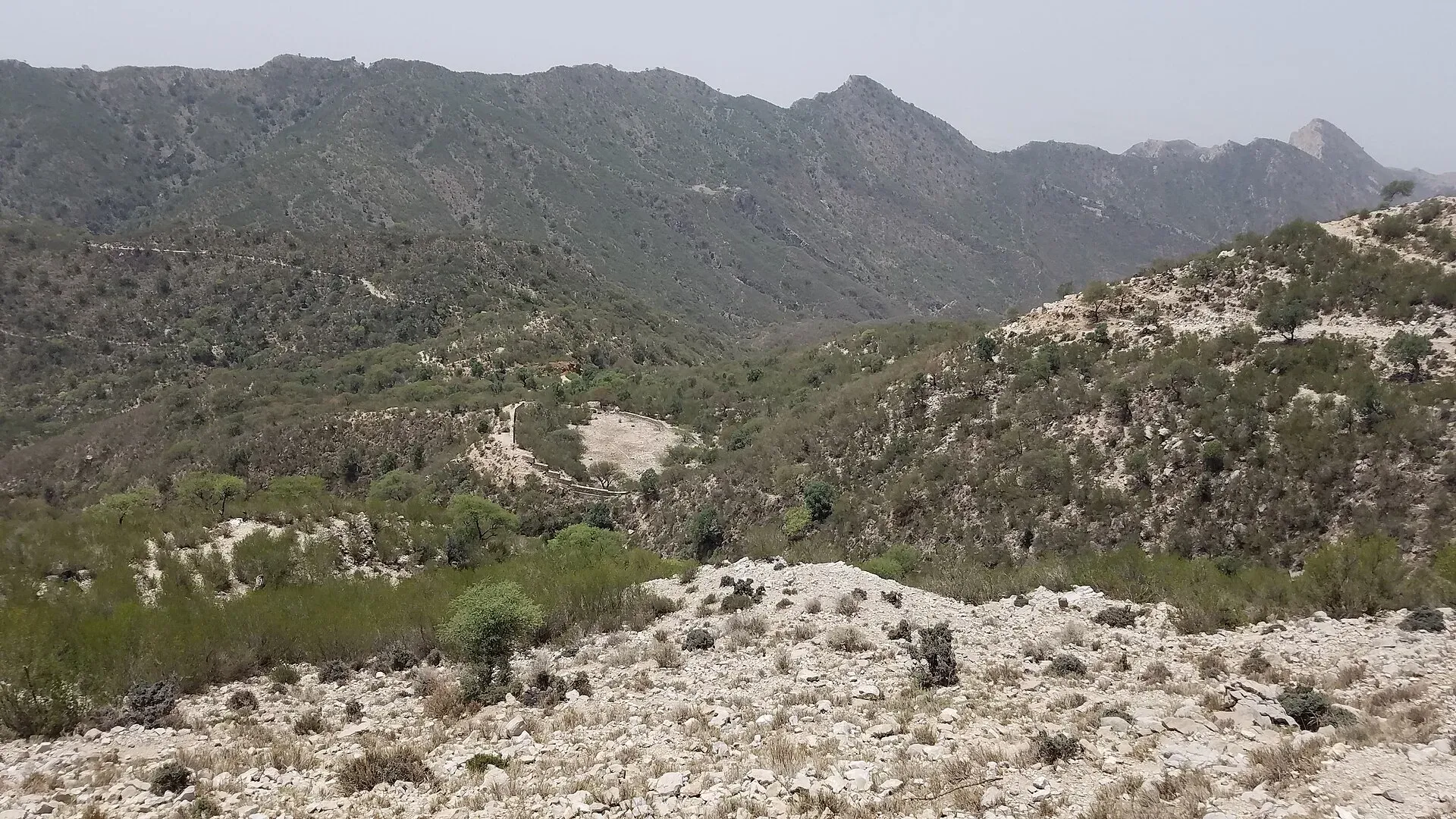
Photo: Doctor.jshah, with thanks · CC BY-SA 4.0 · via Wikimedia Commons · temporary stand-in photo

Sheikh Badin National Park
A hill-top national park in the Sheikh Badin hills, between Lakki Marwat and Dera Ismail Khan in southern KP. About 15,540 hectares, set up in 2003, with a colonial hill station and a Sufi shrine. For foreign visitors: the UK FCDO advises against travel here.
Overview
Sheikh Badin National Park protects a rocky range of hills in southern Khyber Pakhtunkhwa. The hills are an eastern spur of the Sulaiman Mountains and stand on the border of Lakki Marwat and Dera Ismail Khan districts, near Darra Pezu. Wikipedia gives the park's date as 2003 and its area as 15,540 hectares (about 155 square kilometres). PakTourismPortal says it was formally recognised on 22 November 2002, and Dawn (22 December 2020) says it received national park status under the federal Protected Areas Initiative. No park notification or wildlife-department page was found, so these figures are unconfirmed.
The park is built around Sheikh Badin, a small hill station on the summit ridge. Wikipedia gives an average altitude of 1,300 m, and Dawn (2020) puts the top at about 4,200 feet (about 1,280 m). PakTourismPortal lists 5,416 ft (about 1,650 m), so the figures do not agree. Because it is cooler than the surrounding plains, the British used it as a summer station.
Plan your visit
- Nearest town
- Darra Pezu
- Getting there
Sheikh Badin is reached from the Indus Highway near Pezu, about 25 km to the east according to Wikipedia, between Lakki Marwat and Dera Ismail Khan. Wikipedia says the road is unpaved and often damaged by monsoon rain. More
Best months
Mar – Apr, Oct – Nov
- Sheikh Badin National Park
- Related places nearby: Dera Ismail Khan, Lakki Marwat, Mianwali, Thanedar Wala Game Reserve
History
Dawn describes Sheikh Badin as a hill station established in the mid-19th century, used as a summer retreat by missionaries and civil and military officials. T. J. L. Mayer, who worked in the Bannu Mission from 1874 to 1889, is said to have brought a cutting of an olive tree from the Mount of Olives, and the tree grew here. By 1927 the station had long been deserted. Wikipedia adds that folklore says Sheikh Abdul Qadir Gilani spent 40 days in retreat on the hill and that a descendant, Jando Neko, settled here around 1600. Descendants of Mughal families settled after 1857 and still hold much of the hill; disputes are settled by jirga (a council of elders).
The village today
About 50 households live on the hill, mainly Syed and Sahib families, living from livestock and small business. The rocky ground holds little water. Villagers depend on rainwater collected in seven or eight pools that need regular repair. Electricity is unreliable and the road is poorly kept.
Travel advice
For foreign visitors: the UK FCDO advises against all travel to Dera Ismail Khan and Lakki Marwat districts of Khyber Pakhtunkhwa (advice updated 27 October 2026, checked 16 November 2026). The park lies where those two districts meet. The FCDO also notes emergency measures and Governor's Rule in KP since 11 October 2026. Read the live advice and local news before you make any plans; this page is not an invitation to travel against official advice.
What to see and do
- The hill station remains. Wikipedia lists ruined administrative offices, a police station, a partly intact British cemetery, tennis and squash courts and officers' residences from the colonial period. Dawn (2020) mentions a mission house, club house, racquet court, post office, barracks, a ruined chapel, rain-water ponds, and an olive tree grown from a cutting brought from the Mount of Olives.
- The shrine. The main monument is a shrine on the highest hill of the village, where Wikipedia says Sheikh Abdul Qadir Gilani had a retreat. The place is said to take its name from Sheikh Baha-ud-Din Shah, known locally as Jando Neko, who is buried in the village cemetery. Each April the Syed tribe holds a fair called the Sadra, when visitors climb the hill, pray at the graves of the Syeds buried there and bring gifts for local people. Behave respectfully at the shrine.
- Views and walking. The ridge looks out over the plains of Lakki Marwat, Bannu and the Indus valley. Walk only on established tracks.
- Wildlife and plants. A survey cited by Wikipedia recorded 41 bird species (18 of them migratory), 23 species of amphibians and reptiles, and 107 plant species.
When to visit
Summers on the ridge are milder than the plains. Winters are cold and dry, with some snow in January and February according to Wikipedia. Spring and autumn are the most comfortable seasons.
Where to stay and eat
Wikipedia reports about ten tourist huts at the village (with unreliable electricity) and a derelict 1970s resort, the Post Office Resort, once built for its views over the plains; PakTourismPortal also mentions a tourist hut facility. Current availability is not confirmed. Bring water and food, as services are limited.
Good to know
- A fee may apply. Current fees will be added soon; check with the Khyber Pakhtunkhwa Wildlife Department.
- Visitor access, roads and opening arrangements are not confirmed by an official source. Dawn reported in 2020 that the park status was given under a federal protected-areas programme and that work to restore the hill resort was planned. Check what has happened since.
- Follow the standard park rules: take your litter out with you, do not light fires outside marked sites, do not pick plants or disturb animals, and do not hunt. Hunting and trapping inside a national park are offences. Ask the park office before flying a drone; many parks need written permission and drones are banned near borders and sensitive sites.
Highlights
- Cool hill station above the plains
- Colonial-era ruins and a mission-era olive tree
- Hilltop Sufi shrine
- Eastern spur of the Sulaiman Mountains
Getting there
Sheikh Badin is reached from the Indus Highway near Pezu, about 25 km to the east according to Wikipedia, between Lakki Marwat and Dera Ismail Khan. Wikipedia says the road is unpaved and often damaged by monsoon rain. Because both districts are on the FCDO's all-travel list, check current security conditions and road status locally. We have no confirmed public transport details.
Tips
- Check the FCDO advice and local security before any plan
- Ask the KP Wildlife Department about access and permission
- Carry water and food; services are limited
- Treat the shrine with respect
Wildlife
Facilities
- Tourist huts (reported, unconfirmed)
- Colonial-era hill station remains
- Hilltop shrine
Photos we still need: the hill station ruins, shrine, or the olive tree. Send us yours
Sources and last checked
Last checked Confidence low6 sources5 still to check
- Last checked
- Method
- Desk research from published sources
- Confidence
- low
- Checked by
- trek.pk research team
Researched from published sources; not yet checked on the ground by our team. Spot something out of date? Report a mistake.
Sources
- Sheikh Badin National Park · Wikipedia · checked
- Sheikh Badin · Wikipedia · checked
- Darra Pezu · Wikipedia · checked
- Jerusalem to Sheikh Badin: story of an olive tree · Dawn · checked
- Pakistan travel advice (updated 27 October 2026) · UK FCDO · checked
- Sheikh Badin National Park · PakTourismPortal · checked
Still to be checked on the ground (5)
- Park notification, year and area: Wikipedia says 2003 and 15,540 ha; PakTourismPortal says 22 November 2002; no official notification found
- Summit height: Wikipedia 1,300 m (average altitude), Dawn about 4,200 ft, PakTourismPortal 5,416 ft; unresolved
- Whether visitors are currently allowed and the state of the road and huts
- Current security situation
- Hill-station founding date: Dawn says mid-19th century
Nearby and related

Dera Ismail Khan
A historic Indus river city in southern Khyber Pakhtunkhwa where Saraiki and Pashtun cultures meet, near the 5,000-year-old Rehman Dheri mound. Check security advice before any visit.

Lakki Marwat
The headquarters of Lakki Marwat District in the sandy south of Khyber Pakhtunkhwa, about 208 km from Peshawar. A regional market town, with no established visitor sights.

Mianwali
District capital east of the Indus in north-west Punjab. A farm and air-force town with the Chashma and Jinnah barrages nearby.
Thanedar Wala Game Reserve
A 4,047-hectare river-island wetland about 15 km east of Lakki in Lakki Marwat District, Khyber Pakhtunkhwa. A Ramsar wetland of international importance since 23 July 1976. Not set up for visitors; FCDO advises against all travel to Lakki Marwat.