

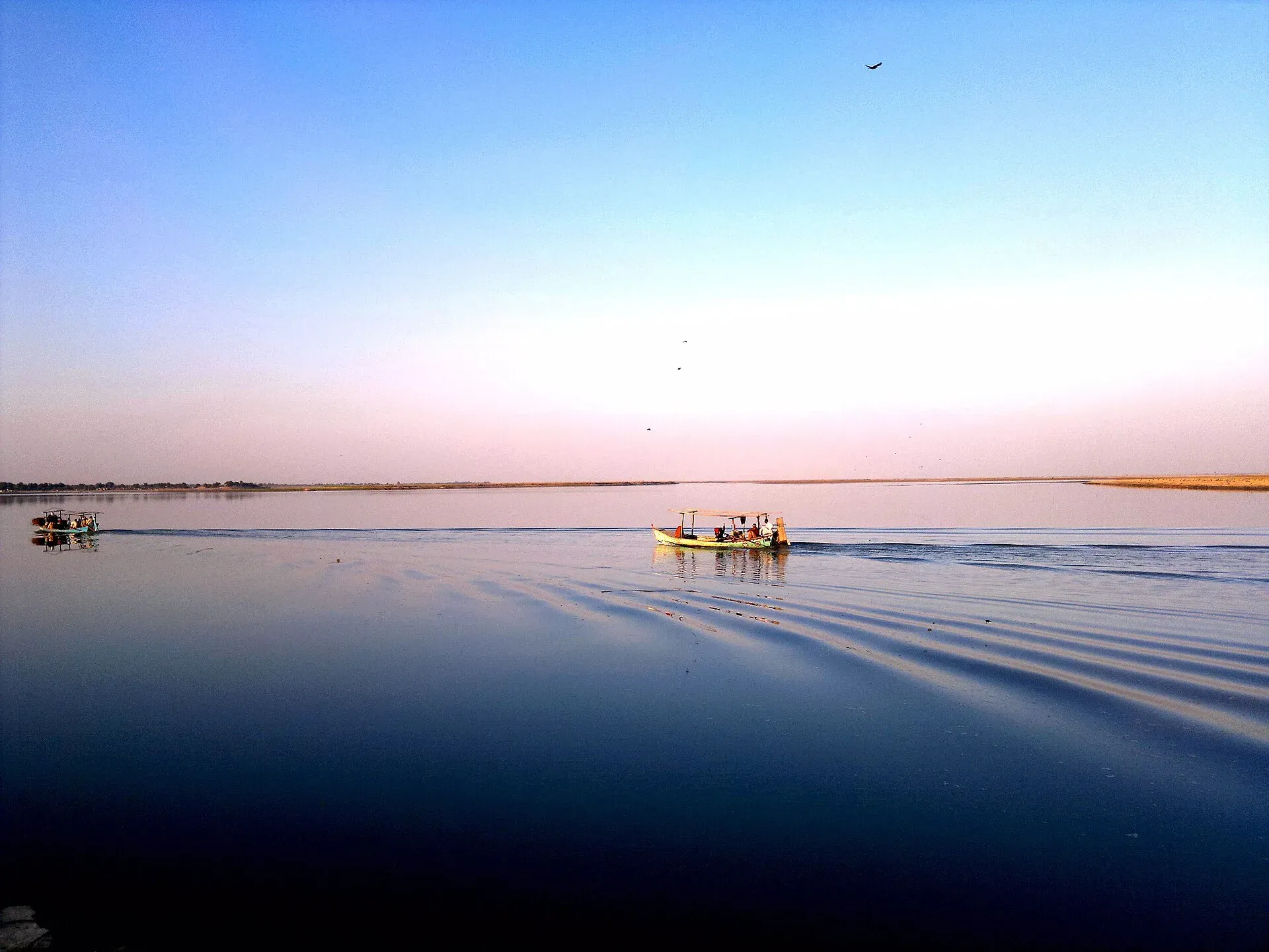
Photo: Dera Ismail Khan, with thanks · CC BY-SA 3.0 · via Wikimedia Commons · temporary stand-in photo

Dera Ismail Khan
A historic Indus river city in southern Khyber Pakhtunkhwa where Saraiki and Pashtun cultures meet, near the 5,000-year-old Rehman Dheri mound. Check security advice before any visit.
Overview
Dera Ismail Khan, usually written D. I. Khan, is the headquarters of its district in southern Khyber Pakhtunkhwa. It lies on the west bank of the Indus near the Gomal River's mouth, about 300 km south of Peshawar and about 230 km from Multan. The first town was founded by Ismail Khan, a Dodai chief, and was destroyed by Indus floods in 1823. The present city was founded in 1825 about 6 km from the river. Trade through the Gomal Pass helped it prosper.
At the 2023 census the municipal committee had 211,760 people and the urban tehsil about 217,455, including the cantonment (Wikipedia, citing the Pakistan Bureau of Statistics). Saraiki is the main language: in the 2023 count for the urban tehsil, 158,342 of 217,455 people spoke Saraiki, 34,142 Pashto and 20,784 Urdu.
Note that D. I. Khan has been affected by militant violence, including attacks in 2023 and 2026. It is not a place for casual tourism. Read the safety section before planning a trip.
Plan your visit
- Getting there
Road: M-14 motorway (280 km) to Hakla and Islamabad (about 355 km, 4 hours 30 minutes); Peshawar about 300 km. Air: airport exists but has no commercial flights. More
Best months
Nov – Mar
- Dera Ismail Khan
- Related places nearby: Sheikh Badin National Park, Koh-e-Sulaiman National Park, Rehman Dheri, Dera Ismail Khan
The city plan and history
In Saraiki, dera means tent or encampment, and the name means "Camp of Ismail Khan". Wikipedia says the Derajat region was settled by Baloch people from the 15th century, and Pashtun settlement came later. After the Indus washed away the first town in 1823, the present city was laid out in 1825 by Nawab Sher Muhammad Khan Sadozai. It has four bazaars running in the cardinal directions that meet at a central square called the Chowgalla. An eight-foot mud wall with nine gates once enclosed it. Wikipedia says all existing buildings date from the 19th century or later.
The British made it a divisional capital in 1861, created the municipality in 1867 and the cantonment in 1894. The Hakla to Dera Ismail Khan Motorway was announced in 2015 as part of the China-Pakistan Economic Corridor.
What to see and do
- The Indus riverfront: wide, slow river views, best in the cool hours.
- Old city gates and bazaars: several 19th-century gates survive, such as Kaneran Wala and Sakki, and the old quarter is a busy trading area. The four bazaars of the 1825 plan still meet at the Chowgalla.
- Noll Bagh and Qureshi Morr: well-known city spots, a park and a busy crossroads.
- Rehman Dheri: an early Indus-era (pre-Harappan) settlement mound about 22 km north, occupied from around 3300 BCE. It covers about 22 hectares and has been only partly excavated. It is on Pakistan's tentative World Heritage list. Check access first.
- Kafir Kot: the ruins of an old fort and temples on a hill by the Indus, some distance from the city. Access can be difficult, so ask locally.
Food and bazaars
Local food mixes Saraiki and Pashtun traditions: grilled meat, rice dishes, flatbreads and strong tea. Ask residents which stalls are busy and reliable. The main trading bazaars are in the old city, with cloth, dry fruit and daily goods.
Getting there and around
- Road: the Hakla to Dera Ismail Khan Motorway (M-14), 280 km long and four lanes, ends at the city. Other roads run to Bannu, Peshawar via Kohat, Mianwali, Zhob and Bhakkar. Peshawar is about 300 km, roughly 4 hours 40 minutes by road, and Islamabad about 355 km, roughly 4 hours 30 minutes (OSRM, checked 16 November 2026).
- Air: Dera Ismail Khan Airport exists, but no commercial flights operate (Wikipedia).
- Around town: rickshaws and taxis. Do not walk or drive around after dark.
Where to stay
Accommodation is basic and limited, mainly around the main roads and the cantonment. Arrange rooms in advance and share your plans with your hotel or host.
Day trips
- Rehman Dheri: a short drive north, for archaeology enthusiasts.
- The Indus and Gomal Pass: scenic but best visited only with local guidance and current security clearance.
When to visit
Winter (November to March) is the most comfortable time. Wikipedia classes the climate as hot arid, with a city altitude of 177 m. Rain falls from February to April and again in the monsoon, from July to September. Summers are very hot.
Safety
Check your government's travel advice and local police guidance. Several attacks have occurred in D. I. Khan, including a bombing on 3 November 2023 a suicide bombing at a wedding on 23 January 2026, and a bombing on 26 September 2026 that Wikipedia says killed 11. Travel with a local host, use main roads and daylight hours, and avoid crowds and sensitive sites.
For foreign visitors: the UK FCDO advises against all travel to Dera Ismail Khan (advice updated 27 October 2026, still current on 17 November 2026). Read the live advice before you plan.
Highlights
- Indus riverfront and old city gates
- Rehman Dheri, a 5,000-year-old settlement mound
- Hakla to D. I. Khan Motorway (M-14)
- Meeting point of Saraiki and Pashtun cultures
Hotels, food, fuel and services in Dera Ismail Khan
Places to stay
- National Club Hotel & RestaurantCall National Club Hotel & RestaurantMap of National Club Hotel & Restaurant in Google Maps
- Shelton Rezidor Hotel Dera Ismail KhanCall Shelton Rezidor Hotel Dera Ismail KhanMap of Shelton Rezidor Hotel Dera Ismail Khan in Google Maps
- Yarik sobat gharMap of Yarik sobat ghar in Google Maps
- FC MessCall FC MessMap of FC Mess in Google Maps
- Islamabad Hotel and RestaurantCall Islamabad Hotel and RestaurantMap of Islamabad Hotel and Restaurant in Google Maps
- Quetta Pashin Piyala HotelMap of Quetta Pashin Piyala Hotel in Google Maps
Places to eat
- Pace RestaurantCall Pace RestaurantMap of Pace Restaurant in Google Maps
- Lasani Pizza TimeCall Lasani Pizza TimeMap of Lasani Pizza Time in Google Maps
- Lasani BroastCall Lasani BroastMap of Lasani Broast in Google Maps
- Qadeemi Sohan Halwa قدیمی سوہن حلوہCall Qadeemi Sohan Halwa قدیمی سوہن حلوہMap of Qadeemi Sohan Halwa قدیمی سوہن حلوہ in Google Maps
- One Pizza & GrillCall One Pizza & GrillMap of One Pizza & Grill in Google Maps
- Midway HotelCall Midway HotelMap of Midway Hotel in Google Maps
Essential services fuel stations, mechanics, ATMs, banks, pharmacies and hospitals and clinics
Fuel
- Attock Petrol PumpMap of Attock Petrol Pump in Google Maps
- Hassan filling station (PSO)Call Hassan filling station (PSO)Map of Hassan filling station (PSO) in Google Maps
- NAVEED & BROTHERS PETROLEUM- Total Petrol StationCall NAVEED & BROTHERS PETROLEUM- Total Petrol StationMap of NAVEED & BROTHERS PETROLEUM- Total Petrol Station in Google Maps
- Nawab & Sons Petrol StationMap of Nawab & Sons Petrol Station in Google Maps
- CaltexMap of Caltex in Google Maps
- City Petrol PumpCall City Petrol PumpMap of City Petrol Pump in Google Maps
Mechanics and tyre shops
- Haji Nisar Tyre DealersCall Haji Nisar Tyre DealersMap of Haji Nisar Tyre Dealers in Google Maps
ATMs
- Allied Bank Ltd. (ABL)Map of Allied Bank Ltd. (ABL) in Google Maps
- Bank of Khyber Circular RoadCall Bank of Khyber Circular RoadMap of Bank of Khyber Circular Road in Google Maps
- NBPMap of NBP in Google Maps
- MCBMap of MCB in Google Maps
- National Bank of Pakistan (NBP)Call National Bank of Pakistan (NBP)Map of National Bank of Pakistan (NBP) in Google Maps
- Bank AL-Habib LtdCall Bank AL-Habib LtdMap of Bank AL-Habib Ltd in Google Maps
Banks and money exchange
- Meezan Bank - Dera Ismail Khan BranchCall Meezan Bank - Dera Ismail Khan BranchMap of Meezan Bank - Dera Ismail Khan Branch in Google Maps
- Bank Alfalah LtdMap of Bank Alfalah Ltd in Google Maps
- MCB Bank LTD. Circular Road Branch. Dera Ismail KhanCall MCB Bank LTD. Circular Road Branch. Dera Ismail KhanMap of MCB Bank LTD. Circular Road Branch. Dera Ismail Khan in Google Maps
- Bank of KhyberMap of Bank of Khyber in Google Maps
- UBL BankMap of UBL Bank in Google Maps
- Allied Bank Ltd.Call Allied Bank Ltd.Map of Allied Bank Ltd. in Google Maps
Pharmacies
- Rashid PharmacyCall Rashid PharmacyMap of Rashid Pharmacy in Google Maps
- Zafar Medicine CompanyCall Zafar Medicine CompanyMap of Zafar Medicine Company in Google Maps
- Mustafa Medicine CompanyCall Mustafa Medicine CompanyMap of Mustafa Medicine Company in Google Maps
Hospitals and clinics
- Dr Nasim Saba Mahsood ClinicCall Dr Nasim Saba Mahsood ClinicMap of Dr Nasim Saba Mahsood Clinic in Google Maps
- Doctor Shoaib Khan (Eye Specialist)Call Doctor Shoaib Khan (Eye Specialist)Map of Doctor Shoaib Khan (Eye Specialist) in Google Maps
- Dikhan Dental Complex 2Map of Dikhan Dental Complex 2 in Google Maps
- Combined military hospital CMHCall Combined military hospital CMHMap of Combined military hospital CMH in Google Maps
- Dr. Ijaz UltrasoundCall Dr. Ijaz UltrasoundMap of Dr. Ijaz Ultrasound in Google Maps
- Mehmood Eye HospitalCall Mehmood Eye HospitalMap of Mehmood Eye Hospital in Google Maps
All listings in Dera Ismail Khan
Listings come from Google Maps data and are unverified: phone numbers, opening months and prices may have changed. Report a problem · Own one of these? Claim it
Tips
- Check current security advice before you plan a visit.
- Travel with a local host and in daylight.
- Visit between November and March.
- Confirm access to Rehman Dheri and Kafir Kot first.
Photos we still need: Rehman Dheri mound; old city gates and bazaars. Send us yours
Sources and last checked
Last checked Confidence low7 sources3 still to check
- Last checked
- Method
- Desk research from published sources
- Confidence
- low
- Checked by
- trek.pk research team
Researched from published sources; not yet checked on the ground by our team. Spot something out of date? Report a mistake.
Sources
- Dera Ismail Khan · Wikipedia · checked
- Rehman Dheri · Wikipedia · checked
- 2026 Dera Ismail Khan District bombing · Wikipedia · checked
- Suicide bomber targets wedding in northwest Pakistan (Arab News) · Arab News · checked
- OSRM driving routes (road distances and times) · Project OSRM / OpenStreetMap · checked
- Foreign travel advice: Pakistan, warnings and insurance · GOV.UK (FCDO) · checked
- Dera Ismail Khan · Wikivoyage · checked
Still to be checked on the ground (3)
- Access to Rehman Dheri and Kafir Kot (Wikipedia gives no visitor access details; Rehman Dheri is about 22 km north)
- Local food specialities and bazaar names (Wikivoyage has nothing for D. I. Khan)
- Date of the January 2026 bombing: our text says 23 January 2026, Wikipedia's city article says 25 January 2026
Nearby and related

Islamabad
Pakistan's green, planned capital at the foot of the Margalla Hills: Faisal Mosque, hillside trails, cafes and the gateway to the north.

Peshawar
Khyber Pakhtunkhwa's capital and one of South Asia's oldest living cities: the Gandhara museum, Qissa Khwani Bazaar, mosques and a strong food culture.

Multan
The City of Saints in southern Punjab: blue-tiled Sufi shrines, a crowded old city, blue pottery, sohan halwa and mangoes.

Sheikh Badin National Park
A hill-top national park in the Sheikh Badin hills, between Lakki Marwat and Dera Ismail Khan in southern KP. About 15,540 hectares, set up in 2003, with a colonial hill station and a Sufi shrine. For foreign visitors: the UK FCDO advises against travel here.

Koh-e-Sulaiman National Park
A mountain national park in the Sulaiman range in Dera Ismail Khan, Khyber Pakhtunkhwa, listed in 2021 at about 300 square kilometres. Very little visitor information exists, and the FCDO advises against all travel to the district.
Rehman Dheri, Dera Ismail Khan
A pre-Harappan town mound of about 3300 to 1900 BC on the Gomal plain, north of Dera Ismail Khan, among the oldest urban sites in South Asia. On Pakistan's UNESCO tentative list since 2004. FCDO advises against all travel to the district.
Gomal Zam Dam
A 133 m roller-compacted concrete dam on the Gomal River in South Waziristan, completed in 2011 and inaugurated in 2013 for irrigation, flood control and power. FCDO advises against all travel to South Waziristan. Information only.
Takht-i-Sulaiman
Takht-i-Sulaiman (3,487 m) is the highest peak of the Sulaiman Mountains in Dera Ismail Khan district. FCDO advises against all travel to Dera Ismail Khan and Balochistan. Information only; this site gives no route.