

Photo: Fassifarooq, with thanks · CC BY-SA 4.0 · via Wikimedia Commons · temporary stand-in photo

Cholistan and Derawar Fort
A 2-3 day road trip from Multan to Bahawalpur and on to Derawar Fort in the Cholistan Desert: 185 km one way. Derawar's 40 bastions are best seen in the cool season, around the February jeep rally.
Customise this route Change the dates, stops and how you travel in the Road Trip Planner.
Overview
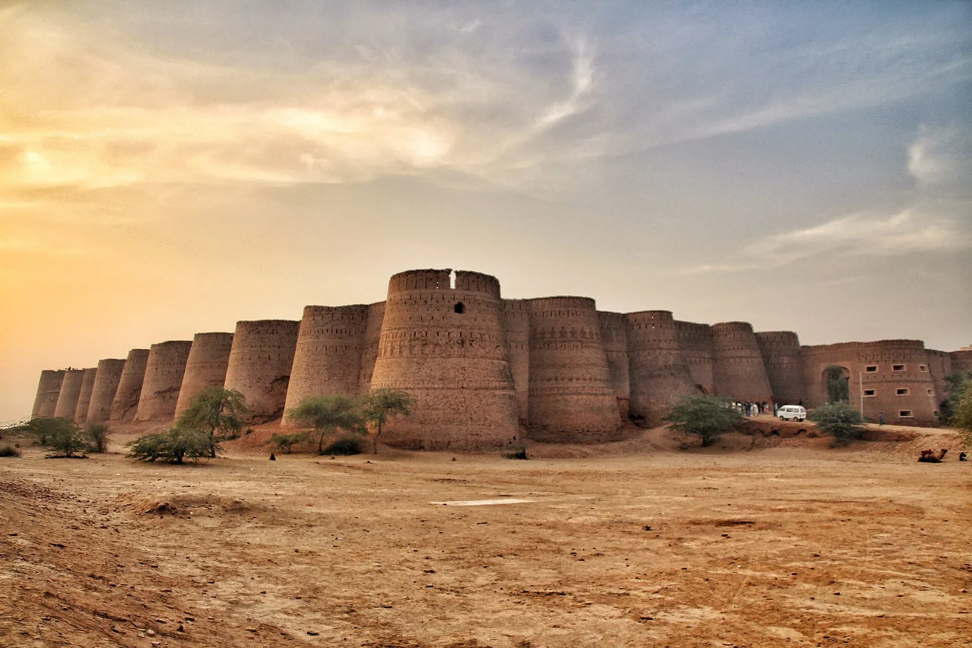
Cholistan is the desert of southern Punjab, east of the Indus plain. The route runs from Multan to Bahawalpur, a city of palaces, then south into the desert to Derawar Fort, the best known of the Cholistan forts. Derawar's walls are 1,500 m around and stand up to 30 m high, with 40 round bastions (Wikipedia). The fort was founded in the ninth century by the Bhati rulers and renovated in 1732 by Nawab Sadeq Muhammad Khan Abbasi (Wikipedia). Pakistan submitted "Derawar and the Desert Forts of Cholistan" to UNESCO's tentative list in 2016.
Who it suits
Travellers who want quiet roads, heritage and a desert landscape, and who are happy with basic services. You will need a car, a driver who knows the roads, and a day for each stage.
When to go
Choose the cool months, roughly November to February. The International Cholistan Desert Jeep Rally was held on 11 to 15 February 2026, with its qualifying round at Dilwash Stadium near Derawar Fort (ProPakistani, 15 January 2026). The TDAP guide says the rally was started to show the desert as a winter destination.
The route
Distances are from OSRM / OpenStreetMap, measured 16 November 2026. Times are driving only, without stops.
- Multan to Bahawalpur: 94 km, about 1 hour 15 minutes.
- Bahawalpur to Ahmadpur East: 54 km, about 50 minutes.
- Ahmadpur East to Derawar Fort: 49.5 km, about 1 hour.
- Bahawalpur to Derawar Fort, direct: 96 km, about 1 hour 40 minutes. Wikipedia places Derawar about 20 km south of Ahmadpur East, but the coordinates in Wikipedia's own articles for the two places are about 42 km apart in a straight line, so the 20 km figure is too low; use the road distance of about 50 km.
- Multan to Derawar Fort, direct: 185 km, about 2 hours 45 minutes.
- Bahawalpur to Uch Sharif: 75 km, about 1 hour 5 minutes, for a side trip to the historic shrines.
Bahawalpur also has the Noor Mahal and other Nawab-era buildings, and Lal Suhanra National Park lies near the city (TDAP).
Stops in order
- Multan. Start of the route. The tiled shrine of Shah Rukn-e-Alam is the best-known landmark.
- Bahawalpur. The Noor Mahal, built in the 1870s as a Nawab's palace, and Bahawalpur Museum, which displays tie-dyed cloth, embroidered shoes and woven date-leaf baskets of the region.
- Uch Sharif (side trip). Wikipedia describes a monument complex of three well-known shrines and about 1,400 graves, tentatively listed for World Heritage. The Tomb of Bibi Jawindi is dated to 1493 or 1494; the shrine of Jalaluddin Bukhari honours a 13th-century Sufi saint who came from Bukhara. Tilework was brought in from Multan, and tombs are typically domed on octagonal bases. Flooding in the early 19th century damaged many tombs. Wikipedia gives the distance from Bahawalpur as about 84 km; OSRM gives about 75 km.
- Ahmadpur East. The last large town before the desert road.
- Derawar Fort. The destination. A camping area run by the provincial tourism corporation sits beside the fort, and the jeep rally has used the area.
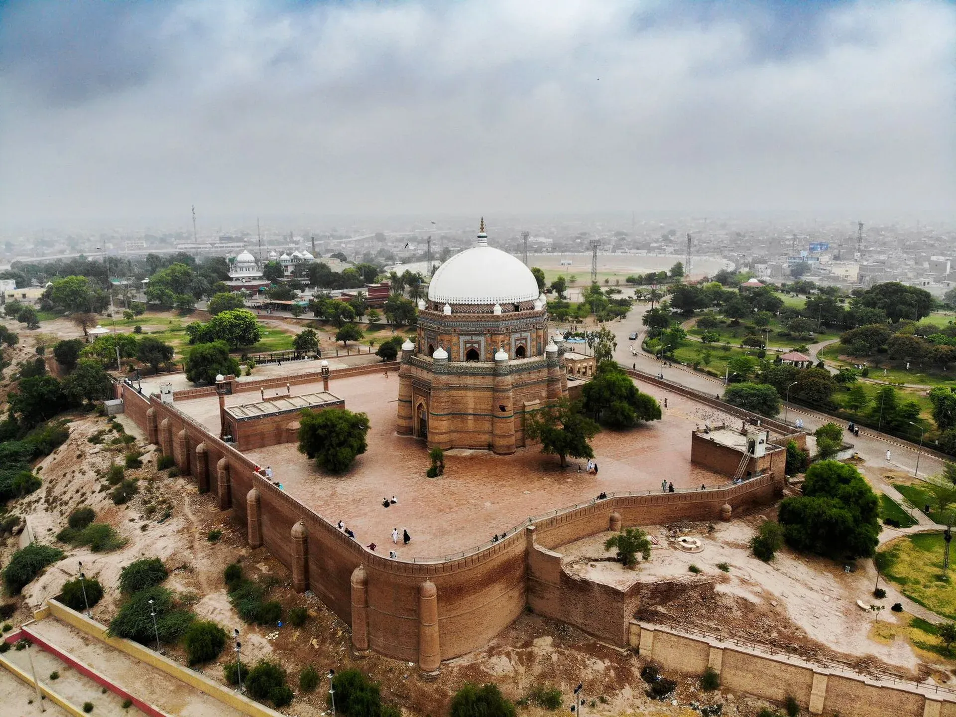
Photo: Yaarahmadd, with thanks · CC BY-SA 4.0 · via Wikimedia Commons · temporary stand-in photo

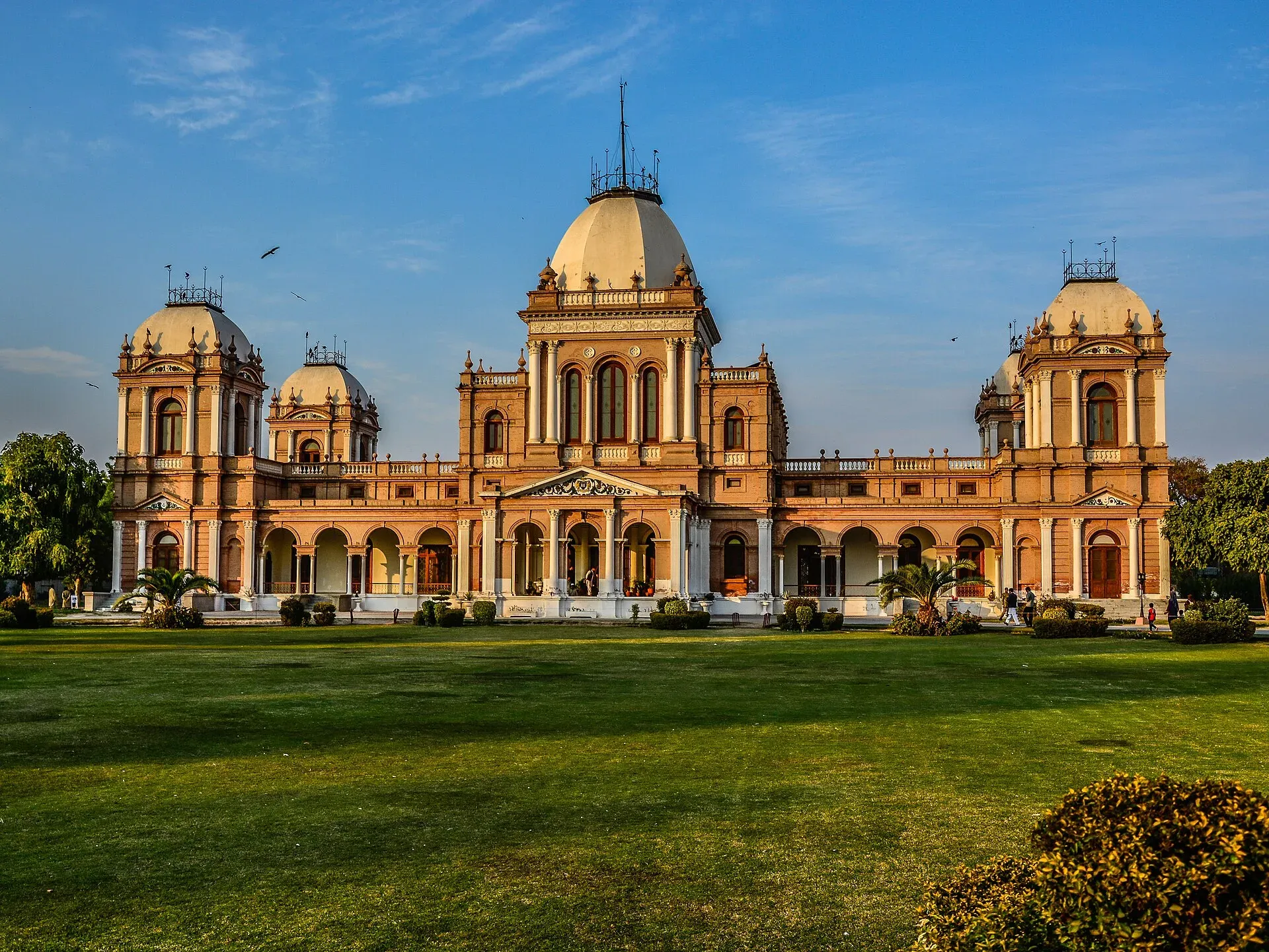
Photo: Muhammad Ashar, with thanks · CC BY-SA 3.0 · via Wikimedia Commons · temporary stand-in photo

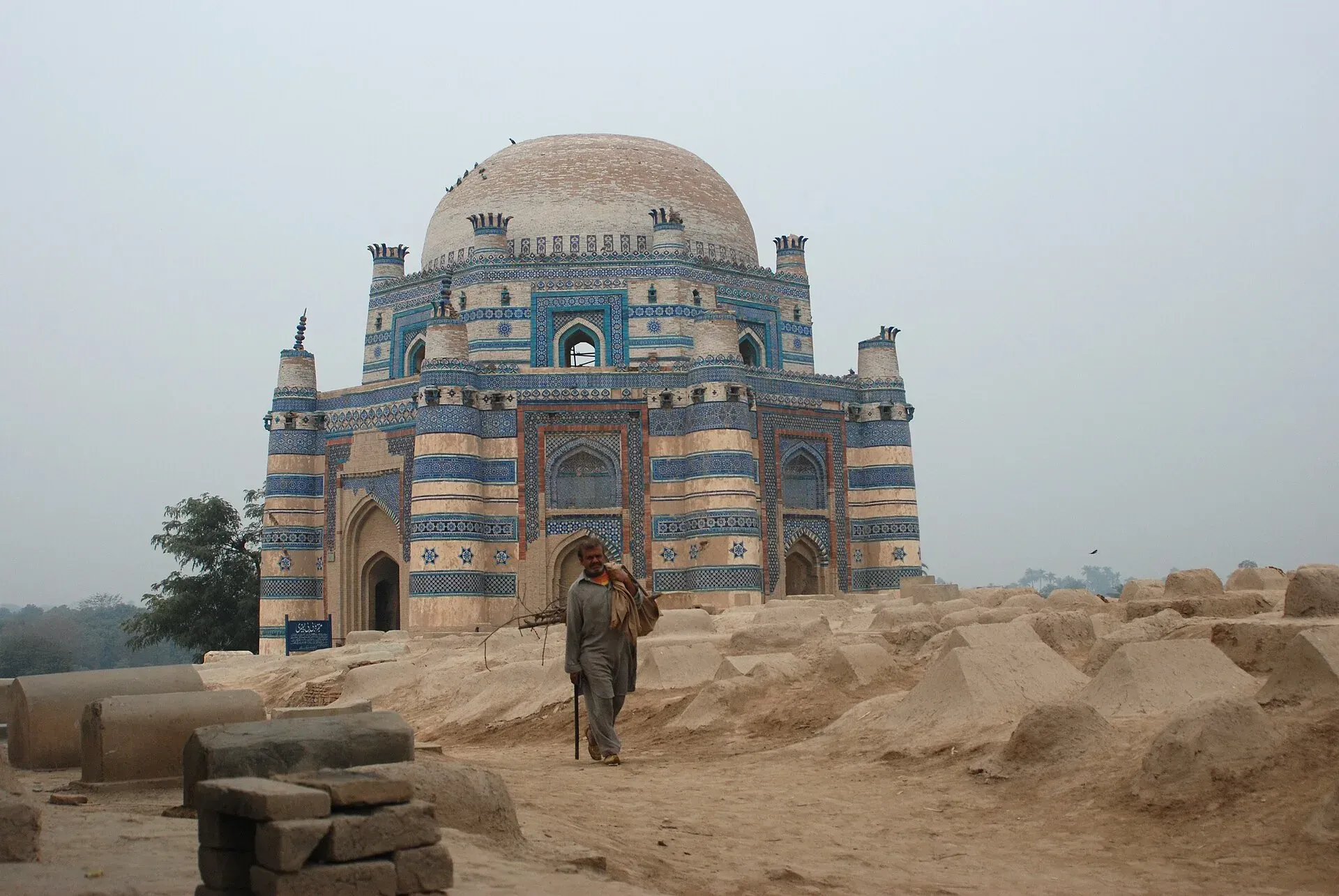
Photo: Batool Nasir, with thanks · CC BY-SA 4.0 · via Wikimedia Commons · temporary stand-in photo

The desert and its people
Wikipedia gives Cholistan as about 25,800 km2 in Bahawalpur Division, part of the greater Thar Desert, about 480 km long and 32 to 192 km wide, with most of it sandy. Rainfall averages up to 180 mm, mostly in July and August, and subsoil water is usually brackish. Herders collect rain in natural pools called toba and built ones called kund. Camels are central to the economy: for milk, meat, transport and racing.
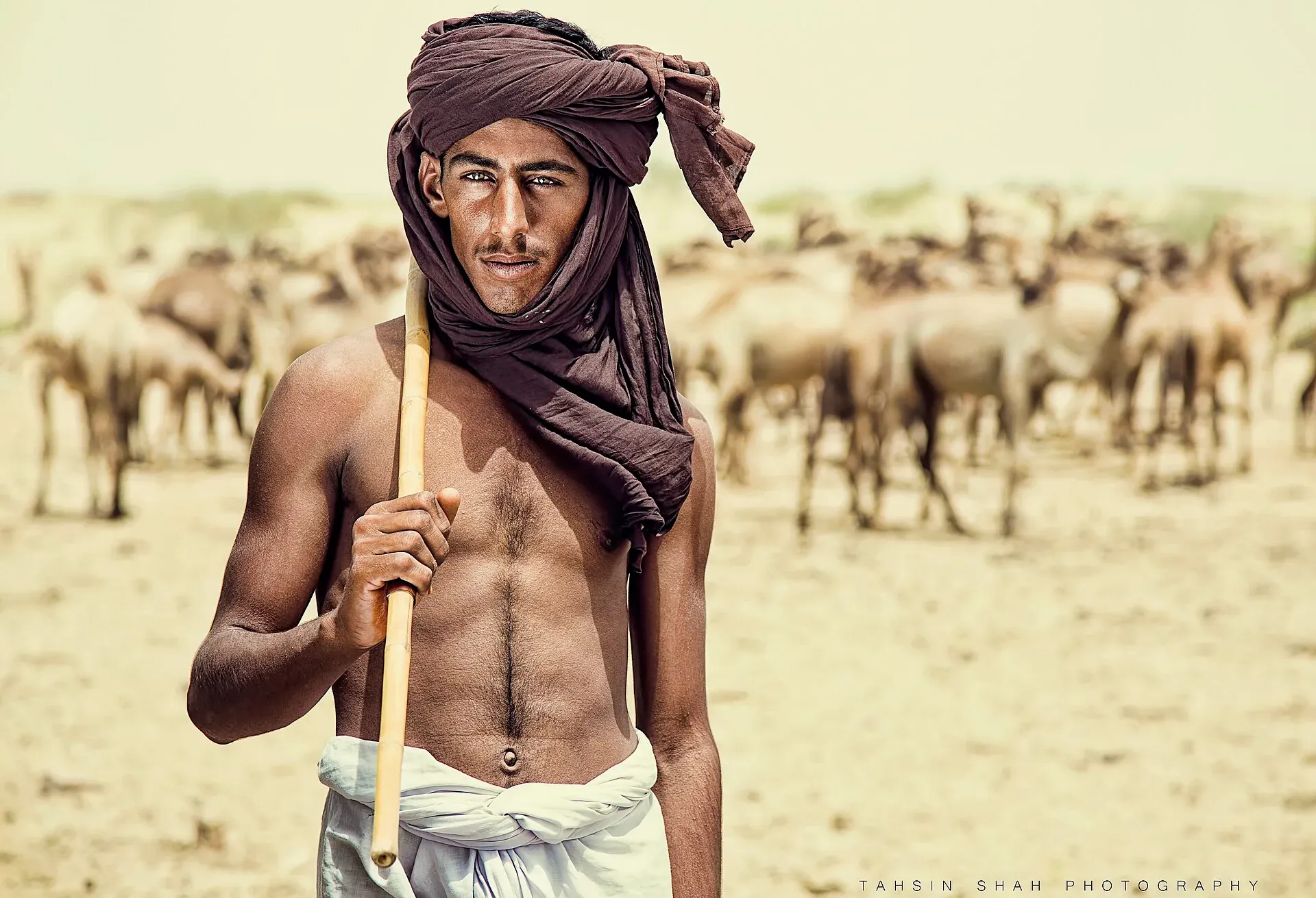
Photo: Tahsin Shah, with thanks · CC BY-SA 4.0 · via Wikimedia Commons · temporary stand-in photo

Local crafts listed by Wikipedia include wool rugs and blankets, khes and pattu textiles, ajrak (block-printed cloth in indigo and red), embroidered khusa (leather shoes), silver and gold jewellery, and pottery such as sarahi jugs. Houbara bustard, an endangered migrant, visit in winter.
The desert forts are on Pakistan's UNESCO tentative list. Besides Derawar, Wikipedia names Meergarh, Jaangarh, Marot, Maujgarh, Dingarh, Khangarh, Khairgarh, Bijnotgarh and Islamgarh.
At Derawar
The interior of the fort is in poor condition: the wood is nearly gone and floors have decayed (Wikipedia). The Abbasi Mosque nearby was built in 1849. Follow the guard's instructions and do not climb on the walls.
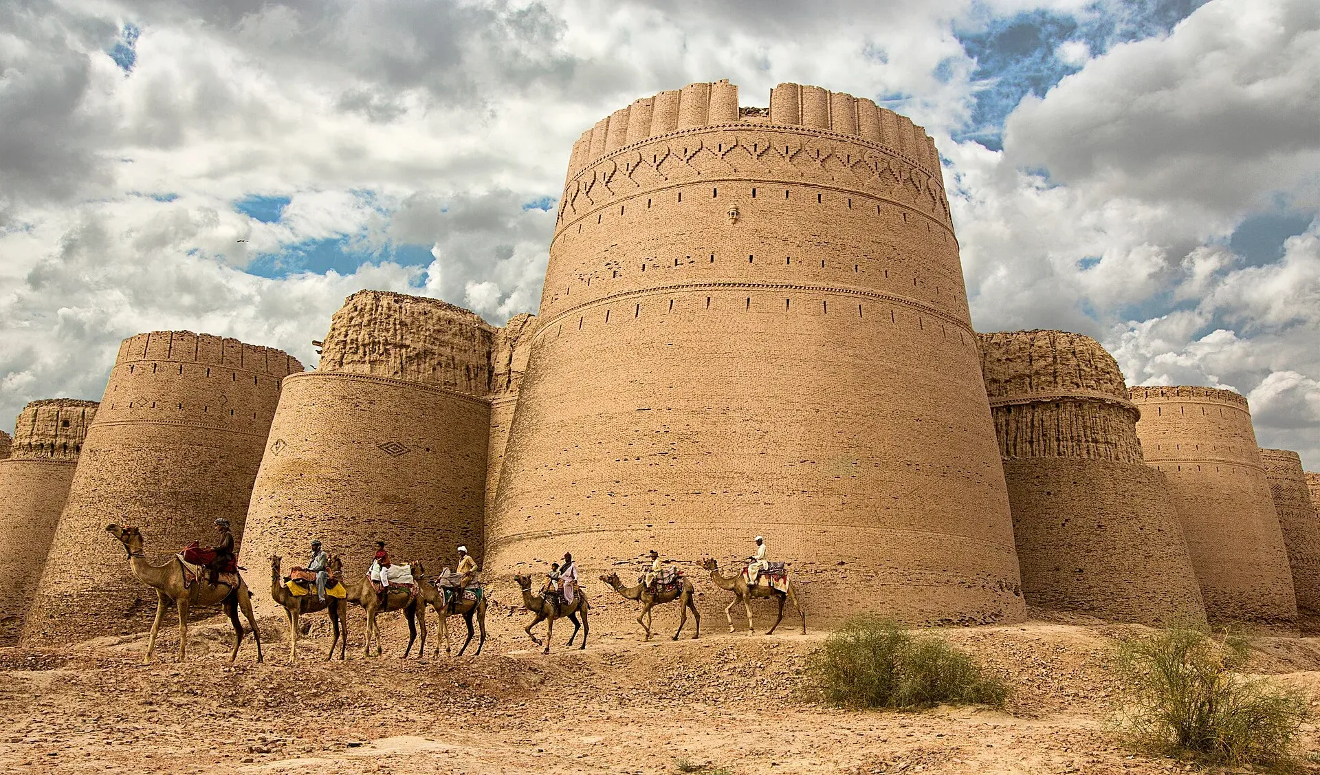
Photo: Tahsin Shah, with thanks · CC BY-SA 4.0 · via Wikimedia Commons · temporary stand-in photo

Practical information
Carry water, food, a spare tyre and a full tank. Mobile coverage may fail in the desert. If you want to leave the paved road into the dunes, hire a local guide and a 4x4. Fees and opening hours are not confirmed here; current fees will be added soon. Ask the district administration or local police about current conditions before you go. For foreign visitors: the UK FCDO advises against all but essential travel within 5 miles of the India border; it names no Cholistan or Bahawalpur district, so check how close any desert track runs to the border before you leave the paved road.
Highlights
- Derawar Fort and its 40 bastions
- Bahawalpur's Noor Mahal and city
- Uch Sharif shrines
- Cholistan jeep rally in February
- Desert scenery
Stops
- MultanStart; shrine of Shah Rukn-e-Alam
- BahawalpurCity of palaces; good overnight base
- Ahmadpur EastLast big town before the desert road
- Derawar FortDesert fort; allow 2 hours
km: distance from the start along the route.
Numbers follow the stops in order. The map shows the 3 stops that have a trek.pk page, not the road itself.
Day by day
Day 1 · Multan to Bahawalpur
Easy first day. See the Noor Mahal and the old town.
Day 2 · Bahawalpur to Derawar Fort and back
Drive to Derawar via Ahmadpur East, visit the fort and mosque, and return before dark.
Day 3 · Optional: Uch Sharif
A round trip from Bahawalpur to the shrines at Uch Sharif (75 km each way).
Road conditions
- Multan to Bahawalpur: a regular highway.
- To Derawar: a Dawn report in 2022 described a paved road to the fort, after earlier complaints of potholes (2013). There is no known 2026 report, so check locally.
- Desert tracks: loose sand; use a 4x4 and a local guide.
Fuel and services
Fuel and hotels in Multan, Bahawalpur and Ahmadpur East. Services at Derawar are minimal. Carry cash; ATMs are in the towns only.
Safety
- Government advice (checked 16 November 2026): the UK FCDO, updated 27 October 2026, advises against all but essential travel within 5 miles of the India border. Ask locally whether any part of your route lies in that zone.
- Desert: heat, sand and long distances between services. Tell someone your route and return time.
- Fort: the structure is fragile; do not climb on the walls.
Tips
- Visit between November and February.
- Carry plenty of water and a full tank.
- Hire a local guide and a 4x4 if you leave the paved road.
- Start early; days are short in winter.
- Check the district administration for any restrictions near the border.
Sources and last checked
Last checked Confidence medium8 sources6 still to check
- Last checked
- Method
- Desk research from published sources
- Confidence
- medium
- Checked by
- trek.pk research team
Researched from published sources; not yet checked on the ground by our team. Spot something out of date? Report a mistake.
Sources
- OSRM driving route service: distances and times measured 16 November 2026 (drive times are without stops) · OSRM / OpenStreetMap contributors · checked
- Pakistan Tourism Guide 2021 · Trade Development Authority of Pakistan (TDAP) · checked
- Derawar Fort · Wikipedia · checked
- New dates announced for Cholistan Desert Rally (15 January 2026) · ProPakistani · checked
- Pakistan travel advice: warnings and insurance (latest update 27 October 2026) · UK Foreign, Commonwealth and Development Office · checked
- Ahmedpur East · Wikipedia · checked
- Cholistan Desert · Wikipedia · checked
- Uch Sharif · Wikipedia · checked
Still to be checked on the ground (6)
- Condition of the road from Ahmadpur East to Derawar (no dated source)
- Distance of any route from the Indian border (FCDO wording opened: 5 miles; Derawar's distance to the border not found)
- Opening hours, entry fees and rest-house options at Derawar (no official source found; Wikipedia gives none)
- Dates of the 2027 jeep rally (PTDC notice for 2026 edition: 11 to 15 February; no 2027 dates found)
- Whether the camping area beside Derawar Fort is currently open to visitors
- Stop distances: the stop list (Derawar about 185 km from Multan) and the OSRM legs in the text (about 197 km) differ; confirm the road distance