

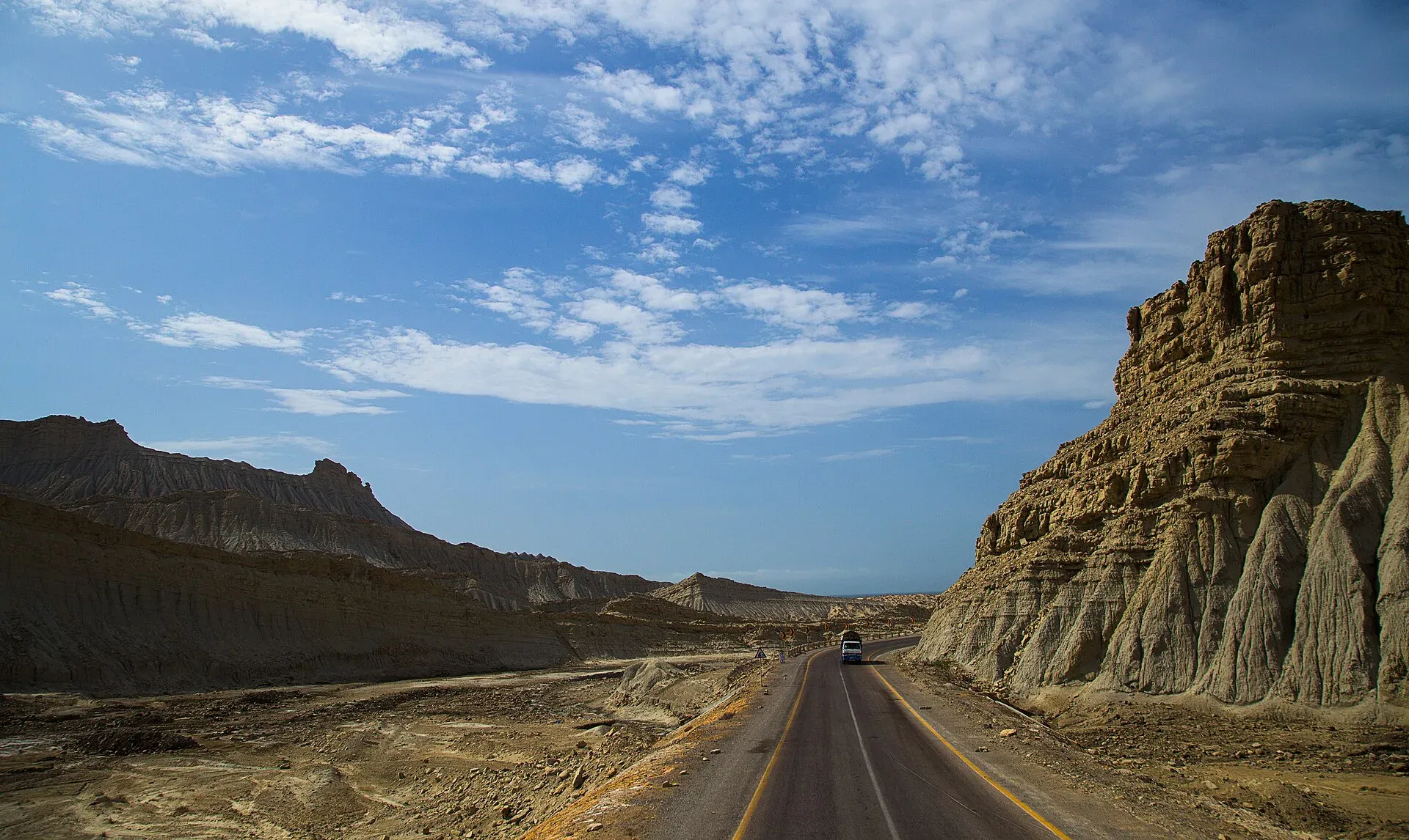
Photo: Furqanlw, with thanks · CC BY-SA 4.0 · via Wikimedia Commons · temporary stand-in photo

Karachi, Makran Coastal Highway and Gwadar
A reference page for the 632 km Makran Coastal Highway (N-10) from Karachi to Gwadar. For foreign visitors: the UK FCDO advises against all travel to Balochistan, and night travel is restricted on the road. Not recommended without current local advice.
Customise this route Change the dates, stops and how you travel in the Road Trip Planner.
Overview
The Makran Coastal Highway (N-10) runs along the Arabian Sea from Karachi to Gwadar. The National Highway Authority maintains it, and the Frontier Works Organisation built it between 2002 and 2004 (Wikipedia). It passes Hingol National Park, Kund Malir beach, Ormara and Pasni, and the drive takes about 7 hours 30 minutes without stops (OSRM). Scenery is desert, hills and sea.
Read this first: current advice
For foreign visitors: the UK FCDO, updated 27 October 2026 and checked on 16 November 2026, advises against all travel to Balochistan Province. Most of this route lies in Balochistan. The Balochistan authorities have also restricted night travel: reports on 30 March 2025 describe a ban on public transport on the N-10 at night, with departures from Karachi or Quetta to Gwadar allowed between 5 am and 10 am and departures from Gwadar between 6 am and 1 pm. A second report (Dawn, 13 August 2025) says the provincial government barred public transport from highways between 5 pm and 5 am. Neither gave an end date, and there is no known notice lifting them, so treat night travel as banned. In March 2026 the Gwadar district administration also warned residents against travelling to Iran (Express Tribune, 1 March 2026). Read the current advice and check with the Balochistan government and local police. This page does not recommend the trip.
Who it suits
The route is described here because many people ask about it. It suits only well-prepared travellers with current official clearance, an experienced local driver and no fixed deadlines.
When to go
Do not travel in the hottest months. Hingol turtles nest on the beaches in August (Wikipedia). For other facts on the seasons, speak to the Balochistan tourism authorities.
The route
Distances are from OSRM / OpenStreetMap, measured 16 November 2026. Times are driving only, without stops.
- Karachi to Hub: 33 km, about 35 minutes.
- Karachi to Kund Malir: 240 km, about 2 hours 55 minutes. Kund Malir, also called Golden Beach, lies at the edge of Hingol National Park, which covers about 6,100 sq km and was established in 1988 (Wikipedia).
- Karachi to Ormara: 355 km, about 4 hours 20 minutes.
- Karachi to Pasni: 513 km, about 6 hours 10 minutes.
- Karachi to Gwadar: 632 km, about 7 hours 30 minutes. Wikipedia gives 653 km for the full length of the highway.
Along the way a rock pillar called the Princess of Hope is part of Hingol park (Wikipedia). Hinglaj Mata is a major Hindu shrine at the park's centre, with a spring pilgrimage. In 2026 the three-day festival began on 17 April and drew about 300,000 pilgrims, with army, Frontier Corps, police and Levies providing security (Dawn, 20 April 2026). The dates move each year, so we cannot give 2027 dates yet.
Stops in order
- Hub (km 33): the last large town before the coast, with fuel and supplies.
- Kund Malir (km 240): the beach at the edge of Hingol National Park. Wikivoyage says desert safaris are offered here.
- Buzi Pass: about 6 km from Kund Malir, where Wikivoyage says the road winds through mountains with the sea on one side.
- Princess of Hope (km 260, OSRM estimate): a rock formation inside Hingol National Park, seen from the road.
- Ormara (km 355): a coastal town with a long beach (Wikivoyage). Dawn (3 June 2026) calls it the first major stop for buses coming from Turbat and Gwadar towards Karachi, and says buses there stop only for meals.
- Pasni (km 513): a fishing town.
- Gwadar (km 632): the port city. Wikivoyage lists West Bay beach and Zalzala Jazeera, an island that appeared after the 2013 earthquake, and notes that Gwadar still lacked enough electricity and drinking water in 2025.
Road conditions
Dawn (3 June 2026) calls the coastal highway new and smooth but says rest stops are few and toilets poor or missing, which matters on a drive of eight hours or more. A coach crash near Hudd Goth, in the Ormara area, killed nine people on 17 January 2026, and police blamed overspeeding (Express Tribune). Long straight stretches tempt drivers to speed.
Practical information
Services are sparse between towns. Fuel, water and food must be planned. Wikipedia confirms the highway passes through Ormara and Pasni. There is no known official rule on permits or escorts for tourists; tour operators say foreign visitors need a Balochistan NOC and some stretches need an escort, but that is not an official source. Fees and permits are not confirmed here; current fees will be added soon.
Highlights
- Hingol National Park
- Kund Malir beach
- Princess of Hope rock formation
- Coastal road to Gwadar port
Stops
- HubGateway to the highway
- Kund MalirBeach at Hingol National Park
- Princess of HopeRock formation in Hingol National Park (OSRM estimate)
- OrmaraCoastal town
- PasniFishing town
- GwadarPort city
km: distance from the start along the route.
Numbers follow the stops in order. The map shows the stops, not the road itself.
Day by day
Day 1 · Karachi to Kund Malir or Ormara
Leave very early. Travel only in daylight and only if the current advice allows it.
Day 2 · Ormara to Gwadar
Drive the remaining coast, reaching Gwadar by afternoon.
Day 3 · Gwadar
Rest day. Check with the Gwadar district administration for any notices.
Fuel and services
Fuel at Karachi and Hub; plan for sparse supplies in between. Carry water and food. Medical help is limited outside Gwadar and Karachi.
Where to stay, eat and fuel up
Places to stay
- Avari Towers KarachiCall Avari Towers KarachiMap of Avari Towers Karachi in Google Maps
- Mövenpick KarachiCall Mövenpick KarachiMap of Mövenpick Karachi in Google Maps
- Ramada Plaza by Wyndham Karachi Airport HotelCall Ramada Plaza by Wyndham Karachi Airport HotelMap of Ramada Plaza by Wyndham Karachi Airport Hotel in Google Maps
- Beach Luxury HotelMap of Beach Luxury Hotel in Google Maps
- Karachi Marriott HotelCall Karachi Marriott HotelMap of Karachi Marriott Hotel in Google Maps
- Ramada by Wyndham Karachi CreekCall Ramada by Wyndham Karachi CreekMap of Ramada by Wyndham Karachi Creek in Google Maps
Places to eat
- Port Grand - KarachiCall Port Grand - KarachiMap of Port Grand - Karachi in Google Maps
- Kolachi RestaurantCall Kolachi RestaurantMap of Kolachi Restaurant in Google Maps
- Bar BQ Tonight CliftonCall Bar BQ Tonight CliftonMap of Bar BQ Tonight Clifton in Google Maps
- Kaybees MACHSCall Kaybees MACHSMap of Kaybees MACHS in Google Maps
- Karachi Hassan Zai Koyla KarahiCall Karachi Hassan Zai Koyla KarahiMap of Karachi Hassan Zai Koyla Karahi in Google Maps
- Gul Plaza Shopping CentreMap of Gul Plaza Shopping Centre in Google Maps
Essential services fuel stations, mechanics, banks, pharmacies and hospitals and clinics
Fuel
- PSO Petrol Pump (Stadium Service Station)Call PSO Petrol Pump (Stadium Service Station)Map of PSO Petrol Pump (Stadium Service Station) in Google Maps
- ShellCall ShellMap of Shell in Google Maps
- KHAZAN ASSOCIATES PARCO Petrol PumpCall KHAZAN ASSOCIATES PARCO Petrol PumpMap of KHAZAN ASSOCIATES PARCO Petrol Pump in Google Maps
- PSO Petrol PumpMap of PSO Petrol Pump in Google Maps
- PSO Petrol PumpCall PSO Petrol PumpMap of PSO Petrol Pump in Google Maps
- Attock Petrol Pump (Classic filling Station)Map of Attock Petrol Pump (Classic filling Station) in Google Maps
Mechanics and tyre shops
- Suzuki Naseer AutosCall Suzuki Naseer AutosMap of Suzuki Naseer Autos in Google Maps
- Ghazi Autos Karachi Hybrid & EFI Mechanics | Auto Electrician Services | Scanning & Diagnostic Workshop / GarageCall Ghazi Autos Karachi Hybrid & EFI Mechanics | Auto Electrician Services | Scanning & Diagnostic Workshop / GarageMap of Ghazi Autos Karachi Hybrid & EFI Mechanics | Auto Electrician Services | Scanning & Diagnostic Workshop / Garage in Google Maps
- Toyota Highway MotorsCall Toyota Highway MotorsMap of Toyota Highway Motors in Google Maps
- Bashir Autos Car ACCall Bashir Autos Car ACMap of Bashir Autos Car AC in Google Maps
Banks and money exchange
- State Bank of PakistanCall State Bank of PakistanMap of State Bank of Pakistan in Google Maps
Pharmacies
- Al Jadeed Super MarketCall Al Jadeed Super MarketMap of Al Jadeed Super Market in Google Maps
- Imtiaz Supermarket - Awami Markaz - KHICall Imtiaz Supermarket - Awami Markaz - KHIMap of Imtiaz Supermarket - Awami Markaz - KHI in Google Maps
- Hydri Super MarketCall Hydri Super MarketMap of Hydri Super Market in Google Maps
- Imtiaz Supermarket - Clifton - KHICall Imtiaz Supermarket - Clifton - KHIMap of Imtiaz Supermarket - Clifton - KHI in Google Maps
- SPAR SharfabadCall SPAR SharfabadMap of SPAR Sharfabad in Google Maps
- Springs StoreCall Springs StoreMap of Springs Store in Google Maps
Hospitals and clinics
- Hashmanis Hospital NumaishCall Hashmanis Hospital NumaishMap of Hashmanis Hospital Numaish in Google Maps
- A.O. HOSPITALCall A.O. HOSPITALMap of A.O. HOSPITAL in Google Maps
- Liaquat National Hospital - Institute for Undergraduate and Postgraduate Medical Studies and Health SciencesCall Liaquat National Hospital - Institute for Undergraduate and Postgraduate Medical Studies and Health SciencesMap of Liaquat National Hospital - Institute for Undergraduate and Postgraduate Medical Studies and Health Sciences in Google Maps
- Indus Hospital & Health NetworkCall Indus Hospital & Health NetworkMap of Indus Hospital & Health Network in Google Maps
- National Medical Centre (NMC)Call National Medical Centre (NMC)Map of National Medical Centre (NMC) in Google Maps
- Patel HospitalCall Patel HospitalMap of Patel Hospital in Google Maps
Listings come from Google Maps data and are unverified: phone numbers, opening months and prices may have changed. Report a problem · Own one of these? Claim it
Safety
- Government advice (checked 16 November 2026): the UK FCDO, updated 27 October 2026, advises against all travel to Balochistan Province.
- Night travel: reports on 30 March 2025 describe a ban on public transport at night on the N-10 until further orders (Dawn). We have not confirmed any change.
- Gwadar notice: on 1 March 2026 the district administration warned residents not to travel to Iran.
- Incidents: attacks on travellers have been reported on Balochistan highways. Do not travel without current local advice.
Tips
- Read the current UK FCDO advice and local notices before planning.
- Do not travel at night; follow the 2025 night-travel restrictions if still in force.
- Carry fuel, water and food; towns are far apart.
- Travel with an experienced local driver and let someone know your route.
- Respect Hinglaj pilgrims and local customs.
Sources and last checked
Last checked Confidence low12 sources7 still to check
- Last checked
- Method
- Desk research from published sources
- Confidence
- low
- Checked by
- trek.pk research team
Researched from published sources; not yet checked on the ground by our team. Spot something out of date? Report a mistake.
Sources
- OSRM driving route service: distances and times measured 16 November 2026 (drive times are without stops) · OSRM / OpenStreetMap contributors · checked
- Pakistan Tourism Guide 2021 · Trade Development Authority of Pakistan (TDAP) · checked
- Makran Coastal Highway · Wikipedia · checked
- Hingol National Park · Wikipedia · checked
- Night travel banned on key highways in Balochistan (30 March 2025) · Dawn · checked
- Safety alert issued in Gwadar (1 March 2026) · The Express Tribune · checked
- Pakistan travel advice: warnings and insurance (latest update 27 October 2026) · UK Foreign, Commonwealth and Development Office · checked
- Hindu devotees perform rituals at Hinglaj, Balochistan (20 April 2026) · Dawn · checked
- Night travel banned in Balochistan (13 August 2025) · Dawn · checked
- Gwadar (Wikivoyage) · Wikivoyage · checked
- If you need to use the loo on the way to Turbat (3 June 2026) · Dawn · checked
- Nine killed, 36 injured as passenger coach overturns on Makran Coastal Highway (17 January 2026) · Express Tribune · checked
Still to be checked on the ground (7)
- Whether the night-travel bans of March 2025 and August 2025 on the N-10 are still in force (no lifting notice found)
- Current security position along the highway and at Gwadar
- Whether tourists need permission or an escort (no official rule found; operators mention a Balochistan NOC)
- Road surface and fuel availability between Hub and Gwadar (nothing dated found)
- Pasni position: Wikipedia says the highway passes through the town; our routing point was 138 m from the road, so this looks fine but is unchecked on the ground
- Hinglaj yatra dates for 2027
- Hingol National Park area: Wikipedia gives about 6,100 sq km, Wikivoyage 1,650 sq km