

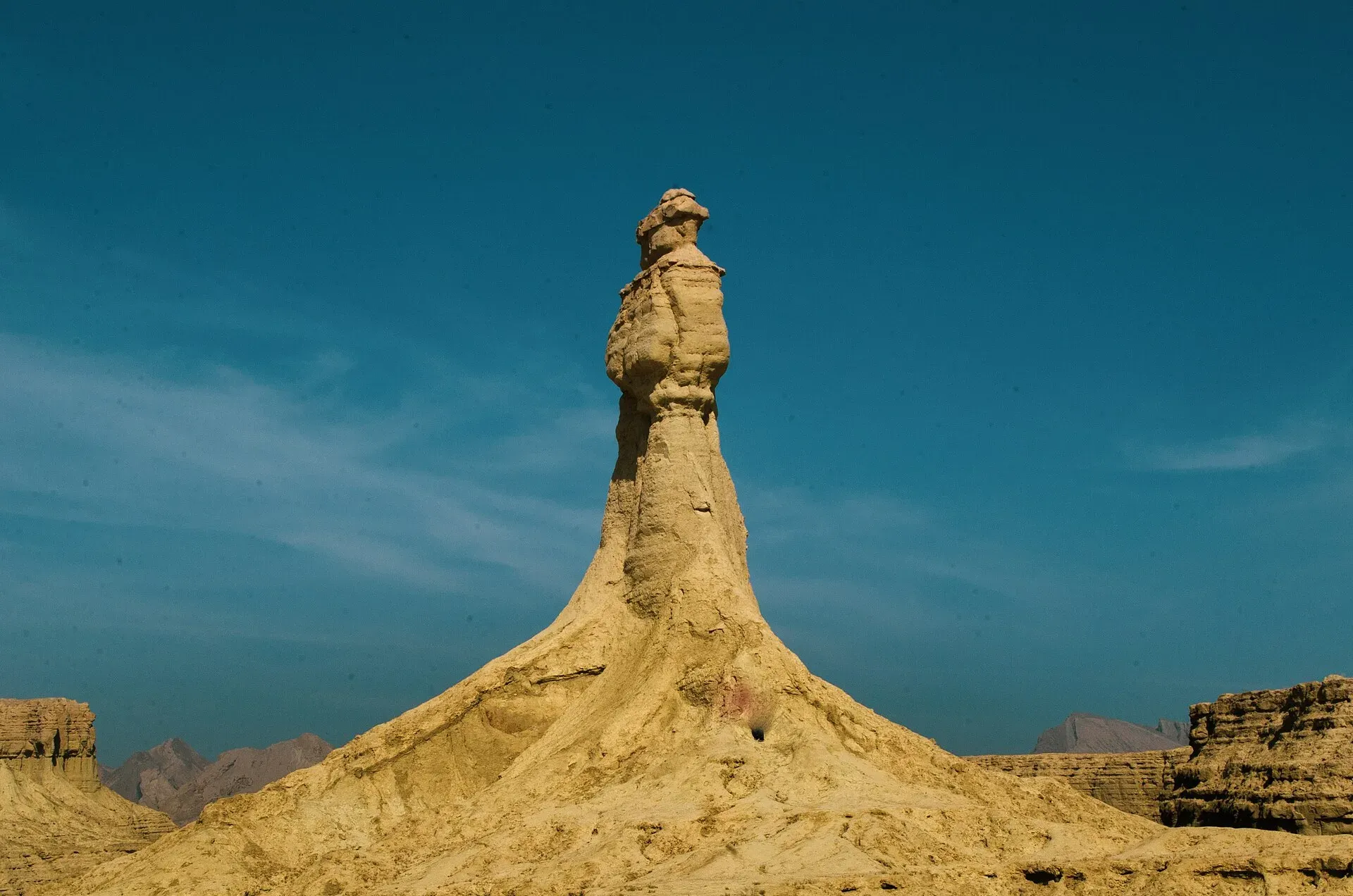
Photo: Aareez Asif, with thanks · CC BY-SA 4.0 · via Wikimedia Commons · temporary stand-in photo

Princess of Hope and the Sphinx (Hingol)
Two wind-carved rock formations inside Hingol National Park, seen from the Makran Coastal Highway near Buzi Pass. Balochistan travel is advised against by the UK FCDO.
Overview
The Princess of Hope and the Balochistan Sphinx are natural rock formations in Hingol National Park, Lasbela District. Wind and water have carved them from the soft, mud-rich rock of the area. Wikipedia says Angelina Jolie named the Princess on a visit to Pakistan as a UN goodwill ambassador; its Princess of Hope article dates the visit to 2002, while its Hingol National Park article says 2004, so the year is uncertain.
Plan your visit
- Nearest town
- Uthal
- Getting there
The Princess of Hope is on the Makran Coastal Highway (N-10), about 260 km and 3 hours by road from central Karachi (OSRM estimate) and about 367 km and 4 hours 20 minutes from Gwadar. More
Best months
Oct – Mar
- Princess of Hope and the Sphinx (Hingol)
- Related places nearby: Hingol National Park, Chandragup Mud Volcano
The two formations
The Princess of Hope is a hoodoo, a tall pillar of eroded rock. Some people see a crowned, skirted figure looking at the horizon. The Balochistan Sphinx, also called the Lion of Balochistan or Abul-Hol, is a rock that looks like a crouching sphinx. It can be seen from the highway in the Buzi Pass section of the Makran Coastal Highway.
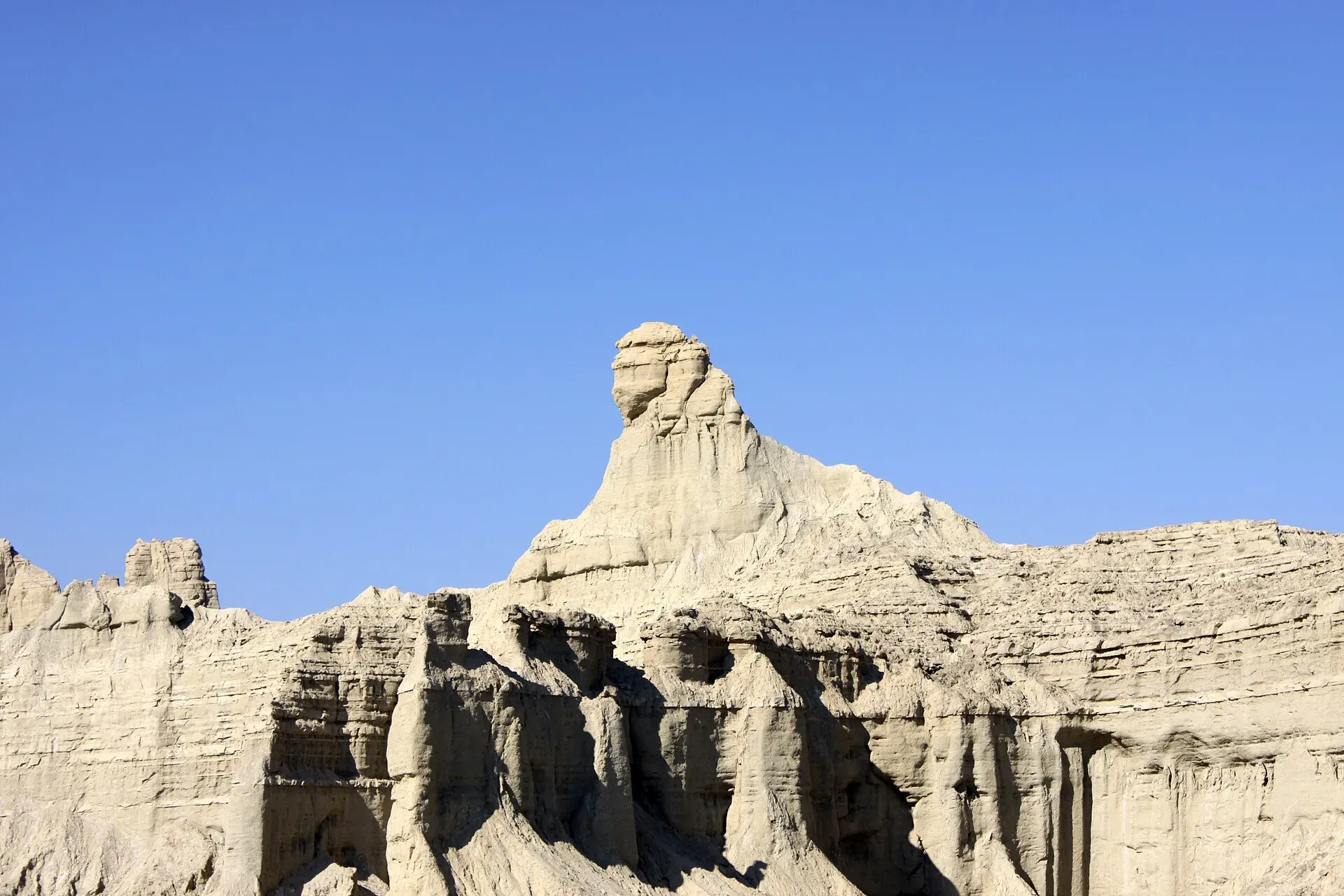
Photo: Bilal Mirza, with thanks · CC BY 2.0 · via Wikimedia Commons · temporary stand-in photo

They are not alone. Wikipedia reports that researchers from the University of Geneva and the University of Tehran documented 36 rock formations in the park, shaped by erosion, sedimentation, waves and wind. The surrounding landscape is one of gorges and unusual mud and rock forms.
The setting: Hingol National Park
Hingol is the largest national park in Pakistan, at about 6,100 sq km, across Gwadar, Lasbela and Awaran districts. It was declared a national park in 1988. The park takes its name from the Hingol River, which forms an estuary before it reaches the Arabian Sea. Large areas are drift sand and coastal semi-desert, with thorn forest in the north and arid hills in the west.
Wikipedia lists wildlife that includes Persian leopard, caracal, striped hyena, Sindh ibex and Balochistan urial. An estimated 60 marsh crocodiles live in the area, olive ridley and green turtles use the coast, and the bird list includes houbara bustard and Dalmatian pelican.
Other places inside or beside the park include the mud volcanoes (see Chandragup), the Hinglaj Mata temple, a major Hindu shrine with an annual spring pilgrimage, and Kund Malir beach at the far edge of the park. See also Hingol National Park.
What to see and do
Stop at the roadside viewpoints, take photographs and look at the cliffs and gullies around the formations. These are look-and-photograph places. Do not climb them, because the rock is soft and crumbles.
The road
The formations are reached on the Makran Coastal Highway (N-10), which runs 653 km along the Arabian Sea coast from Karachi to Gwadar. The Frontier Works Organisation built it, the same body that built the Karakoram Highway; construction began in 2002 and finished on 14 December 2004. The National Highway Authority maintains it. Before the road, Wikipedia says, the journey from Karachi to Gwadar took at least two days on an unpaved track. It now takes about six to seven hours.
When to visit
October to March is the comfortable season. Summers on the Makran coast are very hot, and there is almost no shade. Flooding in February 2024 cut the coastal highway between Gwadar and Karachi (Wikipedia), so check the road before you travel.
Where to stay and eat
There are no hotels at the formations. Hotels are in Karachi, Uthal and Gwadar. Carry water and food, and fill your tank before you leave a town.
Good to know
- Ask the district administration or local police about current conditions before you go. Safety. For foreign visitors: the UK FCDO page for Pakistan (updated 27 October 2026, checked 17 November 2026) advises against all travel to Balochistan Province. Read it and local news before planning any trip.
- Mobile signal is patchy along the highway.
- Park entry rules and any fee are not confirmed; current fees will be added soon.
Highlights
- Hoodoo named Princess of Hope
- Sphinx-like rock beside the highway
- Inside Hingol National Park
- Roadside viewing near Buzi Pass
Getting there
The Princess of Hope is on the Makran Coastal Highway (N-10), about 260 km and 3 hours by road from central Karachi (OSRM estimate) and about 367 km and 4 hours 20 minutes from Gwadar. Wikipedia's figure of 190 km is closer to the straight-line distance; by road it is about 260 km. Karachi is the usual starting point. There is no public transport to the formations, so most visitors use a private car.
Tips
- Do not climb the rock; it crumbles.
- Fill fuel and water before leaving town.
- Check road and security news the same week.
- Go in winter; summers are extremely hot.
Photos we still need: Kund Malir or the coast beside the highway (optional). Send us yours
Sources and last checked
Last checked Confidence medium6 sources4 still to check
- Last checked
- Method
- Desk research from published sources
- Confidence
- medium
- Checked by
- trek.pk research team
Researched from published sources; not yet checked on the ground by our team. Spot something out of date? Report a mistake.
Sources
- Princess of Hope · Wikipedia · checked
- Gwadar · Wikipedia · checked
- Foreign travel advice: Pakistan · UK FCDO · checked
- OSRM routing · OSRM / OpenStreetMap · checked
- Hingol National Park · Wikipedia · checked
- Makran Coastal Highway · Wikipedia · checked
Still to be checked on the ground (4)
- Exact position of the Sphinx viewpoint on the highway (Wikipedia: visible from the Buzi Pass section, no coordinates)
- Park entry rules and fees (not in Wikipedia; park site wildlifeofpakistan.com not opened)
- Security and road conditions (FCDO against all travel to Balochistan; no current road report)
- Year of the naming visit (Wikipedia gives 2002 on one page and 2004 on another)
Nearby and related

Hingol National Park
Pakistan's largest national park, about 6,100 square kilometres along the Makran Coastal Highway: desert canyons, mud volcanoes, the Hingol River, the Princess of Hope rock and the Hinglaj Mata temple.

Chandragup Mud Volcano
A mud volcano in Hingol National Park, close to the Makran Coastal Highway, and a holy site for Hindu pilgrims on the way to Hinglaj Mata. For foreign visitors: the UK FCDO advises against travel to Balochistan.

Gwadar
Arabian Sea port town and Gwadar District headquarters, a fishing settlement that Pakistan bought from Oman in 1958 and now a CPEC port.