

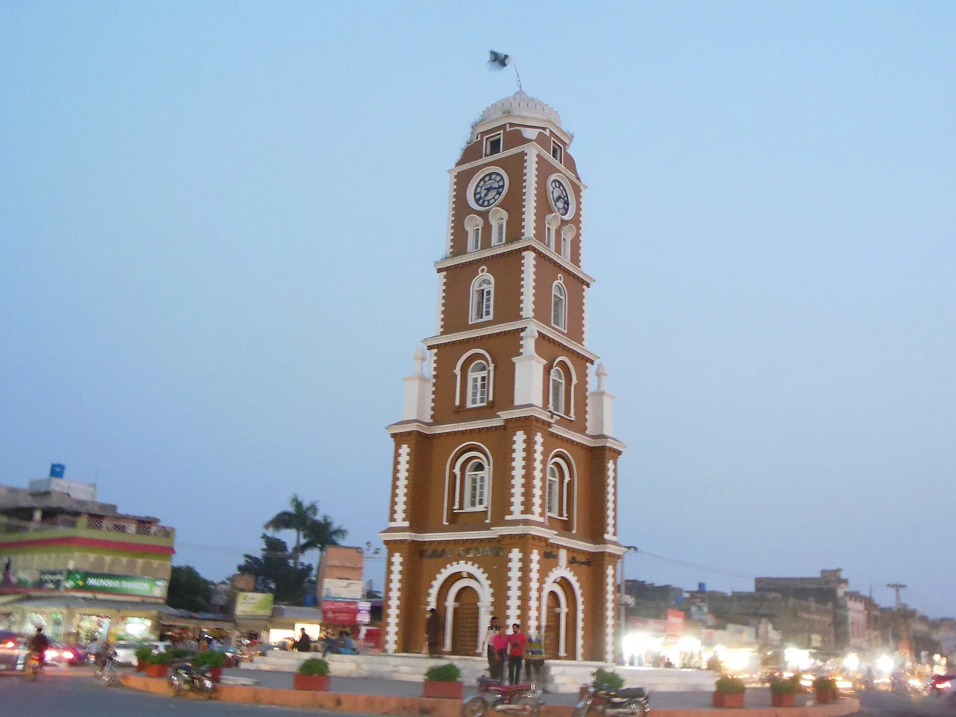
Photo: PakGuru99, with thanks · CC BY-SA 3.0 · via Wikimedia Commons · temporary stand-in photo

M-11 Lahore-Sialkot Motorway
The M-11 links Lahore and Sialkot over about 103 km on four lanes. Wikipedia lists nine interchanges and two service areas. Fog often closes it in winter, and tolls are paid by M-Tag at the north plaza.
The journey
Last verified: 16 November 2026.
Overview
The M-11 runs from the Lahore Ring Road near Kala Shah Kaku to Sambrial, near Sialkot. Sources differ on length: ISPR gave 91 km when FWO completed it (ARY News, 18 March 2020) and Wikipedia gives 103 km, probably counting the link to the Lahore Ring Road. Our earlier 89 km had no source. OpenStreetMap routing gives about 98 km by road between the Lahore Ring Road end and Sialkot. It runs parallel to the Grand Trunk Road and is open, with four lanes although it was designed for six. It opened on 18 March 2020 (ARY News and Wikipedia), after a first section opened in January 2020; the opening ceremony was cancelled because of coronavirus. A separate M-12 (Sialkot to Kharian) is under construction and will continue the line towards Rawalpindi.
Interchanges and services
Wikipedia lists these: Mehmood Booti, Shahdara, Lahore Bypass junction (with the M-2 and N-5), Muridke-Narowal, Wahndo, Pasrur, Daska-Pasrur, Daska-Sialkot and Sialkot. No kilometre markers are given. There are two service areas, one in each direction: Ravi for traffic from Sialkot and Chenab for traffic from Lahore. The Chenab area is newer and bigger.
Rules, tolls and M-Tag
Motorway Police (NHMP) patrol the road; for emergencies call 130. Reports in June 2026 say NHMP restored the motorway limits to 120 km/h for cars and light vehicles and 110 km/h for buses and heavy vehicles, after a temporary cut in March 2026. Limits can change and some stretches carry their own, so follow the signs. Keep left, overtake on the right, and do not stop on the carriageway.
Tolls are charged at interchanges and the NHA publishes the rates; news reports say rates were revised in 2026. Current fees will be added soon, so check the NHA toll chart before you go. Wikipedia says toll plazas are at both ends and M-Tag became the only accepted payment at the northern plaza; the southern plaza initially lacked it.
Weather
Fog is the main hazard from December to January. In January 2026 the Motorway Police repeatedly closed sections of several Punjab motorways for fog, sometimes for days. The M-11 is often closed in winter fog, and was fully closed on 18 January 2026 when other sections began to reopen. Check NHMP updates before you leave and delay the trip if the road is closed.
What to see near the exits
Towns on the line. Pasrur is the tehsil (sub-district) headquarters on the old Sialkot-Amritsar road. Wikipedia says it was founded in the Mughal period under Babur, was a municipality from 1867, and had 102,717 people at the 2023 census. Daska, the next town towards Lahore, is another tehsil headquarters of Sialkot District, said to have been founded under Shah Jahan as Shah Jahanabad; its 2023 population is given as 228,626. Neither article describes sights for a visitor, so these are practical stops for fuel and food rather than destinations.
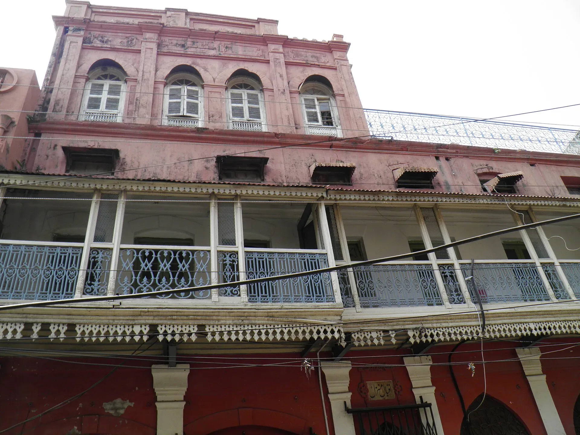
Photo: Sarmad Mahmud, with thanks · CC BY-SA 3.0 · via Wikimedia Commons · temporary stand-in photo

Sialkot. The city is the reason most people use the road. Wikipedia lists Sialkot Fort (repaired around 1185 and later rebuilt in Jahangir's time), Allama Iqbal Manzil, the birthplace of the poet Muhammad Iqbal (born 1877), the Clock Tower, Fatima Jinnah Park, and the wide, green Cantonment area. Gurdwara Beri Sahib marks a place linked by tradition to Guru Nanak. Sialkot's sports-goods industry began in the colonial period to supply British troops. Wikipedia estimates 40 to 60 million footballs a year, and says Sialkot makers supplied the match balls for the 2014, 2018 and 2022 World Cups. The city is also described as the world's largest centre for surgical instruments, with metalwork dating to the 1890s. These are factory trades, so any visit to a workshop needs an introduction from a trade contact.
Lahore end. The motorway starts near the Ring Road, so allow time to cross Lahore to the old city, where the Fort, the Badshahi Mosque and the walled city are the main sights.
Journey times
OSRM (OpenStreetMap routing, checked 17 November 2026) gives about 119 km and about 1 hour 45 minutes from central Lahore to central Sialkot, including city roads at both ends. This is an estimate for driving only, without stops. The M-11 itself is about 98 km between the Ring Road end and Sialkot by the same routing. Add time at the toll plazas and in fog.
Safety
Ask the district administration or local police about current conditions before you go. For foreign visitors: the UK FCDO (updated 27 October 2026) advises against all travel within 5 miles of the India border and notes the Wagah and Kartarpur crossings are closed. Stay on the motorway and use the Sialkot exit. Call 130 for the Motorway Police.
Highlights
- About 103 km, opened 2020
- Nine interchanges and two service areas
- Ravi and Chenab service areas
- Fog closures in winter
Stops
- Lahore Ring Road (Kala Shah Kaku)Southern end
- ShahdaraInterchange
- Muridke-NarowalInterchange
- PasrurInterchange
- DaskaInterchange
- SialkotInterchange at the northern end
km: distance from the start along the route.
Road conditions
Four lanes. Fog closures in winter.
Fuel and services
Ravi and Chenab service areas, one per direction.
Where to stay, eat and fuel up
Places to stay
- Pearl Continental Hotel, LahoreCall Pearl Continental Hotel, LahoreMap of Pearl Continental Hotel, Lahore in Google Maps
- Avari Hotel LahoreCall Avari Hotel LahoreMap of Avari Hotel Lahore in Google Maps
- The Nishat HotelCall The Nishat HotelMap of The Nishat Hotel in Google Maps
- Faletti's Hotel LahoreCall Faletti's Hotel LahoreMap of Faletti's Hotel Lahore in Google Maps
- Four Points by Sheraton LahoreCall Four Points by Sheraton LahoreMap of Four Points by Sheraton Lahore in Google Maps
- Royal Swiss HotelCall Royal Swiss HotelMap of Royal Swiss Hotel in Google Maps
Places to eat
- Savour Foods ShadmanCall Savour Foods ShadmanMap of Savour Foods Shadman in Google Maps
- Monal LahoreCall Monal LahoreMap of Monal Lahore in Google Maps
- McDonald'sCall McDonald'sMap of McDonald's in Google Maps
- Haveli RestaurantCall Haveli RestaurantMap of Haveli Restaurant in Google Maps
- SECOND SLICE BY FORKS N KNIVESCall SECOND SLICE BY FORKS N KNIVESMap of SECOND SLICE BY FORKS N KNIVES in Google Maps
- Spice BazaarCall Spice BazaarMap of Spice Bazaar in Google Maps
Essential services fuel stations, mechanics, banks, pharmacies and hospitals and clinics
Fuel
- PSO Petrol PumpMap of PSO Petrol Pump in Google Maps
- Total Parco LA TownCall Total Parco LA TownMap of Total Parco LA Town in Google Maps
- PSO-Al-Rafay Filling Station - Petrol Pump Thokar Niaz BaigCall PSO-Al-Rafay Filling Station - Petrol Pump Thokar Niaz BaigMap of PSO-Al-Rafay Filling Station - Petrol Pump Thokar Niaz Baig in Google Maps
- Total - Areeb Areel Filling StationCall Total - Areeb Areel Filling StationMap of Total - Areeb Areel Filling Station in Google Maps
- PSO Fuel StationCall PSO Fuel StationMap of PSO Fuel Station in Google Maps
- Total Petrol StationCall Total Petrol StationMap of Total Petrol Station in Google Maps
Mechanics and tyre shops
- Changan City SalesCall Changan City SalesMap of Changan City Sales in Google Maps
- Toyota Airport MotorsCall Toyota Airport MotorsMap of Toyota Airport Motors in Google Maps
- Honda GatewayCall Honda GatewayMap of Honda Gateway in Google Maps
- Saif Traders - Best Tyre Shop in LahoreCall Saif Traders - Best Tyre Shop in LahoreMap of Saif Traders - Best Tyre Shop in Lahore in Google Maps
- Mini MotorsCall Mini MotorsMap of Mini Motors in Google Maps
- Shaharyar Traders | House Of Tyres, Wheels, Alloy Rims, Car Accessories & Car Modification ServicesCall Shaharyar Traders | House Of Tyres, Wheels, Alloy Rims, Car Accessories & Car Modification ServicesMap of Shaharyar Traders | House Of Tyres, Wheels, Alloy Rims, Car Accessories & Car Modification Services in Google Maps
Banks and money exchange
- Link International Exchange Co (Pvt) Ltd Main Branch.Call Link International Exchange Co (Pvt) Ltd Main Branch.Map of Link International Exchange Co (Pvt) Ltd Main Branch. in Google Maps
Pharmacies
- Raja Market Garden Town LahoreCall Raja Market Garden Town LahoreMap of Raja Market Garden Town Lahore in Google Maps
- Rainbow Cash & Carry - EME LahoreCall Rainbow Cash & Carry - EME LahoreMap of Rainbow Cash & Carry - EME Lahore in Google Maps
- Rainbow Cash & Carry - Valencia Town LahoreCall Rainbow Cash & Carry - Valencia Town LahoreMap of Rainbow Cash & Carry - Valencia Town Lahore in Google Maps
- Rainbow Cash & Carry - Model Town LahoreCall Rainbow Cash & Carry - Model Town LahoreMap of Rainbow Cash & Carry - Model Town Lahore in Google Maps
- Shah Fareed Super StoreCall Shah Fareed Super StoreMap of Shah Fareed Super Store in Google Maps
- Hamza Mart & PharmacyCall Hamza Mart & PharmacyMap of Hamza Mart & Pharmacy in Google Maps
Hospitals and clinics
- Holistic CareCall Holistic CareMap of Holistic Care in Google Maps
- Lahore Care HospitalCall Lahore Care HospitalMap of Lahore Care Hospital in Google Maps
- Evercare HospitalCall Evercare HospitalMap of Evercare Hospital in Google Maps
- Prof. Dr. Suhail Sarwar (Suhail's Oculab)Call Prof. Dr. Suhail Sarwar (Suhail's Oculab)Map of Prof. Dr. Suhail Sarwar (Suhail's Oculab) in Google Maps
- MSK HospitalCall MSK HospitalMap of MSK Hospital in Google Maps
- Jinnah Hospital LahoreCall Jinnah Hospital LahoreMap of Jinnah Hospital Lahore in Google Maps
Listings come from Google Maps data and are unverified: phone numbers, opening months and prices may have changed. Report a problem · Own one of these? Claim it
More safety notes
FCDO India-border zone. Fog. Call 130.
Tips
- Check NHMP for fog
- Refuel at the service areas
- Check the FCDO advice near the India border
Photos we still need: the M-11 carriageway, a service area or a toll plaza; Lahore old city or Fort (the Badshahi Mosque photo is used on many other pages). Send us yours
Sources and last checked
Last checked Confidence medium12 sources4 still to check
- Last checked
- Method
- Desk research from published sources
- Confidence
- medium
- Checked by
- trek.pk research team
Researched from published sources; not yet checked on the ground by our team. Spot something out of date? Report a mistake.
Sources
- M-11 motorway (Pakistan) · Wikipedia · checked
- National Highway Authority (official site; toll chart page could not be opened from our connection) · Government of Pakistan · checked
- National Highways and Motorway Police (helpline 130) · Government of Pakistan · checked
- Pakistan restores motorway speed limits to 120 km/h · DrivePK · checked
- Motorway Police begin fines for new speed limits on M2 · Dunya News · checked
- 5 major motorways closed due to fog · ProPakistani · checked
- Pakistan travel advice (updated 27 October 2026) · UK FCDO · checked
- Lahore-Sialkot motorway is now open for traffic · ARY News, 18 March 2020 · checked
- Sialkot · Wikipedia · checked
- Pasrur · Wikipedia · checked
- Daska · Wikipedia · checked
- OSRM driving route Lahore to Sialkot, measured 17 November 2026 (estimate, driving only) · OSRM / OpenStreetMap contributors · checked
Still to be checked on the ground (4)
- Length: 91 km (ISPR via ARY, 2020) vs 103 km (Wikipedia); no NHA figure found (nha.gov.pk blocks automated access)
- Toll rates (NHA): the official NHA notice (revised rates effective 10 July 2026) could not be opened; press reports exist but are not used as fees
- Interchange km markers (not given by any source found)
- OSRM figure for the Ring Road end to Sialkot (about 98 km) was read from OpenStreetMap routing and should be checked against signage
Nearby and related

Sialkot
Industrial district capital near the Jammu border, famous for sports goods and surgical instruments and as the birthplace of the poet Allama Iqbal.

Allama Iqbal Manzil (Sialkot)
The family house in Sialkot where the poet and philosopher Allama Muhammad Iqbal was born in 1877. It is a three-storey house-museum with family photographs, personal objects and a library. Check hours before you go.

Wagah Border Ceremony
The daily flag-lowering ceremony at the Pakistan-India border near Lahore, held before sunset. Check current conditions first: the crossing itself is closed, but spectators can attend the ceremony.

Lahore Heritage and Wagah
A two to three day city trip: Lahore Fort, the Badshahi Mosque and old city, the Shalimar Gardens, and the evening flag-lowering at Wagah, 33 km from the fort. Measured distances and current notes on the new Wagah arena.