

Photo: Ziakhattak at English Wikipedia, with thanks · CC BY-SA 3.0 · via Wikimedia Commons · temporary stand-in photo

N-80 Islamabad-Kohat
The N-80 runs from Tarnol at Islamabad through Fateh Jang and Jand to Kohat, 146 to 170 km depending on the source. It is a regional road and Kohat district is a UK advise-against-all-travel area.
Overview
The N-80 connects Islamabad with Kohat in Khyber Pakhtunkhwa. Wikipedia gives its east end at Tarnol in the Islamabad Capital Territory and its west end at Togh Bala in Kohat District, passing Fateh Jang and Jand. The same article gives 170 km in the headline figure and 146 km in the text, with 121 km in Punjab and 49 km in Khyber Pakhtunkhwa. Those two parts add up to 170 km, not 146, so the article contradicts itself; the 146 km figure comes from the NHA list used on Wikipedia. Our measured 179 km to Kohat city is closer to 170 km, since Togh Bala lies short of the city. Measured by road routing from Tarnol, Fateh Jang is about 50 km away, Jand 117 km and Kohat 179 km.
It is mostly a road for local traffic, freight, and people travelling between Islamabad and the south of KP. There is little tourism on it, and there is no known detailed official description of its condition, so this page is short and some points are marked for checking.
Route
The road starts at Tarnol, on the western edge of Islamabad. It runs west across the Pothohar plateau, passing Fateh Jang and then Jand, a major intersection in Attock district. It then enters Kohat district and ends at Togh Bala. Wikipedia lists the N-80 among the major intersections of the N-55 Indus Highway, which continues to the Kohat Tunnel and Peshawar, but we have not confirmed exactly where the two roads meet.
The road is useful if you are heading for Kohat or the south of Khyber Pakhtunkhwa from Islamabad without going through Peshawar. Because the length differs between sources (146 or 170 km; 170 km fits the Punjab and KP parts), plan on a drive of three to four hours for the measured 179 km, but allow more for traffic.
Road condition
Condition on this road is not documented in published sources. Expect a two-lane road with heavy truck traffic in places and rough edges. Check recent travel reports before you go.
Stops in order
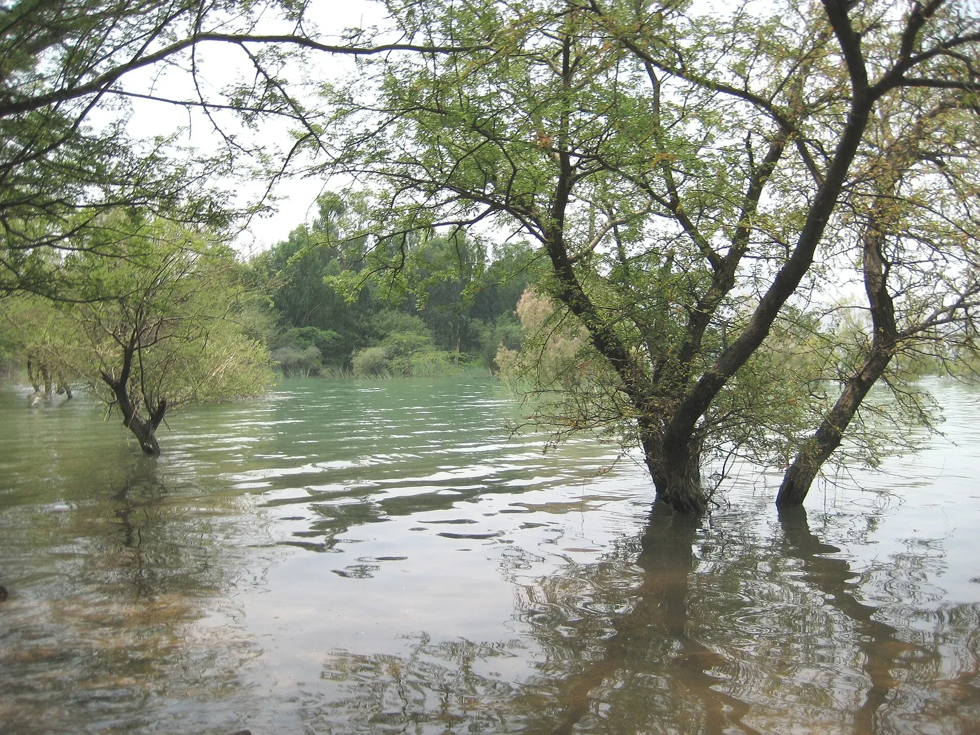
Photo: Aftabbanoori, with thanks · CC BY-SA 3.0 · via Wikimedia Commons · temporary stand-in photo

Distances are from Tarnol by OSRM road routing and are estimates.
- Tarnol (km 0). The start on the western edge of Islamabad, at the junction with the N-5.
- Fateh Jang (about km 50). The seat of Fateh Jang Tehsil in Attock District, with 81,321 people at the 2023 census. It lies between the Kala Chitta Range to the north and the Khairi Murat Range to the south, in the Pothohar region. Its railway station dates from 1881. Wikipedia lists Indar Kot Masjid, described as the oldest mosque in the city and possibly about a thousand years old, as a protected archaeological site, and mentions Tanaza Dam at the foot of Kheri Murat mountain. Check access for both locally.
- Jand (about km 117). The tehsil (sub-district) headquarters in Attock District, with 330,328 people in the tehsil at the 2023 census. Wikipedia's Fateh Jang article calls Jund the last tehsil of Attock District before Khyber Pakhtunkhwa. It is the practical place for a last fuel and food stop.
- Kohat (about km 179). The city lies at about 489 m, with 235,880 people at the 2023 census. Wikipedia lists the British-era fort, the cantonment (1874), Tanda Dam on Tanda Lake (a Ramsar wetland), and Ghamkol Sharif, a Naqshbandi Sufi shrine. Wikipedia says Kohat is famous for guava. The Kohat Pass road north of the city was built by the British in 1849 to 1850.
For foreign visitors, Kohat is the section the FCDO advises against (see the safety section), so these Kohat sights are listed for completeness.
The Kohat Tunnel
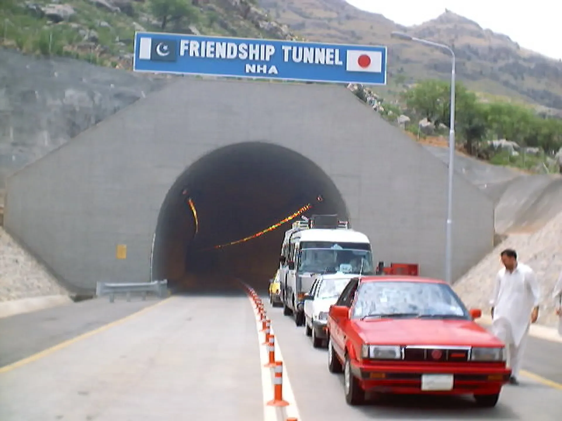
The Kohat Tunnel, also called the Pak-Japan Friendship Tunnel, is on the N-55 (Indus Highway) north of Kohat, not on the N-80 itself. It is 1.89 km long, was built with Japanese loan assistance and opened in June 2003. Wikipedia says it saves about 20 minutes compared with the old Kohat Pass road. It is the usual route between Kohat and Peshawar.
Journey stages
OSRM estimates a drive of about 179 km from Tarnol to Kohat city. Plan on three to four hours for a one-day trip. The road crosses plateau and low ridge country, with no major climb until the Kohat approaches.
Hazards
- Rain and heat: summer heat is high; monsoon rain can flood low spots on the plateau.
- Traffic: trucks and local buses; night driving is dangerous.
- Security: the Kohat end lies in a district with security restrictions (see below).
Fuel and services
Towns on the way, such as Fateh Jang, Jand and Kohat, have fuel stations and basic food stops. We have not checked distances between stations; fill up before leaving Islamabad and at Jand. Carry water and cash, as ATMs are scarce outside towns.
Tolls and checkposts
Tolls are charged at some NHA plazas, and the Kohat Tunnel, on the N-55, has a toll. Current rates will be added soon; check with the NHA. Expect police and army checkposts in the Kohat section. Carry passport and visa copies.
Safety and travel advice by section
Ask the district administration or local police about current conditions before you go. For foreign visitors: the UK FCDO page (updated 27 October 2026, checked 16 November 2026) does not list the Islamabad, Rawalpindi or Attock sections of the road as areas to avoid, but it advises against all travel to Kohat district, which contains the western end. It also notes KP emergency measures and Governor's Rule since 11 October 2026. Foreign visitors should not use the Kohat end of this highway. Check the live text.
Highlights
- Direct link from Islamabad to Kohat
- Passes Fateh Jang and Jand
- Joins the N-55 Indus Highway near Kohat
- Mostly used by local and freight traffic
Stops
- TarnolStart at the N-5, west of Islamabad
- Fateh JangPunjab town
- JandAttock district junction
- KohatKhyber Pakhtunkhwa; FCDO advises against all travel
km: distance from the start along the route.
Numbers follow the stops in order. The map shows the 2 stops that have a trek.pk page, not the road itself.
Where to stay, eat and fuel up
Places to stay
- Serena HotelCall Serena HotelMap of Serena Hotel in Google Maps
- Islamabad Marriott HotelCall Islamabad Marriott HotelMap of Islamabad Marriott Hotel in Google Maps
- Mabali IslandCall Mabali IslandMap of Mabali Island in Google Maps
- Ramada by Wyndham IslamabadCall Ramada by Wyndham IslamabadMap of Ramada by Wyndham Islamabad in Google Maps
- Avari Xpress Residences Islamabad HotelCall Avari Xpress Residences Islamabad HotelMap of Avari Xpress Residences Islamabad Hotel in Google Maps
- Movenpick Hotel CentaurusCall Movenpick Hotel CentaurusMap of Movenpick Hotel Centaurus in Google Maps
Places to eat
- The Monal IslamabadCall The Monal IslamabadMap of The Monal Islamabad in Google Maps
- Tehzeeb Bakers Blue AreaCall Tehzeeb Bakers Blue AreaMap of Tehzeeb Bakers Blue Area in Google Maps
- TKR 3Call TKR 3Map of TKR 3 in Google Maps
- Savour FoodsCall Savour FoodsMap of Savour Foods in Google Maps
- Cheezious Commercial MarketCall Cheezious Commercial MarketMap of Cheezious Commercial Market in Google Maps
- Savour FoodsCall Savour FoodsMap of Savour Foods in Google Maps
Essential services fuel stations, mechanics, pharmacies and hospitals and clinics
Fuel
- Attock Petrol PumpMap of Attock Petrol Pump in Google Maps
- PSO Petrol PumpMap of PSO Petrol Pump in Google Maps
- PSO Petrol Pump (Zoom Filling)Call PSO Petrol Pump (Zoom Filling)Map of PSO Petrol Pump (Zoom Filling) in Google Maps
- Attock Petrol PumpCall Attock Petrol PumpMap of Attock Petrol Pump in Google Maps
- Byco Petrol Pump (Range Road)Map of Byco Petrol Pump (Range Road) in Google Maps
- PSO Petrol PumpCall PSO Petrol PumpMap of PSO Petrol Pump in Google Maps
Mechanics and tyre shops
- Mohammed Bilal tyre centreMap of Mohammed Bilal tyre centre in Google Maps
- Toyota GT MotorsCall Toyota GT MotorsMap of Toyota GT Motors in Google Maps
- JAPAN TYRES Blue AreaCall JAPAN TYRES Blue AreaMap of JAPAN TYRES Blue Area in Google Maps
- Polygon CastCall Polygon CastMap of Polygon Cast in Google Maps
- Hybrid SpecialistCall Hybrid SpecialistMap of Hybrid Specialist in Google Maps
- Honda CapitalCall Honda CapitalMap of Honda Capital in Google Maps
Pharmacies
- Imtiaz Mega - Ramzan Mall - islamabadCall Imtiaz Mega - Ramzan Mall - islamabadMap of Imtiaz Mega - Ramzan Mall - islamabad in Google Maps
- D.WATSON CHEMIST BLUE AREACall D.WATSON CHEMIST BLUE AREAMap of D.WATSON CHEMIST BLUE AREA in Google Maps
- D.WATSON CHEMIST F-11 MARKAZCall D.WATSON CHEMIST F-11 MARKAZMap of D.WATSON CHEMIST F-11 MARKAZ in Google Maps
- Shaheen Chemist I-8 MarkazCall Shaheen Chemist I-8 MarkazMap of Shaheen Chemist I-8 Markaz in Google Maps
- Shaheen ChemistCall Shaheen ChemistMap of Shaheen Chemist in Google Maps
- D. Watson Chemist F-10 MarkazCall D. Watson Chemist F-10 MarkazMap of D. Watson Chemist F-10 Markaz in Google Maps
Hospitals and clinics
- Shifa International Hospitals LimitedCall Shifa International Hospitals LimitedMap of Shifa International Hospitals Limited in Google Maps
- Amanat Eye Hospital RawalpindiCall Amanat Eye Hospital RawalpindiMap of Amanat Eye Hospital Rawalpindi in Google Maps
- Maryam Memorial Hospital (MMH)Call Maryam Memorial Hospital (MMH)Map of Maryam Memorial Hospital (MMH) in Google Maps
- Combined Military Hospital Rawalpindi (CMH)Call Combined Military Hospital Rawalpindi (CMH)Map of Combined Military Hospital Rawalpindi (CMH) in Google Maps
- Advanced International Hospital IslamabadCall Advanced International Hospital IslamabadMap of Advanced International Hospital Islamabad in Google Maps
- Brain Surgery HospitalCall Brain Surgery HospitalMap of Brain Surgery Hospital in Google Maps
Listings come from Google Maps data and are unverified: phone numbers, opening months and prices may have changed. Report a problem · Own one of these? Claim it
More safety notes
- Tarnol to Jand: not listed by the UK FCDO (checked 16 November 2026).
- Kohat district: all travel advised against.
- Avoid night driving.
Tips
- Do not drive after dark.
- Read the FCDO text for Kohat district before planning.
- Fill up in Islamabad and Jand.
- Have ID and visa copies ready for checkposts.
Photos we still need: the N-80 road itself (Fateh Jang or Jand section). Send us yours
Sources and last checked
Last checked Confidence low9 sources4 still to check
- Last checked
- Method
- Desk research from published sources
- Confidence
- low
- Checked by
- trek.pk research team
Researched from published sources; not yet checked on the ground by our team. Spot something out of date? Report a mistake.
Sources
- National highways of Pakistan · Wikipedia · checked
- N-80 National Highway · Wikipedia · checked
- N-55 National Highway · Wikipedia · checked
- Pakistan travel advice: warnings and insurance (updated 27 October 2026) · UK Foreign, Commonwealth & Development Office · checked
- OSRM routing (road distances measured from the start of each highway) · OpenStreetMap / Project OSRM · checked
- Fateh Jang · Wikipedia · checked
- Jand Tehsil · Wikipedia · checked
- Kohat · Wikipedia · checked
- Kohat Tunnel · Wikipedia · checked
Still to be checked on the ground (4)
- Current condition and any tolls (no source found; Wikipedia is silent)
- Fuel stations (no source found)
- Exact junction at the west end (Wikipedia names only Togh Bala, Kohat District, and says nothing of the N-55)
- Whether Indar Kot Masjid and Tanaza Dam at Fateh Jang are open to visitors
Nearby and related

Islamabad
Pakistan's green, planned capital at the foot of the Margalla Hills: Faisal Mosque, hillside trails, cafes and the gateway to the north.

Rawalpindi
Islamabad's older twin city: a busy bazaar and cantonment, the north's main rail and bus hub, and an easy base for Taxila and Murree.

Kohat
A fort-and-cantonment city south of Peshawar, reached through the Kohat Tunnel, with a British-era fort, Tanda Dam and wildlife park, and a reputation for guavas. Check security advice first.

Kohat Pass
A low pass through the Khigana hills between Peshawar and Kohat, now mostly bypassed by the 1.89 km Kohat Tunnel on the N-55. For foreign visitors: the UK FCDO advises against all travel to Kohat and Peshawar.