

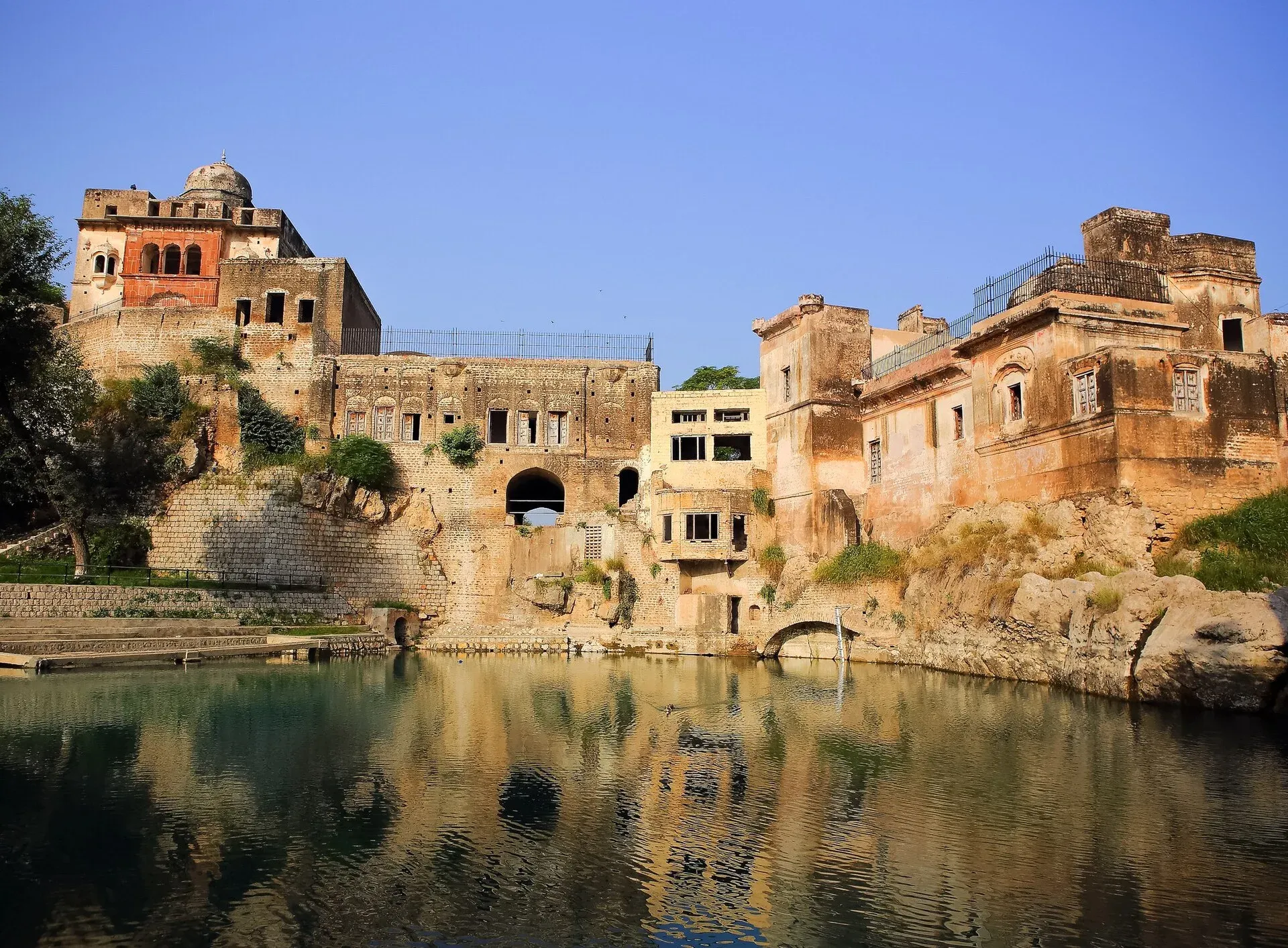
Photo: ClicksByMohammadOmer, with thanks · CC BY-SA 3.0 · via Wikimedia Commons · temporary stand-in photo
Salt Range: Katas Raj, Khewra, Kallar Kahar
A two-day, about 360 km loop from Islamabad by the M-2 to Kallar Kahar, the Katas Raj temples and the Khewra Salt Mine. Khewra stopped receiving visitors in August 2026 until after the monsoon, so check first.
Customise this route Change the dates, stops and how you travel in the Road Trip Planner.
Overview
The Salt Range is a line of low hills in northern Punjab, rich in salt, old temples and a few lakes. This loop from Islamabad visits three places in about 360 km of driving: the lake and peacock hills at Kallar Kahar, the Hindu temples and sacred pool at Katas Raj, and Khewra, one of the world's largest salt mines.
Who it suits
Families and day-trip travellers who like history and easy driving. The road is paved all the way. Stay overnight in the area or return to Islamabad.
When to go
October to March is cooler and best for sightseeing. Summers are hot, and the monsoon rain can flood roads and cut off sites. Katas Raj was hit by floods in July 2025: Dawn (21 July 2025) reported collapsed boundary walls and a damaged gate, while officials said the temples themselves were not damaged.
The route
Distances are from OSRM / OpenStreetMap, measured 16 November 2026; times are without stops.
- Islamabad to Kallar Kahar: 134 km, about 1 hour 30 minutes. Babur wrote about the lake and the area in his memoirs (Wikipedia).
- Kallar Kahar interchange: it is interchange 17 of the M-2 (OpenStreetMap), about 4 km from the town, and Wikipedia says it also serves Choa Saidan Shah and Katas Raj. We do not have a kilometre marker for it.
- Kallar Kahar to Katas Raj: 27 km, about 27 minutes. The complex has a sacred pond and a group of temples called Satghara. The pond is revered by Hindus and legend links it to Shiva's grief (Wikipedia). Temple A dates to the tenth century (Wikipedia). In 2016 the pond dried up, which was blamed on groundwater use by nearby cement works; the Supreme Court ruled in 2018 that factories must pay for water they take (Wikipedia).
- Katas Raj to Khewra: 20.5 km, about 28 minutes. Khewra Salt Mine has about 40 km of tunnels and is reached by a small train. Visitors see a salt mosque, a salt bridge and illuminated salt walls (Wikipedia).
- Khewra to Islamabad: 177 km, about 2 hours 15 minutes.
The Salt Range
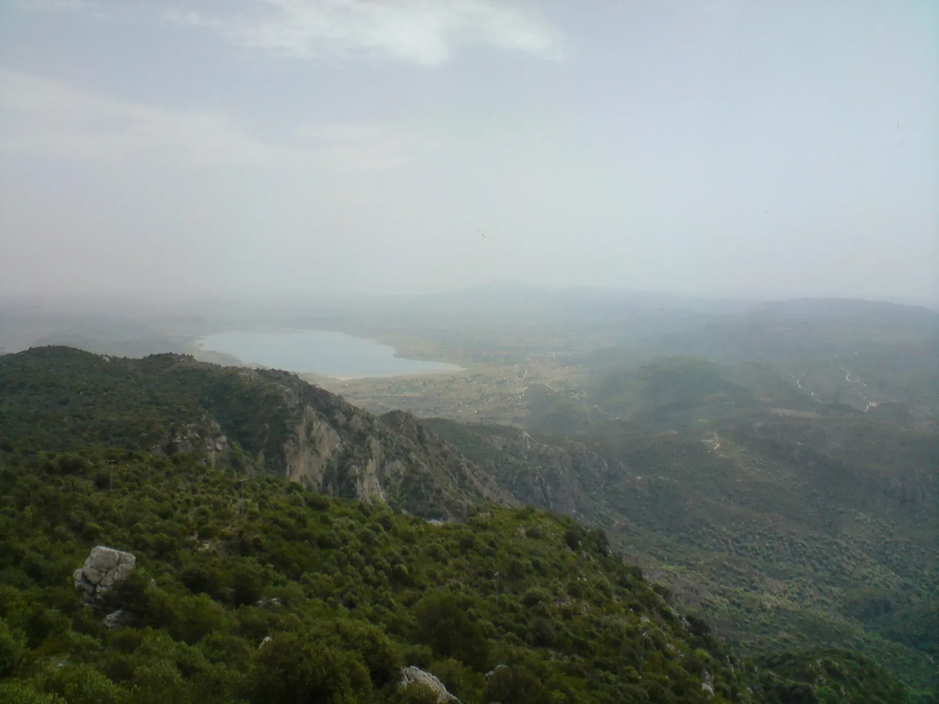
Photo: M. Ali Awab, with thanks · CC BY-SA 3.0 · via Wikimedia Commons · temporary stand-in photo
Wikipedia describes the range as lying south of the Pothohar Plateau and north of the Jhelum River, with Sakesar (1,522 m) the highest point. It is named for its rock salt, which feeds the Khewra, Kalabagh and Warcha mines. Salt beneath the thrust sheets acts as a lubricant, which is why the hills are lower than the main Himalayan belt. Fossil-bearing rocks go back to the Ediacaran period, up to 570 million years ago. The range is also home to the Punjab urial, a wild sheep found only in northern Punjab, and has wildlife sanctuaries at Chumbi Surla and Khabikki Lake, plus Uchhali Lake and Chinji National Park. A Buddhist monastery inscription found at Kura dates from about 495 to 500 CE.
Kallar Kahar
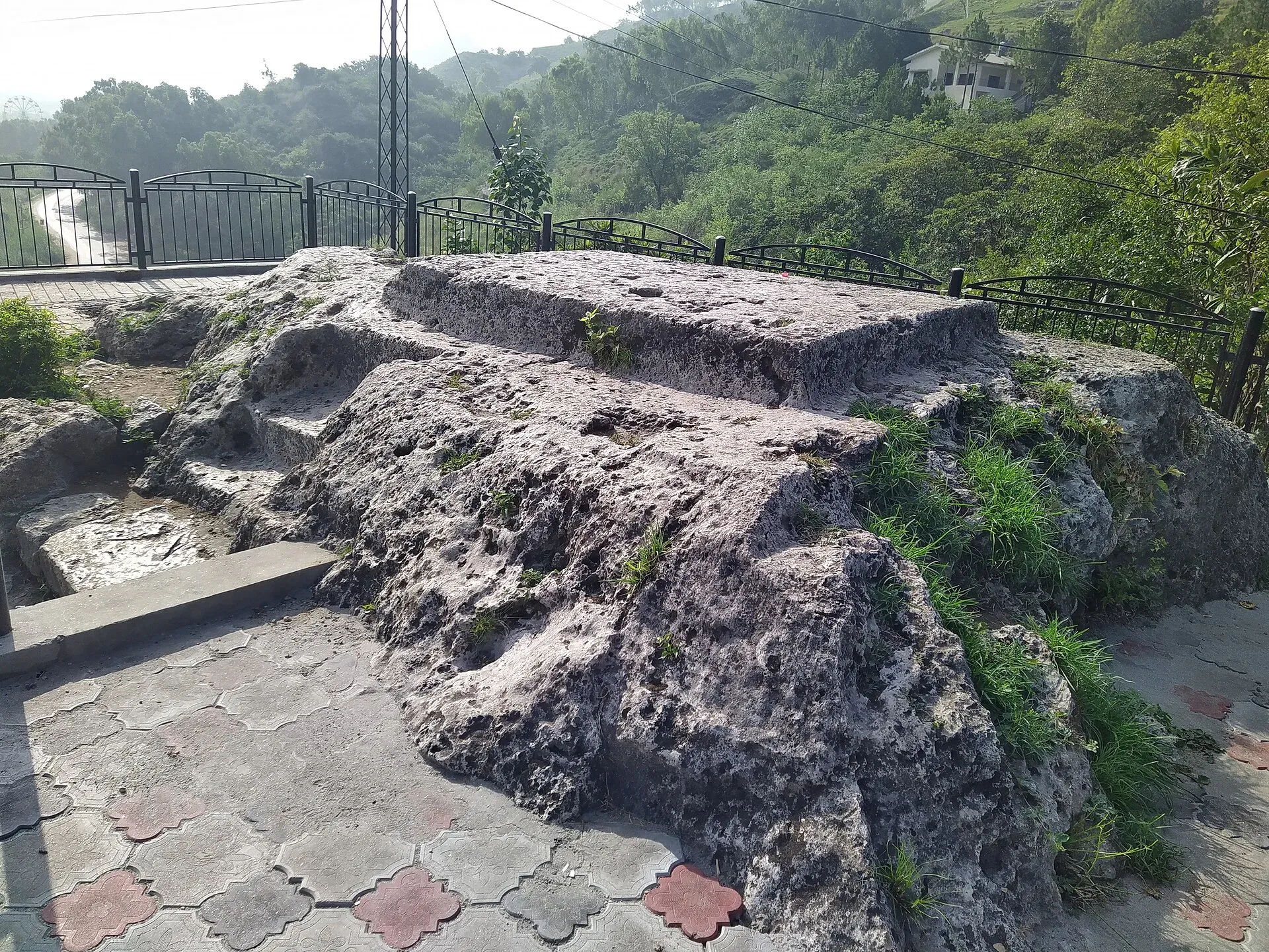
Photo: Tahir mq, with thanks · CC BY-SA 4.0 · via Wikimedia Commons · temporary stand-in photo
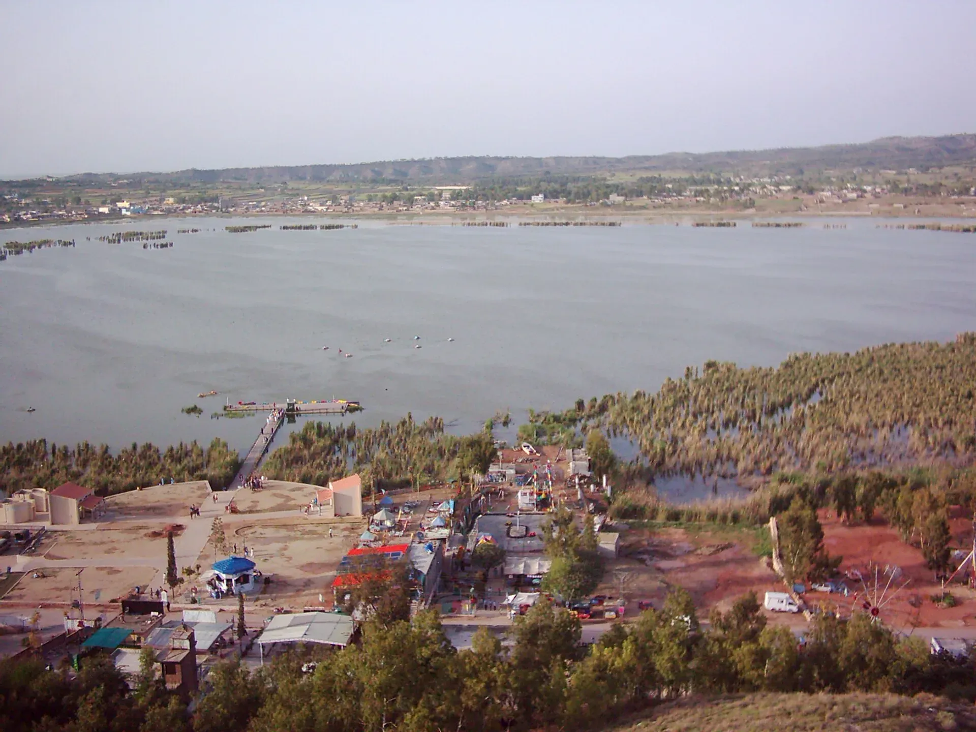
Photo: Mannadeem, with thanks · CC BY-SA 3.0 · via Wikimedia Commons · temporary stand-in photo
Kallar Kahar is a town in Chakwal District, with a shallow salt lake beside it. Babur camped near the lake in 1519 and wrote about it in his memoirs, calling the area a child of Kashmir for its beauty and pleasant weather. The nearby Takht-e-Babri is a rock-cut platform linked to Babur. Wikipedia says peacocks have long lived here, although numbers have fallen because of population growth and illegal capture. Our own pages note that Bagh-e-Safa, the old Mughal garden, was reported neglected by Dawn in 2016. Plan an easy half day: walk by the lake, see Takht-e-Babri and drive on. Alternatively, drive on to Sakesar for the views; access to the summit area is controlled by the Pakistan Air Force, so check before going.
Choa Saidan Shah and Katas Raj
Choa Saidan Shah is a spring-fed town about 6 km from Katas Raj, named after the saint Saidan Shah and known for its shrine, roses and perfumes. Katas Raj is a group of Hindu temples around a sacred pond, dating from about the 6th to 10th centuries. It matters to Hindus and is visited by pilgrims each year. Wikipedia says Temple A dates to the tenth century. Check the condition of the pond, which dried up in 2016.
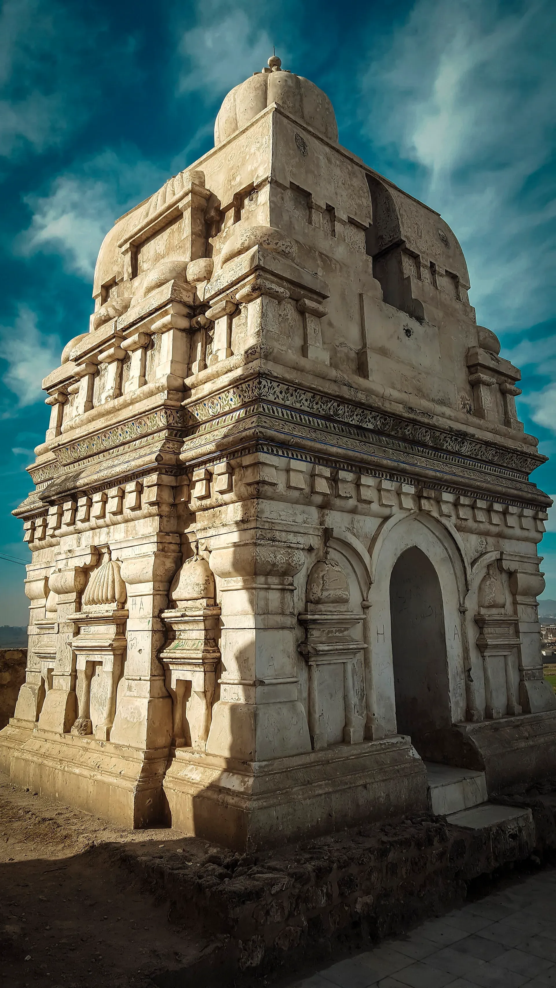
Photo: Shahzaib Damn Cruze, with thanks · CC BY-SA 4.0 · via Wikimedia Commons · temporary stand-in photo
Inside Khewra Salt Mine
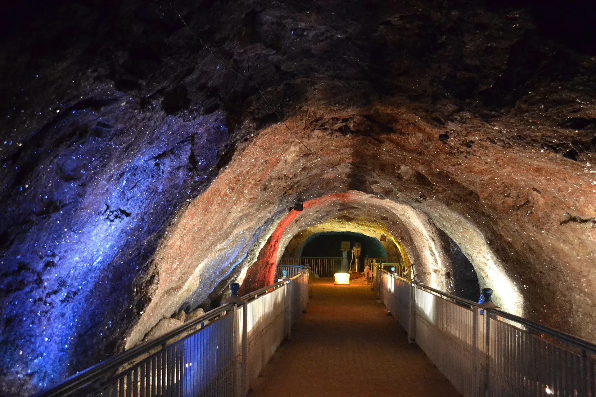
Photo: Shikari7, with thanks · CC BY-SA 3.0 · via Wikimedia Commons · temporary stand-in photo
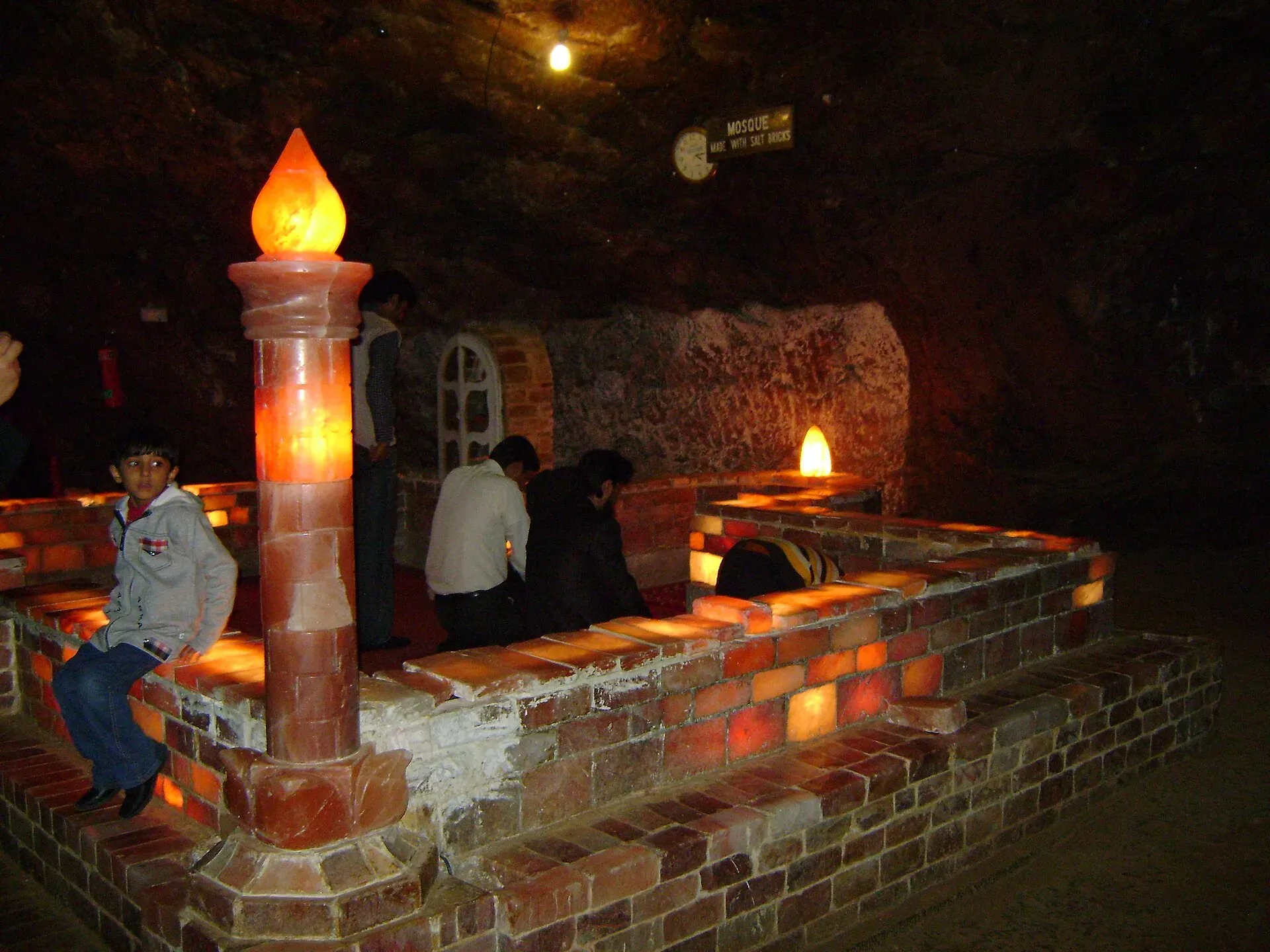
Photo: Mr. Shamayel Afzal Khan, with thanks · CC BY-SA 4.0 · via Wikimedia Commons · temporary stand-in photo
The mine's history is tied by tradition to Alexander the Great, whose army's horses were said to lick the rock. Under the Mughals salt was traded as far as Central Asia, and under Sikh rule it was a source of revenue. In 1872 the British engineer H. Warth developed the main tunnel. Wikipedia lists output of about 350,000 tonnes a year in 2019-20, of roughly 99 per cent pure halite, and says the mine takes in about 250,000 visitors a year. It has 19 levels, 11 of them underground, running about 730 m into the mountain, with about 40 km of tunnels at a steady 18 to 20 C. Visitors ride the 610 mm narrow-gauge Khewra Salt Mines Railway. Sights on the tour include:
- The Assembly Hall, about 75 m high.
- Pul-Saraat, a pillarless salt bridge over a brine pond 25 m deep.
- A small mosque built of salt bricks, about 50 years old.
- The Sheesh Mahal (Palace of Mirrors), lit with pink salt crystals, and carvings including a Minar-e-Pakistan replica.
- A 20-bed ward opened in 2007 that uses salt therapy for asthma and breathing problems.
Bring a light jacket, because the air in the mine is cool.
Food and local shopping
Wikipedia and the place pages give little about food. Salt from the Range is sold at Khewra, and Choa Saidan Shah is known for roses and perfumes. Ask locally before buying.
Closure notice for Khewra
On 10 August 2026 the manager of the Punjab Minerals Development Corporation at Khewra announced that visitors would not be admitted until the monsoon ended, because heavy rain had raised water in the mine's ponds and maintenance was needed. No reopening date was given and we have not confirmed that it had reopened by 16 November 2026. Call the mine office or check the Corporation's notices before you go.
Practical information
Fuel and food are available at Chakwal, Kallar Kahar and near Khewra. Entry fees for Katas Raj and the mine are not confirmed here; current fees will be added soon. Katas Raj is a place of worship and a conservation site, so dress modestly and follow staff instructions.
Highlights
- Kallar Kahar lake and peacocks
- Katas Raj temples and sacred pool
- Khewra Salt Mine train and salt mosque
- Easy motorway driving from Islamabad
- Salt Range hills
Stops
- Kallar KaharLake and peacock hills
- Katas RajTemples and sacred pool
- Khewra Salt MineSalt mine tour (check opening)
km: distance from the start along the route.
Numbers follow the stops in order. The map shows the stops, not the road itself.
Day by day
Day 1 · Islamabad to Katas Raj
Drive the M-2 to Kallar Kahar, see the lake, then continue to Katas Raj. Overnight near Kallar Kahar or Chakwal.
Day 2 · Khewra and return
Drive to Khewra (20.5 km) if the mine is open, then return to Islamabad (177 km).
Road conditions
- M-2 motorway: modern, fast and well signed.
- Link roads: paved but narrow near Katas Raj and Khewra.
- Weather: heavy monsoon rain can flood roads and damage sites; Katas Raj had flood damage to its walls and gate in July 2025 (Dawn, 21 July 2025).
Fuel and services
Fuel and rest areas on the M-2. Small hotels and restaurants at Kallar Kahar and Choa Saidan Shah. Basic medical help at Khewra and Chakwal.
Where to stay, eat and fuel up
Places to stay
- Pearl Continental Hotel, LahoreCall Pearl Continental Hotel, LahoreMap of Pearl Continental Hotel, Lahore in Google Maps
- Avari Hotel LahoreCall Avari Hotel LahoreMap of Avari Hotel Lahore in Google Maps
- Serena HotelCall Serena HotelMap of Serena Hotel in Google Maps
- Islamabad Marriott HotelCall Islamabad Marriott HotelMap of Islamabad Marriott Hotel in Google Maps
- The Nishat HotelCall The Nishat HotelMap of The Nishat Hotel in Google Maps
- Faletti's Hotel LahoreCall Faletti's Hotel LahoreMap of Faletti's Hotel Lahore in Google Maps
Places to eat
- The Monal IslamabadCall The Monal IslamabadMap of The Monal Islamabad in Google Maps
- Tehzeeb Bakers Blue AreaCall Tehzeeb Bakers Blue AreaMap of Tehzeeb Bakers Blue Area in Google Maps
- TKR 3Call TKR 3Map of TKR 3 in Google Maps
- Savour FoodsCall Savour FoodsMap of Savour Foods in Google Maps
- Savour Foods ShadmanCall Savour Foods ShadmanMap of Savour Foods Shadman in Google Maps
- Cheezious Commercial MarketCall Cheezious Commercial MarketMap of Cheezious Commercial Market in Google Maps
Essential services fuel stations, mechanics, pharmacies and hospitals and clinics
Fuel
- Attock Petrol PumpMap of Attock Petrol Pump in Google Maps
- PSO Petrol PumpMap of PSO Petrol Pump in Google Maps
- PSO Petrol PumpMap of PSO Petrol Pump in Google Maps
- Total Parco LA TownCall Total Parco LA TownMap of Total Parco LA Town in Google Maps
- PSO-Al-Rafay Filling Station - Petrol Pump Thokar Niaz BaigCall PSO-Al-Rafay Filling Station - Petrol Pump Thokar Niaz BaigMap of PSO-Al-Rafay Filling Station - Petrol Pump Thokar Niaz Baig in Google Maps
- Total - Areeb Areel Filling StationCall Total - Areeb Areel Filling StationMap of Total - Areeb Areel Filling Station in Google Maps
Mechanics and tyre shops
- Mohammed Bilal tyre centreMap of Mohammed Bilal tyre centre in Google Maps
- Changan City SalesCall Changan City SalesMap of Changan City Sales in Google Maps
- Toyota Airport MotorsCall Toyota Airport MotorsMap of Toyota Airport Motors in Google Maps
- Honda GatewayCall Honda GatewayMap of Honda Gateway in Google Maps
- Saif Traders - Best Tyre Shop in LahoreCall Saif Traders - Best Tyre Shop in LahoreMap of Saif Traders - Best Tyre Shop in Lahore in Google Maps
- Mini MotorsCall Mini MotorsMap of Mini Motors in Google Maps
Pharmacies
- Imtiaz Mega - Ramzan Mall - islamabadCall Imtiaz Mega - Ramzan Mall - islamabadMap of Imtiaz Mega - Ramzan Mall - islamabad in Google Maps
- Raja Market Garden Town LahoreCall Raja Market Garden Town LahoreMap of Raja Market Garden Town Lahore in Google Maps
- Rainbow Cash & Carry - EME LahoreCall Rainbow Cash & Carry - EME LahoreMap of Rainbow Cash & Carry - EME Lahore in Google Maps
- D.WATSON CHEMIST BLUE AREACall D.WATSON CHEMIST BLUE AREAMap of D.WATSON CHEMIST BLUE AREA in Google Maps
- D.WATSON CHEMIST F-11 MARKAZCall D.WATSON CHEMIST F-11 MARKAZMap of D.WATSON CHEMIST F-11 MARKAZ in Google Maps
- Rainbow Cash & Carry - Valencia Town LahoreCall Rainbow Cash & Carry - Valencia Town LahoreMap of Rainbow Cash & Carry - Valencia Town Lahore in Google Maps
Hospitals and clinics
- Holistic CareCall Holistic CareMap of Holistic Care in Google Maps
- Lahore Care HospitalCall Lahore Care HospitalMap of Lahore Care Hospital in Google Maps
- Shifa International Hospitals LimitedCall Shifa International Hospitals LimitedMap of Shifa International Hospitals Limited in Google Maps
- Amanat Eye Hospital RawalpindiCall Amanat Eye Hospital RawalpindiMap of Amanat Eye Hospital Rawalpindi in Google Maps
- Maryam Memorial Hospital (MMH)Call Maryam Memorial Hospital (MMH)Map of Maryam Memorial Hospital (MMH) in Google Maps
- Evercare HospitalCall Evercare HospitalMap of Evercare Hospital in Google Maps
Listings come from Google Maps data and are unverified: phone numbers, opening months and prices may have changed. Report a problem · Own one of these? Claim it
Safety
- Government advice (checked 16 November 2026): the UK FCDO, updated 27 October 2026, does not list the Salt Range districts in its restricted areas.
- Mine closure: the Khewra Salt Mine was closed to visitors from 10 August 2026 for the monsoon and maintenance.
- Flooding: avoid dry stream beds and low roads after rain.
Tips
- Phone ahead: the Khewra mine was closed to visitors from August 2026 until after the monsoon.
- Dress modestly at Katas Raj and remove your shoes at shrines.
- Carry water; there is little shade at the temples.
- Visit on a weekday to avoid the crowds at Kallar Kahar.
- Keep to marked paths at the temple complex; the buildings are old.
Photos we still need: Choa Saidan Shah market or shrine, and the M-2 at the Kallar Kahar interchange. Send us yours
Sources and last checked
Last checked Confidence medium10 sources5 still to check
- Last checked
- Method
- Desk research from published sources
- Confidence
- medium
- Checked by
- trek.pk research team
Researched from published sources; not yet checked on the ground by our team. Spot something out of date? Report a mistake.
Sources
- OSRM driving route service: distances and times measured 16 November 2026 (drive times are without stops) · OSRM / OpenStreetMap contributors · checked
- Pakistan Tourism Guide 2021 · Trade Development Authority of Pakistan (TDAP) · checked
- Katas Raj Temples · Wikipedia · checked
- Khewra Salt Mine · Wikipedia · checked
- Kallar Kahar · Wikipedia · checked
- Khewra Salt Mine temporarily closed to tourists (10 August 2026) · ProPakistani · checked
- Pakistan travel advice: warnings and insurance (latest update 27 October 2026) · UK Foreign, Commonwealth and Development Office · checked
- Katas Raj Temple complex stands intact against deluge (21 Jul 2025) · Dawn · checked
- M-2 motorway (Pakistan) · Wikipedia · checked
- Salt Range · Wikipedia · checked
Still to be checked on the ground (5)
- Whether Khewra Salt Mine has reopened and its opening hours (only the 10 August 2026 closure notice found; no reopening or hours source)
- Current state of the Katas Raj pond and temples (Dawn July 2025: walls and gate damaged, filtration plant idle for years; nothing later)
- Entry fees at Katas Raj, Khewra and Kallar Kahar (no official source found)
- Kilometre marker of the Kallar Kahar interchange (M-2 interchange 17; no official km figure)
- Whether Takht-e-Babri and the lakeside paths are maintained and open


