

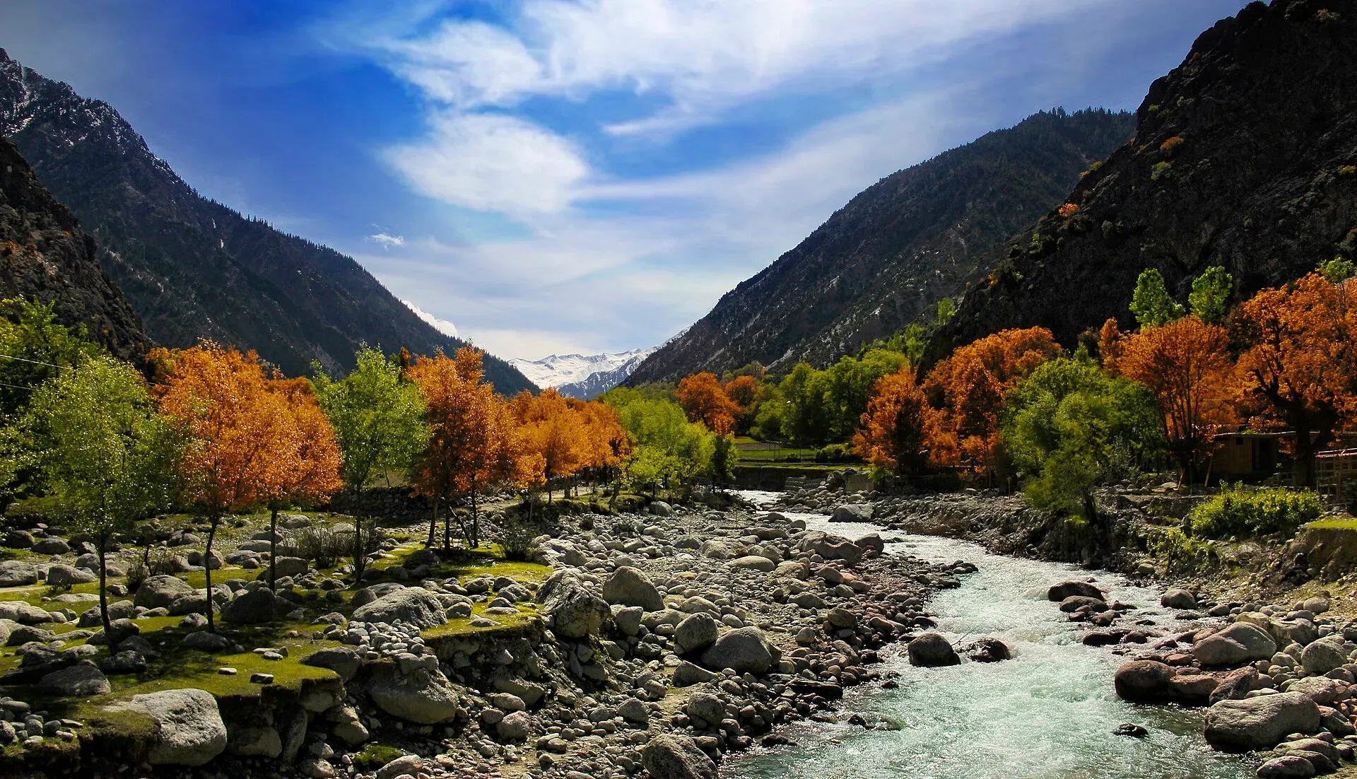
Photo: Hassan Ali (Hsnbook), with thanks · CC BY-SA 3.0 · via Wikimedia Commons · temporary stand-in photo

Donson Pass and Kundyak An
- Duration
- 2 days
- Distance
- 10.2 km
- Grade
- Easy
- Max altitude
- 2,970 m
- Season
- Apr – Oct
A two-day forest traverse from Bumburet to Rumbur over two low ridges, through ancient cedars and the Acholgah Gol, in the Kalasha valleys.
Overview
This two-day walk joins Bumburet to the upper Rumbur valley over two low forested ridges: Donson Pass (2,970 m) and Kundyak An (2,855 m). In between you cross the Acholgah Gol, a side valley that still has relatively intact forest. The route covers about 10 km, from Batrik in Bumburet to the Rumbur Gol.
The headline sights are the cedars on top of Donson Pass, which the old guide estimated to be at least 1,000 years old, and the old-growth forest on Kundyak An, with trees 300 to 1,000 years old. On clear days you also get views of Tirich Mir and Noshaq.
Getting to the start
Bumburet is one of three Kalasha valleys in Chitral District, with villages at roughly 1,900 to 2,200 m. It is reached by road from Ayun (also written Ayrun) in the main Chitral valley, where the Bumburet and Rumbur valleys meet the Chitral river. Shared jeeps run from Ataliq Bazaar in Chitral. Rumbur is the side valley to the north of Bumburet. The walk links the two, so a vehicle at the Rumbur end is the usual way back to Chitral. Rumbur transport is sporadic, so arrange onward transport in advance.
Who it suits
It suits anyone with moderate fitness who wants to see Kalasha hill country without technical terrain. The climbs are 930 m on day one and 875 m on day two, and the trail on the Rumbur side is overgrown, so route-finding is the main challenge. Do it south to north with a Bumburet villager who knows the way. Rumbur villagers rarely use this route and may not know it. This page grades it easy.
When to go
Mid-April to mid-October. The Kalasha festivals are Joshi in May, Uchau in autumn, Pul around the September full moon and Chaumos around the winter solstice in December, so only the first three fall within the walking season. Outsiders are not admitted to parts of Chaumos until purified, so ask before planning a visit then. In May and June the forest floor near Kundyak An has morel mushrooms (qutsi), and wild strawberries come later. The road linking Acholgah to lower Rumbur is open only in low water and is usually impassable from May to July.
Terrain underfoot
The walk stays below 3,000 m and is mostly forest, so the ground is soft and often steep. The climb out of Batrik is a gully with a solid but steep trail. The upper slopes of Donson Pass are cedar forest and the descent crosses flower meadows and a steep spur. In the Acholgah valley the route follows a road and footbridges. North of Kundyak An there is no obvious trail, the ground is overgrown. The last descent follows a stream with several footbridges.
The route
From Batrik (2,040 m) climb the gully behind the village on a steep but solid trail through cedar and some chilghoza pine, where logging is visible. You can also start from Krakal on a gentler donkey track that joins at 2,700 m. Donson Pass is 2.5 km from Batrik and has huge cedars. Descend through flower meadows and steep spur to a wooden shelter at Owzurie (2,460 m), then traverse high above the Donson Gol to the hot spring at the confluence with Acholgah Gol. Camp at Passuwala, Shigala or Gomenah (1,980 m).
On day two, walk north up the road past big cedars, then climb to Kundyak An (2,855 m) through forest. There is no obvious trail north of the pass, so a local guide is essential. Descend to Narajau (2,225 m), then cross eight footbridges (the number varies with water level) to the Rumbur Gol (2,070 m). Cross the sturdy plank bridge to the road.
Culture and people
The Kalasha Valleys are home to the Kalasha people, with smaller Kho and Gujar communities. The Kalasha follow a religion tied to the mountains, rivers and forests, and have their own language. The valleys are fertile, with oak forests and hand-dug irrigation channels, and grow wheat, maize, grapes, apples, apricots and walnuts. Visitors pay a toll on entering the valleys, which Wikipedia says supports the preservation of Kalasha culture; current amounts are not confirmed here.
The settlements in Acholgah are lived in year round by Kalasha men from Anish and Batrik who tend livestock. A few women come in July and August to work the fields. Notches cut in trees encourage bees, and Kalasha harvest honey from them. Near the Rumbur finish is the shrine of Sajigor, in an oak grove, which only men may visit. Respect Kalasha customs: ask before photographing people or visiting shrines. Narajau is a Kalasha house with a barley field; Traghdhur nearby is a Muslim and Gujar settlement.
Practical information
Bumburet has nearly two dozen hotels, mostly in Anish, Brun, Batrik and Krakal, with basic shops in each village. Many rooms are empty outside festival times, so prices can be negotiated. In Rumbur, rooms are in Balanguru and Grom. Jeeps run from Chitral's Ataliq Bazaar to Bumburet and Rumbur. At the finish, walk 3.5 km (about an hour) on the road to Balanguru and Grom, or wait for a vehicle. Maps: US AMS 1:253,440 Chitral (I-42 F), which is not useful at trek scale, and Survey of India sheets 38 M/10 and 38 M/9, which show detail but with errors on this route.
Highlights
- Huge cedars on Donson Pass, over 1,000 years old
- Old-growth forest on Kundyak An
- Kalasha herding settlements in Acholgah
- Views of Tirich Mir and Noshaq
Day by day
- StartBatrik (Bumburet)
- Day 1Gomenah (or Passuwala, Shigala)
- Day 2Rumbur Gol
| Day | Route | Hours | Distance | Ascent / descent | Camp and altitude |
|---|---|---|---|---|---|
| Day 1 | Batrik to Gomenah | 3–5 h | 5.7 km | +930 m / −990 m | Gomenah (or Passuwala, Shigala), 1,980 m |
Day 1 notesClimb steeply behind Batrik (2,040 m) through cedar and chilghoza forest to Donson Pass (2,970 m), 2.5 km on. Descend through meadows and a steep spur to the Owzurie shelter (2,460 m). Traverse above the Donson Gol, pass the hot spring near the Acholgah confluence, and camp at Gomenah (1,980 m) or the nearby settlements. Several footbridges cross the Acholgah Gol. Underfoot: a steep gully path, then forest, meadow and a steep spur, finishing on a traverse above the Donson Gol. | |||||
| Day 2 | Gomenah to Rumbur Gol | 4–5 h | 4.5 km | +875 m / −785 m | Rumbur Gol, 2,070 m |
Day 2 notesCross the Acholgah Gol and follow the road north to its end through cedar forest. Climb through a logging scar and old-growth forest to Kundyak An (2,855 m). The trail is absent on the north side, so follow your guide to Narajau (2,225 m), then down the stream over footbridges to the Rumbur Gol (2,070 m). Cross the plank bridge to the road. Allow time on the north side, where the forest floor is overgrown and the path is hard to see. | |||||
Getting there
Chitral to Bumburet jeeps leave regularly from Ataliq Bazaar in Chitral. You can also take any Chitral to Ayun vehicle and look for a ride from there. At the finish, walk 3.5 km along the road on the true left bank of the Rumbur Gol to Balanguru and Grom, or flag a jeep. Rumbur transport is sporadic.
Permits and rules
- Permit needed
- Yes, Restricted zone
- Fee
- Current fees will be added soon
- Last checked
- 16 November 2026
The old guide listed the Kalasha valleys as a restricted zone where no trek permit is needed and visits are authorised by the DC in Chitral. Foreign visitors need a No Objection Certificate (NOC) for Chitral district. A Senate committee briefing reported on 6 May 2026 that the requirement is still in force, and KP Tourism launched an online NOC system in July 2025 that registered tour operators use. Rules have been relaxed and reinstated before, so confirm the current position with a Chitral tour operator, KP Tourism or the Deputy Commissioner's office in Chitral before you travel (checked 16 November 2026). Pakistani citizens do not need a trek permit, but carry your CNIC. Operator material also notes that foreign visitors have at times been barred from staying overnight in the Kalash valleys; ask in Chitral before you plan a camp.
How trekking permits, NOCs and registration work: Visa and permits.
Season
Best: Apr – Oct
Water and camps
Camp at Passuwala, Shigala or Gomenah (1,980 m) on day one: all have streams and fields. A mineral-water spring is two hours up the Acholgah Gol. Water is available at the Owzurie shelter area and from side streams, but not on the ridges. In Bumburet and Rumbur you can stay in village hotels at both ends of the trek.
Gear and safety
Altitude is low, so altitude problems are not likely. The main risks are losing the trail north of Kundyak An and slippery or high-water footbridges on the Narajau stream. Do not attempt this without a local guide. Logging and milling occur in the forest, and rockfall happens on steep spurs. The nearest help is in Bumburet or Rumbur. Keep to Kalasha rules: women's areas and shrines such as Sajigor are not open to all visitors.
Ask the district administration or local police about current conditions before you go. For foreign visitors: the UK FCDO advises against all travel on the N-45 from north of the Mardan ring road to the edge of Chitral city, including the Kalash valleys (advice updated 27 October 2026, checked 16 November 2026). Read the live advice before you plan.
Variations
From Rumbur, Urghuch and Uchusht are possible walks to Chitral, and the Bohok Pass loop (see Other treks in Chitral) starts here. Gree An is a one-day link between Birir and Bumburet (see that trek).
Tips
- Go south to north with a guide from Bumburet.
- The trail north of Kundyak An fades. Do not go without a local.
- Ask permission before photographing Kalasha people or shrines.
- Expect the Acholgah road to be impassable May to July in high water.
Stay and eat in Chitral
Chitral is the nearest town to the trek: somewhere to sleep and stock up before and after.
Places to stay
- Tirch Mir View Hotel ChitralCall Tirch Mir View Hotel ChitralMap of Tirch Mir View Hotel Chitral in Google Maps
- Hindukush HeightsCall Hindukush HeightsMap of Hindukush Heights in Google Maps
- Tower Hotel ChitralCall Tower Hotel ChitralMap of Tower Hotel Chitral in Google Maps
- Legendary Hotel ChitralCall Legendary Hotel ChitralMap of Legendary Hotel Chitral in Google Maps
- Hindukush Sarai ChitralCall Hindukush Sarai ChitralMap of Hindukush Sarai Chitral in Google Maps
- BnB Chitral TownCall BnB Chitral TownMap of BnB Chitral Town in Google Maps
Places to eat
- Diwan Hotel & RestaurantCall Diwan Hotel & RestaurantMap of Diwan Hotel & Restaurant in Google Maps
- Kashmir Bakers and Sweet HouseCall Kashmir Bakers and Sweet HouseMap of Kashmir Bakers and Sweet House in Google Maps
- Chitral Guest House and Zowalo RestaurantCall Chitral Guest House and Zowalo RestaurantMap of Chitral Guest House and Zowalo Restaurant in Google Maps
Essential services fuel stations, mechanics, ATMs, pharmacies and hospitals and clinics
Fuel
- PSO Filling StationMap of PSO Filling Station in Google Maps
- PSO oil fill Station Danin ChitralMap of PSO oil fill Station Danin Chitral in Google Maps
- By Pass Petrol PumpCall By Pass Petrol PumpMap of By Pass Petrol Pump in Google Maps
- Rehman Filling Station Bakrabad ChitralMap of Rehman Filling Station Bakrabad Chitral in Google Maps
- Filling Station BakrabadCall Filling Station BakrabadMap of Filling Station Bakrabad in Google Maps
- Chumurkone Petrol PumpMap of Chumurkone Petrol Pump in Google Maps
Mechanics and tyre shops
- Car Repairing Near Al Khidmat FoundationMap of Car Repairing Near Al Khidmat Foundation in Google Maps
ATMs
- Bank AlfalahMap of Bank Alfalah in Google Maps
- NBP AitemaadCall NBP AitemaadMap of NBP Aitemaad in Google Maps
- Summit BankMap of Summit Bank in Google Maps
- Soneri Bank LtdMap of Soneri Bank Ltd in Google Maps
- JS bankMap of JS bank in Google Maps
Pharmacies
- Alim MedicosCall Alim MedicosMap of Alim Medicos in Google Maps
- Alam MedicoseCall Alam MedicoseMap of Alam Medicose in Google Maps
- Miftah Medicose Ataliq BazarMap of Miftah Medicose Ataliq Bazar in Google Maps
- Rastan PharmacyMap of Rastan Pharmacy in Google Maps
Hospitals and clinics
- District Headquarter HospitalMap of District Headquarter Hospital in Google Maps
- CHILDREN HOSPITALMap of CHILDREN HOSPITAL in Google Maps
- Aga Khan Diagnostic Center, ChitralCall Aga Khan Diagnostic Center, ChitralMap of Aga Khan Diagnostic Center, Chitral in Google Maps
- Chitral Scout HospitalCall Chitral Scout HospitalMap of Chitral Scout Hospital in Google Maps
- Dr.Jan, Endovascular Neurosurgeon, Neurovascular SpecialistMap of Dr.Jan, Endovascular Neurosurgeon, Neurovascular Specialist in Google Maps
- Alkhidmat Diagnostic CenterCall Alkhidmat Diagnostic CenterMap of Alkhidmat Diagnostic Center in Google Maps
Listings come from Google Maps data and are unverified: phone numbers, opening months and prices may have changed. Report a problem · Own one of these? Claim it
Photos we still need: Donson Pass cedars, Acholgah Gol footbridges and the Kundyak An forest. Send us yours
Health and emergency
Mobile signal is patchy on most treks, so tell someone your plan before you go. Emergency numbers
Sources and last checked
Last checked Confidence medium8 sources6 still to check
- Last checked
- Method
- Desk research from published sources
- Confidence
- medium
- Checked by
- trek.pk research team
Researched from published sources; not yet checked on the ground by our team. Spot something out of date? Report a mistake.
Sources
- Trekking in the Karakoram and Hindukush (Lonely Planet, c. 2002), Chitral chapter · Lonely Planet · checked
- Lesser-known treks of Chitral and the Hindu Raj edge (research notes) · trek.pk research, 2026-11-15 · checked
- Donson Pass and Kundyak An trek · Apricot Tours · checked
- Kalasha Valleys · Wikipedia · checked
- Senate panel flags hurdles to Chitral tourism (6 May 2026) · The Express Tribune · checked
- KP launches online NOC system for foreign tourists (July 2025) · Daily Times / APP · checked
- Senate panel highlights security, infrastructure issues affecting Chitral tourism (6 May 2026) · Pakistan Today · checked
- Kalash people (festivals, valleys, farming) · Wikipedia · checked
Still to be checked on the ground (6)
- Whether foreign visitors are currently allowed to camp or stay overnight in Acholgah and the Kalash valleys
- Pass heights: Donson 2,970 m and Kundyak An 2,855 m (Lonely Planet and Apricot agree)
- Trail condition and logging damage on Donson and Kundyak An
- Status of the Acholgah to Rumbur road
- Current NOC conditions (the Senate briefing of 6 May 2026, reported by Express Tribune and Pakistan Today, says the Chitral NOC still applies; an undated Zameen report says it was withdrawn) and Kalash valley entry fees (the only figure found, Rs 600 for foreigners, is from 2019 and unofficial)
- Current vehicle availability and fare from Rumbur back to Chitral
Nearby and related

Gree An

Other treks in Chitral

Ansoo Lake Trail

Donson Pass
A forested ridge pass of 2,970 m above Batrik in Bumburet, the first of two low passes on the Bumburet to Rumbur walk through Acholgah. Known for ancient cedars.
Kundyak An
A low forested pass of 2,855 m between Acholgah and the Rumbur valley, the second ridge on the Bumburet to Rumbur walk. Old-growth forest; no clear trail on the north side.
Gree An (Gumbak An)
A steep forest pass of about 3,060 m between Guru in Birir and Gumbak in Bumburet, in the Kalasha valleys. A one-day walk with views of Tirich Mir and Noshaq.
Donson Gol Hot Spring (Acholgah)
A hot spring above the Donson Gol, at the confluence with the Acholgah Gol, passed on the Donson Pass and Kundyak An trek in Chitral. Known only from our trek page.