

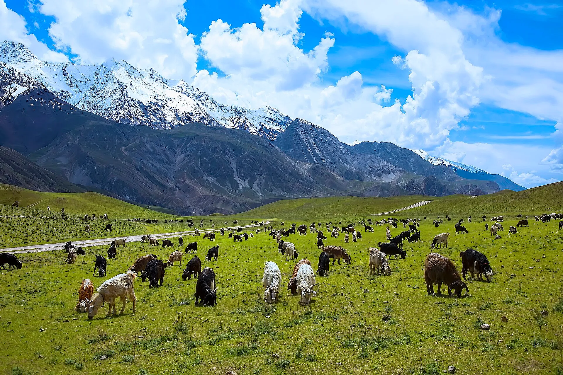
Photo: Tahsin A Shah, with thanks · CC BY-SA 4.0 · via Wikimedia Commons · temporary stand-in photo

Other treks in Chitral
A roundup of shorter and lesser-known treks in Chitral: Kalasha valley crossings, Chitral Gol National Park, Arkari, Turikho, Golen and Shishi passes, and the Hindu Raj crest.
This page collects several shorter treks in Chitral. Each heading below is a separate route with its own season, grade and permit rules, so read the notes for the one you plan to walk.
21 routes: Routes at a glance · Urghuch · Uchusht · Bohok Pass · Utak An · Jinjeret · Merin (Chitral Gol National Park) · Bironshal (Chitral Gol National Park) · Arkari · Besti An and Lutkho An · Gazikistan · Jughor · Roghili An · Dok An · Rosh · Udren · Saraghrar Base Camp · Chikor Pass · Nizhdaru An · Hindu Raj Crest · Bashqar
Overview
These shorter and less-trekked routes in Chitral sit around the main trek pages. Unless noted, the old guide listed them as open zone. The Kalasha valley, Arkari, Turikho and some border routes are restricted zones, where visits are authorised by the Deputy Commissioner in Chitral. Foreign visitors should also check the Chitral NOC position.
Routes at a glance
| Route | Days | Highest point | Character |
|---|---|---|---|
| Urghuch | 1 | about 3,066 m (ridge near Sunwat) | Easy ridge walk from Rumbur |
| Uchusht | 2 | forested ridge | Easy but tricky, little used |
| Bohok Pass | 3 | 4,725 m | Moderate loop from Rumbur |
| Utak An | not given | 4,647 m | Moderate snowfield pass |
| Merin | 1 to 2 | 2,200 m roadhead | Easy, wildlife |
| Bironshal | 2 | 3,068 m | Easy but long |
| Besti An | 3 | 4,633 m | Demanding, border area |
| Rosh | 4 | 4,300 m (Kotgaz) | Moderate |
| Udren | 4 | 4,300 m | Moderate, glacier |
| Saraghrar Base Camp | 5 | 4,200 m | Demanding, glacier skills |
| Chikor Pass | 5 to 7 | 4,330 m | Moderate, unmarked |
| Nizhdaru An | 2 to 3 | 5,087 m | Demanding, technical |
| Hindu Raj Crest | 5 | 4,763 m | Demanding, cross-country |
Heights come from the old guidebook and vary by source. Words used below: an is a pass, gol a side valley, shal a summer pasture, ghari a camp site, and gree a rough cross-country pass.
Urghuch
Easy one-day walk from Rumbur, one of the three Kalasha valleys, to Urghuch village, 6.5 km south of Chitral. Rumbur is called Rukmu in Kalasha. Head east up the side valley south of Balanguru, cross the ridge south of Sunwat (3,066 m), pass an abandoned Mehtar's rest house and descend to a spring (2,272 m) and the Urghuch valley. From Urghuch find a jeep, walk to Chitral or Ayun, or cross the footbridge over the Chitral river to the Chitral to Drosh road.
Uchusht
Two easy days from Rumbur to Uchusht, 1.5 km south of Chitral town. The trail is little used and tricky, so take a guide from Balanguru. Go up a side valley above Balanguru to the herders' hut at Palario, climb to the forested ridge between Rumbur and Urghuch, then contour north into the upper Urghuch basin. There is no water on the ridge top. Descend past herders' huts to Uchusht.
Bohok Pass
A moderate three-day loop from Rumbur. Walk west up the Gangalwat Gol past Shekhanandeh to the Shekhan Bohok Gol confluence (3,518 m), 12 km on. Head south up that valley over Bohok Pass (4,725 m) into the Kalasha Bohok Gol, then descend past Narajau to the Rumbur Gol road.
Utak An
A moderate trek over Utak An (4,647 m), one of several snowfield passes between the Begusht Gol and the upper Rumbur Gol. Start at Turi Beshgar, 4 km up Begusht Gol, and go 7 km up the Mohour Gol to Putrik. The pass lies east of there, above Dundeeni Chhat, the summer pasture of Chitral Gol's markhor. The route continues south-east to Chimirsan Ghari and Shekhanandeh.
Jinjeret
Jinjeret Kuh is a western side valley of the Chitral river south of Drosh. Its people converted to Islam in the 20th century but still speak Kalashamun and live in Kalasha-style houses. Old forts stand near the highest village, and a restored watchtower can be visited on a tour. It is an easy day trip from Drosh or overnight from Chitral. Special-hire jeeps go 7 km to Dashmanandeh or 5 km further to the road end.
Merin (Chitral Gol National Park)
Merin has old bungalows above the south bank of the Chitral Gol. Chitral Gol National Park (7,750 hectares, set up in 1984) is reported to hold the largest markhor population in the world, with 2,278 counted in 2021 (Wikipedia). Markhor is a spiral-horned wild goat. Female and young markhor live on the cliffs across the river all year, and in December the males come down to mate. Snow leopard, Siberian ibex and Himalayan black bear also live in the park. The park road is described as narrow and risky, especially in rain. It can be a day hike from Chitral or a two-day trip. From the roadhead (2,200 m), descend 45 minutes to a footbridge and climb 15 minutes to Merin (1,980 m). The climb back takes about 1.5 hours. Bring binoculars. The upriver route to Kasavir (9.2 km round trip) is passable only when the river is low, usually August to October.
Bironshal (Chitral Gol National Park)
The route climbs through cedar forest and the park is cold and dry, with snow on the peaks until about June (Wikipedia). Wikipedia mentions the former Mehtar's summer fort at Birmoghlasht, above 2,800 m, which is probably the same place under another spelling; confirm with a guide. An easy 10 km route starts from the sealed road past the DC's office in Chitral and climbs 1,600 m to the ruined Mehtar's bungalow at Bironshal (3,068 m). It takes six to eight hours up, too far for a day trip, so plan two days. Return takes four to six hours. Beyond Bironshal, the only route is a difficult game watchers' track to Kasavir. The cross-country route to Dooni Gol is in bad shape and not recommended.
Arkari
A seldom-visited area under the Afghan border peaks, between the Hindu Kush crest and Gul Lasht Zom (6,657 m) and Tirich Mir. The Arkari river flows north to the Lutkho. Routes here are challenging, and a local guide is essential. Jeeps run to Owirdeh at the road end (about four hours from Chitral). The area is restricted and visits are authorised by the DC in Chitral.
Besti An and Lutkho An
Besti An (4,633 m) links Agram Gol and Besti Gol, forming a wildlife sanctuary on the Afghan border. A demanding three-day near-loop from Owirdeh goes counterclockwise, July to mid-September. Day one reaches Nawasin Ghari (3,447 m), day two climbs 600 m to the pass and drops 1,200 m to Khoin, and day three follows the Besti Gol to the Arkari roadhead. Lutkho An, a harder pass, leads to the Siruik valley and has a ledge on a 75 m cliff that may need fixed ropes. Maps swap the two pass names, so check with local guides. Beware of Agram An, an uncontrolled pass to Afghanistan.
Gazikistan
A grassy camp site between the lower and upper Gazikistan glaciers below Gul Lasht Zom, and a base camp for climbs on surrounding peaks. It is a two-day trek from Owirdeh. Camp at Yun (6.5 km) or Kurobakh (14.5 km) at the mouth of the Nuqsan valley. Gazikistan is 6.5 km beyond Kurobakh.
Jughor
Jughor village is south of Chitral town across the river. Visit it the day before you set out to organise a trek. Four demanding passes lie at its head. From the 3,161 m trail junction, one trail goes up the Kapashung Gol to Domukh An (4,380 m) and Kapashung Gree (4,318 m), both leading to Shishi Gol. The other goes up Bungolbahan Gol to Koghozi An (4,480 m, a difficult Class 3 route) and Roghili Gree (4,638 m). All are snow-free only from July and best crossed before late September. Hire a local herder.
Roghili An
From Lut Chhat in the upper Roghili Gol, a demanding route crosses Roghili An (4,496 m) south-east over a steep ridge to Madaglasht in Shishi Gol. Beyond the lake, cross the stream to its south bank, where the route splits from the harder Roghili Gree. See the Roghili Gol trek for the approach.
Dok An
Dok An (4,420 m) links Istor, the highest Golen Gol village, to upper Shishi Gol. The pass is moderate and usually open mid-June to September. Istor villagers graze flocks at Warazo Shal. From there it is a one-day trek over the pass. You can then turn north-east into upper Shishi Gol, cross Lohigal An and loop back to Istor.
Rosh
A four-day trek up the Rosh Gol from Zundrangram in the Tirich valley, moderate and little visited. Day one reaches Duru (3,600 m), a camp with flowers and springs, about 13 km up. Day two goes to the Rosh Gol Glacier and the ablation valley of Kotgaz (4,300 m). Day three is a hike on the glacier for views of Saraghrar. On day four, return to Zundrangram. The area lies in the restricted zone, so visits are authorised by the DC in Chitral.
Udren
A moderate four-day trek to the head of the Udren Glacier, under Udren Zom (7,108 m), Noshaq and Istor-o-Nal. From Shagrom follow the Tirich Gol, cross a footbridge and go up the Udren Gol past Shang-o-Lasht to a camp 8 km from the confluence. Cross the glacier on moraine to its true left side for views of Istor-o-Nal, then camp in the ablation valley at 4,300 m. Return in two days.
Saraghrar Base Camp
A demanding five-day trek to the base camp of the 1959 Italian expedition. From Zang Lasht cross to Burzum village (2,400 m) and walk up Ziwor Gol past the Uts hot springs to Golung Shal (2,800 m) and the abandoned Gram Shal (3,400 m). Day three crosses the Ushko Glacier and follows the Nirogh Glacier to Saraghrar Base Camp (4,200 m), amid 6,000 m and 7,000 m peaks. It takes two days to return. Glacier travel skills are needed.
Chikor Pass
Chikor Pass (4,330 m) links two uninhabited valleys, Uzhnu and Ziwor, in Turikho. It is usually open mid-July to mid-September. A moderate five- to seven-day near-loop goes from Uzhnu village north and west up Uzhnu Valley, over the pass to Gram Shal in Ziwor Gol, and down Ziwor Gol to Zang Lasht. The route is unmarked, in a restricted zone.
Nizhdaru An
A demanding technical 25 km crossing of Nizhdaru An (5,087 m) from Sor Rich in Rich Gol to Bang in the Yarkhun valley, best in July or August. It takes two or three days. Camp below a small glacier, climb it steeply (fixed rope or step-cutting may be needed, bring an ice axe and crampons), then descend scree to the Garagar meadows (4,023 m). Bang to Mastuj jeeps are available.
Hindu Raj Crest
A demanding five-day cross-country trek along the Hindu Raj crest over three rarely used passes: Ghochhar An (4,727 m), Bang Gol Muli An (4,763 m) and Siru An (4,572 m), from Khot Lasht to Yashkist. It is for experienced, self-reliant trekkers who can navigate and talk to herders. Passes are normally snow-free July to late September, and herders leave the pastures in early September.
Bashqar
The upper Bashqar Gol has glacial lakes below Ghuchhar Sar (6,249 m). Beyond the first lake, the valley splits into Thalo Gol and Manali Gol. These valleys suit demanding trekking and climbing, starting and finishing at Sor Laspur. The passes at the heads lead to Dir and Swat, in areas the old guide called lawless. Avoid crossing them.
Highlights
- Kalasha crossings: Urghuch, Uchusht, Bohok Pass, Utak An
- Chitral Gol National Park: Merin and Bironshal
- Arkari: Besti An, Lutkho An and Gazikistan
- Turikho: Rosh, Udren, Saraghrar Base Camp, Chikor Pass
- Passes: Jughor, Roghili An, Dok An, Nizhdaru An, Hindu Raj Crest
- Bashqar and Jinjeret Kuh
Getting there
Most routes start from Chitral town. Jeeps leave from Ataliq Bazaar for the Kalasha valleys, Drosh and Mulkho. Jeeps for Golen leave from the stand across Chew Bridge. Arkari jeeps depart from the Damdam Hotel in the morning, and special hires are available. Lowari Tunnel (opened July 2017) gives year-round road access from Dir; check its status before travelling.
Permits and rules
- Fee
- Current fees will be added soon
- Last checked
- 16 November 2026
Rules differ between the routes on this page; this is a general note for Chitral.
Most routes were listed as open zone with no trek permit. Kalasha valley, Arkari, Turikho and some border routes are restricted zones, with visits authorised by the DC in Chitral. Foreign visitors need a No Objection Certificate (NOC) for Chitral district. A Senate committee briefing reported on 6 May 2026 that the requirement is still in force, and KP Tourism launched an online NOC system in July 2025 that registered tour operators use. Rules have been relaxed and reinstated before, so confirm the current position with a Chitral tour operator, KP Tourism or the Deputy Commissioner's office in Chitral before you travel (checked 16 November 2026). Pakistani citizens do not need a trek permit, but carry your CNIC.
How trekking permits, NOCs and registration work: Visa and permits.
Season
Best: Jun – Sep · general guide; each route differs
Water and camps
See each section. Many of these routes have no villages, so plan to camp near streams and herders' huts, and carry fuel and food.
Gear and safety
Several routes cross glaciers or steep scree and need ropes, crampons and an ice axe. Take a local guide on all unmarked routes. Do not approach uncontrolled border passes such as Agram An. Rescue is slow in these valleys.
Ask the district administration or local police about current conditions before you go. For foreign visitors: the UK FCDO advises against all travel on the N-45 from north of the Mardan ring road to the edge of Chitral city, including the Kalash valleys (advice updated 27 October 2026, checked 16 November 2026). Read the live advice before you plan.
Variations
Full pages exist for Shah Jinali An, Roghili Gol, Zani An, Phargam An, Kasavir, Donson Pass and Kundyak An, and Gree An.
Tips
- Use a local guide or herder for any route marked as unmarked or seldom used.
- Map names and pass names are inconsistent; confirm with locals.
- High passes are usually open only from July to late September.
- Ask the DC in Chitral about restricted zones before you go.
Photos we still need: Rumbur and the Kalasha valleys, the Arkari valley, the Turikho valley (Rosh, Udren, Saraghrar), and the high passes; only one photo (Chitral Gol meadows) is included. Send us yours
Health and emergency
Mobile signal is patchy on most treks, so tell someone your plan before you go. Emergency numbers
Sources and last checked
Last checked Confidence low7 sources6 still to check
- Last checked
- Method
- Desk research from published sources
- Confidence
- low
- Checked by
- trek.pk research team
Researched from published sources; not yet checked on the ground by our team. Spot something out of date? Report a mistake.
Sources
- Trekking in the Karakoram and Hindukush (Lonely Planet, c. 2002), Chitral chapter · Lonely Planet · checked
- Lesser-known treks of Chitral and the Hindu Raj edge (research notes) · trek.pk research, 2026-11-15 · checked
- Senate panel flags hurdles to Chitral tourism (6 May 2026) · The Express Tribune · checked
- KP launches online NOC system for foreign tourists (July 2025) · Daily Times / APP · checked
- Lowari Tunnel · Wikipedia · checked
- Chitral Gol National Park · Wikipedia · checked
- Rumbur Valley · Wikipedia · checked
Still to be checked on the ground (6)
- All distances, altitudes and times come from the 2002 Lonely Planet text and were not re-checked against current sources
- Pass heights vary between sources and maps
- Zone status and Deputy Commissioner authorisation for Arkari, Turikho, the Kalasha valleys and border routes (no dated official source)
- Road access to Owirdeh and other roadheads (road continues past Ovir Deh per one operator; blocked by avalanches in 2017; no current report)
- Pass names Besti An, Lutkho An and Sad Qalachi An are swapped on some maps
- Chitral Gol: Wikipedia places the Mehtar summer fort at Birmoghlasht above 2,800 m; the old guide gives Bironshal (3,068 m); whether these are the same place is unconfirmed
Nearby and related

Shah Jinali An
Roghili Gol
Zani An

Phargam An

Kasavir (Chitral Gol National Park)

Donson Pass and Kundyak An

Gree An
Nizhdaru An
A demanding, technical 25 km glacier crossing of about 5,087 m between the Rich Gol and Bang in the upper Yarkhun valley, Chitral. Two or three days, July or August.
Bang Gol Muli An
A rarely used pass of about 4,763 m on the Hindu Raj crest in Chitral, crossed on the five-day Khot Lasht to Yashkist traverse. Cross-country, for self-reliant trekkers.
Ghochhar An
A high pass of about 4,727 m on the Hindu Raj crest in Chitral, reached from the Jacha Gol above Shahglasht. First pass of the five-day Khot Lasht to Yashkist crest traverse.
Bohok Pass
A pass of about 4,725 m between the Shekhan Bohok Gol and the Kalasha Bohok Gol, crossed on a moderate three-day loop from Rumbur, Chitral.
Utak An
A snowfield pass of about 4,647 m between the Begusht Gol and the upper Rumbur Gol in Chitral, above the summer pasture of Chitral Gol's markhor. Moderate.
Roghili Gree
A demanding pass of about 4,638 m near the head of the Roghili Gol in Golen Gol, Chitral, beyond the Roghili lakes. Local guide or herder needed.
Besti An
A pass of about 4,633 m linking the Agram Gol and Besti Gol in Arkari, Chitral, near the Afghan border. Demanding three-day near-loop from Owirdeh. Restricted area.
Siru An
A rarely used pass of about 4,572 m, the last of three on the Hindu Raj crest trek from Khot Lasht to Yashkist in Chitral. For self-reliant trekkers.
Roghili An
A demanding pass of 4,496 m in the Hindu Kush and Hindu Raj, leading from the upper Roghili Gol in Golen Gol over a steep ridge to Madaglasht in Shishi Gol, Chitral.
Koghozi An
A difficult Class 3 pass of 4,480 m at the head of Bungolbahan Gol above Jughor, south of Chitral town. Snow-free only from July.
Domukh An
A demanding pass of 4,380 m at the head of Kapashung Gol above Jughor near Chitral town, leading towards Shishi Gol.
Dok An
A moderate pass of 4,420 m between Istor in Golen Gol and the upper Shishi Gol in Lower Chitral, usually open from mid-June to September.
Lohigal An (Ghuchhar Sar An)
A non-glacial pass of 4,361 m linking Shishi Gol with Lohigal Gol and Golen Gol in Lower Chitral. Crossed on a moderate four-day trek from Madaklasht to Istor.
Chikor Pass
A pass of 4,330 m linking the uninhabited Uzhnu and Ziwor valleys in Turikho, Upper Chitral. Usually open mid-July to mid-September; unmarked, restricted zone.
Zani An (Tirich An)
A 3,840 m pass between Uthool in Mulkho and Shagrom in the Tirich valley, Upper Chitral. A one-day crossing that starts many Tirich Mir base camp treks.
Gree An (Gumbak An)
A steep forest pass of about 3,060 m between Guru in Birir and Gumbak in Bumburet, in the Kalasha valleys. A one-day walk with views of Tirich Mir and Noshaq.
Kundyak An
A low forested pass of 2,855 m between Acholgah and the Rumbur valley, the second ridge on the Bumburet to Rumbur walk. Old-growth forest; no clear trail on the north side.
Maskor Pass
A low pass of 2,745 m between Birir and Bumburet in the Kalasha valleys. A slightly longer alternative to Gree An; little detail is available.

Thalo Pass
A long high crossing between Kumrat in Upper Dir and Laspur in Upper Chitral, advertised by operators. Needs a local guide; route details and height are not verified.
Saraghrar
Saraghrar (7,340 m) is a Hindu Kush massif above Upper Chitral, the fourth-highest independent peak of the range. An Italian expedition made the first ascent in 1959. Zani An and Rosh Gol trekkers see it.
Istor-o-Nal
Istor-o-Nal (7,403 m) is the third-highest peak of the Hindu Kush, a few kilometres north-east of Tirich Mir. It was first climbed in 1955 by American climbers. Zani An and the Udren Glacier trek see it.
Uts Hot Springs (Ziwor Gol)
Hot springs in the Ziwor Gol valley, Turikho, Chitral, passed on the trek to Saraghrar Base Camp. Known only from a short trek description.