

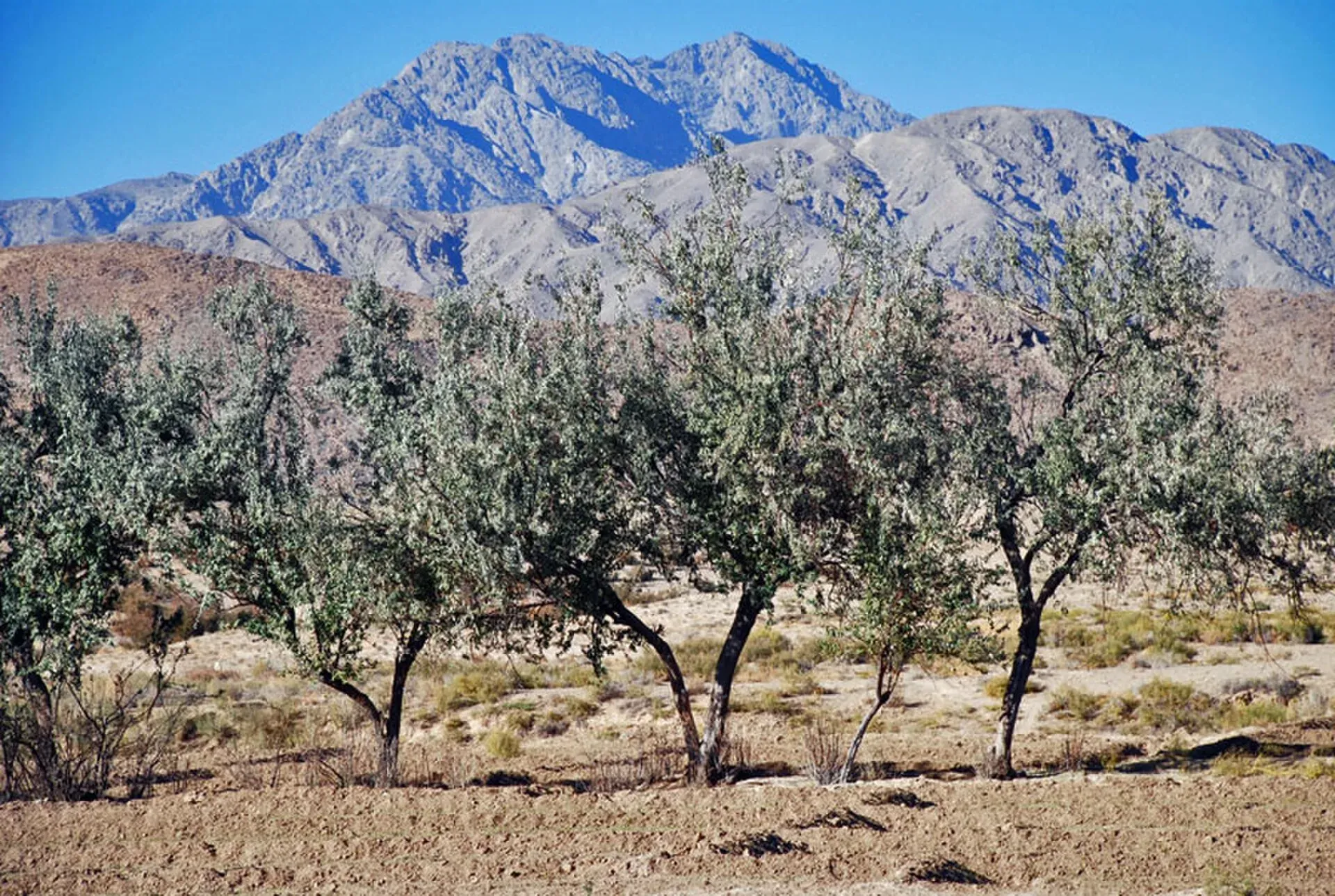
Photo: Maqsoodshah01, with thanks · Public domain (CC0) · via Wikimedia Commons · temporary stand-in photo
Koh-i-Chiltan Trail
- Duration
- 1 day
- Grade
- Strenuous
- Max altitude
- 3,194 m
- Season
- Mar – May, Sep – Nov
A hard day climb of Koh-i-Chiltan (3,194 m) from Hazarganji-Chiltan National Park near Quetta. Security and access rules apply; sources on route and time are thin.
Overview
Koh-i-Chiltan is a peak of 3,194 m in the Chiltan group of the Sulaiman Mountains, in Quetta District, Balochistan (Wikipedia, citing a Balochistan mountaineering club). Other sources give 3,050 m or about 3,200 m, and an INP-WealthPK feature quotes about 10,500 feet (3,200 m), so the height is not settled. Wikipedia ranks it third-highest in the Quetta area, after Zarghun Ghar and Koh-i-Takatu.
The name comes from Chiltan or Chehel-Tan, Persian and Brahui for "forty bodies". A local Balochi tradition, recorded by the traveller Harry de Windt, says the mountain is haunted by the spirits of forty children. Wikipedia calls the mountain steep and rocky. Juniper grows on its higher slopes, while the foothills below carry wild pistachio and ash.
About the national park
The peak rises inside Hazarganji-Chiltan National Park, declared in 1980 and about 20 km from Quetta along the Quetta-Karachi highway. It lies between Chiltan on the west and Hazarganji on the east, and locals call the area Mian Ghundai. Wikipedia gives the area as about 15,555 hectares in its summary box (its text has a different figure). An INP-WealthPK news feature calls it the only national park in an arid, dry temperate region of Pakistan.
The park protects the Chiltan markhor (a wild goat, also called the Sulaiman markhor), which Wikipedia puts at roughly 300 to 400 animals, along with about 800 Chiltan ibex, a few urial on the western slopes, and the Indian wolf, striped hyena and caracal. The feature counts 106 bird species and about 225 plant species. It describes about 30 km of hiking tracks inside the park and at least 10 hideouts that staff use to watch animals. A small museum and two official rest houses are in the park, and the feature says a food point or shop is "direly needed" because thousands of visitors come at weekends.
Who it suits
Fit, experienced hill walkers with a local guide. It is graded strenuous here because the summit is above 3,000 m and the climb starts at about 1,830 m (6,000 ft in the news feature), but this is an estimate: no source gives distance, time or route. Local clubs climb the peak with groups.
When to go
Spring (March to May) and autumn (September to November) are an estimate of the best seasons. No source states them. The feature says temperatures fall by at least 5 degrees Celsius at about 6,500 to 7,000 feet. Summer is hot at low level, and winter is cold with snow on top. Check the forecast.
The route
A destination page encourages visitors to trek in the Chiltan range and says hikers use the park to summit Chiltan peak. There is no verified route, distance, ascent or time, so none is published here. What the sources do describe is the setting. The foothills are savannah with wild pistachio and ash, the upper slopes are almost barren, and Wikipedia calls the mountain steep and rocky. Ask park staff or a Quetta climbing club for a guide.
Wildlife and park rules
The Silk Road destination page says markhor come to feed in the early hours. Hunting was once common but is now prohibited, and the park is a protected area under the Balochistan Wildlife Department. Keep to paths, take your rubbish and do not disturb animals.
Practical information
- Park distance: about 20 km from Quetta.
- Facilities: rest houses, a small museum and a small water source. A day trip from Quetta is suggested.
- Fees and permits: see the permits note. Current fees will be added soon.
- Security: Balochistan has special access rules and travel advice. Check before you go.
Highlights
- Koh-i-Chiltan, 3,194 m, a peak of the Chiltan range
- Hazarganji-Chiltan National Park, declared in 1980
- Juniper on the higher slopes
- Park known for wild goats (markhor)
Day by day
- StartHazarganji-Chiltan National Park (base about 1,830 m)
- Day 1Koh-i-Chiltan summit and back
| Day | Route | Hours | Distance | Ascent / descent | Camp and altitude |
|---|---|---|---|---|---|
| Day 1 | Hazarganji-Chiltan National Park to Koh-i-Chiltan summit and back | not given (long day, our estimate) | not given | not given | not given |
Day 1 notesDrive from Quetta to the national park and start walking from the base at about 1,830 m. Climb through the park towards the summit at 3,194 m, where juniper grows on the higher slopes. No verified route, distance or time exists, so go with a local guide and start at first light. Return by the same way before dark. | |||||
Getting there
The national park is about 20 km from Quetta along the Quetta-Karachi highway and, according to a Silk Road destination page, any vehicle can reach it. Koh-i-Chiltan lies in the Chiltan group of the Sulaiman Mountains. An INP-WealthPK news feature puts the park's base camp at about 6,000 feet (about 1,830 m) and the peak at about 10,500 feet. The park has rest houses and a small water source, and Quetta is the place for all other facilities.
Permits and rules
- Permit needed
- Yes, Restricted zone
- Fee
- Current fees will be added soon
- Last checked
- 16 November 2026
Balochistan has sensitive-area access controls. Foreign visitors generally need a Home Department NOC for Balochistan, and Levies escorts may be required. The park is a wildlife department protected area. No fee was confirmed. Contact the Balochistan Forest and Wildlife Department and the local administration before you go.
How trekking permits, NOCs and registration work: Visa and permits.
Season
Best: Mar – May, Sep – Nov
Water and camps
The park page mentions a small water source and a small one-room government guest house; the INP-WealthPK feature counts two official rest houses in the park and two more at Karakas, near it. Camping is common in the park, but there are no known official camp sites. Carry all your drinking water for the climb.
Gear and safety
Security
For foreign visitors: the UK FCDO advises against all travel to Balochistan Province (advice updated 27 October 2026, checked 16 November 2026). Quetta is within the province. Read the live advice before you plan. Pakistani nationals face fewer barriers than foreigners, and local clubs climb Quetta peaks regularly.
Altitude and weather
The summit is above 3,000 m, so expect cold and wind. Winter brings snow. Start early.
Wildlife and rules
The park is protected from hunting. Do not disturb wild animals. Juniper forest is fragile; keep to paths and take your rubbish.
Navigation
No reliable route description exists. Take a local guide.
Variations
Zarghoon Ghar, near Quetta, is Balochistan's highest peak at 3,578 m, but is not covered by this page.
Tips
- For foreign visitors: the UK FCDO advises against all travel to Balochistan; read the live advice before planning a trip
- Hire a local guide and tell the wildlife department your plan
- Carry plenty of water: only a small water source is mentioned
- Go in spring or autumn, not in mid-summer or deep winter
Stay and eat in Quetta
Quetta is the nearest town to the trek: somewhere to sleep and stock up before and after.
Places to stay
- Serena Hotel, QuettaCall Serena Hotel, QuettaMap of Serena Hotel, Quetta in Google Maps
- METRO HOTELCall METRO HOTELMap of METRO HOTEL in Google Maps
- Jan Luxury HotelCall Jan Luxury HotelMap of Jan Luxury Hotel in Google Maps
- BMC Complex Boys HostelMap of BMC Complex Boys Hostel in Google Maps
- Zamzama HotelCall Zamzama HotelMap of Zamzama Hotel in Google Maps
- Grand Hotel QuettaCall Grand Hotel QuettaMap of Grand Hotel Quetta in Google Maps
Places to eat
- Jaan Broast And BiryaniCall Jaan Broast And BiryaniMap of Jaan Broast And Biryani in Google Maps
- Takatu Nights RestaurantCall Takatu Nights RestaurantMap of Takatu Nights Restaurant in Google Maps
- Usmania RestaurantCall Usmania RestaurantMap of Usmania Restaurant in Google Maps
- Abdali Baba Super MarketCall Abdali Baba Super MarketMap of Abdali Baba Super Market in Google Maps
- Quetta Club LimitedCall Quetta Club LimitedMap of Quetta Club Limited in Google Maps
- Mubarak Food & Restaurant Branch 2 QuettaCall Mubarak Food & Restaurant Branch 2 QuettaMap of Mubarak Food & Restaurant Branch 2 Quetta in Google Maps
Essential services fuel stations and hospitals and clinics
Fuel
- Caltex Petrol PumpCall Caltex Petrol PumpMap of Caltex Petrol Pump in Google Maps
- ShellCall ShellMap of Shell in Google Maps
- Askari Petrol Pump (PSO Pump)Call Askari Petrol Pump (PSO Pump)Map of Askari Petrol Pump (PSO Pump) in Google Maps
- Byco Petrol PumpMap of Byco Petrol Pump in Google Maps
- Sehar CNG & PSO Fuel StationCall Sehar CNG & PSO Fuel StationMap of Sehar CNG & PSO Fuel Station in Google Maps
- ShellCall ShellMap of Shell in Google Maps
Hospitals and clinics
- Saleem Medical ComplexCall Saleem Medical ComplexMap of Saleem Medical Complex in Google Maps
- Aria Institute of Medical Sciences - AIMSCall Aria Institute of Medical Sciences - AIMSMap of Aria Institute of Medical Sciences - AIMS in Google Maps
Listings come from Google Maps data and are unverified: phone numbers, opening months and prices may have changed. Report a problem · Own one of these? Claim it
Health and emergency
Mobile signal is patchy on most treks, so tell someone your plan before you go. Emergency numbers
Sources and last checked
Last checked Confidence low5 sources10 still to check
- Last checked
- Method
- Desk research from published sources
- Confidence
- low
- Checked by
- trek.pk research team
Researched from published sources; not yet checked on the ground by our team. Spot something out of date? Report a mistake.
Sources
- Koh-i-Chiltan · Wikipedia · checked
- Hazarganji-Chiltan National Park · Visit Silk Road · checked
- Hazarganji-Chiltan National Park needs showcasing as tourist hotspot · INP-WealthPK · checked
- Pakistan travel advice · UK FCDO (GOV.UK) · checked
- Hazarganji-Chiltan National Park · Wikipedia · checked
Still to be checked on the ground (10)
- Summit height: 3,194 m (Wikipedia, which cites a 2010 Balochistan mountaineering club page) / 3,050 / about 3,200 m; no survey figure found
- Route, distance, time and height gain (none sourced)
- Permits and escort rules for Pakistani and foreign visitors
- Current security situation: the FCDO advice (updated 27 October 2026) is against all travel to Balochistan Province, now rechecked and stated on the page; local police and Home Department conditions still unconfirmed
- Season (inferred)
- Base altitude of about 1,830 m (earlier research note)
- Park area: Wikipedia gives two different figures (15,555 ha in the summary box; 131,522 ha in the text). The news feature gives about 15,555 ha
- District: Wikipedia places the national park in Mastung District, while the peak page says Quetta District
- Number and condition of rest houses and whether they can be booked
- Whether the 30 km of park hiking tracks include a route to the summit

