

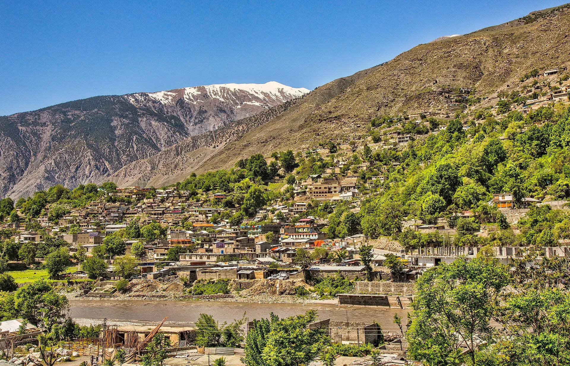
Photo: Shah Tahsin Anwar, with thanks · CC BY-SA 4.0 · via Wikimedia Commons · temporary stand-in photo

Lohigal An
- Duration
- 4 days
- Distance
- 47.5 km
- Grade
- Moderate
- Max altitude
- 4,361 m
- Season
- Jul – Sep
A four-day crossing of a 4,361 m non-glacial pass from Madaklasht to Istor in Lower Chitral, through forest, meadows and herders' huts. Moderate, with one long climb on day 2.
Overview
Lohigal An is a pass of 4,361 m that links the Shishi Gol with the Lohigal Gol, a side valley of the Golen Gol, in Lower Chitral. It is not a glacier pass. The climb from the Madaklasht side is steady and the descent into Lohigal Gol is steep. Herders on the Shishi side also call it Ghuchhar Sar An. In Khowar, ghuchhar means waterfall and sar means head.
The route runs through pine and juniper slopes, summer pastures and flower meadows. Peaks above 6,000 m stand over the pass, among them Ghuchhar Sar (6,249 m). Few trekkers come here, so you will meet herders more often than other groups.
Getting to the start
The road to Madaklasht (about 2,581 m) leaves the Chitral valley at Drosh and is about 40 km long and unpaved, according to Wikipedia. One operator puts the drive from Chitral at about an hour. Madaklasht lies in the far north of the Shishikoh valley in Lower Chitral. It has a government dispensary and an Aga Khan Health Center, and its electricity comes from a local micro hydro plant.
Who it suits
This is a moderate trek of four days with one real climb of about 850 m on day 2. You need to be comfortable at 4,000 m and with long walking days of 4 to 6 hours. There is no glacier or rope work. Route-finding is not hard, but a local guide helps at the Dok An fork and on the steep descent. Operators in Chitral say a licensed guide is a government requirement, so plan to hire one.
When to go
July to mid-September is the safe window. Snow can lie on the pass until early July. Late June departures run, but expect snow patches. The valleys are green in July and August and the herders are in their summer huts. Check the weather before you commit: floods and landslides in Golen in recent years have damaged the roads and paths.
The route
You start at Madaklasht (about 2,580 m) and walk up the Shishi Gol on its right bank, through fields and pasture to the meadow of Deozari. A side trail leads east towards the Andowir Glacier. Do not follow it. The old route over the Andowir An into Dir crosses crevassed ice and is not suitable for trekkers.
From the Gujar settlement of Ruagol Ghari the path climbs to the huts at Ghuchharsar Ghari (3,505 m), where you camp. On day 2 you pass the fork for the Dok An after about an hour and reach Lohigal An an hour later. Then you drop through meadows into the upper Lohigal Gol and camp near the huts of Krui Uts (3,581 m), "red spring".
Day 3 follows the Lohigal Gol down to Chhatar Ghuni (3,000 m), where it meets the Golen Gol. Day 4 follows the Golen Gol to Istor (2,700 m), the last village with a road. From Chhatar Ghuni you can also turn towards the harder Phargam An trek.
Terrain underfoot
Day 1 starts on the right bank of the Shishi Gol, through fields and pasture to the meadow of Deozari (about 10 km, 2 to 3 hours by one operator's figures). Beyond it the path runs through trees to the Gujar huts at Ruagol Ghari, then climbs steeply at times for one to two hours to Ghuchharsar Ghari. Day 2 is grass and scree up to the pass, with an hour of walking to the Dok An fork and a further hour to the crest. One operator describes the pass as non-glaciated but with hard terrain, and calls the north-side descent into the Lohigal Gol difficult and steep. Below it the route drops through flowering meadows for about 6.5 km. Day 3 crosses from one bank of the Lohigal Gol to the other and passes several summer settlements. Day 4 follows the Golen Gol on a trail that narrows towards Istor.
Culture and people
Madaklasht is a Lower Chitral village. Its people speak Madaklashti, a Persian dialect, which makes it unusual in Chitral. Wikipedia says their forebears came to Chitral from Badakhshan in the late 16th century to make firearms for the Mehtar of Chitral, and that most residents are Ismaili Muslims. The settlements on the way, such as Ruagol Ghari, are summer camps of Gujar herders. The valleys have no shops. Buy what you need in Chitral or Drosh. If you stay in a hut area, ask before you camp near the animals, and pay for any milk or help you receive.
Preparing for the trek
Sleeping heights stay modest. Madaklasht is at about 2,580 m, the camps are at 3,505 m, 3,581 m and 3,000 m, and the last night is at about 2,700 m. The only time you go above 4,000 m is the pass crossing on day 2. That makes the trek a reasonable first crossing above 4,000 m, but spend a night or two in Chitral or Madaklasht first if you have come straight from low ground. Carry waterproofs, warm layers and gloves, because snow can lie on the pass into early July. Poles help on the steep, loose descent. One operator schedules a spare day in its 12-day Chitral itinerary for weather and road delays, which is a sensible allowance for anyone planning a tight return flight.
Practical information
- Maps. The US AMS 1:250,000 sheet Churrai (NJ 43-1) covers the route. On some maps the labels for Dok An and Lohigal An look swapped, and Istor appears as Ustur. The older British survey sheets 43 A/1 and 42 D/4 show more detail.
- Permits. Chitral is in Khyber Pakhtunkhwa. See the permit section below. The legacy guide lists this as an open zone with no trekking permit.
- Water. Water is plentiful on both sides of the pass. Streams run beside all four camps.
- Food. Take all food from Chitral. Herders can sell milk and yoghurt in summer.
- Exit. The road continues past Istor to Chhatar Ghuni and Dukadaki, but public vehicles usually go only as far as Istor. Jeeps leave Istor for Chitral in the early morning (about two to three hours). Walking the road to the Chitral-Mastuj road takes four to five hours.
- Safety. Your guide should decide on the Dok An fork. Do not cross the Andowir Glacier.
Highlights
- Non-glacial pass at 4,361 m with a view of Ghuchhar Sar (6,249 m)
- Pine, juniper and flower meadows on both sides
- Summer huts of Gujar herders
- Ends in the Golen valley at Istor
- Links to the harder Phargam An trek
Day by day
| Day | Camp | Altitude |
|---|---|---|
| 1 | Ghuchharsar Ghari | 3,505 m |
| 2 | Krui Uts | 3,581 m |
| 3 | Chhatar Ghuni | 3,000 m |
| 4 | Istor | 2,700 m |
| Day | Route | Hours | Distance | Ascent / descent | Camp and altitude |
|---|---|---|---|---|---|
| Day 1 | Madaklasht to Ghuchharsar Ghari | 4–6 h | 14 km | +905 m | Ghuchharsar Ghari, 3,505 m |
Day 1 notesWalk up the right (north) bank of the Shishi Gol through fields and pasture to Deozari, about 10 km. A side trail to the Andowir Glacier leaves here. Ignore it. Continue through trees to the Gujar huts at Ruagol Ghari, then climb steeply at times for one to two hours to the huts at Ghuchharsar Ghari. Several good camp sites are close by. | |||||
| Day 2 | Ghuchharsar Ghari to Krui Uts over Lohigal An | 4.5–6 h | 11 km | +856 m / −780 m | Krui Uts, 3,581 m |
Day 2 notesFollow the stream's right bank. After an hour the trail to the Dok An splits off to the north. Keep north-east for another hour to Lohigal An (4,361 m), with a view of Ghuchhar Sar (6,249 m). Descend through flowering meadows for about 6.5 km to the huts at Krui Uts. The descent is steep at first. | |||||
| Day 3 | Krui Uts to Chhatar Ghuni | 4–5 h | 13.5 km | −581 m | Chhatar Ghuni, 3,000 m |
Day 3 notesGo north along the left bank of the Lohigal Gol for a short way, then cross to the other bank. Continue down through several summer settlements to the meeting of the Lohigal Gol and Golen Gol at Chhatar Ghuni. Springs and meadows give plenty of choice for camping. Phargam An trekkers join here. | |||||
| Day 4 | Chhatar Ghuni to Istor | 3–4 h | 9 km | −300 m | Istor, 2,700 m |
Day 4 notesWalk down the Golen Gol to Istor, the last village on the valley road. Look for a jeep to Chitral, which usually leaves early in the morning, or walk on towards the main road. | |||||
Getting there
From Chitral, take a van from Ataliq Bazaar to Drosh, then hire a vehicle on the unpaved road of about 40 km to Madaklasht. Chitral to Madaklasht is roughly 40 km and about an hour by direct hire according to one operator. Islamabad to Chitral is a 9 to 10 hour drive by the Swat Motorway, N-45 and the Lowari Tunnel. Check the tunnel's current opening hours with NHA before you travel, as closures and delays have been reported.
At the end, jeeps run from Istor to Chitral, usually in the early morning (two to three hours). You can also hire a vehicle or walk the road for four to five hours towards the main road.
Permits and rules
- Permit needed
- Usually not, Open zone
- Fee
- Current fees will be added soon
- Last checked
- 16 November 2026
Zone. The old guide lists this trek as open, with no trekking permit. Check that before you go.
Foreign visitors. Chitral district is in Khyber Pakhtunkhwa. KP Tourism launched an online NOC system in July 2025 for tourist-visa holders visiting Chitral, Swat, Upper Dir and other northern areas, using an app and website. A report in The Express Tribune on 6 May 2026 says foreigners still need an NOC to visit Chitral. The portal is open to foreign mountaineers and trekkers as well as tourist-visa holders (Daily Times, 14 July 2025). Ask your tour operator or KP Tourism before you go.
Guide. Operators state that a licensed guide is a government requirement.
Pakistani visitors. No permit is reported. Carry your CNIC.
How trekking permits, NOCs and registration work: Visa and permits.
Season
Best: Jul – Sep
Water and camps
Water is easy to find on this trek. The Shishi Gol, the stream above Ghuchharsar Ghari and the Lohigal Gol all run clear. Camps are at Ghuchharsar Ghari (3,505 m), Krui Uts (3,581 m) and Chhatar Ghuni (3,000 m). All are meadows near huts. No facilities exist. Carry a stove and fuel, since wood is scarce above the tree line.
Gear and safety
You cross 4,361 m, so know the signs of altitude sickness and sleep no higher than needed. Snow can lie on the pass in early summer. Bring waterproofs, warm layers and gloves. The descent into Lohigal Gol is steep and loose, so poles help. Do not try the Andowir An: it is a crevassed glacier route. There is no mobile signal in the side valleys, and rescue would depend on herders and a long walk to Istor. Tell the Chitral police or your operator your plan. Floods in the Golen valley have damaged paths and bridges in the past, so ask locally about the lower stages.
For foreign visitors: the UK FCDO advises against all travel on the N-45 from north of the Mardan ring road to the edge of Chitral city, including the Kalash valleys (advice updated 27 October 2026, checked 16 November 2026). Most road routes to Chitral use the N-45. Read the live advice before you plan.
Variations
From Chhatar Ghuni you can link to the Phargam An trek towards Laspur, which is harder and involves higher ground. The Dok An and Roghili An also connect the Shishi and Golen valleys. You can walk the route in reverse, but the climb from Istor is long and steep. See also owir-an for a nearby Chitral pass.
Tips
- Take a local guide for the Dok An fork and the steep descent.
- Do not follow the trail to the Andowir An: it crosses crevassed glacier.
- Start the pass day early. Cloud and showers come in the afternoon.
- Ask in Chitral or Drosh about current road and flood damage in the Golen valley before you go.
- Bring all food from Chitral.
Photos we still need: Lohigal An pass with Ghuchhar Sar in view; Ghuchharsar Ghari huts and the Shishi Gol path. Send us yours
Health and emergency
Mobile signal is patchy on most treks, so tell someone your plan before you go. Emergency numbers
Sources and last checked
Last checked Confidence medium8 sources4 still to check
- Last checked
- Method
- Desk research from published sources
- Confidence
- medium
- Checked by
- trek.pk research team
Researched from published sources; not yet checked on the ground by our team. Spot something out of date? Report a mistake.
Sources
- Legacy trek.pk page (text from Lonely Planet, Trekking in the Karakoram and Hindukush, c. 2002; facts only) · trek.pk / Lonely Planet · checked
- Madaklasht · Wikipedia · checked
- Lohigal An Trek · Apricot Tours · checked
- KP Tourism Department launches online NOC system for foreign tourists · Associated Press of Pakistan · checked
- Senate panel flags hurdles to Chitral tourism (6 May 2026) · The Express Tribune · checked
- NHA flayed for stopping traffic through Lowari Tunnel · Dawn · checked
- Golen Gol Hydropower Project · WAPDA · checked
- KP launches online NOC system for foreign tourists · Daily Times · checked
Still to be checked on the ground (4)
- Current condition of the Madaklasht road and the Golen Gol road to Istor after floods
- Whether Istor still has regular jeeps to Chitral (operators drive it; regular service not confirmed)
- Pass height (4,361 m from the old guide and operator pages; no independent source)
- Daily distances and times (operator pages repeat the old guide; not independently measured)
Nearby and related

Owir An

Ansoo Lake Trail

Bashigram Lake Trail
Lohigal An (Ghuchhar Sar An)
A non-glacial pass of 4,361 m linking Shishi Gol with Lohigal Gol and Golen Gol in Lower Chitral. Crossed on a moderate four-day trek from Madaklasht to Istor.
Dok An
A moderate pass of 4,420 m between Istor in Golen Gol and the upper Shishi Gol in Lower Chitral, usually open from mid-June to September.
Andowir An
A crevassed glacier pass from the upper Shishi Gol over the Andowir Glacier into Dir. Not suitable for trekkers; its height is not stated in our sources.
Phargam An
A demanding pass of 4,975 m between Golen Gol and the Laspur valley in Chitral, passing Buni Zom. Four days from Istor to Harchin. Obscure route, guide essential.
Madaklasht
A high valley village in Lower Chitral at about 2,580 m, about 40 km from Chitral city by an unpaved road, and the start of the Lohigal An trek.