

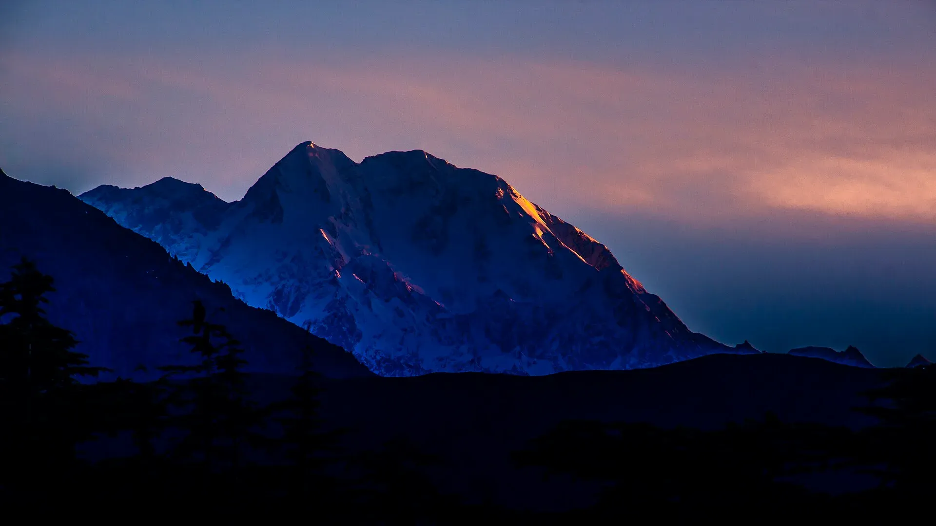
Photo: KaleemUllah550, with thanks · CC BY-SA 4.0 · via Wikimedia Commons · temporary stand-in photo
Owir An
- Duration
- 3 days
- Distance
- 15.7 km
- Grade
- Moderate
- Max altitude
- 4,337 m
- Season
- Jun – Sep
A short moderate crossing of the 4,337 m Owir An, from Shahguch in the Ojhor valley to Mujhen in Owir, with close views of Tirich Mir. Three days, 16 km.
Overview
The Owir An (4,337 m) is a ridge-top pass on the south side of the Tirich Mir massif. It joins the Ojhor valley, south-west of the mountain, to the Owir valley on the south-east. The walk is short, three days by the standard route, and it gives some of the best close views of Tirich Mir (7,708 m) you can get without a glacier trek. From the pass you also see the Buni Zom massif and the Shandur range on the far horizon.
Tirich Mir from the south
Tirich Mir (7,708 m) is the highest mountain of the Hindu Kush and overlooks Chitral town. Its name comes from the Tirich valley and the Khowar word mir, meaning mountain. It was first climbed on 21 July 1950 by Arne Næss, Per Kvernberg, Henry Berg and Tony Streather, who approached by the South Barum glacier and climbed the south ridge. The Owir An walk looks at the same south side from the ridges on both sides of the pass. The usual trekking approach to the mountain is from the other side, up the Tirich valley to Shagrom, the highest permanent settlement, and that route is in a restricted zone.
Who it suits
The trek is moderate. The distance is only about 16 km, but you gain about 1,170 m in the first two days and drop about 1,260 m on the last. Walkers who are fit and have spent a night or two at 3,000 m will manage it. The trail over the pass is not hard to find, so a guide is optional in the old guidebook. Operators now say a licensed guide is a government requirement, so confirm what applies to you. In a snowy year, or early in the season, a snowfield lies on both sides of the pass. Bring an ice axe and crampons if you start before July.
When to go
Mid-June to mid-September. Operator departures start around 20 June to 1 July. Snow is deep and soft before July. August is usually the most settled. Late September brings cold nights.
The route
You can start at Shahguch (3,000 m), a wide grassy area between the villages of Sussoom and Kiyar. Camp here the first night to acclimatise.
Day 1. Walk 15 minutes up the road to Kiyar, then follow a trail past the polo field and up through fields. A dry rocky spur with a cairn stays on your left. In about an hour you reach a saddle with a fine view of Tirich Mir. Contour up the east side of the Ojhor Gol for 45 to 60 minutes to Kiyar High Camp (3,500 m), a level grassy site.
Day 2. Climb to a ridge and turn east up the south side of the valley. You cross a snow patch and climb a gully left of the rocky outcrop. The final climb to the pass is steep and takes one to 1.5 hours. A small black outcrop lies just left of the pass. On the far side the trail stays above the left bank of the stream and reaches a level site with some grass after about an hour. Owir High Camp (4,178 m) lies a further 45 minutes on, near a small pool.
Day 3. Follow an old canal, then cross ridges with good views back to Tirich Mir. The trail drops to the upper hamlet, then through the village to Mujhen (2,927 m).
Alternative finish. From the level site below the pass you can turn up the Barum valley to Gologari (4,200 m), then on to Shahbronz (3,000 m), where you change porters. From Shahbronz the trail runs up the Barum Gol to Shukushal (about 3,800 m), the local name for the Tirich Mir base camp. See tirich-mir-base-camp for the glacier-side base camps. The old guide says the higher Norwegian base camp (about 4,700 m) is two days beyond Shukushal.
Terrain underfoot
- Day 1. Field paths and a track past the polo field, then a dry rocky spur and a saddle. The last section contours across a hillside above small clear streams to a level grass camp.
- Day 2. A ridge, a snow patch where two streams join, a gully beside a rocky bluff and a steep final climb to the pass. On the far side a faint trail follows the left bank of a stream, then a ridge, to a level site and the high camp near a small pool.
- Day 3. An old canal path, then a trail that contours round several ridges and drops through fields and houses to Mujhen.
Before July, snow lies on both sides of the pass. Apricot Tours says the snowfield climbs take about 30 minutes each on the two sides in a heavy snow year. The descent from the pass starts steeply on loose ground.
Getting to the start and away
Shahguch is a wide grassy area between Sussoom (2,896 m) and Kiyar, and Kiyar is a 15-minute walk from it. The old guide gives about two hours by jeep from Chitral. ATP gives 5 to 6 hours from Chitral to Kiyar, which is much longer, so leave room in the schedule for the drive.
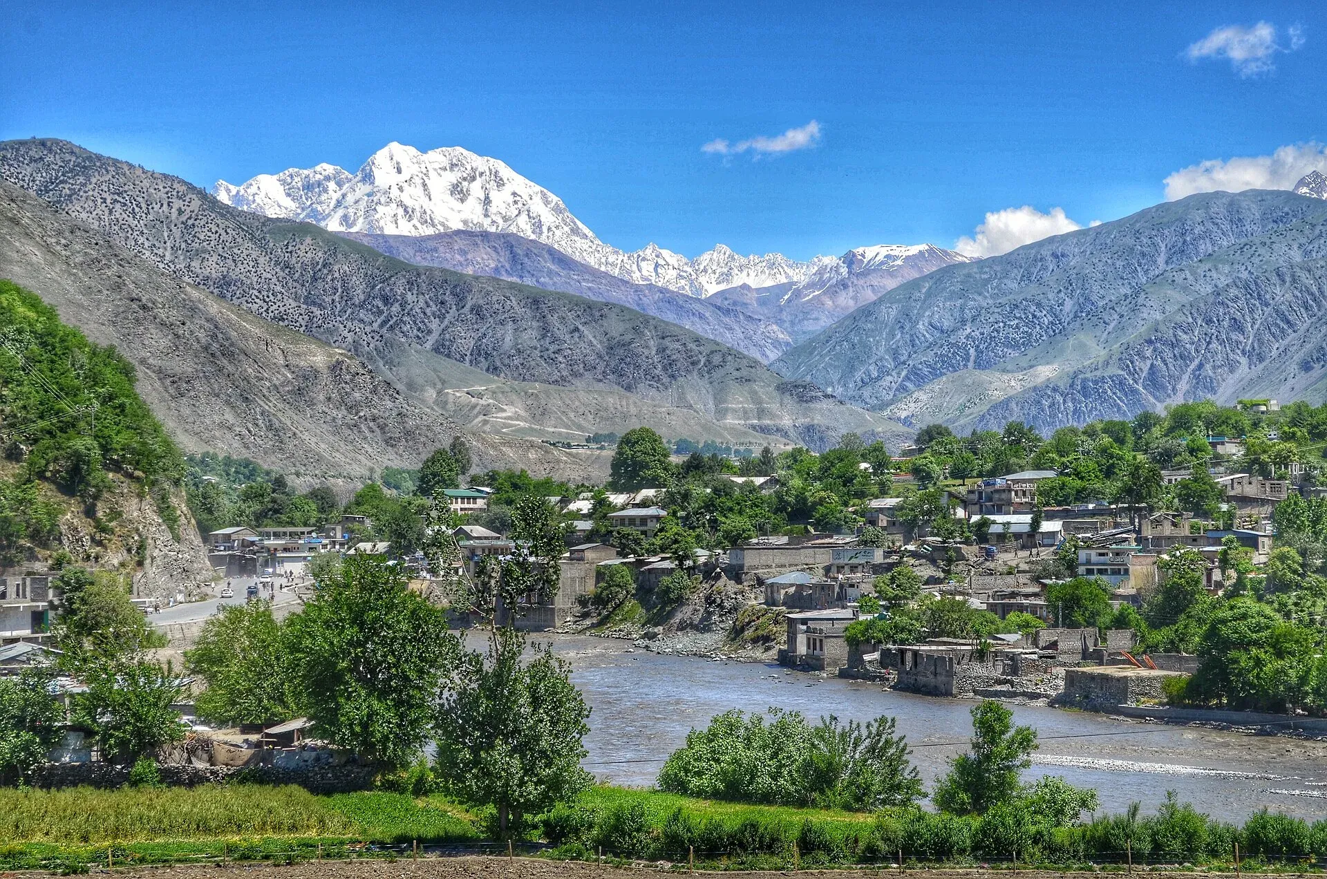
Photo: Emaad Paracha, with thanks · CC BY-SA 4.0 · via Wikimedia Commons · temporary stand-in photo
At the end, jeeps run from Mujhen to Chitral. Apricot Tours also lists a walk of about 3 hours from Mujhen to Parpish, then a drive of 1.5 to 2 hours to Chitral along the Chitral River. The old guide gives the same Parpish link, 4.8 km to Riri and 3.2 km on to Parpish and the bridge to the Chitral-Gilgit road.
Culture and people
The Ojhor valley has Khowar-speaking farming villages. Owir is a separate valley with its own villages, and Mujhen is among the highest. Porters from Ojhor work between Kiyar or Lasht and the first Owir village. Owir porters take over for the Barum side. In 1950 a Norwegian-British team made the first ascent of Tirich Mir, led by Arne Naess. Their story is told in Tirich Mir: The Norwegian Himalaya Expedition.
Practical information
- Maps. US AMS sheets Mastuj (NJ 43-13) at 1:250,000 and Zebak (J-42 X) at 1:253,440. Lasht in Ojhor and Mujhen are not labelled. Riri is spelled Reri.
- Porters. Ojhor porters ask a flat daily rate that includes food. For Tirich Mir Base Camp, hire Owir porters at Shahbronz.
- Permits. The old guide lists the Owir An itself as open. Tirich Mir Base Camp is in a restricted zone. See below.
- Exit. From Mujhen, jeeps run to Chitral. If none is there, walk 4.8 km to Riri and look for one. Beyond Riri you can walk 3.2 km to Parpish and the bridge to the Chitral-Gilgit road.
- Reverse direction. Jeeps to Riri, Mujhen and Shahbronz leave from Chitral's Owir sarai in Naya Bazaar. They use a newer bridge about 3 km north of the Parpish bridge.
Highlights
- Close views of the southern flanks of Tirich Mir (7,708 m)
- Pass at 4,337 m with Buni Zom and the Shandur range in view
- Only 16 km, so a good short trek
- Option to continue up the Barum valley to Shukushal
Day by day
| Day | Camp | Altitude |
|---|---|---|
| 1 | Kiyar High Camp | 3,500 m |
| 2 | Owir High Camp | 4,178 m |
| 3 | Mujhen | 2,927 m |
| Day | Route | Hours | Distance | Ascent / descent | Camp and altitude |
|---|---|---|---|---|---|
| Day 1 | Shahguch to Kiyar High Camp | 2–2.5 h | 4 km | +330 m | Kiyar High Camp, 3,500 m |
Day 1 notesCamp the night before at Shahguch to acclimatise. Walk to Kiyar and follow the trail up through fields, keeping a dry rocky spur with a cairn on your left. Cross a saddle after about an hour for a view of Tirich Mir and the upper Ojhor Gol. Contour up the east side of the valley, over small clear streams, to a sheltered grassy camp with room for many tents. | |||||
| Day 2 | Kiyar High Camp to Owir High Camp | 4–4.5 h | 4.7 km | +837 m / −150 m | Owir High Camp, 4,178 m |
Day 2 notesReach a ridge, turn east and contour to a snow patch where two streams join. Climb the gully left of the rocky bluff, then make a steep climb of one to 1.5 hours to Owir An (4,337 m). Descend beside a small stream, then along a ridge above its left bank, to a level site after about an hour. Continue to the camp near a small pool. | |||||
| Day 3 | Owir High Camp to Mujhen | 2–2.5 h | 7 km | −1,260 m | Mujhen, 2,927 m |
Day 3 notesCross the stream and follow an abandoned canal. The trail contours round several ridges with fine views up to Tirich Mir. You reach a ridge above fields and houses, drop to the upper settlement after an hour, and follow a broad trail through the village to Mujhen. | |||||
Getting there
From Chitral, jeeps leave the Ojhor sarai, behind Hotel Dreamland, for Sussoom and Kiyar (about 30 km). The old guide gave two hours; the first 20 km to Garam Chashma and the bridge at Shoghor is sealed, and the last 10 km is a steep jeep road. One operator now quotes five to six hours from Chitral to the Kiyar trailhead, so allow plenty of time and check locally.
At the end, jeeps run from Mujhen or Shahbronz to Chitral. Islamabad to Chitral takes 9 to 10 hours by the Swat Motorway, N-45 and the Lowari Tunnel. Check NHA for tunnel closures.
Permits and rules
- Permit needed
- Usually not, Open zone
- Fee
- Current fees will be added soon
- Last checked
- 16 November 2026
Zone. The old guide lists this route as open, with no trekking permit. Tirich Mir Base Camp, which you can add as an extension, is in a restricted zone and needs a permit and security clearance (see tirich-mir-base-camp).
Foreign visitors. KP Tourism launched an online NOC system in July 2025 for tourist-visa holders visiting Chitral and other northern areas. The Express Tribune reported on 6 May 2026 that foreigners still need an NOC for Chitral. We have not confirmed if the portal covers this trek. Check with KP Tourism or a licensed operator.
Guide. Operators state a licensed guide is a government requirement.
How trekking permits, NOCs and registration work: Visa and permits.
Season
Best: Jun – Sep
Water and camps
Streams run near every camp. Kiyar High Camp (3,500 m) is a sheltered, level grass site with room for many tents. Owir High Camp (4,178 m) is near a small pool. Shahguch (3,000 m), the starting meadow, has good water. Carry food from Chitral.
Gear and safety
You reach 4,337 m with a steep final climb. Acclimatise at Shahguch and Kiyar before the pass. In heavy snow years, or early in the season, snow lies on both sides, so bring an ice axe and crampons before July. Cloud can hide the pass. The descent from the pass starts steeply on loose ground. Rescue means a long carry and jeep ride to Chitral.
Ask the district administration or local police about current conditions before you go. For foreign visitors: the UK FCDO advises against all travel on the N-45 from north of the Mardan ring road to the edge of Chitral city, including the Kalash valleys (advice updated 27 October 2026, checked 16 November 2026). Most road routes to Chitral use the N-45. Read the live advice before you plan.
Variations
Alternative finish to Shahbronz. From the level site below the pass, follow the trail along the left bank to Gologari (4,200 m), then descend to Shahbronz (3,000 m), about 4 hours and 1,200 m of descent. From there you can go up to Shukushal (about 3,800 m, six hours) or on to the Norwegian base camp. See tirich-mir-base-camp. You can also do the trek in reverse, starting at Mujhen and finishing at Kiyar.
Tips
- Spend your first night at Shahguch (3,000 m) to acclimatise.
- Before July, expect snow on both sides of the pass and carry an ice axe.
- The trail over the pass is easy to lose in cloud. Go with a guide or porters who know it.
- Start early on pass day to finish before afternoon cloud.
- Check current jeep access with your operator, because the roads here have changed.
Stay and eat in Chitral
Chitral is the nearest town to the trek: somewhere to sleep and stock up before and after.
Places to stay
- Tirch Mir View Hotel ChitralCall Tirch Mir View Hotel ChitralMap of Tirch Mir View Hotel Chitral in Google Maps
- Hindukush HeightsCall Hindukush HeightsMap of Hindukush Heights in Google Maps
- Tower Hotel ChitralCall Tower Hotel ChitralMap of Tower Hotel Chitral in Google Maps
- Legendary Hotel ChitralCall Legendary Hotel ChitralMap of Legendary Hotel Chitral in Google Maps
- Hindukush Sarai ChitralCall Hindukush Sarai ChitralMap of Hindukush Sarai Chitral in Google Maps
- BnB Chitral TownCall BnB Chitral TownMap of BnB Chitral Town in Google Maps
Places to eat
- Diwan Hotel & RestaurantCall Diwan Hotel & RestaurantMap of Diwan Hotel & Restaurant in Google Maps
- Kashmir Bakers and Sweet HouseCall Kashmir Bakers and Sweet HouseMap of Kashmir Bakers and Sweet House in Google Maps
- Chitral Guest House and Zowalo RestaurantCall Chitral Guest House and Zowalo RestaurantMap of Chitral Guest House and Zowalo Restaurant in Google Maps
Essential services fuel stations, mechanics, ATMs, pharmacies and hospitals and clinics
Fuel
- PSO Filling StationMap of PSO Filling Station in Google Maps
- PSO oil fill Station Danin ChitralMap of PSO oil fill Station Danin Chitral in Google Maps
- By Pass Petrol PumpCall By Pass Petrol PumpMap of By Pass Petrol Pump in Google Maps
- Rehman Filling Station Bakrabad ChitralMap of Rehman Filling Station Bakrabad Chitral in Google Maps
- Filling Station BakrabadCall Filling Station BakrabadMap of Filling Station Bakrabad in Google Maps
- Chumurkone Petrol PumpMap of Chumurkone Petrol Pump in Google Maps
Mechanics and tyre shops
- Car Repairing Near Al Khidmat FoundationMap of Car Repairing Near Al Khidmat Foundation in Google Maps
ATMs
- Bank AlfalahMap of Bank Alfalah in Google Maps
- NBP AitemaadCall NBP AitemaadMap of NBP Aitemaad in Google Maps
- Summit BankMap of Summit Bank in Google Maps
- Soneri Bank LtdMap of Soneri Bank Ltd in Google Maps
- JS bankMap of JS bank in Google Maps
Pharmacies
- Alim MedicosCall Alim MedicosMap of Alim Medicos in Google Maps
- Alam MedicoseCall Alam MedicoseMap of Alam Medicose in Google Maps
- Miftah Medicose Ataliq BazarMap of Miftah Medicose Ataliq Bazar in Google Maps
- Rastan PharmacyMap of Rastan Pharmacy in Google Maps
Hospitals and clinics
- District Headquarter HospitalMap of District Headquarter Hospital in Google Maps
- CHILDREN HOSPITALMap of CHILDREN HOSPITAL in Google Maps
- Aga Khan Diagnostic Center, ChitralCall Aga Khan Diagnostic Center, ChitralMap of Aga Khan Diagnostic Center, Chitral in Google Maps
- Chitral Scout HospitalCall Chitral Scout HospitalMap of Chitral Scout Hospital in Google Maps
- Dr.Jan, Endovascular Neurosurgeon, Neurovascular SpecialistMap of Dr.Jan, Endovascular Neurosurgeon, Neurovascular Specialist in Google Maps
- Alkhidmat Diagnostic CenterCall Alkhidmat Diagnostic CenterMap of Alkhidmat Diagnostic Center in Google Maps
Listings come from Google Maps data and are unverified: phone numbers, opening months and prices may have changed. Report a problem · Own one of these? Claim it
Photos we still need: Shahguch, Kiyar High Camp, the Owir An pass and Mujhen (no open-licence photo found). Send us yours
Health and emergency
Mobile signal is patchy on most treks, so tell someone your plan before you go. Emergency numbers
Sources and last checked
Last checked Confidence medium8 sources5 still to check
- Last checked
- Method
- Desk research from published sources
- Confidence
- medium
- Checked by
- trek.pk research team
Researched from published sources; not yet checked on the ground by our team. Spot something out of date? Report a mistake.
Sources
- Legacy trek.pk page (text from Lonely Planet, Trekking in the Karakoram and Hindukush, c. 2002; facts only) · trek.pk / Lonely Planet · checked
- Tirich Mir · Wikipedia · checked
- Owir An Trek · Apricot Tours · checked
- Ovir Pass and Tirich Mir Base Camp (ATP-TR-14) · Adventure Tours Pakistan · checked
- KP Tourism Department launches online NOC system for foreign tourists · Associated Press of Pakistan · checked
- Senate panel flags hurdles to Chitral tourism (6 May 2026) · The Express Tribune · checked
- NHA flayed for stopping traffic through Lowari Tunnel · Dawn · checked
- KP launches online NOC system for foreign tourists · Daily Times · checked
Still to be checked on the ground (5)
- Chitral to Kiyar drive time (old guide: 2 hours; ATP: 5 to 6 hours; Apricot gives none, only Chitral to Bumburet about 3 hours and Kiyar 15 minutes on foot from Shahguch)
- Owir High Camp altitude: 4,178 m (old guide, Apricot) vs 4,187 m (ATP); pass 4,337 m (Apricot, ATP) or 4,338 m (ATP overview)
- Daily distances and times from the old guide
- Operator itineraries schedule the pass over two walking days from Kiyar (3 hours to the high camp, 3 hours to the pass); the old guide gives 2 to 2.5 and 4 to 4.5 hours
- Time and route from Mujhen to Parpish (operator: about 3 hours on foot; old guide: 4.8 km to Riri, 3.2 km to Parpish)


