

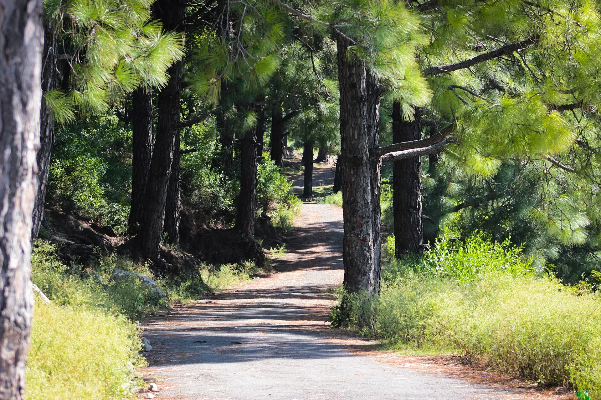
Photo: AhmedKamal92, with thanks · CC BY-SA 3.0 · via Wikimedia Commons · temporary stand-in photo
Margalla Trail 7
- Duration
- 1 day
- Distance
- 5 km
- Grade
- Moderate
- Season
- Oct – Apr
A marked 5 km trail from Siri Saral village (C-12) in Margalla Zone 3, 2 to 2.5 hours, moderate to intense and quiet. Go early and in a group.
Overview
Trail 7 is the only regular trail starting from Zone 3 of Margalla Hills National Park, on the western side near Taxila. It begins at Siri Saral village in Sector C-12. The Express Tribune reported in April 2025 that the route is about 5 km long, fully marked, and takes roughly 120 to 150 minutes. A board at the trailhead shows the distance and end point.
Who it suits
Fit walkers who want a quieter day. The Tribune calls it moderate to intense. It is a good choice if the main trails feel too busy, but it has less help nearby.
When to go
October to April is the comfortable season. A freshwater stream runs within the first 500 m, but only in summer and the monsoon, so in the cool months do not count on it. Start early so you are off the trail well before sunset.
The route
The trail leaves the village and climbs through greenery with views over the hills. It is marked all the way. The Tribune does not name the highest point or the height gained, so none is given here. Landmarks in order, as far as published: the trailhead board about 100 m from Dera Dari, the possible stream within the first 500 m, then the marked climb to the end point.
The park around the trail
Margalla Hills National Park was established in 1980 and covers about 17,386 ha under the Islamabad Wildlife Management Board. The range rises from about 685 m at its western end to 1,604 m at Tilla Charouni in the east. Zone 3, where Trail 7 starts, is on the lower, western side. The rock layers record a seabed that was lifted when India collided with Asia about 40 to 50 million years ago, and fossils such as seashells have been found in the hills.
Wikipedia's park entry gives Shah Allah Dittah as another name for Trail 7 and lists a beginner climbing crag of that name, about 15 m high. Chir pine, olive and phulai are among the native trees. Rhesus macaque monkeys live in the park. Leopard, grey goral and barking deer also live in the park, and kalij pheasant and golden oriole are among its birds.
Snakes and footing
The park is home to venomous snakes, including Russell's viper, the Himalayan pit viper and the saw-scaled viper. Wear closed shoes, watch where you put your hands and feet on rocky ground, and keep to the marked path.
Safety
The Tribune notes that parking is limited and security is lacking. It advises starting early, parking at Dera Dari and hiking in groups because the trail is quiet. Trails 3 and 5 are seen as safer because of wildlife staff and ranger posts. Leopards live in the park, so hike in daylight only.
Culture and people
Siri Saral is a village community. Be polite and keep to the track when you pass houses and fields. The area is near sites linked with Alexander the Great, according to the Tribune.
Practical information
- Time: 120 to 150 minutes (Tribune, 2025).
- Distance: about 5 km.
- Fees: none stated in the source. The IWMB charges for organised activities, with no amounts published. Current fees will be added soon.
Highlights
- The only regular trail starting in Zone 3
- About 5 km, fully marked, with a board at the trailhead
- Greenery and wildlife
- Much quieter than Trails 3 and 5
Day by day
- StartSiri Saral village, Sector C-12 (near Dera Dari restaurant)
- Day 1Siri Saral village (C-12) along the marked trail
| Day | Route | Hours | Distance | Ascent / descent | Camp and altitude |
|---|---|---|---|---|---|
| Day 1 | Siri Saral village (C-12) along the marked trail | 2–2.5 h | 5 km | not given | not given |
Day 1 notesPark at Dera Dari and walk about 100 m to the trailhead board. Follow the marked path uphill, crossing the stream in the first 500 m if it is flowing. Keep to the markers to the end point, then return the same way. Allow the full time and start early. | |||||
Getting there
Trail 7 starts at Siri Saral village in Sector C-12, in Zone 3 of the national park, a few kilometres from Taxila. Parking is limited, so park at Dera Dari restaurant, about 100 m from the trailhead. There is no regular public transport to the trailhead.
Permits and rules
- Permit needed
- Usually not, Open zone
- Fee
- Current fees will be added soon
- Last checked
- 16 November 2026
This trail is inside Margalla Hills National Park. The CDA trails page lists no fee. The Islamabad Wildlife Management Board (IWMB) announced in 2023 that fees apply for organised activities, but no amounts were published in published sources. Current fees will be added soon. Check with CDA (051-9252573) or IWMB before you go.
How trekking permits, NOCs and registration work: Visa and permits.
Season
Best: Oct – Apr
Water and camps
Carry all the water you need. There is no camping in the national park.
Gear and safety
Heat and exertion
The CDA advises one litre of water for every hour of walking in hot weather, sturdy rubber-soled shoes, a hat with a strap, a long-sleeved shirt and sunscreen. In very hot weather walk only in the coolest part of the day. Avoid strenuous trails if you have heart, blood pressure or breathing problems.
Wildlife
Leopards live in the park. In 2021 visitors were warned against Trails 4 and 6 after sunset, and in November 2022 Trail 3 was closed briefly after leopard sightings at Saidpur. Hike in daylight, stay in a group, keep to marked tracks and do not feed monkeys.
Getting help
If you are ill or hurt, stay where you are and ask someone to get help. A July 2026 report mentions missing signs and no first-aid points on busy trails, so carry your own basics and a charged phone.
Variations
Trail 7 is separate from the Trails 1 to 6 group on the Islamabad side.
Tips
- Start early and hike in a group
- Park at Dera Dari, about 100 m from the start
- Expect fewer rangers than on Trails 3 and 5
- Carry all the water you need
Stay and eat in Islamabad
Islamabad is the nearest town to the trek: somewhere to sleep and stock up before and after.
Places to stay
- Serena HotelCall Serena HotelMap of Serena Hotel in Google Maps
- Islamabad Marriott HotelCall Islamabad Marriott HotelMap of Islamabad Marriott Hotel in Google Maps
- Mabali IslandCall Mabali IslandMap of Mabali Island in Google Maps
- Ramada by Wyndham IslamabadCall Ramada by Wyndham IslamabadMap of Ramada by Wyndham Islamabad in Google Maps
- Avari Xpress Residences Islamabad HotelCall Avari Xpress Residences Islamabad HotelMap of Avari Xpress Residences Islamabad Hotel in Google Maps
- Movenpick Hotel CentaurusCall Movenpick Hotel CentaurusMap of Movenpick Hotel Centaurus in Google Maps
Places to eat
- The Monal IslamabadCall The Monal IslamabadMap of The Monal Islamabad in Google Maps
- Tehzeeb Bakers Blue AreaCall Tehzeeb Bakers Blue AreaMap of Tehzeeb Bakers Blue Area in Google Maps
- TKR 3Call TKR 3Map of TKR 3 in Google Maps
- Savour FoodsCall Savour FoodsMap of Savour Foods in Google Maps
- Cheezious Commercial MarketCall Cheezious Commercial MarketMap of Cheezious Commercial Market in Google Maps
- Savour FoodsCall Savour FoodsMap of Savour Foods in Google Maps
Essential services mechanics and pharmacies
Mechanics and tyre shops
- Mohammed Bilal tyre centreMap of Mohammed Bilal tyre centre in Google Maps
Pharmacies
- Imtiaz Mega - Ramzan Mall - islamabadCall Imtiaz Mega - Ramzan Mall - islamabadMap of Imtiaz Mega - Ramzan Mall - islamabad in Google Maps
Listings come from Google Maps data and are unverified: phone numbers, opening months and prices may have changed. Report a problem · Own one of these? Claim it
Photos we still need: Trail 7 trailhead board and the marked path above Siri Saral (the current photo shows a Margalla trail in general); the stream near the start, when it is flowing. Send us yours
Health and emergency
Mobile signal is patchy on most treks, so tell someone your plan before you go. Emergency numbers
Sources and last checked
Last checked Confidence medium7 sources3 still to check
- Last checked
- Method
- Desk research from published sources
- Confidence
- medium
- Checked by
- trek.pk research team
Researched from published sources; not yet checked on the ground by our team. Spot something out of date? Report a mistake.
Sources
- Margalla Trail 7 becomes hikers haven (Apr 2025) · The Express Tribune · checked
- Adventure: Margalla Hills trails · Capital Development Authority (CDA) · checked
- Hiking and trekking tours in Islamabad's Margalla Hills are no longer free (27 Nov 2023) · ProPakistani · checked
- Tourist rush threatens Margallas (July 2026) · The Express Tribune · checked
- People warned against going to Trails 4 and 6 after sunset due to leopard fears (2021) · Geo News · checked
- Margalla Hills: fees for Trail 5 and 6 activities · Dawn · checked
- Margalla Hills National Park (area, elevation, geology, wildlife, trails) · Wikipedia · checked
Still to be checked on the ground (3)
- End point and altitude (not stated by the Express Tribune; the CDA trails page lists only Trails 1 to 6; a search snippet from The News mentions Kainthla village on the Shah Allah Ditta road as the end, but that page returned 403 and was not read)
- Whether the stream flows in your season
- Current fees and security situation (Dawn, 29 Nov 2023, reports fees only for organised group activities on Trails 5 and 6; nothing found for Trail 7)


