

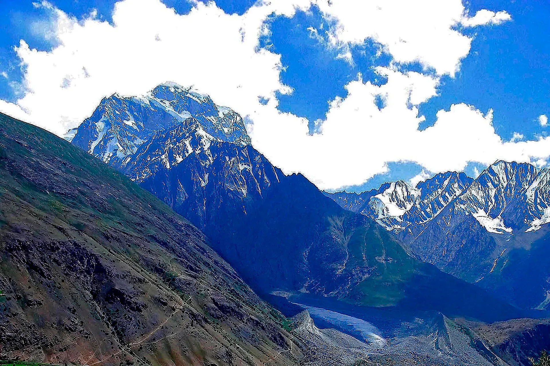
Photo: Pervez Ahmad Khan, with thanks · CC BY-SA 3.0 · via Wikimedia Commons · temporary stand-in photo
Shah Jinali An
- Duration
- 4 days
- Distance
- 39 km
- Grade
- Moderate
- Max altitude
- 4,140 m
- Season
- Jun – Sep
A four-day Hindu Raj crossing from Rua to Yashkist over the 'king's polo ground' pass, close to the Afghan border. Long but not technical.
Overview
Shah Jinali An crosses the Hindu Raj between the Rich Gol and the upper Yarkhun valley in Upper Chitral. The name means "king's polo ground" in Khowar. It comes from the long, level meadows west of the pass, which are wide and flat enough to play polo on. The route is about 39 km and takes four days from Rua to Yashkist.
The trek runs less than 8 km from the Afghan border and the Wakhan Corridor. You will see few other trekkers. Most walkers who do it join it to a longer crossing along Pakistan's northern edge, such as Thui An, Broghil, or Chilinji An.
The Hindu Raj and the Yarkhun valley
The Hindu Raj is the range between the Hindu Kush and the Karakoram, running between Chitral and Gilgit. Wikipedia names Koyo Zom (about 6,872 m) as its highest peak and lists Thui I (6,662 m) and Gul Lasht Zom (6,657 m) among the others. Most summits stand between 5,000 and 6,000 m. The Yarkhun River drains this country and flows on past Mastuj towards Chitral town. On the pass day, an operator lists the Afghan border range and Qala-i-Ust (6,317 m) among the sights.
Who it suits
The pass is fairly low for the Hindu Raj, and the paths are clear. Operators describe it as easy but long, and we grade it moderate. You need to be fit enough for a steep, loose-scree day from Rua to Dershal (about 16 km) and for a knee-testing 1,140 m descent on the last day. You do not need glacier skills. Hire a local guide or porter anyway, because the area is near the border and footbridges can be washed out.
When to go
The pass is normally walkable from mid-June to mid-September. Snow lingers on the upper stages into June. By late September the herders leave the high pastures and nights are cold. Midsummer afternoons in the Yarkhun valley floor at the end can be very hot.
The route
You start at Rua (2,820 m), the highest village of the Rich Gol. The first day follows the river, then turns east into the Shah Jinali Gol. A boulder crossing and a short scree climb lead to a limestone and marble valley, then to Dershal (3,300 m) with shaded camp sites among birch and juniper.
On day two you climb gently to Shah Ghari (3,690 m), an old Gujar camp with stone shelters. If you are already acclimatised, you can push on to the high camp. Day three crosses the pass area, over 3 km of meadow with long views. The pass itself, marked by a cairn, is about three hours from Shah Ghari. You then descend to Ishperu Dok high camp (3,990 m).
Day four drops through a canyon of footbridges to the Siru Gol, then climbs over a ridge shoulder and down through Yashkist (2,850 m) to the Yarkhun valley floor. Going east to west, you can split Lasht to Siru Gol into two stages by sleeping at Shusht or Yashkist.
What the ground is like
- Day 1: a riverside path in the Rich Gol, one footbridge, then a boulder crossing and loose scree up into the Shah Jinali Gol. A limestone and marble valley with level terraces follows, then birch and juniper.
- Day 2: a gentle climb along the east bank, past birch-lined side streams, with the silty glacial outwash stream near Shah Ghari.
- Day 3: a steeper start, then over 3 km of open, rolling meadow. The pass itself is marked by a cairn.
- Day 4: a steep descent past herders' huts, a canyon with three footbridges, a short climb over a ridge shoulder and a descent through Yashkist to the hot valley floor.
Preparing for the crossing
The highest camps are about 4,000 m, so allow time to acclimatise in Chitral or Mastuj before you start. Day 2 is short for that reason. One operator warns of extreme heat on sunny days with no shade, and of nights below freezing above 4,000 m, with snow possible. Carry sun protection and warm layers. The same operator requires insurance that covers helicopter evacuation, with a minimum of US$30,000 on its own trips. Carry food and a stove for all four days, and check the footbridges with your guide before you leave Rua.
Culture and people
The upper Yarkhun is home to Khowar-speaking farming and herding families. Villages such as Shusht, Yakhdan and Yashkist bring their livestock up to Ishperu Dok in summer. Porters here often agree a flat price per stage that includes their own food, so settle this before you leave.
Practical information
Jeeps run from Chitral to Rua in about eight hours, and you can also hire one privately. Since the Lowari Tunnel opened in 2017 you can also reach Chitral by road from Dir all year round, so check the road status before you plan. At the end, walk 15 minutes upvalley to the new bridge below Shusht and flag a ride to Lasht and Mastuj. Take food and a stove: there are no shops on the route. Maps: the US AMS 1:250,000 sheet Mastuj (NJ 43-13) covers it. Locals call the pass Jinali Ghari.
Highlights
- Long, flat alpine meadows west of the pass
- Passes within 8 km of the Wakhan Corridor
- Can be joined with Thui An, Broghil or Chilinji
- Birch and juniper valley with limestone and marble walls
Day by day
| Day | Camp | Altitude |
|---|---|---|
| 1 | Dershal | 3,300 m |
| 2 | Shah Ghari | 3,690 m |
| 3 | Ishperu Dok high camp | 3,990 m |
| 4 | Yashkist | 2,850 m |
| Day | Route | Hours | Distance | Ascent / descent | Camp and altitude |
|---|---|---|---|---|---|
| Day 1 | Rua to Dershal | 6–7 h | 16 km | +480 m | Dershal, 3,300 m |
Day 1 notesWalk up the Rich Gol from Rua (2,820 m), crossing a footbridge to the east bank after about an hour. Moghlang (2,926 m) is a possible early camp. Turn east into the Shah Jinali Gol, cross a boulder bridge and climb loose scree to level terraces. Pass through birch and juniper to a footbridge and the shaded camps at Dershal. | |||||
| Day 2 | Dershal to Shah Ghari | 2–2.5 h | 6.2 km | +390 m | Shah Ghari, 3,690 m |
Day 2 notesFollow the east bank past birch-lined side streams. Cross the stream from the pass above its junction with the glacier outwash. Shah Ghari is an old Gujar camp with stone shelters and a livestock pen. A short day, which helps acclimatisation. If the Dershal footbridge is out, use the north bank and a snow bridge higher up. | |||||
| Day 3 | Shah Ghari to Ishperu Dok high camp | 4–5 h | 7.1 km | +450 m / −150 m | Ishperu Dok high camp, 3,990 m |
Day 3 notesClimb the stream's west bank for 1 to 1.5 hours to the start of the pass area, a meadow over 3 km long. The cairn at Shah Jinali An (4,140 m) is about three hours from Shah Ghari. The level ground just west is the 'polo field'. Descend gently, bearing left, to a grassy camp one hour below the pass. | |||||
| Day 4 | Ishperu Dok high camp to Yashkist | 4 h | 9.7 km | −1,140 m | Yashkist, 2,850 m |
Day 4 notesPass the herders' huts of Ishperu Dok, then drop through a canyon and over three footbridges to the Siru Gol confluence. Cross a fourth bridge and walk about 250 m downstream to a possible camp (3,120 m). Climb over a ridge shoulder, then descend through Yashkist (2,850 m) to the hot Yarkhun valley floor and the old polo field. | |||||
Getting there
Chitral to Rua takes about eight hours by jeep. Ask at the Mastuj jeep stand near Ataliq Bridge or hire a vehicle privately. From the finish at Yashkist, walk 15 minutes to the bridge below Shusht, then take a jeep to Lasht and on to Mastuj. Mastuj to Chitral takes several hours more.
Permits and rules
- Permit needed
- Yes, Restricted zone
- Fee
- Current fees will be added soon
- Last checked
- 16 November 2026
Treated as a restricted area because the route runs within about 8 km of the Afghan border. The old guide said no trek permit was needed, but visits are authorised by the Deputy Commissioner in Chitral. Foreign visitors need a No Objection Certificate (NOC) for Chitral district. A Senate committee briefing reported on 6 May 2026 that the requirement is still in force, and KP Tourism launched an online NOC system in July 2025 that registered tour operators use. Rules have been relaxed and reinstated before, so confirm the current position with a Chitral tour operator, KP Tourism or the Deputy Commissioner's office in Chitral before you travel (checked 16 November 2026). Pakistani citizens do not need a trek permit, but carry your CNIC. Check the zone status for this route with the DC office before you go.
How trekking permits, NOCs and registration work: Visa and permits.
Season
Best: Jun – Sep
Water and camps
Water is plentiful on days 1 and 2. Dershal and Shah Ghari have clear streams, and the pass area has many camp sites. The glacial outwash stream is silty. Day 4 has springs near the footbridges. Camp at the Siru Gol (3,120 m) if you are walking east to west rather than trying to reach Ishperu Dok from Lasht in one go. At Yashkist you can camp near an old polo field with a shallow pool.
Gear and safety
The highest camps are about 4,000 m, so acclimatise and watch for altitude sickness. Footbridges can wash out in high water; carry a rope or plan a camp on the other bank. Weather turns quickly on the pass. The route is within about 8 km of the Afghan border: carry your passport or CNIC, keep to the usual route, and expect checks. Rescue is slow in this area. Nearest medical care is in Mastuj or Chitral.
Ask the district administration or local police about current conditions before you go. For foreign visitors: the UK FCDO advises against all travel on the N-45 from north of the Mardan ring road to the edge of Chitral city, including the Kalash valleys (advice updated 27 October 2026, checked 16 November 2026). Most road routes to Chitral use the N-45. Read the live advice before you plan.
Variations
Shah Jinali An is often joined to other treks. West to east, you can precede it with the Broghil and Karambar An trek and the Chilinji An and Qalander Uween trek for a three-pass walk along the northern border. You can also follow it with the Thui An crossing from Yasin. More Hindu Raj options, including Nizhdaru An and the Hindu Raj Crest, are in Other treks in Chitral.
Tips
- Spend a night at Dershal before climbing to the pass.
- Footbridges are sometimes washed out. Ask locals about the Dershal bridge.
- Agree one flat price per stage with porters, including their food.
- Carry water on the climb out of the Siru Gol; it is dry in places.
Stay and eat in Mastuj
Mastuj is the nearest town to the trek: somewhere to sleep and stock up before and after.
Places to stay
- Hot Spring Guest HouseCall Hot Spring Guest HouseMap of Hot Spring Guest House in Google Maps
- Noor Mahal GuesthouseCall Noor Mahal GuesthouseMap of Noor Mahal Guesthouse in Google Maps
- Mastuj Hindukash HeightsMap of Mastuj Hindukash Heights in Google Maps
- PTDC Motel -MastujCall PTDC Motel -MastujMap of PTDC Motel -Mastuj in Google Maps
- Al Salah Hotel & Restaurant MastujCall Al Salah Hotel & Restaurant MastujMap of Al Salah Hotel & Restaurant Mastuj in Google Maps
Listings come from Google Maps data and are unverified: phone numbers, opening months and prices may have changed. Report a problem · Own one of these? Claim it
Photos we still need: the Shah Jinali pass meadow, Shah Ghari or Ishperu Dok (no suitable open-licence photo found). Send us yours
Health and emergency
Mobile signal is patchy on most treks, so tell someone your plan before you go. Emergency numbers
Sources and last checked
Last checked Confidence medium10 sources5 still to check
- Last checked
- Method
- Desk research from published sources
- Confidence
- medium
- Checked by
- trek.pk research team
Researched from published sources; not yet checked on the ground by our team. Spot something out of date? Report a mistake.
Sources
- Trekking in the Karakoram and Hindukush (Lonely Planet, c. 2002), Chitral chapter · Lonely Planet · checked
- Lesser-known treks of Chitral and the Hindu Raj edge (research notes) · trek.pk research, 2026-11-15 · checked
- Shah Jinali Trek · Hunza Guides Pakistan · checked
- Shah Jinali / Thui An trek · ATP Pakistan · checked
- Senate panel flags hurdles to Chitral tourism (6 May 2026) · The Express Tribune · checked
- KP launches online NOC system for foreign tourists (July 2025) · Daily Times / APP · checked
- Lowari Tunnel · Wikipedia · checked
- List of Restricted/Prohibited/Border Areas in Pakistan (14 Jan 2026; operator page, supporting only) · Apricot Tours · checked
- Hindu Raj · Wikipedia · checked
- Yarkhun River · Wikipedia · checked
Still to be checked on the ground (5)
- Pass height: 4,140 m (ATP day text, used on this page) vs 4,259 m (ATP overview and other operators); a 1967 Himalayan Club report gives about 4,200 m (snippet only, not opened)
- Whether the Rich Gol road still ends at Rua: ATP gives about 8 hours by jeep from Chitral to Rua (2,820 m), matching this page; current road state unknown
- Current zone status and whether a Deputy Commissioner permit applies on this border-adjacent route (Express Tribune, 6 May 2026, and Daily Times, 14 Jul 2025, confirm a KP NOC for Chitral; an operator list dated 14 Jan 2026 treats Shah Jinali as a restricted trek)
- Condition of the footbridge at Dershal and in the Siru Gol canyon
- Hunza Guides page for this trek returned HTTP 403 and was not read; ATP lists the pass at 4,140 to 4,259 m in different sections


