

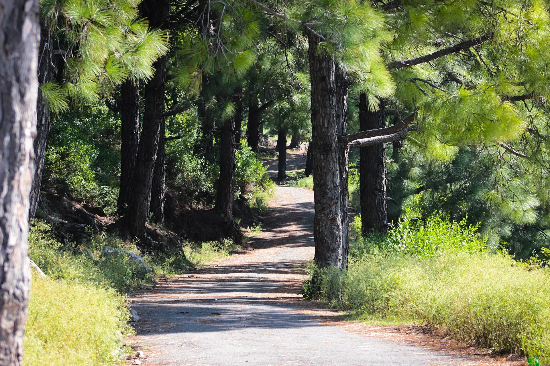
Photo: AhmedKamal92, with thanks · CC BY-SA 3.0 · via Wikimedia Commons · temporary stand-in photo
Tilla Charouni Trail
- Duration
- 1 day
- Grade
- Strenuous
- Max altitude
- 1,604 m
- Season
- Oct – Apr
The hike to Tilla Charouni, the highest point of the Margalla Hills at 1,604 m, by the Dino Valley ramp or Shahdara and Shumbar waterfall. One write-up gives about 3 hours.
Overview
Tilla Charouni is the highest point of the Margalla Hills. Wikipedia gives its height as 1,604 m (5,262 ft); one GPS reading gives 1,597 m, so the figure is about 1,600 m. The summit lies at the northern edge of Margalla Hills National Park, where Islamabad Capital Territory meets Haripur district in Khyber Pakhtunkhwa. A boundary stone marks the line on the top.
The hill is part of a limestone range. Wikipedia describes subtropical pine forest on the cooler upper slopes, with chir pine (Pinus roxburghii) and oak, and broadleaf trees lower down. This hike is longer and more remote than the numbered city trails.
Who it suits
Strong, fit walkers with some hill experience. Write-ups call it moderate to strenuous. One blog rates the ground as steep, uneven and rocky, and not suitable for beginners without an experienced guide. It is not a good first Margalla walk. Choose Trail 1, 2 or 3 first.
When to go
October to April is the comfortable season. Summer is hot. Avoid the monsoon, when slopes are slippery. Pick a dry day with a stable forecast and good visibility, and plan to finish in daylight.
Getting to the start
Two approaches are described.
- Dino Valley. Pakistan Traveler says the trail begins at Dino Valley. How2HaveFun describes starting from the Pir Sohawa side near the Dino Valley area, then following an uphill dirt track towards the ridge. The author asks readers to park only in an authorised place and not to drive onto unpaved tracks to shorten the climb.
- Shahdara and Shumbar waterfall. A GPS listing describes a route that starts at Shahdara and passes the Shumbar waterfall. This is the longer way in.
We have not confirmed the access roads, parking or current rules for either start. Ask CDA (the Capital Development Authority) or the IWMB (Islamabad Wildlife Management Board), or a local guide, before you go.
The route
From Dino Valley the path climbs a dirt track to the ridge, then steepens to the upper ridge and the summit. The upper section is poorly marked. Smaller tracks branch off, thorny undergrowth narrows the path in places, and it is easy to lose the line.
Times vary widely. Two blogs give about 1 to 1.5 hours for the climb from Dino Valley. A single write-up gives about 3 hours in total, and other hikers are reported to need two to three hours or more for the ascent alone. Allow for the slowest figure if you are not used to steep ground. Published GPS tracks differ in length, so no distance or height gain is given here. Use a local guide or a recorded GPS track and do not rely on this page for navigation.
The summit
The summit is covered in dense pine. Communication towers and installations stand on it. They are operational and restricted: stay outside fenced areas, do not approach the equipment and follow any security instructions. From the ridge, one blog reports views over the surrounding ridges, Islamabad and the Khanpur side of the range.
Weather and lightning
Lightning is a real risk on this exposed top. One hiker reports a bolt striking near the summit, with charred trees nearby as evidence. If you hear thunder, leave the ridge, the towers and isolated trees, and shelter in a solid building or a fully enclosed vehicle. After rain, mud, pine needles and wet rock are slippery. The same blog reports several falls.
Culture and people
The trail is far from the main tourist areas, so you may meet only a few villagers and herders. Be polite, ask before crossing private land and take your rubbish with you.
Practical information
- Water: none reliably on the route. One blog advises at least two litres per person, plus food.
- Kit: a charged phone with an offline map, a power bank, a headlamp, a first-aid kit and sturdy footwear.
- Camping: not allowed in the national park.
- Fees: IWMB charges fees for organised activities; amounts are not published. Current fees will be added soon.
- Wildlife: leopards live in the park. Do not hike alone or after dark. The area is remote, so tell someone your plan.
Highlights
- Highest point of the Margalla Hills, 1,604 m
- Remote and quiet compared with Pir Sohawa trails
- Two possible starts: Dino Valley or Shumbar waterfall
- About 3 hours in total (one write-up); two blogs give 1 to 1.5 hours for the climb from Dino Valley
Day by day
- StartDino Valley vehicle ramp (alternative: Shahdara / Shumbar waterfall)
- Day 1Tilla Charouni and back
| Day | Route | Hours | Distance | Ascent / descent | Camp and altitude |
|---|---|---|---|---|---|
| Day 1 | Dino Valley ramp (or Shumbar waterfall) to Tilla Charouni and back | about 3 h in total (one write-up) | not given | not given | not given |
Day 1 notesStart from the Dino Valley vehicle ramp on the Pir Sohawa side, or from Shahdara past the Shumbar waterfall. Follow the dirt track up to the ridge, then climb steeply to the summit at about 1,604 m, where towers and a boundary stone stand among pines. The upper path is poorly marked and thorny in places. There is no verified distance or height gain, so take a guide or GPS track, carry water and turn back if the weather or light changes. Return the same way. | |||||
Getting there
Two approaches are described: from the Dino Valley vehicle ramp on the Pir Sohawa side, or from Shahdara past the Shumbar waterfall. The peak is on the Islamabad and Haripur border in the north of the park. One blog advises parking only in an authorised place and not driving onto unpaved tracks. We have not confirmed the access roads, parking or current rules for either start. Ask CDA or the IWMB, or a local guide, before you go.
Permits and rules
- Permit needed
- Usually not, Open zone
- Fee
- Current fees will be added soon
- Last checked
- 16 November 2026
This trail is inside Margalla Hills National Park. The CDA trails page lists no fee. The Islamabad Wildlife Management Board (IWMB) announced in 2023 that fees apply for organised activities, but no amounts were published in published sources. Current fees will be added soon. Check with CDA (051-9252573) or IWMB before you go.
How trekking permits, NOCs and registration work: Visa and permits.
Season
Best: Oct – Apr
Water and camps
Carry all the water you need: one blog advises at least two litres per person, plus food. There is no camping in the national park.
Gear and safety
Heat and exertion
The CDA advises one litre of water for every hour of walking in hot weather, sturdy rubber-soled shoes, a hat with a strap, a long-sleeved shirt and sunscreen. In very hot weather walk only in the coolest part of the day. Avoid strenuous trails if you have heart, blood pressure or breathing problems.
Lightning and wet ground
The summit is exposed and carries communication towers. One hiker reports lightning striking near the top. Turn back if thunder is forecast or heard. After rain, mud, pine needles and wet rock are slippery.
Wildlife
Leopards live in the park. In 2021 visitors were warned against Trails 4 and 6 after sunset, and in November 2022 Trail 3 was closed briefly after leopard sightings at Saidpur. Hike in daylight, stay in a group, keep to marked tracks and do not feed monkeys.
Getting help
If you are ill or hurt, stay where you are and ask someone to get help. A July 2026 report mentions missing signs and no first-aid points on busy trails, so carry your own basics and a charged phone.
Variations
Trails 1, 3 and 5 reach Pir Sohawa Road, a different part of the hills.
Tips
- Carry plenty of water: the route is remote
- Go with an experienced local or a group
- Start at first light so you are down before dark
- Check access and fees with CDA or IWMB first
- The summit has restricted communication installations: stay outside fenced areas and follow security instructions
Stay and eat in Islamabad
Islamabad is the nearest town to the trek: somewhere to sleep and stock up before and after.
Places to stay
- Serena HotelCall Serena HotelMap of Serena Hotel in Google Maps
- Islamabad Marriott HotelCall Islamabad Marriott HotelMap of Islamabad Marriott Hotel in Google Maps
- Mabali IslandCall Mabali IslandMap of Mabali Island in Google Maps
- Ramada by Wyndham IslamabadCall Ramada by Wyndham IslamabadMap of Ramada by Wyndham Islamabad in Google Maps
- Avari Xpress Residences Islamabad HotelCall Avari Xpress Residences Islamabad HotelMap of Avari Xpress Residences Islamabad Hotel in Google Maps
- Movenpick Hotel CentaurusCall Movenpick Hotel CentaurusMap of Movenpick Hotel Centaurus in Google Maps
Places to eat
- The Monal IslamabadCall The Monal IslamabadMap of The Monal Islamabad in Google Maps
- Tehzeeb Bakers Blue AreaCall Tehzeeb Bakers Blue AreaMap of Tehzeeb Bakers Blue Area in Google Maps
- TKR 3Call TKR 3Map of TKR 3 in Google Maps
- Savour FoodsCall Savour FoodsMap of Savour Foods in Google Maps
- Cheezious Commercial MarketCall Cheezious Commercial MarketMap of Cheezious Commercial Market in Google Maps
- Savour FoodsCall Savour FoodsMap of Savour Foods in Google Maps
Essential services mechanics and pharmacies
Mechanics and tyre shops
- Mohammed Bilal tyre centreMap of Mohammed Bilal tyre centre in Google Maps
Pharmacies
- Imtiaz Mega - Ramzan Mall - islamabadCall Imtiaz Mega - Ramzan Mall - islamabadMap of Imtiaz Mega - Ramzan Mall - islamabad in Google Maps
Listings come from Google Maps data and are unverified: phone numbers, opening months and prices may have changed. Report a problem · Own one of these? Claim it
Photos we still need: the trail between Dino Valley and the ridge, and the Shumbar waterfall. Send us yours
Health and emergency
Mobile signal is patchy on most treks, so tell someone your plan before you go. Emergency numbers
Sources and last checked
Last checked Confidence low8 sources4 still to check
- Last checked
- Method
- Desk research from published sources
- Confidence
- low
- Checked by
- trek.pk research team
Researched from published sources; not yet checked on the ground by our team. Spot something out of date? Report a mistake.
Sources
- Margalla Hills · Wikipedia · checked
- Tilla Charouni, highest point in Margalla Hills (GPS track) · Wikiloc · checked
- Hiking and trekking tours in Islamabad's Margalla Hills are no longer free (27 Nov 2023) · ProPakistani · checked
- People warned against going to Trails 4 and 6 after sunset due to leopard fears (2021) · Geo News · checked
- Tilla Charouni · Pakistan Traveler · checked
- Tilla Charouni hike · How2HaveFun (2021) · checked
- Tilla Charouni · Simple English Wikipedia · checked
- Trekking trails among most amazing landscapes of Islamabad · The Express Tribune · checked
Still to be checked on the ground (4)
- Distance and height gain (user GPS tracks vary from about 14 to 23 km; none opened)
- Time (1 to 1.5 hours steep from Dino Valley per two blogs; about 3 hours elsewhere)
- Exact trailheads and road access (Dino Valley / Pir Sohawa side per How2HaveFun; may have changed)
- Whether the route needs a permit or guide (IWMB permits for organised activities only; no official fee)


