

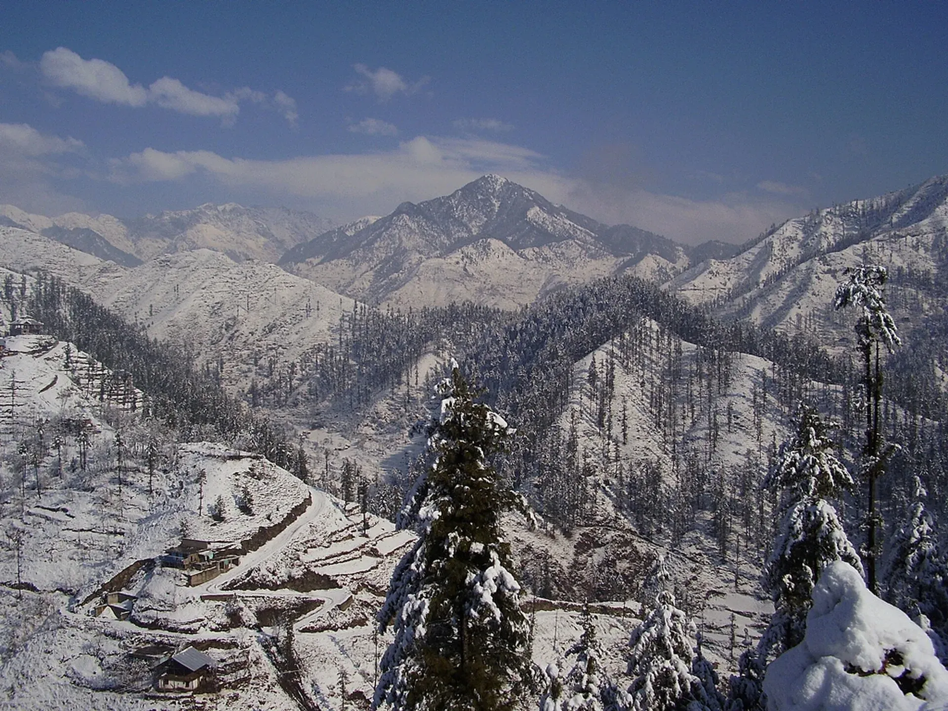
Photo: Farhan3aslam2, with thanks · CC BY-SA 4.0 · via Wikimedia Commons · temporary stand-in photo

Alpuri
The small hill town that is the headquarters of Shangla District, at about 1,587 m on the road between Swat and the Indus. A working administrative town, not a tourist stop.
Overview
Alpuri is the capital of Shangla District in Khyber Pakhtunkhwa. Wikipedia gives its average elevation as 1,587 m. The district was created in 1995; before that it was a sub-division of Swat. The district government offices, the police chief and the deputy commissioner are here. Shangla has five tehsils: Alpuri, Bisham (Besham), Chakesar, Martung and Puran.
There is no known 2023 census figure for Alpuri town itself. The Wikipedia district article gives 891,252 people for Shangla District in the 2023 census.
Plan your visit
- Getting there
Road: about 54 km from Mingora (OSRM about 1 h, optimistic) and about 32 km from Besham on the KKH (about 25 min). Local vans run from both. More
Best months
Apr – Jun, Sep – Oct
- Alpuri
- Related places nearby: Besham, Saidu Sharif, Mingora, Swat Valley
Town and services
Alpuri is a place to pass through or to do business, not a sightseeing stop. Wikipedia describes it as the healthcare hub of the district, with a district headquarters hospital and several private hospitals. Two government colleges teach to intermediate level, and there is a government degree college. The town is known for cool summers and snow in winter. The surrounding hills are green, and the roads are steep and narrow.
Recent history
On 13 November 2007 militants from neighbouring Swat took the district headquarters without resistance from the police, and left on 22 or 23 November as government troops approached. Residents reported food shortages. A suicide bombing on 12 October 2009 killed 47 people. These events are part of why current advice for the area is cautious.
Getting there
When to visit
The climate is humid subtropical. The average temperature is about 15.8 C and annual rainfall is about 1,040 mm. July is the wettest month (155 mm) and November the driest (25 mm). Mean daily temperatures run from 4.5 C in January to 25.4 C in July, with daily highs averaging 8.6 C in January and 32.1 C in June. Spring and autumn are the easiest seasons. Expect snow in winter and heavy rain in July and August, which can block roads.
Where to stay and eat
Expect a few basic hotels and tea houses near the bazaar. There is no tourist infrastructure to speak of. Besham and Mingora have more choice.
Basic services
For pharmacies, fuel and cash machines, ask locally. Hospitals, pharmacies, fuel stations and ATMs are normal in a district headquarters, but none is confirmed for this town from an official source. Ask at your hotel, and use the business listings on this site.
Safety and good to know
For foreign visitors: the UK FCDO (updated 27 October 2026, checked 17 November 2026) advises against all but essential travel to Shangla, and against all travel to Swat. Neighbouring areas on the Karakoram Highway are also listed. This is government advice, not a closure. Read it, check with local police and your hotel, and travel in daylight.
Highlights
- District headquarters of Shangla
- Cool hill climate at about 1,587 m
- Main healthcare hub for the district
Hotels, food, fuel and services in Alpuri
Places to stay
- Shangla Hills Hotel & RestaurantCall Shangla Hills Hotel & RestaurantMap of Shangla Hills Hotel & Restaurant in Google Maps
- Machaar AbshaarCall Machaar AbshaarMap of Machaar Abshaar in Google Maps
Essential services fuel stations, pharmacies and hospitals and clinics
Fuel
- PSO Filling Station Shangla TopMap of PSO Filling Station Shangla Top in Google Maps
- Lilownai Filling StationCall Lilownai Filling StationMap of Lilownai Filling Station in Google Maps
- مدینہ فلنگ اسٹیشنCall مدینہ فلنگ اسٹیشنMap of مدینہ فلنگ اسٹیشن in Google Maps
- Haji Kashmir Filling StationMap of Haji Kashmir Filling Station in Google Maps
- Shah pak gas agencyCall Shah pak gas agencyMap of Shah pak gas agency in Google Maps
Pharmacies
- Lilownai pakistanCall Lilownai pakistanMap of Lilownai pakistan in Google Maps
- Hussain Medical StoreMap of Hussain Medical Store in Google Maps
- Sagar Pharmacy PagoraiMap of Sagar Pharmacy Pagorai in Google Maps
- Amjad medical storeCall Amjad medical storeMap of Amjad medical store in Google Maps
Hospitals and clinics
- Khyber Medical ComplexCall Khyber Medical ComplexMap of Khyber Medical Complex in Google Maps
- Mansoor Doctors HospitalCall Mansoor Doctors HospitalMap of Mansoor Doctors Hospital in Google Maps
Listings come from Google Maps data and are unverified: phone numbers, opening months and prices may have changed. Report a problem · Own one of these? Claim it
Tips
- Read the FCDO advice for Shangla before you plan a visit.
- Travel in daylight only.
- Carry cash; do not rely on card payments.
- Combine with a stop at Besham if you are on the highway.
Photos we still need: Alpuri town or bazaar. Send us yours
Sources and last checked
Last checked Confidence medium5 sources3 still to check
- Last checked
- Method
- Desk research from published sources
- Confidence
- medium
- Checked by
- trek.pk research team
Researched from published sources; not yet checked on the ground by our team. Spot something out of date? Report a mistake.
Sources
- Alpuri · Wikipedia · checked
- Shangla District · Wikipedia · checked
- Pakistan travel advice (updated 27 October 2026) · UK Foreign, Commonwealth & Development Office · checked
- OSRM driving route service: distances and times measured 16 November 2026 (times are optimistic, without stops) · OSRM / OpenStreetMap · checked
- Map coordinates · OpenStreetMap · checked
Still to be checked on the ground (3)
- Whether any 2023 census figure exists for Alpuri town (Wikipedia gives none; the Pakistan Bureau of Statistics tables were not checked)
- Current hotels, pharmacies, fuel and ATMs
- Road condition to Besham and Mingora
Nearby and related

Besham
A busy Indus-side town and junction on the Karakoram Highway at about 613 m, long used as the first overnight stop from Islamabad towards Gilgit and Hunza.

Saidu Sharif
The administrative town of Swat, joined to the bazaar city of Mingora, with the ancient Butkara stupa, the Swat Museum of Gandhara art, a Sufi shrine and the road into the Swat valley.

Mingora
Largest city of the Swat Valley on the Swat River, about 984 m up, with 361,112 people at the 2023 census. The usual base for Saidu Sharif, the Swat Museum and Buddhist sites.

Swat Valley
A long green river valley in northern Khyber Pakhtunkhwa, with Gandhara Buddhist sites, orchards, hill towns and the road up to Kalam. Check the current security advice before you plan a trip.

Khyber Pakhtunkhwa
Mountains, Buddhist ruins and old bazaars in north-west Pakistan: Swat, Kaghan, Chitral, the Kalash valleys, the Khyber Pass and Peshawar.