

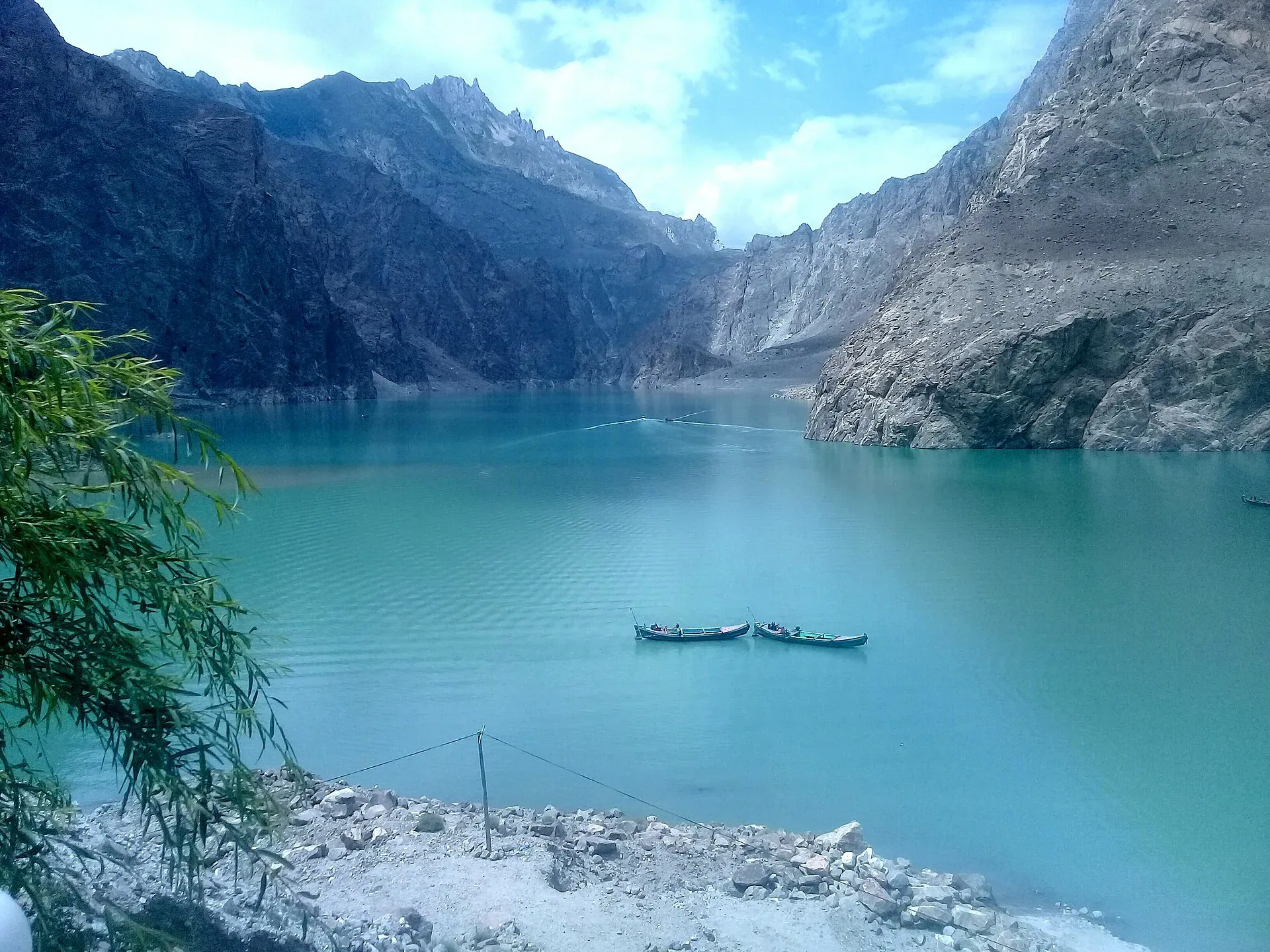
Photo: Peracha1, with thanks · CC BY-SA 4.0 · via Wikimedia Commons · temporary stand-in photo
Attabad Lake
A turquoise lake about 21 km long in Gojal, Hunza. It formed when a landslide blocked the Hunza River on 4 January 2010. The Karakoram Highway now passes it through five tunnels.
Overview
Attabad Lake, also called Hunza Lake, fills a stretch of the Hunza River valley in Gojal, upper Hunza. It is not an old lake. It formed on 4 January 2010, when a landslide at Attabad village, about 14 km east of Karimabad, blocked the river. The water rose for five months and began to spill over the landslide dam in early June 2010.
At its largest the lake is about 21 km long and up to 109 m deep. Its colour changes with the light, from milky green to deep turquoise, and mountains rise straight from the shore.
Plan your visit
- Nearest town
- Karimabad
- Getting there
Attabad Lake is on the Karakoram Highway (N-35) in Gojal, upper Hunza, about 14 km east of Karimabad. From Karimabad the lake's upper end is about 33 km by road (OSRM, 31 minutes of driving without stops); More
Best months
May – Oct
- Attabad Lake
- Related place nearby: Borith Lake
How it formed, and what it cost local people
The landslide killed twenty people. About 6,000 people from the villages upstream lost their homes or land, and up to 25,000 were affected, including people cut off from the road. Ayeenabad and the lower part of Shishkat went under the water, as did about 40% of Gulmit and parts of Hussaini and Ghulkin. More than 19 km of the Karakoram Highway (KKH) was submerged, and for years people and goods crossed by boat. Many families still live with this loss, so be thoughtful when you photograph homes and fields.
Lowering the lake
The Frontier Works Organization blasted the spillway on 27 March 2012 and again on 15 May 2012, which lowered the lake by at least 10 m (Wikipedia). Dawn reported in June 2010 that 242 houses, 135 shops, four hotels, two schools and four factories had been flooded, along with several hundred acres of farmland. Other figures exist, because estimates changed as the water rose. Wikipedia counts more than 170 houses and 120 shops flooded in Gojal.
What to see and do
- Drive the tunnels. In September 2015 a new 24 km section of the KKH opened with five tunnels, about 7 km in total, known as the Pakistan-China Friendship Tunnels. They run along the shore and give the best views of the lake from the road.
- Boating. Local operators run boat trips on the lake, and Wikivoyage says boats can be rented at its northern end. The TDAP guide lists boating, jet-skiing, fishing and winter sports among the activities. Current prices will be added soon; agree the price and the route before you board.
- Viewpoints and short stops. There are lay-bys and small hotels on the shore. Sunrise and early morning are quiet and clear.
- Keep going north. Passu, Hussaini and Borith Lake are a short drive further up the valley.
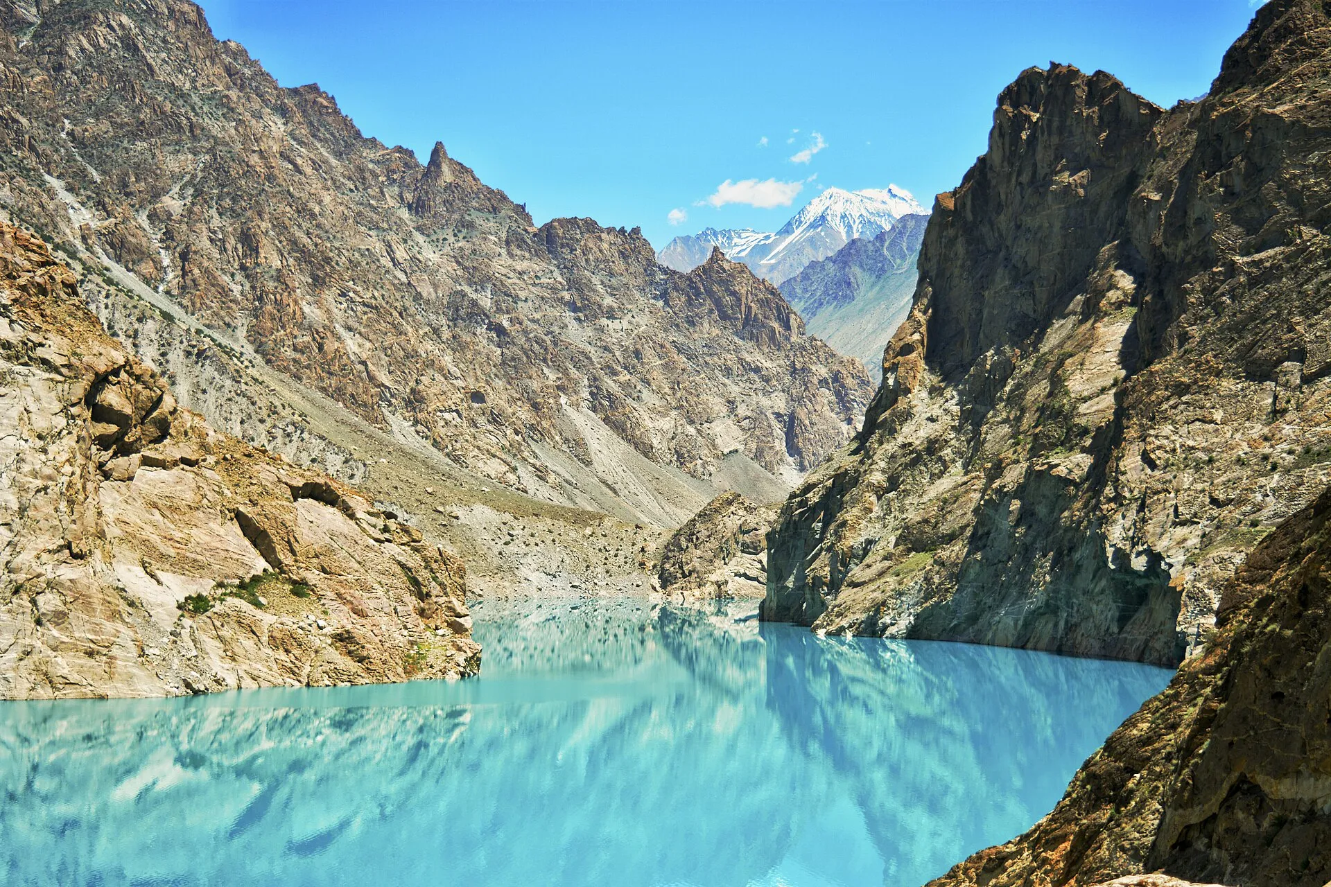
Photo: Hassanzealous, with thanks · CC BY-SA 4.0 · via Wikimedia Commons · temporary stand-in photo
When to visit
The lake can be visited all year, as the highway is kept open, but May to October is the most comfortable and the water is at its brightest in the long days of summer. Autumn colour in the valley is good in October. In winter it is cold, and snow or rockfall can slow the KKH. Check road reports before you travel.
Where to stay and eat
Most visitors stay in Karimabad, Aliabad or Gulmit, and some small lakeside hotels and restaurants serve fish and local dishes. Camping rules on the shore are set locally. Ask your hotel or the Gilgit-Baltistan Tourism Department before you pitch a tent.
Good to know
- Getting there: the lake is on the KKH (N-35), about 14 km east of Karimabad. The dam site is about 14 km east of Karimabad (Wikipedia) and the upper end of the lake near Gulmit is about 33 km from Karimabad by road (OSRM: 31 minutes of pure driving). Allow 30 to 45 minutes or more, longer in traffic. Wikipedia gives the lake as up to 21 km long and 109 m deep, and the five Pakistan-China Friendship Tunnels (about 7 km together) as inaugurated on 14 September 2015. Gilgit is a few hours' drive south.
- Boating safety: the water is cold and deep. Wear a life jacket, even if you swim well, and do not swim in the lake.
- Fees: a fee may apply for boat rides and some lakeside facilities. Current fees will be added soon.
- Weather: summer afternoons can be windy. In spring and autumn, carry a warm layer.
- Road: the KKH here can be closed briefly by rockfall or landslides. Ask locally before long drives.
Highlights
- Formed by a landslide on 4 January 2010
- About 21 km long, up to 109 m deep
- Five Pakistan-China Friendship Tunnels run along the shore
- Boat trips between lakeside villages and viewpoints
- Short drive to Passu and Borith Lake
Getting there
Attabad Lake is on the Karakoram Highway (N-35) in Gojal, upper Hunza, about 14 km east of Karimabad. From Karimabad the lake's upper end is about 33 km by road (OSRM, 31 minutes of driving without stops); allow 30 to 45 minutes or more. From Gilgit expect a few hours' drive. Shared vans and buses run along the KKH; ask for the Gulmit or Sost service and get off at the lake. The new tunnels run beside the lake.
Tips
- Go early for calm water and clear light.
- Agree boat prices and routes before you board and wear a life jacket.
- Respect the villages that lost land here and ask before photographing people.
- Check KKH road reports in winter and the monsoon.
Photos we still need: the Attabad (Pakistan-China Friendship) tunnels; boats at the northern end of the lake. Send us yours
Sources and last checked
Last checked Confidence medium4 sources3 still to check
- Last checked
- Method
- Desk research from published sources
- Confidence
- medium
- Checked by
- trek.pk research team
Researched from published sources; not yet checked on the ground by our team. Spot something out of date? Report a mistake.
Sources
- Attabad Lake · Wikipedia · checked
- Pakistan Tourism Guide 2021 · TDAP (Trade Development Authority of Pakistan) · checked
- OSRM driving route service: road distances and times measured 16 November 2026 (driving only, optimistic on mountain roads) · OSRM / OpenStreetMap contributors · checked
- Hunza Valley travel guide · Wikivoyage · checked
Still to be checked on the ground (3)
- Boat operators, prices (not given) and boat-trip routes (Wikipedia only lists boating)
- Camping and swimming rules (no official source found)
- Surface altitude of the lake: Wikipedia, opened again on 17 November 2026, still gives none; we do not publish a figure.


