

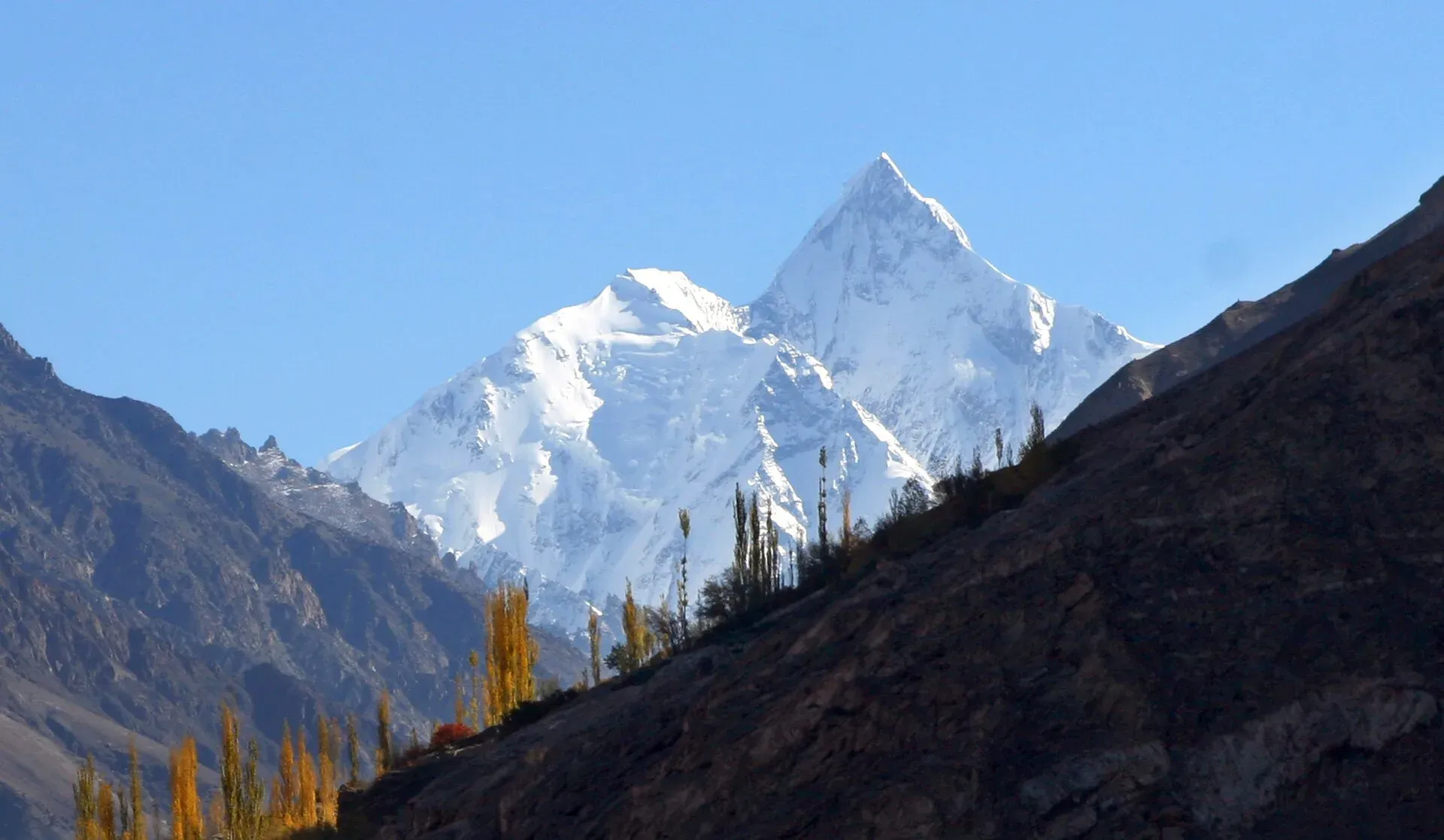
Photo: Ghazi Ghulamraza, with thanks · CC BY-SA 3.0 · via Wikimedia Commons · temporary stand-in photo

Boibar
- Duration
- 3 days
- Distance
- 27.4 km
- Grade
- Easy
- Max altitude
- 4,000 m
- Season
- Jun – Sep
A quiet three-day walk up the Boibar valley from Morkhun, south of Sost, through old juniper forest and the first Wakhi settlement in Gojal to a high camp at Maidun (4,000 m), with a side trip to Qarun Pass.
Overview
Boibar is an east-west valley whose river runs down from Qarun Koh (Karun Koh, about 6,977 m; older sources give 7,164 m) to the Hunza River at Morkhun, about 10 km south of Sost. It is one of the quietest valleys in Upper Hunza. The old Wakhi village of Avgarch is on the route and is said to be the first settlement of the Wakhi people in Gojal. The valley also holds some very old juniper trees. Some of those that survive are said to be more than 1,000 years old.
Boibar was the original route to Shimshal, before the modern road was built. The trek is short and the climbing is gradual. It is a good first trek for people who want to see a Wakhi village and wild country without crowds.
Who it suits
The trek suits walkers with average fitness. It is graded easy in the guidebook, but you still climb to 4,000 m, so allow for the height. The Qarun Pass side trip, at 4,873 m, is a long day with a steep final scree gully. The trail from Jamalabad has some rockfall risk and a steep, narrow chimney with log steps, so it is not ideal for anyone who dislikes heights.
Hire a local guide or porter. They know the trail and the area, and your payment supports the village.
When to go
The season is mid-June to September. In June there can be snow on the upper slopes. Morkhun gets more rain than the other Gojal villages (its name means "rain house"), so afternoon showers are possible. Between Jamalabad and Avgarch the trail passes under loose cliffs, and you should avoid it in rain or high wind.
The route
From Morkhun, on the KKH halfway between Afiyatabad and Passu, a short link road leads to Jamalabad (2,789 m), above the true right bank of the Boibar River. The trail goes east along a canal. A shrine to Shah Shams with white flags sits on the south side of the river. After about 30 minutes you cross the first footbridge to the true left bank, and another 30 minutes brings you to a clear side stream from the ridge of Sangar.
The red marks on the rock at Bandiletk are said by villagers to come from an evil spirit, and people avoid the place after dark. The area is also known as Lalazar. After a second footbridge, take the left fork on the true right bank, back-track a few minutes, and climb a short scree slope and a steep chimney with steps made of juniper branches to a terrace. From there you see Jurjur-Khun-e-Sar (6,055 m) to the south and Parigar Sar (6,200 m) to the east. The name means the rock where fairies live.
Avgarch (3,200 m) is the old farming settlement. It has a mosque with unusual wood carvings and two forts, which recall the long fights with Kirghiz raiders who used the upper Hunza valley until the 19th century. A single giant juniper, Baltar Yarz, stands near the village. From Avgarch, cross the river by a footbridge and walk south-east to Boibar (3,505 m), a barren summer settlement. Boibar sits in a side valley under the north face of Tupodan (6,106 m).
On day 2, climb to the cold spring of Xunza Kuk and then Pariyar, which are the upper limit of the junipers. The pastures here are overgrazed and many junipers have been cut. Maidun (4,000 m) has good water and is the base for exploring the upper valley. The route to Tupodan Base Camp, used by the first British ascent in 1987, goes south from here up the Tupodan Glacier.
The Qarun Pass day trip goes up from Maidun past yellow rock to the pasture of Zardgarben, then to the base of the pass at about 4,500 m, where routes split for Qarun Koh and Parigar Sar base camps. The pass route turns south up a scree gully and reaches Qarun Pass (4,873 m) in about one hour. It looks south to Lupgar Sar, Trivor and Destaghil Sar. This was the old way to Shimshal, with a 2,100 m drop of loose scree down to Dut.
Day 3 returns to Jamalabad by the same route.
Underfoot
The route starts on a link road and canal path, then crosses two footbridges. A scree slope and a steep chimney with juniper-branch steps lead to a terrace above Avgarch. Above Avgarch the ground is stony and overgrazed, with cold springs, then rocky moraine near Maidun. The Qarun Pass day trip climbs a steep scree gully with loose stones, so go up early and descend carefully.
Preparation
The trek is graded easy, but Maidun is at 4,000 m and the pass trip reaches 4,873 m. Sleep a night at Boibar (3,505 m) before climbing higher, carry a tent and stove, and agree stages with porters beforehand. Avoid the trail below the cliffs in rain or wind. A trekker who dislikes exposure should look at the chimney before committing.
Culture and people
Avgarch and Boibar are names that also appear in the Wakhan corridor of Afghanistan, which suggests the original Wakhi settlers may have come from there. The people of the five villages between Sost and Morkhun still call themselves Avgarchi. Mamu Singh, the founder of Shimshal, is said to have seen the Lupgar meadows from Qarun Pass and decided to take his livestock there. The mosque and the fortified houses at Avgarch are in use, so ask before you enter and dress modestly.
Practical information
Transport to Morkhun is easy on any bus or van between Afiyatabad and Passu. A road to Avgarch was being built when the guidebook was written, with plans to extend it to Boibar, so ask locally whether it now reaches Avgarch. Porters ask for a flat rate per stage, including food and an equipment allowance. Agree the stages first.
The old trek.pk page lists the area as open, with no permit. Foreign-trekker rules and fees in Gilgit-Baltistan changed in 2024 and were later contested. Ask your operator or the Gilgit-Baltistan Tourism Department.
Highlights
- Avgarch, the old Wakhi settlement, with its carved mosque and forts
- Ancient juniper forest, some trees over 1,000 years old
- Views of Parigar Sar, Tupodan and Qarun Koh
- The old route to Shimshal over Qarun Pass (4,873 m)
- An easy road start near the KKH
Day by day
| Day | Camp | Altitude |
|---|---|---|
| 1 | Boibar | 3,505 m |
| 2 | Maidun | 4,000 m |
| 3 | Jamalabad | 2,789 m |
| Day | Route | Hours | Distance | Ascent / descent | Camp and altitude |
|---|---|---|---|---|---|
| Day 1 | Jamalabad to Boibar | 3.5–4.5 h | 7.7 km | +716 m | Boibar, 3,505 m |
Day 1 notesFollow the canal east, cross two footbridges and pass Bandiletk. Take the left fork, climb the scree slope and the narrow chimney to the terrace, then walk to Avgarch (3,200 m). Cross the river and climb south-east to the huts of Boibar, 1.5 hours beyond Avgarch. Watch for rockfall between Jamalabad and Avgarch. | |||||
| Day 2 | Boibar to Maidun | 2 h | 6 km | +495 m | Maidun, 4,000 m |
Day 2 notesWalk to the cold spring at Xunza Kuk (1 hour) and Pariyar (30 minutes), then Maidun (another 30 minutes). Camp at Maidun, which has good water. Optional Qarun Pass side trip: 11 km, 4 to 5 hours, 873 m up and down, reaching 4,873 m. | |||||
| Day 3 | Maidun to Jamalabad | 4–5 h | 13.7 km | −1,211 m | Jamalabad, 2,789 m |
Day 3 notesRetrace your steps down the valley. Take care on the juniper-branch steps and under the cliffs near Avgarch. Walk the link road to Morkhun and catch a vehicle on the KKH. | |||||
Getting there
Morkhun is on the Karakoram Highway halfway between Afiyatabad and Passu. Any bus, van or wagon heading south from Afiyatabad or north from Passu will drop you there. From Morkhun, north of the bridge and south of the army camp, walk half a kilometre along the Jamalabad link road to its end. Since 2015 the KKH has bypassed Attabad Lake through tunnels, so the road from Gilgit is open all year, apart from landslides and winter snow.
Permits and rules
- Permit needed
- Usually not, Open zone
- Fee
- Current fees will be added soon
- Last checked
- 16 November 2026
The old trek.pk page lists no permit. Rules and fees for foreign trekkers in Gilgit-Baltistan changed in 2024 and were later contested, and no current official list was found. Check with the Gilgit-Baltistan Tourism Department or a licensed operator.
How trekking permits, NOCs and registration work: Visa and permits.
Season
Best: Jun – Sep
Water and camps
Water is good at Boibar, at the spring at Xunza Kuk and at Maidun. On the lower trail there are clear side streams, including one from Sangar. Camp at Boibar and Maidun. The grassy areas below Pariyar are overgrazed and can be muddy. Treat all water.
Gear and safety
The main hazards are rockfall between Jamalabad and Avgarch, the steep scree and chimney section above the second footbridge and the high altitude at Maidun and Qarun Pass. Avoid the right fork after the second bridge, which villagers call dangerous. Carry layers, a tent and a stove. Rescue would need to come from Sost or Morkhun, and a helicopter has to be requested through the army and an operator.
Variations
From Maidun you can go to Tupodan Base Camp (south, up the Tupodan Glacier), Qarun Koh Base Camp (east across the glacier) or Parigar Sar Base Camp (north-east). Sangar, a scenic ridge below Jurjur-Khun-e-Sar (6,055 m), is about 5 hours up from Morkhun, so an 8 to 9 hour round trip. Qarun Pass looks across to the Lupgar meadows, see lupgar-sar-base-camp.
Tips
- Do not use the trail between Jamalabad and Avgarch in rain or high wind. Rockfall is a risk.
- Take the left fork after the second footbridge, not the right.
- Respect the mosque and forts at Avgarch. Ask before you go in.
- Spend a night at Maidun before going up to Qarun Pass.
- Agree the stages and rates with your porters before you start.
Photos we still need: Avgarch, the old junipers, Boibar valley and Qarun Pass (the current photo shows the Hunza valley in general; Karun Koh has no usable photo here). Send us yours
Health and emergency
Mobile signal is patchy on most treks, so tell someone your plan before you go. Emergency numbers
Sources and last checked
Last checked Confidence low4 sources6 still to check
- Last checked
- Method
- Desk research from published sources
- Confidence
- low
- Checked by
- trek.pk research team
Researched from published sources; not yet checked on the ground by our team. Spot something out of date? Report a mistake.
Sources
- Trekking in the Karakoram and Hindukush (Boibar trek) · Lonely Planet, c. 2002 (facts only) · checked
- PM inaugurates Pak-China Friendship Tunnels over Attabad Lake · Dawn · checked
- GB winter adventure tourism hit by soaring permit fee, visa delays · Dawn · checked
- Karun Kuh (summit about 6,977 m, revised down from 7,164 m) · Wikipedia · checked
Still to be checked on the ground (6)
- Whether the road to Avgarch has been built. A 2019 blog still says villagers were building it; no newer report found
- Condition of the footbridges and the steep chimney with juniper-branch steps above Jamalabad
- Qarun Pass height of 4,873 m comes from the book only. Qarun Koh: Wikipedia gives about 6,977 m (older figure 7,164 m); the page now says so
- No recent trip report was found, so all times and distances come from the c. 2002 guidebook
- Whether any permit or fee applies for foreigners in the Boibar valley
- Only one photo is used and it shows the Hunza valley in general, not Boibar
Nearby and related

Lupgar Sar Base Camp

Kilik and Mintaka Passes

Asumbar Haghost
Qarun Pass
A scree pass of 4,873 m above the Boibar valley near Morkhun, reached as a long side trip from Maidun. It was the old route towards Shimshal.
Jurjur Khona Sar
Jurjur Khona Sar (6,029 m) is an unclimbed peak of the South Ghujerab Mountains near Passu and Sust. Our Boibar trek page gives 6,055 m and places it south of the Boibar terrace.