

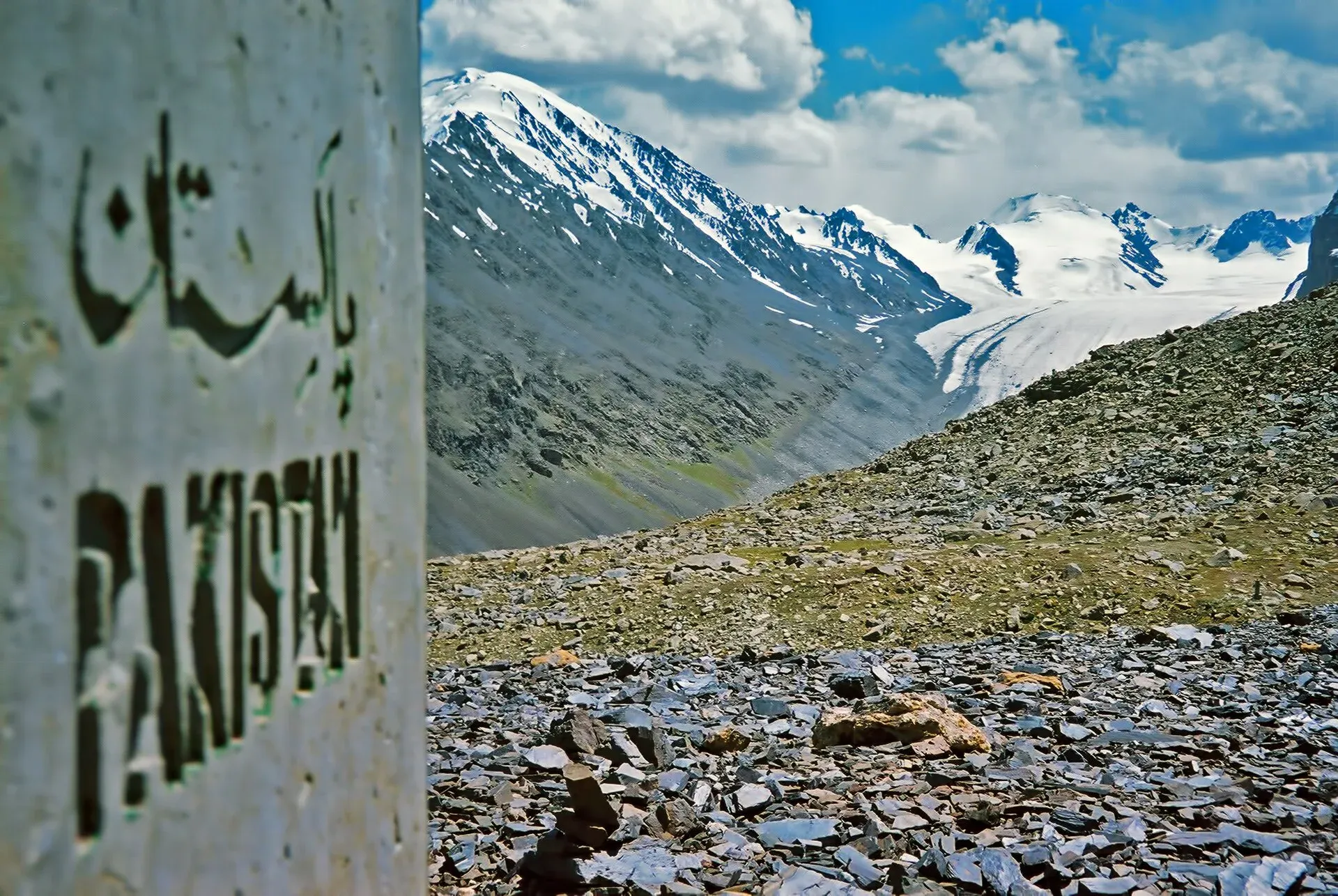
Photo: Saad Mohamed, with thanks · CC BY-SA 3.0 · via Wikimedia Commons · temporary stand-in photo

Kilik and Mintaka Passes
- Duration
- 6–8 days
- Distance
- 88.4 km
- Grade
- Moderate
- Max altitude
- 4,827 m
- Season
- Jun – Sep
A gentle six-day trek (eight with both pass day trips) from Misgar up the old Silk Route valleys to the Kilik and Mintaka passes on the China border. Broad trails, grassy camps and easy gradients, but the border makes the permit rules important.
Overview
Kilik and Mintaka are two historic passes on Pakistan's border with China, north of Misgar in Upper Hunza (Gojal). For centuries they carried traders and travellers between the Hunza valley and the Taghdumbash Pamir. The Kilik valley is wide and grassy, and the Mintaka valley is a steeper, granite-walled valley with waterfalls. Both passes are broad and gentle, and you do not need technical skills to reach them. The trails are 1 to 3 m wide, camps are on grass, and water is easy to find.
The trek has a loop shape from Misgar: up the Kilik valley to Murkushi, on to Sad Buldi and a day trip to Kilik Pass, back to Murkushi, then up the Mintaka valley to Gul Khwaja Uween with a day trip to Mintaka Pass. It then returns down the same route.
Who it suits
This is one of the easiest treks in northern Pakistan. It suits first-time Karakoram trekkers and families with older children who walk well. The highest points are Kilik Pass (about 4,827 m) and Mintaka Pass (about 4,700 m), so you still need to acclimatise. The camps are 3,659 m to 4,244 m.
The real difficulty is bureaucratic. These are border passes, and rules for foreigners have changed several times. Read the permit notes below and confirm everything with an operator before you book.
When to go
The usual season is June to September. The Kilik valley can have snow at the upper camps in early June. The Mintaka valley is shaded until mid-morning, so an early start on a hot day is useful. In July and August the lower valleys are warm and the high pastures cool. Afternoon storms can bring rain and cold.
The route
Misgar (3,075 m) is a village high above the Kilik River. A road continues north to Kalam Darchi (7 km, 20 minutes by jeep, or about 1.5 hours on foot). Kalam Darchi is an old Gilgit Scouts post built in the late 1930s on the site of a watchtower.
Day 1 follows the Kilik River's true right bank, with several bridges, through grassy birch groves such as Arbab-e-Bul, Rung Hil, Put Hil and Lup Jangal. Murkushi (3,659 m), at the confluence of the Kilik and Mintaka rivers, is the largest camp. Choose a spot among the birches at the north end, under the granite cliffs. The day is 21 km, or 14 km beyond Kalam Darchi.
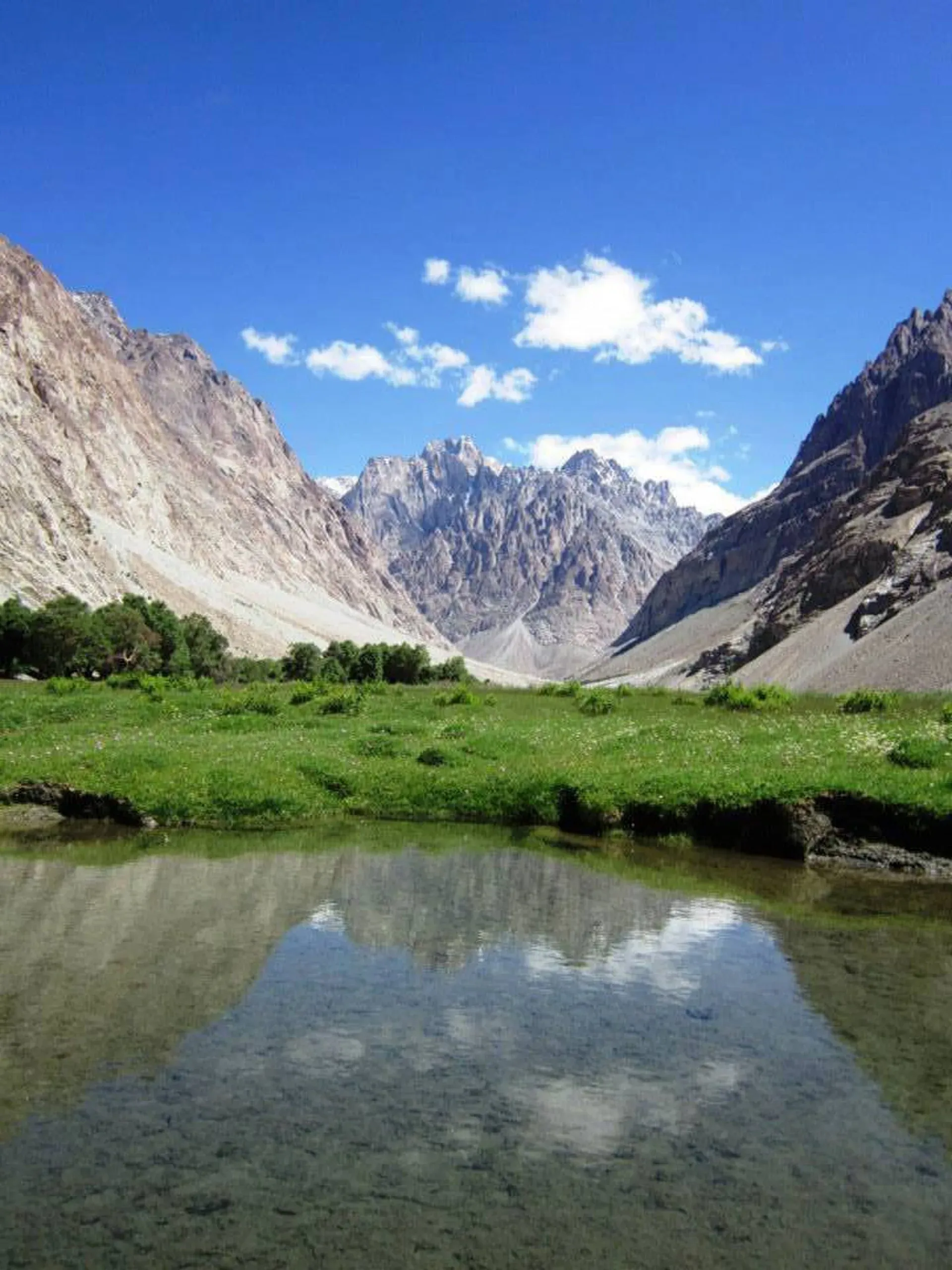
Photo: Shahid misgari, with thanks · CC BY-SA 3.0 · via Wikimedia Commons · temporary stand-in photo

Day 2 climbs 585 m to Sad Buldi (4,244 m), passing the Ship Shepk area and a livestock gate. You cross a former lake bed and pass a Kirghiz tomb hung with Marco Polo sheep horns at Gumbish, then reach the Shireen Maidan plain. Beyond it the landscape becomes open, rolling pamir. Sad Buldi has a herders' hut and a pen. Boulders near the river carry petroglyphs of riders, ibex and hunting scenes. Camp here rather than at Haaq across the river.
The side trip to Kilik Pass is about 11 km and 4 to 4.5 hours. Go up the river route to Luto Harai, then climb a hill to a broad plateau. The pass (4,827 m) is a wide area with a border marker and a lake. Return along the high flower slopes.
On day 3 retrace to Murkushi. On day 4 cross to the Mintaka valley and walk up its true left bank for about 11.5 km and 4 hours, passing grassy flats, waterfalls and herders' huts at Yatumgoz Harai (about 4,509 m), to Gul Khwaja Uween (4,169 m). It has a granite cliff with two cascades, a glacier to the south-east and a couple of huts for porters. This is the best camp for Mintaka. The side trip to Mintaka Pass (about 4,700 m; the book says 4,726 m, Wikipedia 4,709 m) climbs 530 m by an army-built trail with a few scrambly sections. It takes 4 to 4.5 hours for the round trip. Marmots, ram chukor and signs of bears and wolves have been seen.
Day 5 goes back to Murkushi. Day 6 follows the trail and then the road down to Misgar in about 5 hours.
Why these passes mattered
Wikipedia records that Mintaka and Kilik were the two main ways into Gojal from the north. Mintaka was the older main route until advancing glaciers made it harder. Caravans then used Kilik, which is wider, free of glaciers and has grazing for animals. Laden animals could cross into upper Hunza, but porters had to carry the loads on to Gilgit. Mintaka is said to mean "a thousand ibex" in Kyrgyz. In the 1890s the British placed outposts near the passes during the Great Game with Russia. When the Karakoram Highway was planned in the 1960s, Pakistan first favoured Mintaka, but China recommended Khunjerab, and the highway went that way. The passes have been little used since.
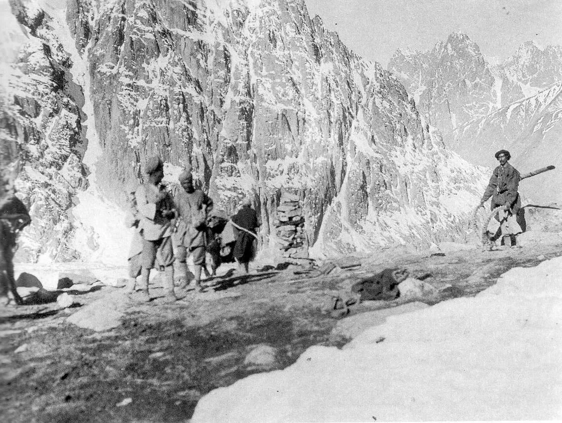
Photo: John Hill (upload); photo by F. M. Bailey, 1918, with thanks · CC BY-SA 3.0 · via Wikimedia Commons · temporary stand-in photo

Underfoot
Day 1 is a broad trail with bridges, grass flats and birch groves. Above Murkushi the Kilik valley becomes open, rolling pamir (high plateau grassland) with streams to cross on warm afternoons. The Kilik Pass trip climbs a hill to a broad plateau. The Mintaka valley is narrower, with a moraine to cross, waterfalls and some rockfall, and the army-built trail to the pass has a few scrambly sections.
Preparation
The camps lie between 3,659 m and 4,244 m, and the passes are at about 4,700 and 4,827 m. Take at least one night at Murkushi, carry layers and rain cover for afternoon storms, and carry your own food and tent. Your porters will want a say in the stages, so agree them in Misgar.
Culture and people
Misgar was settled in the 19th century by Burushaski-speaking families from Hunza, sent by the Mir to guard against raiders from the Pamirs. After the British conquest of Hunza in 1891 it became the empire's farthest outpost, linked by telegraph to Gilgit. The name comes from Wakhi: mis means nose and gar rock, after the stone in the roadside shrine. Misgar villagers are the main guides and porters. They traditionally use donkeys and yaks, and they set the stages and rates among themselves. Agree the stages, pay and food before you start. Bring your own tent and food.
Practical information
Guidebook stages: Misgar to Arbab-e-Bul, then Murkushi, then Sad Buldi, and Murkushi to Gul Khwaja Uween (or the lower Gurgun Pert, which porters prefer). When your porters ride in a vehicle to Kalam Darchi, you pay half a stage less. Agree whether you camp at the higher site, because it is cold and higher for porters.
Trekkers can go as far as the border markers on each pass, but must not cross into China. Chinese border guards patrol the area, and a mistake could close Misgar to foreigners. Misgar villagers rightly insist that foreigners go to the passes with a villager.
The Misgar link road leaves the KKH north of Afiyatabad. You pass the Afiyatabad check post, so carry your passport and visa. The route may lie inside the Khunjerab National Park area; fees reported by operators and travellers vary widely and are not confirmed. Check before you go.
Highlights
- Two historic Silk Route passes on the China border
- Wide, grassy valleys with birch groves and easy trails
- Petroglyphs at Sad Buldi and a Kirghiz tomb at Gumbish
- Waterfalls and granite walls in the Mintaka valley
- Marco Polo sheep country; marmots on the grass flats
Day by day
| Day | Camp | Altitude |
|---|---|---|
| 1 | Murkushi | 3,659 m |
| 2 | Sad Buldi | 4,244 m |
| 3 | Murkushi | 3,659 m |
| 4 | Gul Khwaja Uween | 4,169 m |
| 5 | Murkushi | 3,659 m |
| 6 | Misgar | 3,075 m |
| Day | Route | Hours | Distance | Ascent / descent | Camp and altitude |
|---|---|---|---|---|---|
| Day 1 | Misgar to Murkushi | 6–7 h | 21 km | +584 m | Murkushi, 3,659 m |
Day 1 notesWalk or drive the 7 km road to Kalam Darchi, then follow the Kilik River's true right bank through birch groves and grassy flats: Arbab-e-Bul, Rung Hil, Put Hil and Lup Jangal. The broad trail is easy to follow. Camp in the birches at the north end of Murkushi under the granite cliffs. | |||||
| Day 2 | Murkushi to Sad Buldi | 4.5 h | 11.7 km | +585 m | Sad Buldi, 4,244 m |
Day 2 notesThe valley changes from rock spires to rolling pamir. Pass a big spring, the livestock gate, the Gumbish tomb and Shireen Maidan. Reach the windy plain of Sad Buldi, with petroglyphs on boulders nearby. Optional side trip to Kilik Pass: 11 km, 4 to 4.5 hours, 583 m up and down. | |||||
| Day 3 | Sad Buldi to Murkushi | 3–3.5 h | 11.7 km | −585 m | Murkushi, 3,659 m |
Day 3 notesRetrace your steps. If you are fit and your porters agree, you can combine this day with day 4 to save time. The Hapuchan valley side trip (14 km, 4.5 hours) is an alternative day from Sad Buldi. | |||||
| Day 4 | Murkushi to Gul Khwaja Uween | 4 h | 11.5 km | +537 m | Gul Khwaja Uween, 4,169 m |
Day 4 notesCross to the Mintaka valley and walk its true left bank on a good trail past grassy flats, cascades and Yatumgoz Harai. Cross a moraine and reach the camp beneath the granite cliff with two waterfalls. Optional side trip to Mintaka Pass: 7.5 km, 4 to 4.5 hours, 530 m up and down. | |||||
| Day 5 | Gul Khwaja Uween to Murkushi | 3.5 h | 11.5 km | −537 m | Murkushi, 3,659 m |
Day 5 notesRetrace your steps down the Mintaka valley. Fit groups can do this after the Mintaka Pass side trip on the same day. | |||||
| Day 6 | Murkushi to Misgar | 5 h | 21 km | −584 m | Misgar, 3,075 m |
Day 6 notesThe valley is shaded until mid-morning, so start early on hot days. Walk down the trail to Kalam Darchi, then take the road back to Misgar. | |||||
Getting there
Misgar is on a 16 km link road that leaves the Karakoram Highway about 15 minutes north of Afiyatabad. Public wagons have run from Gilgit to Misgar (the guidebook gives a 7 am departure from Jamat Khana bazaar); check the current timetable locally. A special hire from Afiyatabad takes about 30 minutes. From Passu or Sost, vehicles and local transport go via Afiyatabad. Since 2015 the KKH has bypassed Attabad Lake through tunnels, so the road from Gilgit is open all year apart from landslides and winter snow. From Misgar, a road continues 7 km to Kalam Darchi, where the trail begins.
Permits and rules
- Permit needed
- Usually not, Open zone
- Fee
- Current fees will be added soon
- Last checked
- 16 November 2026
The old trek.pk page and the 2002 book list the area as open and say there is no permit. The passes are on the China border, and the book describes a ban on foreigners from 1947 until about 1999. Current official guidance was not found. Tour operators list Gilgit-Baltistan and park fees, but these are not official. Check with the Gilgit-Baltistan Tourism Department, a licensed operator and the Afiyatabad check post before you go, and carry your passport.
How trekking permits, NOCs and registration work: Visa and permits.
Season
Best: Jun – Sep
Water and camps
Water is plentiful in the Kilik valley, with springs and clear side streams at most camps. In the Mintaka valley, the stretch between Murkushi and Yatumgoz Harai has no clear water, so fill your bottles at Murkushi. Camps are on grass at Murkushi (birches, clear stream), Sad Buldi and Gul Khwaja Uween (two porters' huts). Sad Buldi is better than nearby Haaq for camping, with more grass and less wind.
Gear and safety
The trail is easy, but altitude is real above 4,000 m. Spend time at Murkushi to acclimatise, and watch for headache and nausea. Weather can turn cold with little warning. Streams can be high on warm afternoons. On the Mintaka trail there is some rockfall and moraine collapse, so take care. Do not cross the border: stay within the markers. Rescue is from Misgar or Sost, and a helicopter has to be requested through the army and an operator.
Variations
Hapuchan valley is a 14 km day trip from Sad Buldi that leads to Hapuchan Pass on the border, home to Marco Polo sheep. A side valley south leads to Wodwashk Pass. You can also use only one valley: Kilik alone is about 4 days, Mintaka alone about 4 days. For another Gojal trek with a side trip to a high pass, see boibar.
Tips
- Confirm permits and any border-area rules before you travel. They have changed and sources disagree.
- Go to the passes only with a Misgar villager, and stop at the border markers.
- Start with donkeys from Misgar. You cannot count on finding them upvalley.
- Camp at Gul Khwaja Uween for the Mintaka side trip, not at the lower site.
- Carry your passport. You pass the Afiyatabad check post.
Photos we still need: Murkushi camp, Sad Buldi petroglyphs and Gul Khwaja Uween. Send us yours
Health and emergency
Mobile signal is patchy on most treks, so tell someone your plan before you go. Emergency numbers
Sources and last checked
Last checked Confidence low7 sources7 still to check
- Last checked
- Method
- Desk research from published sources
- Confidence
- low
- Checked by
- trek.pk research team
Researched from published sources; not yet checked on the ground by our team. Spot something out of date? Report a mistake.
Sources
- Trekking in the Karakoram and Hindukush (Kilik and Mintaka Passes trek) · Lonely Planet, c. 2002 (facts only) · checked
- Kilik and Mintaka Pass Trek, Misgar Valley · Apricot Tours (operator) · checked
- Khunjerab National Park · Wikipedia · checked
- PM inaugurates Pak-China Friendship Tunnels over Attabad Lake · Dawn · checked
- GB winter adventure tourism hit by soaring permit fee, visa delays · Dawn · checked
- Kilik Pass (4,827 m) · Wikipedia · checked
- Mintaka Pass (4,709 m) · Wikipedia · checked
Still to be checked on the ground (7)
- Whether foreigners currently need an NOC, a permit or a registered guide for the Misgar valley and the two border passes. No official 2025-26 notice was found
- Whether the old statement that the passes were closed to foreigners until 1999 still has any effect. Wikipedia (uncited) says the Chinese-side valleys are closed and that Pakistani operators ran tours in the late 2010s; one operator page lists the zone as open. No official notice found
- Khunjerab National Park fees for foreigners (team to supply current fees)
- Mintaka Pass height: the book gives 4,726 m, Wikipedia 4,709 m. Kilik at 4,827 m matches Wikipedia
- Public transport times and Misgar guest-house availability (the book's information is from about 2000)
- Porter rates and stage rules, which Misgar village sets itself
- Commons credits the 1918 Mintaka photograph to F. M. Bailey (stated free of copyright) uploaded by John Hill; confirm the credit line
Nearby and related

Boibar

Batura Glacier

Asumbar Haghost
Hapuchan Pass
A pass on the Chinese border at the head of the Hapuchan valley in Misgar. Border area: restricted, not a trek for visitors.
Wodwashk Pass
An obscure glaciated pass between the Hapuchan valley and Wodwashk Bar in Misgar, with 30 to 60 minutes of glacier travel. Height unknown. Border area, ask locally.

Kilik Pass
A broad 4,827 m pass on the China border north of Misgar in Gojal. A historic Silk Road route and an easy summer trek, but border rules matter.

Mintaka Pass
A 4,709 m border pass west of Khunjerab, once the main Silk Road route into Hunza. Reached on foot from Misgar; take care with border rules.