

Photo: Imran Shah, with thanks · CC BY-SA 2.0 · via Wikimedia Commons · temporary stand-in photo
Batura Glacier
- Duration
- 5 days
- Distance
- 64.6 km
- Grade
- Moderate
- Max altitude
- 3,630 m
- Season
- Jun – Oct
A five-day walk beside one of the longest glaciers in the Karakoram, through summer pastures and juniper forest to Guchesham, beneath the Batura Wall and its huge ice floes. Moderate, with one glacier crossing.
Overview
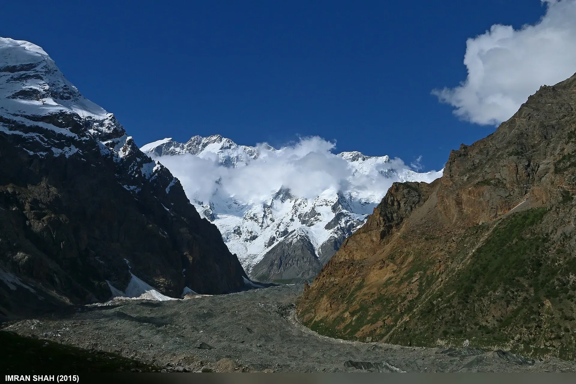
The Batura Glacier is about 57 km long and flows east from the Batura Muztagh to the KKH, just north of Passu. It is one of the longest glaciers outside the polar regions. This trek follows its north edge on the old herders' paths, not on the ice. The scenery comes from the Batura Wall, the line of snow peaks above the glacier, with several summits over 7,000 m and ice floes that fall thousands of metres.
Most of the route is in ablation valleys, the quiet troughs between the glacier and the hillside. Here you find streams, willows, wild roses, birch and juniper. The gradient is gentle, so it is good for acclimatisation. The only real difficulty is the glacier crossing near the start, which is short and well marked by local use but easy to get wrong without help.
The glacier
The Batura Glacier lies in Gojal, upper Hunza, just north of the Batura massif (7,795 m) and Passu Peak (7,500 m). Wikipedia describes the lower glacier as a grey expanse of rock and gravelly moraine bordered by summer villages and pastures, with livestock, roses and juniper. About two-thirds of the middle and lower glacier lies under thick debris, so the surface looks like a rubble field rather than ice. The terminus was about 0.5 km above the Karakoram Highway in 1984 and has since retreated, which is one reason the crossing changes from year to year. The deep valleys are dry, with about 10 cm of precipitation a year, while the peaks collect 100 to 130 cm of snowfall.
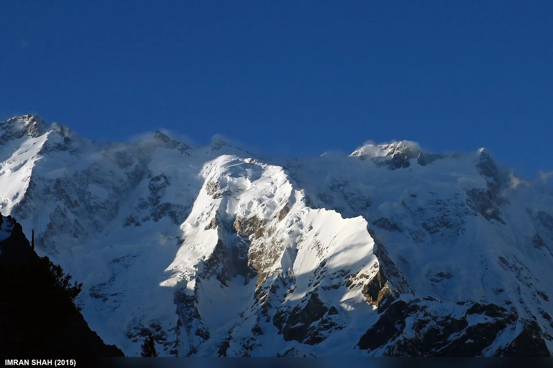
Photo: Imran Shah, with thanks · CC BY-SA 2.0 · via Wikimedia Commons · temporary stand-in photo
Who it suits
This is a good first Karakoram trek for people with some camping experience. It needs fitness for 5 to 6 hours of walking each day, but there are no steep climbs. You must be comfortable on broken ground and moraine. You do not need ropes or crampons on the main route.
Porters from Passu are strongly advised. Trekkers often get lost on the glacier, and local authorities have asked that anyone going onto it be accompanied by someone from Passu.
When to go
The season is June to October. July and August are warm, and the north side of the glacier is sunny and dry. Dust and heat can be tiring on the lower sections. The glacier crossing is easier and safer when the melt has not raised the streams too far. In October the herders bring their animals down, and the pastures are quiet. By August the stream at Uzhokpirt may be dry, so you collect water from the lake.
Terrain underfoot
Expect four kinds of ground. Dusty ablation valleys and lateral moraine make up most of days 1 to 3, with loose stone underfoot. The glacier crossing near Yunzben is about 2 km of broken rock and gravel over debris-covered ice. Between camps the trail passes willow, tamarisk, wild rose and juniper along streams. Several streams, including the Werthum and the Bostong, are forded or crossed near the glacier and run higher on warm afternoons. Near Guchesham the ground is gravel, moraine and meadow.
The route
The first day is the one that needs care. From China Camp (2,430 m) or from Janabad, walk up onto the lateral moraine and follow a dusty ablation valley to Yunzben (2,880 m). A few minutes later the trail crosses the glacier to the north side. The crossing is about 2 km and takes one to 1.5 hours over broken rock. It is marked only by small cairns and dung, and it changes from year to year. After the glacier, climb the narrow moraine ridge to junipers, then reach Uzhokpirt (3,075 m), a shady camp beside a silty lake.
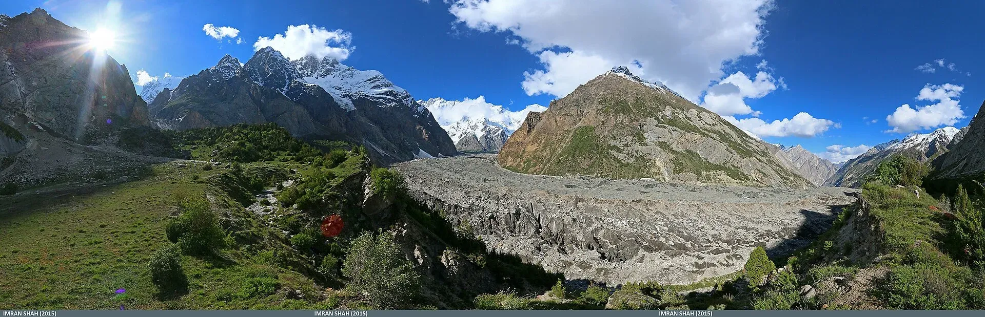
Photo: Imran Shah from Islamabad, Pakistan, with thanks · CC BY-SA 2.0 · via Wikimedia Commons · temporary stand-in photo
Day 2 is short. The path winds through willows, tamarisk, wild rose and juniper to Kush Bel, where the first big view of the upper glacier and the Batura First Ice Floe opens. Continue to Yashpirt (3,302 m), a herders' pasture in a juniper forest with direct views of the ice floe. Camp away from the huts.
Day 3 is the longest, at about 15.7 km. You pass an old millstone, the poplar stand at Piyakh Sheet and the fan at Fatima'il Sheet. Then you ford the Werthum stream near its confluence with the glacier and follow it to Kukhil, then Shilmin. The last stage crosses the Bostong stream to Guchesham (3,630 m), the usual turning point. From the moraine behind camp the view of the Batura Wall is the best of the trek.
From Guchesham you can make a day trip to the meadows of Lupdur (3,870 m), about 5 km each way, for views of the Batura Second Ice Floe and Kampir Dior (7,168 m). Guides can also take you across the Yukshgoz Glacier to base camps for Kampir Dior and Pamiri Sar, which are 2 to 3 days of extra work.
The return is by the same route in two days. A longer return crosses the glacier higher up, at Piyakh Sheet, and comes back on the south margin through Maidun, Wudmull and Kirgus Washk. That crossing is harder, with loose moraine and crevasses, and needs a guide who knows it.
Culture and people
The pastures on this side belong to the Wakhi families of Passu. In summer, women and children move the herds uphill in a group called the kuch, and milk and make butter and cheese in stone huts. The herders' huts are private. Do not use them for shelter or camp between them. Bring your own food and shelter. The kuch returns to Passu in mid-October, and villagers celebrate the reunion. Ask before you photograph people, and keep your porters' wishes in mind when you plan the stages.
Practical information
Trek stages are fixed by custom. The traditional count is 4.5 stages one way from Passu to Guchesham, though porters sometimes ask for five. Agree the stages, the pay and any food or equipment allowance before you start.
China Camp is a short drive north of Passu. The Janabad start is on the west side of the KKH, 1.3 km longer but walkable from every hotel. Passu has simple guesthouses and some supplies, but you should bring all your trekking food.
The official fee and permit rules for foreign trekkers in Gilgit-Baltistan have changed since the book was written. The old trek.pk page lists no permit for this trek. Check with the Gilgit-Baltistan Tourism Department or your operator before you set out. The route lies in the Karakoram, near the Khunjerab National Park and the Central Karakoram National Park, so park or waste-management fees may apply.
Highlights
- Views of the Batura Wall, with many peaks over 7,000 m
- The Batura First and Second Ice Floes from close range
- Gentle walking through juniper, birch and willow in ablation valleys
- A visit to Wakhi summer pastures at Yashpirt and Guchesham
- Optional day trip to the Lupdur meadows (3,870 m)
Day by day
| Day | Camp | Altitude |
|---|---|---|
| 1 | Uzhokpirt | 3,075 m |
| 2 | Yashpirt | 3,302 m |
| 3 | Guchesham | 3,630 m |
| 4 | Yashpirt | 3,302 m |
| 5 | China Camp / Passu | 2,430 m |
| Day | Route | Hours | Distance | Ascent / descent | Camp and altitude |
|---|---|---|---|---|---|
| Day 1 | China Camp to Uzhokpirt | 5–6 h | 11.5 km | +645 m | Uzhokpirt, 3,075 m |
Day 1 notesFollow the canal and lateral moraine to Yunzben (2,880 m), then cross the Batura Glacier on the cairned local route (about 2 km, 1 to 1.5 hours). Climb the narrow moraine north of the ice to the first junipers. Reach the lake and camp at Uzhokpirt among willows and juniper. A Janabad start adds 1.6 km. | |||||
| Day 2 | Uzhokpirt to Yashpirt | 2–3 h | 5.1 km | +227 m | Yashpirt, 3,302 m |
Day 2 notesA short, easy day through ablation valleys with willow, wild rose and juniper. At Kush Bel you first see the upper glacier and the Batura First Ice Floe. Cross the stream at Yinj Gar Dur Gush and climb to the pasture at Yashpirt. Camp away from the huts. | |||||
| Day 3 | Yashpirt to Guchesham | 5–6 h | 15.7 km | +328 m | Guchesham, 3,630 m |
Day 3 notesFollow the ablation valley past Piyakh Sheet and Fatima'il Sheet. Ford the Werthum stream near the glacier, walk on to Kukhil (3,501 m) and Shilmin (3,627 m). Cross the Bostong stream to Guchesham, the highest camp. Spend the evening on the moraine for the Batura Wall. Optional: day trip to Lupdur (3,870 m). | |||||
| Day 4 | Guchesham to Yashpirt | 6–7 h | 15.7 km | −328 m | Yashpirt, 3,302 m |
Day 4 notesRetrace the route down the north side of the glacier. Camp at Yashpirt, or go on to Uzhokpirt if you are fit. Days 4 and 5 together make the guidebook's return of 32.3 km. | |||||
| Day 5 | To China Camp | 5–6 h | 16.6 km | −872 m | China Camp / Passu, 2,430 m |
Day 5 notesCross the glacier again near Yunzben with your guide and walk out along the moraine to the KKH. A longer alternative return crosses higher up from Piyakh Sheet to Maidun and follows the south margin via Kirgus Washk, adding a day. | |||||
Getting there
Passu is on the KKH between Karimabad (Hunza) and Sost. Coaches and vans between Gilgit and Sost stop at Passu. Since September 2015 the KKH has bypassed Attabad Lake through tunnels, so the road from Gilgit is open, apart from landslides and winter snow. From Passu you can hire a jeep or tractor to China Camp (about 15 minutes north on the KKH). Or walk from Janabad, on the west side of the KKH.
Permits and rules
- Permit needed
- Usually not, Open zone
- Fee
- Current fees will be added soon
- Last checked
- 16 November 2026
The old trek.pk page and the 2002 guidebook list no permit. Local authorities expect a Passu guide or porter on the glacier. Fees and rules for foreign trekkers in Gilgit-Baltistan changed in 2024 and were later challenged; no official current list was found. Check with the Gilgit-Baltistan Tourism Department or a licensed operator.
How trekking permits, NOCs and registration work: Visa and permits.
Season
Best: Jun – Oct
Water and camps
There is water at nearly every camp, from side streams. Uzhokpirt has a stream that may dry in August, when you take water from the nearby lake. Yunzben has only moraine pools, which are silty. Kukhil has small, dusty camp sites, and the best site is a gravel bank about 100 m below. Guchesham has a spring across the Bostong stream. Treat all water. Do not camp between herders' huts.
Gear and safety
The main hazards are getting lost on the glacier, stream crossings (Werthum and Bostong are higher on warm afternoons) and rockfall under the lateral moraines. The glacier crossing between Yunzben and Uzhokpirt is not technical, but visibility and route-finding matter. Ropes are not needed on the standard route. Take a hat, sun cream and water bottles for the dry stages. The higher south-margin crossing from Piyakh Sheet to Maidun has crevasses and very loose rock. Do not try it without a local guide. Rescue would come from Passu or Gulmit on foot or by helicopter, which must be arranged through the army or an operator.
Variations
Lupdur (3,870 m) is a 6-hour day trip from Guchesham. From Lupdur, guides can take you across the Yukshgoz Glacier to Poop Shikar Gah and on to Kampir Dior and Pamiri Sar base camps. For a shorter trip, walk the south margin only to Maidun and back (3 to 4 days), but you will not see the Batura Wall. A steep trail from Mulungeen to Patundas links with patundas.
Tips
- Hire a Passu guide or porter. The first glacier crossing is easy to get wrong.
- Settle the number of stages and the pay with your porters before you leave.
- Camp away from the herders' huts, and do not use the huts.
- Carry water purification. By August the stream at Uzhokpirt may be dry and you drink from the lake.
- The south-side return is cooler in July and August but has a longer, harder glacier crossing.
Photos we still need: the Yunzben glacier crossing, Uzhokpirt, Yashpirt and Guchesham (current photos show the peaks and a different glacier). Send us yours
Health and emergency
Mobile signal is patchy on most treks, so tell someone your plan before you go. Emergency numbers
Sources and last checked
Last checked Confidence medium6 sources5 still to check
- Last checked
- Method
- Desk research from published sources
- Confidence
- medium
- Checked by
- trek.pk research team
Researched from published sources; not yet checked on the ground by our team. Spot something out of date? Report a mistake.
Sources
- Trekking in the Karakoram and Hindukush (Batura Glacier trek) · Lonely Planet, c. 2002 (facts only) · checked
- Batura Glacier · Wikipedia · checked
- Khunjerab National Park · Wikipedia · checked
- PM inaugurates Pak-China Friendship Tunnels over Attabad Lake · Dawn · checked
- GB winter adventure tourism hit by soaring permit fee, visa delays · Dawn · checked
- GB tourism stakeholders trade blame as permit fees remain undecided · Dawn (29 Apr 2025) · checked
Still to be checked on the ground (5)
- Current permit, fee and registration rules for foreign trekkers on the Batura Glacier (the 2024–25 fee increase was suspended by a court in 2025; no official fee list found)
- Whether the route across the glacier at Yunzben is still the same. The ice and moraine change every year
- Day 3 distance of 15.7 km and all timings come from a c. 2002 guidebook
- Whether park fees (Khunjerab or Central Karakoram National Park) apply on this route
- Condition of Werthum stream and Kukhil footbridge


