

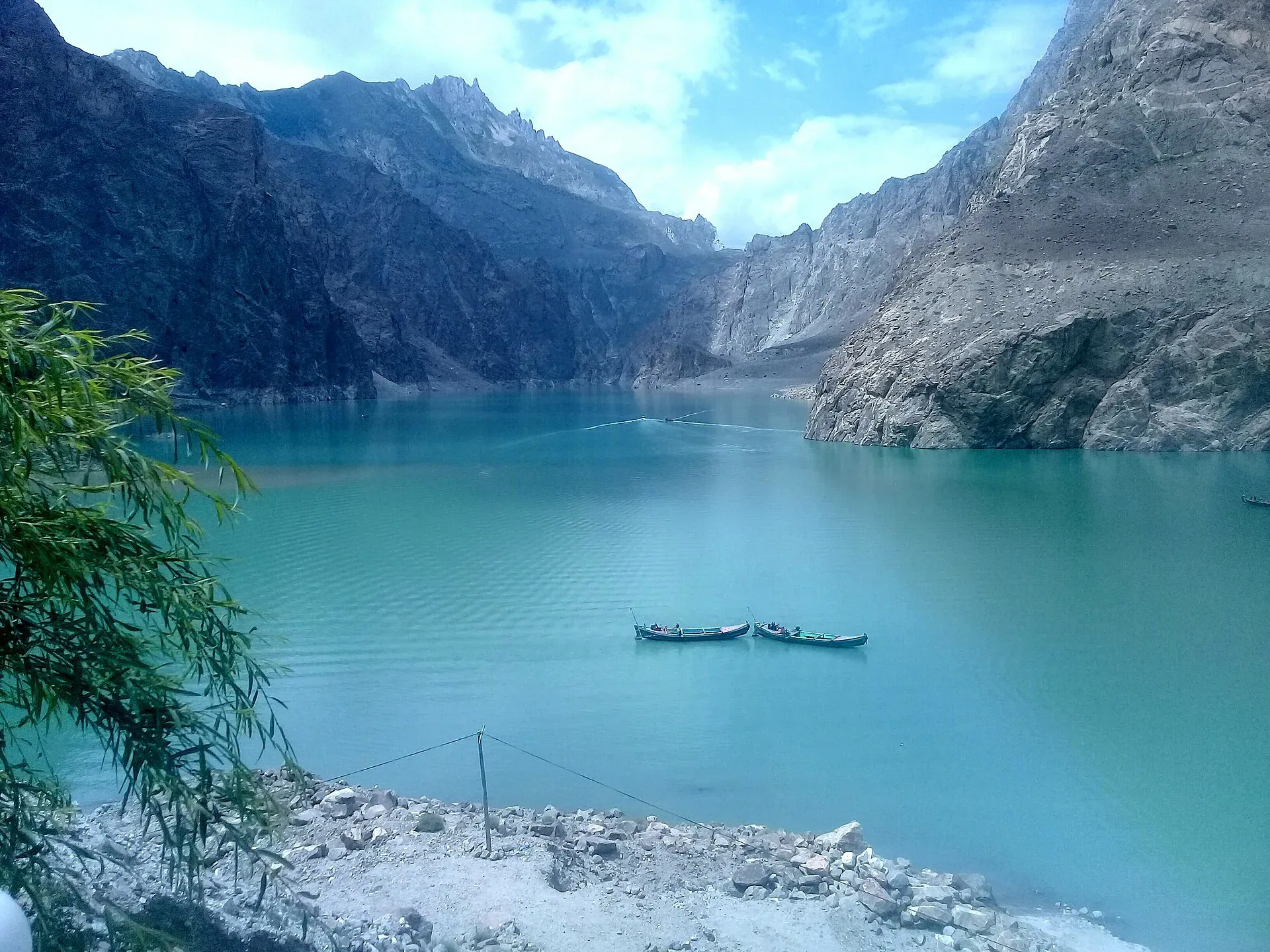
Photo: Peracha1, with thanks · CC BY-SA 4.0 · via Wikimedia Commons · temporary stand-in photo

Attabad Tunnels (Pakistan-China Friendship Tunnels)
Five tunnels on a 24 km realigned stretch of the Karakoram Highway that bypass Attabad Lake in Hunza. Opened in September 2015, they are a drive-through landmark, not a place to stop inside.
Overview
The Attabad Tunnels, officially the Pakistan-China Friendship Tunnels, are five tunnels on a 24 km realigned stretch of the Karakoram Highway (N-35) in Hunza. They carry traffic past Attabad Lake, which formed after a landslide in 2010. The tunnels are a drive-through landmark, not a place to stop.
Plan your visit
- Nearest town
- Gulmit
- Getting there
The tunnels are on the N-35 north of Karimabad. From Gilgit to Attabad Lake it is about 127 km by road (OSRM, around 1 hour 35 minutes without traffic); shared vans and buses toward Gulmit or Sost use the tunnels. More
Best months
May – Oct
- Attabad Tunnels (Pakistan-China Friendship Tunnels)
- Related places nearby: Attabad Lake, Gilgit
Why the road was moved
On 4 January 2010 a landslide struck Attabad village, about 14 km east of Karimabad, and dammed the Hunza River. Twenty people died. The lake that built up behind the dam grew to about 21 km long and 109 m deep at its greatest. It drowned more than 19 km of the Karakoram Highway, flooded houses, shops and farmland, and displaced about 6,000 people in the villages upstream. About 25,000 people were cut off by the loss of the road.
Water began to pass over the dam in early June 2010, and in 2012 the Frontier Works Organization blasted a spillway, lowering the lake by at least 10 m. The road stayed under water. Until September 2015, vehicles and passengers crossed the lake on boats and barges.
The tunnels
The new road has five tunnels, listed as 3,360 m, 2,736 m, 435 m, 410 m and 195 m, about 7 km in all. Prime Minister Nawaz Sharif inaugurated the realignment on 14 September 2015. The project cost is given as US$275 million, a figure that needs clarification, and the work was contracted to the China Road and Bridge Corporation.
Driving through
The tunnels are used by cars, vans and buses on the way between Karimabad, Gulmit and Sost in Upper Hunza (Gojal). There is nothing to visit inside. Shared vans and buses toward Gulmit or Sost use them.
The lake
Attabad Lake is the reason most visitors stop nearby. It is known for its blue-green colour, and boating, jet-skiing and fishing are offered on its shores. These are covered on the Attabad Lake page. Stop at the lake, not at the tunnel mouths.
When to visit
The highway is used all year, but winter snow and landslides in the gorges can delay traffic. Spring to autumn is easier.
Photography and safety
Do not stop, park or walk inside a tunnel. Tunnel portals and the road works around them are on a strategic road, so ask before photographing any security post or construction equipment. Take pictures only from safe, designated pull-offs.
Good to know
- Ask the district administration or local police about current conditions before you go. Travel advice. For foreign visitors: the UK FCDO (updated 27 October 2026, checked 16 November 2026) does not advise against Gilgit-Baltistan generally, but it advises against all travel on the Karakoram Highway between Mansehra and Chilas, which many road routes from Islamabad use. Read the live page.
- Fees. No fee applies to the tunnels that we could confirm.
- Nearby. Attabad Lake, Gulmit and Passu. Gilgit is the nearest large town: see Gilgit.
Highlights
- Five tunnels, about 7 km in total
- 24 km realigned stretch of the KKH
- Opened 14 September 2015
- Bypasses the lake formed by the 2010 landslide
Getting there
The tunnels are on the N-35 north of Karimabad. From Gilgit to Attabad Lake it is about 127 km by road (OSRM, around 1 hour 35 minutes without traffic); shared vans and buses toward Gulmit or Sost use the tunnels.
Tips
- Do not stop or walk in the tunnels.
- Take photos from safe pull-offs before or after the tunnels.
- Allow extra time in winter or after heavy rain.
- Check the FCDO page for the KKH before you plan.
Photos we still need: a tunnel portal or the road through the tunnels. Send us yours
Sources and last checked
Last checked Confidence medium4 sources2 still to check
- Last checked
- Method
- Desk research from published sources
- Confidence
- medium
- Checked by
- trek.pk research team
Researched from published sources; not yet checked on the ground by our team. Spot something out of date? Report a mistake.
Sources
- Attabad Lake · Wikipedia · checked
- PM inaugurates Attabad Tunnel · Geo News · checked
- Foreign travel advice: Pakistan · UK FCDO · checked
- Karakoram Highway · Wikipedia · checked
Still to be checked on the ground (2)
- Exact map point for the tunnels (the lake coordinate is used)
- Contractor name (China Road and Bridge Corporation) from a Karakoram Highway reference; no second source opened this pass
Nearby and related

Attabad Lake
A turquoise lake about 21 km long in Gojal, Hunza. It formed when a landslide blocked the Hunza River on 4 January 2010. The Karakoram Highway now passes it through five tunnels.

Gilgit
Gateway to Gilgit-Baltistan on the Karakoram Highway: a busy mountain town with the Kargah Buddha and the base for Hunza, Naltar and Skardu.