

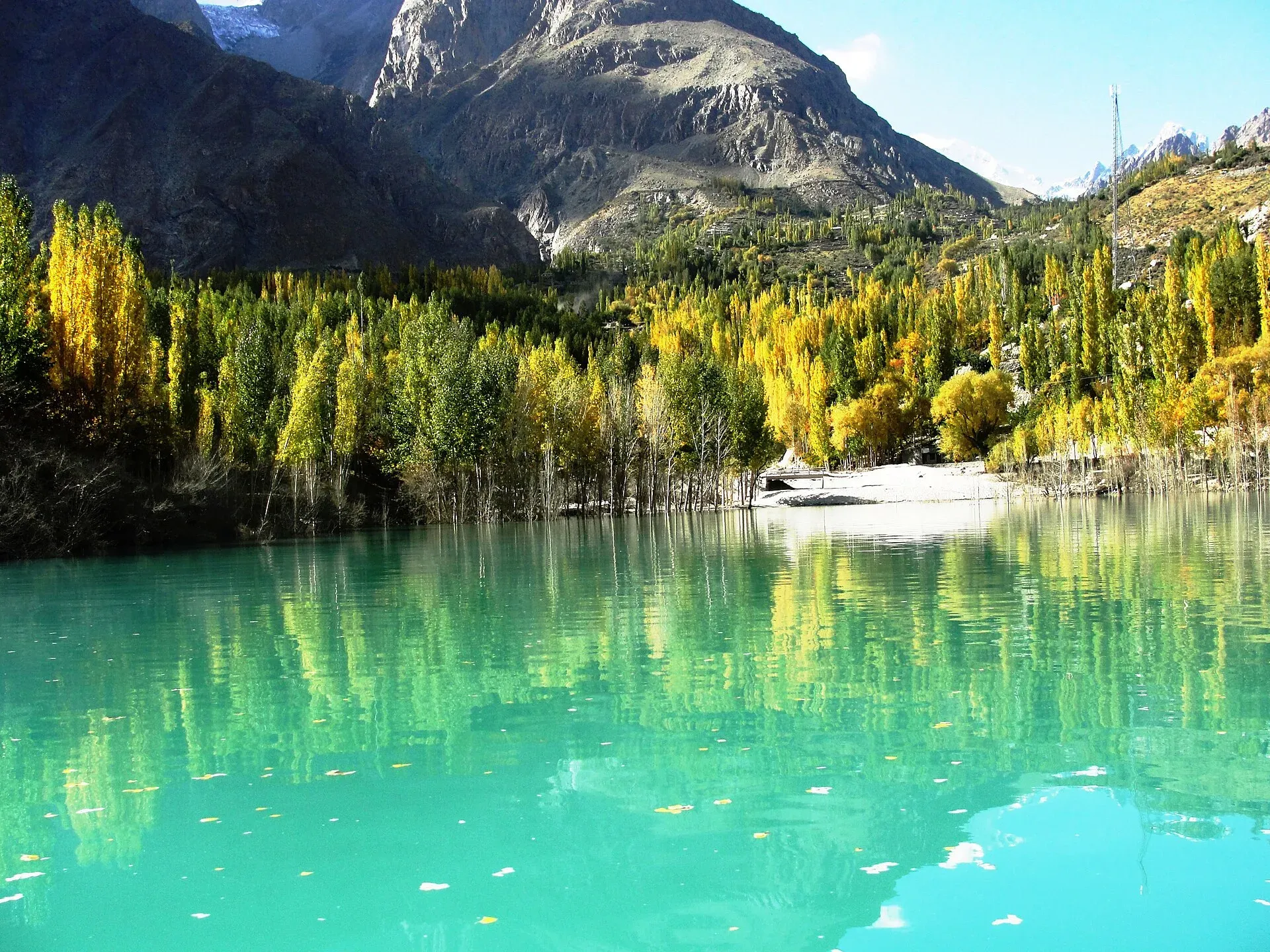
Photo: Noorpamiri, with thanks · CC BY-SA 3.0 · via Wikimedia Commons · temporary stand-in photo

Gulmit
The administrative centre of Gojal (Upper Hunza), at 2,465 m on the Karakoram Highway. A calm base for Ghulkin, Borith Lake, the museum and fort walks.
Overview
Gulmit is the administrative centre of Gojal, the upper part of Hunza District in Gilgit-Baltistan. It stands at 2,465 m on the KKH (Wikipedia). A 2016 survey counted about 5,000 people, which is not a census figure. There is no known 2023 census figure for Gulmit.
The people are mainly Wakhi and belong to the Ismaili branch of Islam; the Ismaili community organisations for Gojal have their offices in Gulmit. The Gulmit Glacier is named after the town. The setting is dry and cool, with orchards and poplars between steep rocky slopes.
Plan your visit
- Getting there
Road: On the KKH about 36 km north of Karimabad (OSRM, optimistic 30 min) and about 15 km south of Passu. Vans and buses run between Gilgit and Sost. More
Best months
May – Oct
- Gulmit
- Related places nearby: Gojal and Shimshal, Borith Lake, Attabad Lake, Passu, Sost, Hunza Valley, Karimabad (Hunza)
History in brief
Hunza was a princely state until 1974, and Gulmit was its summer capital, with the old summer palace of the Mir (ruler) of Hunza at the northern edge of the historic polo ground. After the state was abolished, Gulmit became the seat of the tehsil (sub-district) government. Wikipedia says the oldest intact house in the village is more than six centuries old, and the old part of the village holds the tomb of Salim Khan III (1790 to 1824).
What to see and do
- Ondra Fort: on Ondra hill above Gulmit and Ghulkin. Wikipedia says Qutlug Baig is believed to have built it in the 16th century, and that its ramparts rise 6 to 13 feet. The staircase up the hill has more than 1,600 steps, which Wikipedia calls the longest in Pakistan; the community built it in two to three months. From the fort there are views of the Ghulkin Glacier and the villages below.
- Ghulkin village and glacier: below Ondra Fort, with the Ghulkin Glacier close behind.
- Cultural museum: a small museum of local objects in a traditional house. One guide places it in a hotel, so ask locally for its location and hours.
- Borith Lake: about 2,600 m. A GB Tourism page says it was a winter hunting place for the Mir of Hunza, and that it has shrunk and turned brackish. A guide gives about 2 km from the village; others describe a long walk over the Ghulkin Glacier, so confirm the route.
- Attabad Lake: the lake formed by the 2010 landslide, close by to the south.
- Village lanes and orchards: apricot and cherry trees. Wikivoyage lists short walks to Kamris, Andra and Ghulkin, and views of Tupopdan and Shatubar Glacier.
- Local festivals: Wikivoyage says seasonal festivals feature traditional musicians and dancers. Ask locally about dates.
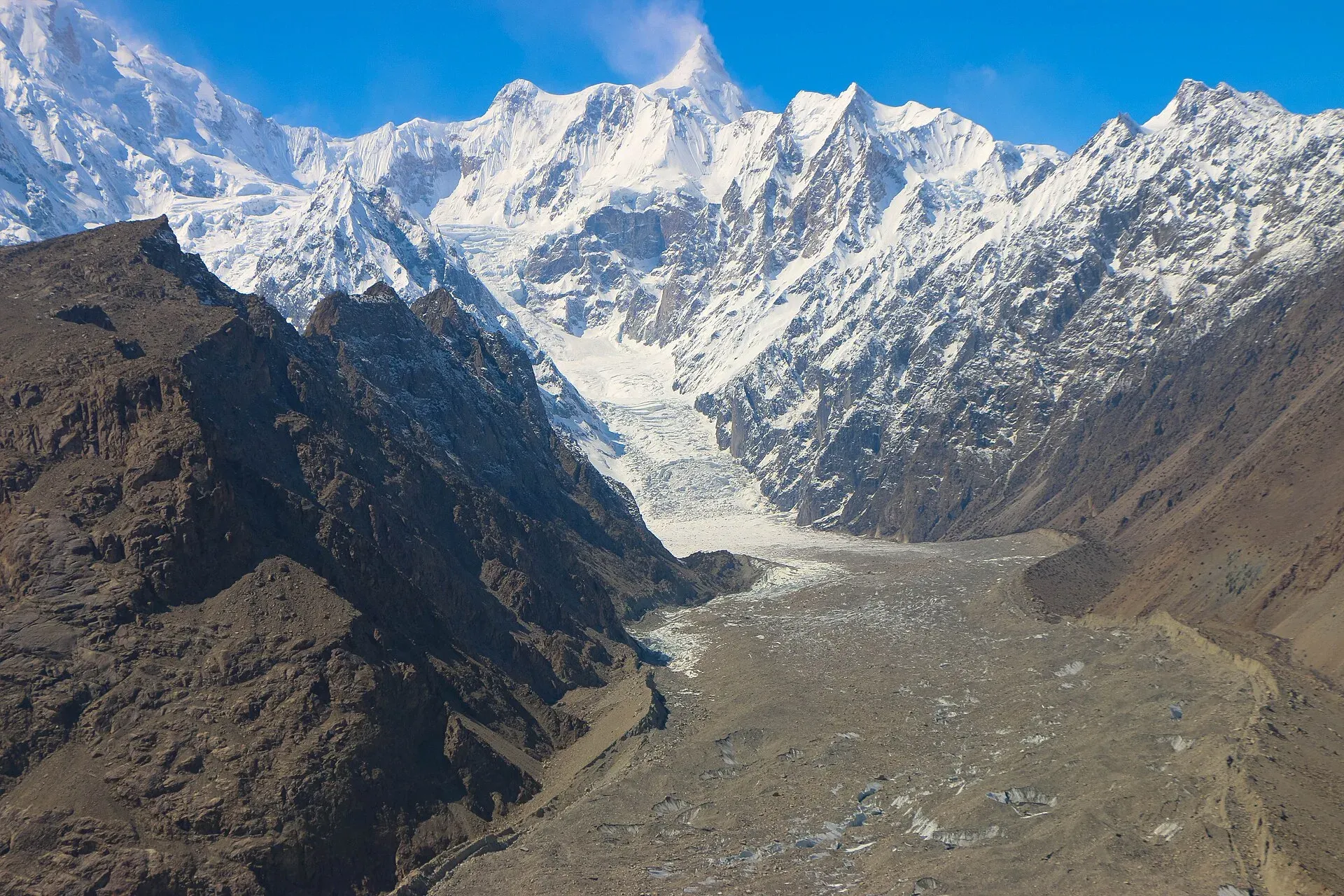
Photo: Akbar Khan Niazi, with thanks · CC BY-SA 3.0 · via Wikimedia Commons · temporary stand-in photo

Climate and season at a glance
Gulmit is a cool desert. May is its wettest month at about 24 mm, November the driest at about 2 mm, and the mean July temperature is 21.8 C. Dress for cold nights even in summer.
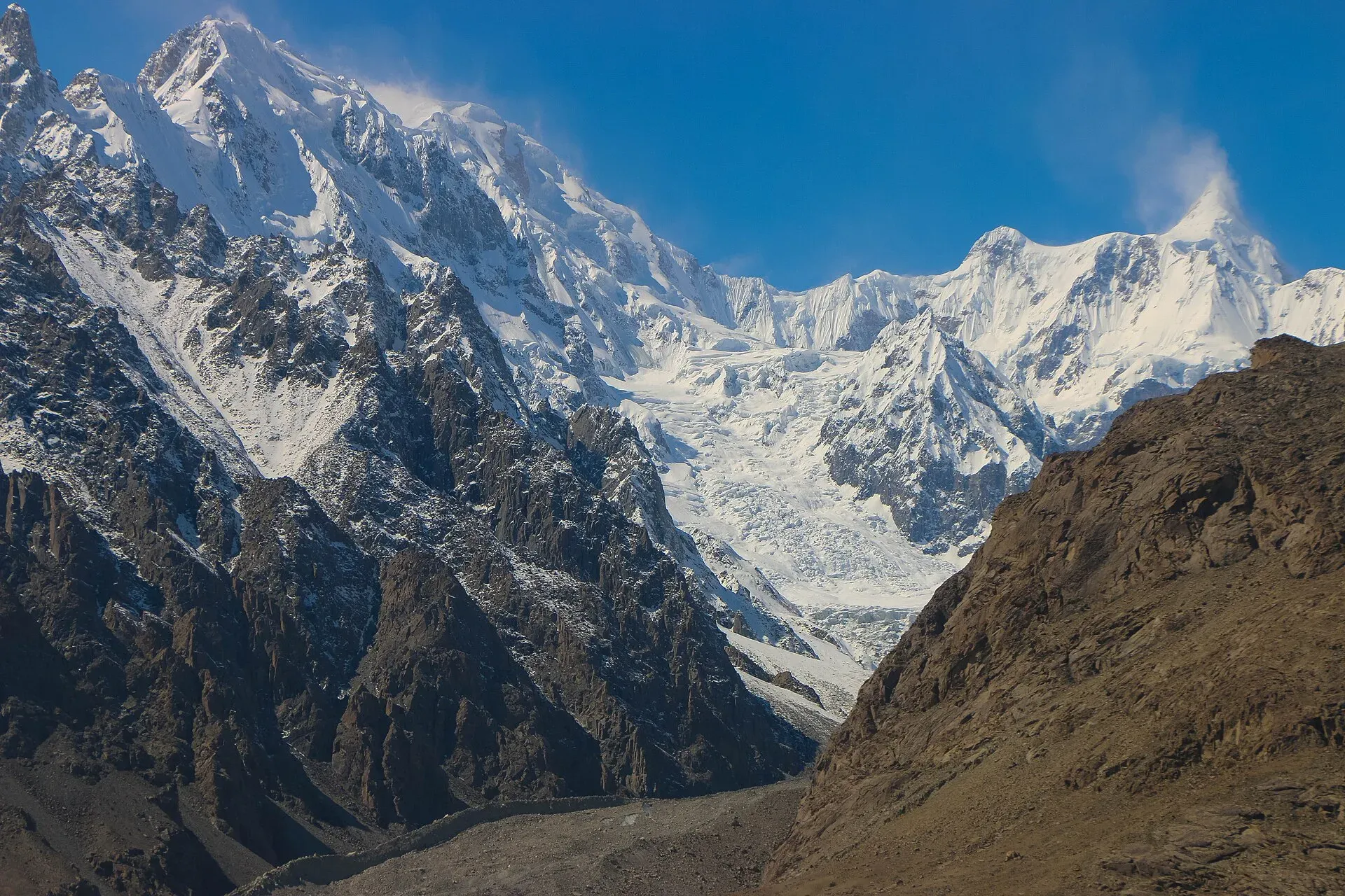
Photo: Akbar Khan Niazi, with thanks · CC BY-SA 3.0 · via Wikimedia Commons · temporary stand-in photo

Getting there
- Road: Gulmit is on the KKH about 36 km north of Karimabad (OSRM about 30 minutes, optimistic) and about 15 km south of Passu (Wikipedia says about 20 km). Sost is about 54 km further north. Gilgit is about 138 km away (guide).
- By air: the nearest airport is Gilgit.
- Public transport: vans and buses between Gilgit and Sost stop in Gulmit.
When to visit
May to October is the best time. Gulmit is cool arid: summer averages are about 18 to 24 C, July is warmest at about 22 C on average, and January averages about minus 5.5 C (Wikipedia). Annual rainfall is only about 113 mm, so the sun is strong and the nights can be cold. Winter brings snow, and many hotels close.
Where to stay and eat
Guesthouses and small hotels are in the town bazaar and highway strip, with quieter family-run rooms in Ghulkin and Hussaini. Meals are simple: soup, bread, potatoes, eggs and tea. In summer, book ahead.
Treks and day trips
Day trips go to Ghulkin, Borith Lake, Passu and Attabad Lake. Longer treks into Gojal start nearby; see the Gojal trek page.
Safety and good to know
Do not walk onto glacier ice without a guide. The KKH can be blocked by rockfall. Dress modestly and ask before photographing people. Carry your passport or national ID. The Tourist Police help line is 1422. The local bank ATM is reported not to accept foreign cards, so carry cash from Aliabad or Karimabad. Fees for guides, museum and lakes are not confirmed here; current fees will be added soon.
Highlights
- Ghulkin village and glacier
- Ondra Fort viewpoint
- Borith Lake walk
- Cultural museum
Stay, eat and essentials near Gulmit
Within 8 km of Gulmit, nearest first.
Places to stay
- Fallen Man's HeavenMap of Fallen Man's Heaven in Google Maps
- Jovenna Resort GulmitMap of Jovenna Resort Gulmit in Google Maps
- Moksha Resorts HunzaCall Moksha Resorts HunzaMap of Moksha Resorts Hunza in Google Maps
- Silk Route LodgeCall Silk Route LodgeMap of Silk Route Lodge in Google Maps
- Gulmit Continental Hotel Hunza ValleyMap of Gulmit Continental Hotel Hunza Valley in Google Maps
- Karakorum Family Guest House HunzaCall Karakorum Family Guest House HunzaMap of Karakorum Family Guest House Hunza in Google Maps
Places to eat
- Bozlanj CaféMap of Bozlanj Café in Google Maps
- Sikandar Biryani HouseCall Sikandar Biryani HouseMap of Sikandar Biryani House in Google Maps
- Valley EatsCall Valley EatsMap of Valley Eats in Google Maps
- Jahaan Restaurant GulmitCall Jahaan Restaurant GulmitMap of Jahaan Restaurant Gulmit in Google Maps
Essential services fuel stations, banks and hospitals and clinics
Fuel
- Total Parco GulmitMap of Total Parco Gulmit in Google Maps
- Faizi Petrol ShopMap of Faizi Petrol Shop in Google Maps
- Rehbar filling station GhulkinMap of Rehbar filling station Ghulkin in Google Maps
Banks and money exchange
- NBP Branch & ATMMap of NBP Branch & ATM in Google Maps
- National Bank of PakistanMap of National Bank of Pakistan in Google Maps
Hospitals and clinics
- Aga Khan Health CentreMap of Aga Khan Health Centre in Google Maps
- Govt Civil THQ HospitalMap of Govt Civil THQ Hospital in Google Maps
Listings come from Google Maps data and are unverified: phone numbers, opening months and prices may have changed. Report a problem · Own one of these? Claim it
Tips
- Spend a night here for quieter evenings than Karimabad.
- Walk the Ghulkin lanes early in the day.
- Confirm the Borith Lake path with a local.
- Carry enough cash; do not count on cards in Gojal.
Photos we still need: Ondra Fort and its staircase. Send us yours
Sources and last checked
Last checked Confidence medium6 sources4 still to check
- Last checked
- Method
- Desk research from published sources
- Confidence
- medium
- Checked by
- trek.pk research team
Researched from published sources; not yet checked on the ground by our team. Spot something out of date? Report a mistake.
Sources
- Gulmit · Wikipedia · checked
- District Hunza tourist guide and map · Tourism & Culture Department, Gilgit-Baltistan (tourism.gov.pk) · checked
- Borith Lake (GB Tourism) · Gilgit-Baltistan Tourism · checked
- OSRM driving route service: distances and times measured 16 November 2026 (times are optimistic, without stops) · OSRM / OpenStreetMap · checked
- Pakistan Tourism Guide 2021 · TDAP Pakistan · checked
- Gulmit · Wikivoyage · checked
Still to be checked on the ground (4)
- Museum location and opening hours (Wikipedia and gulmit.info give none)
- Borith Lake walking route (no source opened gives a route)
- Whether cards or ATMs work in Gojal (no source found)
- Ondra Fort access, opening and any fee
Nearby and related

Other treks in Gojal

Passu Glacier and Borith Lake Walk

Gojal and Shimshal
Upper Hunza: Gulmit, Ghulkin, Passu and Sost on the Karakoram Highway, with big glaciers and the Passu Cones, plus the remote Shimshal valley, its Wakhi village and its mountaineering community.
Borith Lake
A small lake in Gojal, upper Hunza, a short walk from Hussaini and Gulmit. It lies at about 2,600 m, fed by meltwater from Hussaini Glacier, and is a resting stop for migrating wildfowl.

Attabad Lake
A turquoise lake about 21 km long in Gojal, Hunza. It formed when a landslide blocked the Hunza River on 4 January 2010. The Karakoram Highway now passes it through five tunnels.
Passu
A Wakhi village in Gojal beside the Passu Glacier, below the jagged Passu Cones (Tupopdan, 6,106 m). Known for Hussaini Suspension Bridge, glacier walks and Batura views.

Sost
The last town on the Karakoram Highway before the Chinese border, at about 2,800 m. Sost has Pakistan's immigration and customs offices, a dry port, and is the base for Khunjerab Pass.

Hunza Valley
A long Karakoram valley on the Karakoram Highway, with Karimabad, Baltit and Altit forts, Ganish village and Attabad Lake, below Rakaposhi and Ultar Sar. About 100 km from Gilgit.

Karimabad (Hunza)
The main town of Hunza, set on a terrace below Baltit Fort with Rakaposhi, Ultar and Diran in view. A good base for forts, viewpoints, Attabad Lake and the road to Gojal.

Hunza and Khunjerab (KKH)
A 7-8 day road trip from Islamabad up the Karakoram Highway to Hunza and on to Khunjerab Pass (4,693 m), with overnight stops at Besham, Chilas and Gilgit.