

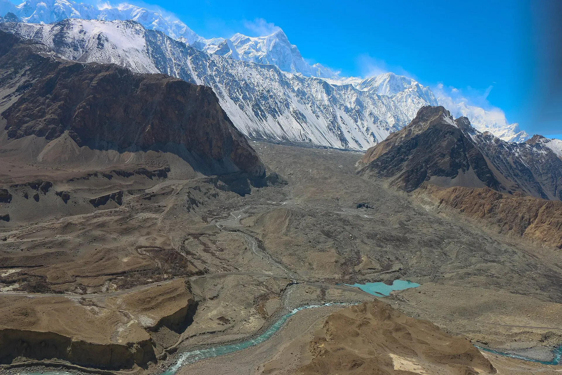
Photo: Akbar Khan Niazi, with thanks · CC BY-SA 3.0 · via Wikimedia Commons · temporary stand-in photo

Passu
A Wakhi village in Gojal beside the Passu Glacier, below the jagged Passu Cones (Tupopdan, 6,106 m). Known for Hussaini Suspension Bridge, glacier walks and Batura views.
Overview
Passu is a village in Gojal (Upper Hunza), Gilgit-Baltistan, close to the tongue of the Passu Glacier and just south of the Batura Glacier. The people are mainly Wakhi, whose families came from the Wakhan over several waves between about 1870 and 1948 (Wikipedia). The Passu Cones, also called Tupopdan or the Passu Cathedral, rise above the village to 6,106 m and are among the most photographed peaks in the region. Passu Sar, nearby, is 7,478 m. Sources give no village height; one tourism page gives about 2,500 m.
There is no known 2023 census figure for Passu.
Plan your visit
- Nearest town
- Gulmit
- Getting there
Road: On the KKH, about 50 km north of Aliabad (GB Tourism) and about 39 km south of Sost. Buses and vans run Gilgit to Sost. More
Best months
May – Oct
- Passu
- Related places nearby: Gojal and Shimshal, Borith Lake, Attabad Lake, Gulmit, Sost, Khunjerab National Park, Hunza Valley, Shispare
People and culture
Residents speak Wakhi and are almost entirely Ismaili Muslims, according to Wikipedia. Wikivoyage suggests asking locally about weddings in nearby Hussaini, where visitors may be able to see traditional costume, food and dancing. Treat any invitation as a favour, and ask before taking photographs of people.
What to see and do
- Passu Cones: best seen at sunrise and sunset from the fields and the highway.
- Passu Glacier: its tongue lies close to the village. A trail climbs the side of the glacier past Borith Lake, which Wikivoyage calls perhaps the best viewpoint in the area.
- Hussaini Suspension Bridge: a swaying bridge with gaps between its planks over the Hunza River near Hussaini. Wikipedia gives its length as 194 m, citing Dawn (5 July 2022); other sources give different figures. Cross only if you are steady on heights.
- Borith Lake: about 2,600 m, north-east of Passu, and said to be shrinking and brackish (GB Tourism).
- Batura Glacier: about 57 km long (Wikipedia's Passu page says 56 km) and one of the longest outside the poles; day walks and longer treks need a local guide.
- Village walks: orchards and stone terraces. The village is small enough to walk around, and the Hunza River bends around it in a wide meander.
Walks from Passu
- Hussaini bridge circuit: a path starts at the first hairpin south of Passu, and a circular walk can cross the Hussaini bridge further downstream.
- Borith Lake and the glacier trail: a road climbs the hillside from Hussaini to the lake, where there is a camping area. A trail continues up the side of the Passu Glacier.
- Yunz valley: lies between the Passu and Batura glaciers, behind Zard Sar. Wikivoyage describes a cairn-marked trail that keeps to the right of the lake below the Passu Glacier. Route-finding is not simple, so go with a local guide.
Getting there
- Road: Passu is on the Karakoram Highway, about 50 km north of Aliabad (GB Tourism Hunza guide) and about 51 km from Karimabad (OSRM about 40 minutes, optimistic). Sost is about 39 km north. Gilgit is about 147 km downstream (Express Tribune via Wikipedia).
- Public transport: buses and vans on the KKH between Gilgit and Sost stop at Passu; Wikivoyage says services leave from the northern end of the village. Ask your hotel about shared jeeps.
- Shimshal turn-off: the road to Shimshal leaves the highway about 5 km north of Passu, according to Wikivoyage.
When to visit
May to October is the main season. Summer is cool and sunny, and autumn has golden poplars. Winter is very cold, and many guesthouses close. Rock and landslide closures on the KKH can happen at any time of year, especially after summer storms.
Where to stay and eat
Guesthouses and small hotels line the KKH near the Passu Cones, with more in the village and near the glacier. Rooms are simple. Most guesthouses have an attached restaurant, and meals are home-style: soup, bread, potatoes, local butter and tea. There are fewer places to stay than in some neighbouring villages, and there is a general store in the village. Wikivoyage recommends apricot cake at one restaurant south of the village. Book ahead in July and August.
Treks and day trips
Day walks include the Passu Glacier and the Borith Lake path. Longer treks go to Batura, the Shimshal side and across passes; see the Gojal trek page. The road trip to Khunjerab Pass starts from Sost, about 39 km north.
Safety and good to know
Hussaini Bridge is risky, with wide gaps, and has a record of accidents. Glaciers have crevasses and moving ice. Do not go onto the ice without a guide. Pay attention to rockfall at the road bends. The Tourist Police number is 1422. A fee may apply for the bridge and for guides; current fees will be added soon.
Highlights
- Passu Cones (Tupopdan, 6,106 m)
- Passu Glacier close to the village
- Hussaini Suspension Bridge
- Base for Borith Lake and Batura
Stay, eat and essentials near Passu
Within 8 km of Passu, nearest first.
Places to stay
- Borith Lake Hotel & ResortCall Borith Lake Hotel & ResortMap of Borith Lake Hotel & Resort in Google Maps
- Rehman Backpacker HostelCall Rehman Backpacker HostelMap of Rehman Backpacker Hostel in Google Maps
- REHMAN homestay innCall REHMAN homestay innMap of REHMAN homestay inn in Google Maps
- Monarch Resort HunzaCall Monarch Resort HunzaMap of Monarch Resort Hunza in Google Maps
Essential services fuel stations
Fuel
- Rehbar filling station GhulkinMap of Rehbar filling station Ghulkin in Google Maps
Listings come from Google Maps data and are unverified: phone numbers, opening months and prices may have changed. Report a problem · Own one of these? Claim it
Tips
- Stay at least one night to see the Cones at both ends of the day.
- Do not cross Hussaini Bridge if you dislike heights.
- Take a guide for glaciers and long treks.
- Carry enough cash and warm clothes, even in summer.
Photos we still need: Yunz valley or the Borith Lake trail. Send us yours
Sources and last checked
Last checked Confidence medium7 sources3 still to check
- Last checked
- Method
- Desk research from published sources
- Confidence
- medium
- Checked by
- trek.pk research team
Researched from published sources; not yet checked on the ground by our team. Spot something out of date? Report a mistake.
Sources
- Passu village · Wikipedia · checked
- District Hunza tourist guide and map · Tourism & Culture Department, Gilgit-Baltistan (tourism.gov.pk) · checked
- Borith Lake (GB Tourism) · Gilgit-Baltistan Tourism · checked
- OSRM driving route service: distances and times measured 16 November 2026 (times are optimistic, without stops) · OSRM / OpenStreetMap · checked
- Pakistan Tourism Guide 2021 · TDAP Pakistan · checked
- Hussaini Suspension Bridge · Wikipedia · checked
- Passu · Wikivoyage · checked
Still to be checked on the ground (3)
- Village altitude (about 2,500 m from one tourism page; Wikipedia gives none)
- Whether a bridge entry fee applies and its amount (Wikipedia's summary box lists a toll but gives no price)
- Whether the Hussaini bridge circuit and Yunz valley trails are signed (Wikivoyage describes cairns only)
Nearby and related

Other treks in Gojal

Batura Glacier

Shimshal Village

Passu Glacier and Borith Lake Walk

Gojal and Shimshal
Upper Hunza: Gulmit, Ghulkin, Passu and Sost on the Karakoram Highway, with big glaciers and the Passu Cones, plus the remote Shimshal valley, its Wakhi village and its mountaineering community.
Borith Lake
A small lake in Gojal, upper Hunza, a short walk from Hussaini and Gulmit. It lies at about 2,600 m, fed by meltwater from Hussaini Glacier, and is a resting stop for migrating wildfowl.

Attabad Lake
A turquoise lake about 21 km long in Gojal, Hunza. It formed when a landslide blocked the Hunza River on 4 January 2010. The Karakoram Highway now passes it through five tunnels.

Gulmit
The administrative centre of Gojal (Upper Hunza), at 2,465 m on the Karakoram Highway. A calm base for Ghulkin, Borith Lake, the museum and fort walks.

Sost
The last town on the Karakoram Highway before the Chinese border, at about 2,800 m. Sost has Pakistan's immigration and customs offices, a dry port, and is the base for Khunjerab Pass.

Khunjerab National Park
A high-altitude park on the Pakistan-China border, created in 1975 to protect Marco Polo sheep, snow leopard and Himalayan ibex. It surrounds the Khunjerab Pass on the Karakoram Highway.

Hunza Valley
A long Karakoram valley on the Karakoram Highway, with Karimabad, Baltit and Altit forts, Ganish village and Attabad Lake, below Rakaposhi and Ultar Sar. About 100 km from Gilgit.

Shispare
Shispare (7,611 m) is the high peak in the Batura Muztagh seen above Passu and the Passu Glacier. It was first climbed in 1974 by a Polish-German expedition.

Hunza and Khunjerab (KKH)
A 7-8 day road trip from Islamabad up the Karakoram Highway to Hunza and on to Khunjerab Pass (4,693 m), with overnight stops at Besham, Chilas and Gilgit.