

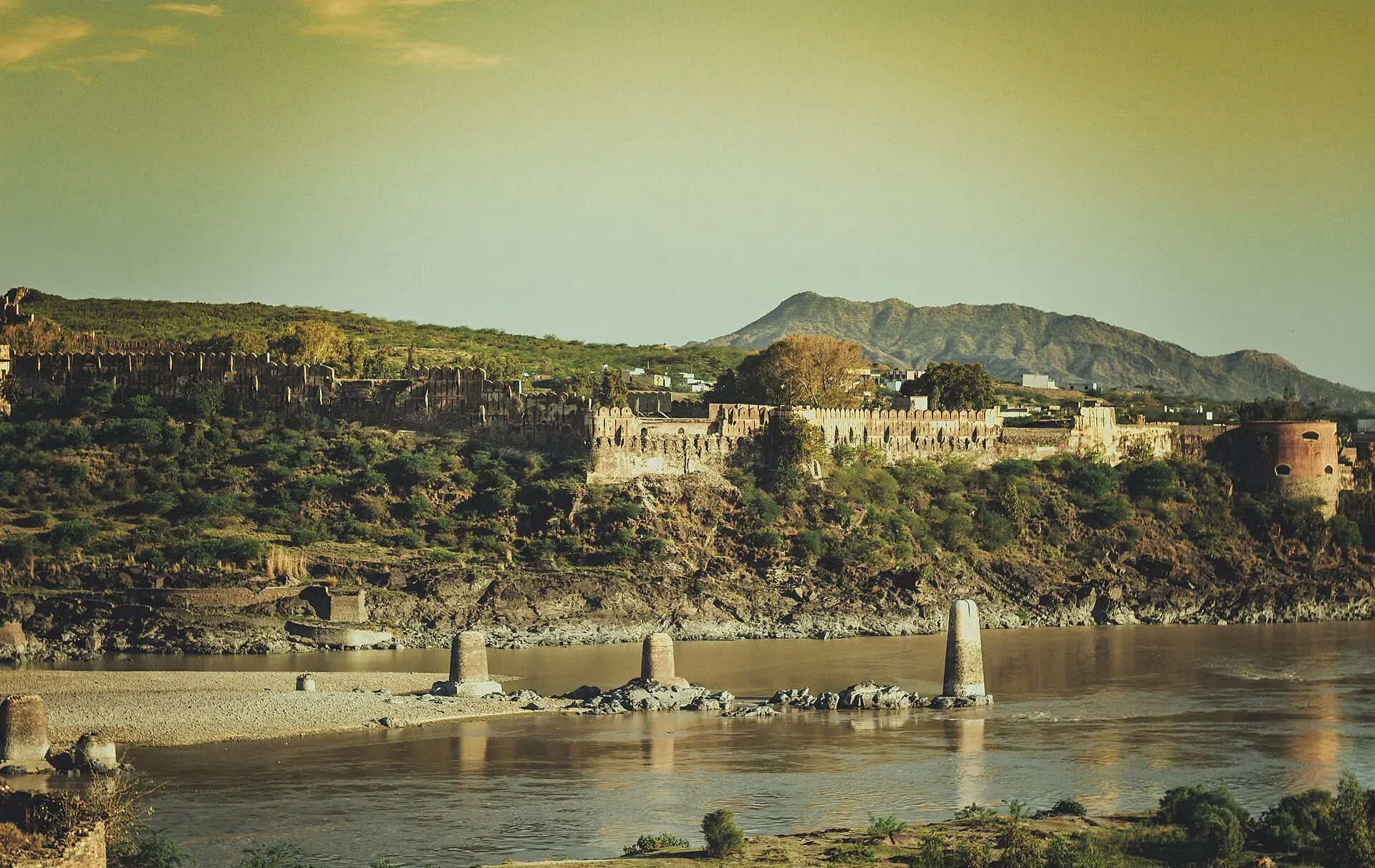
Photo: Imkashi94, with thanks · CC BY-SA 4.0 · via Wikimedia Commons · temporary stand-in photo

Attock Kabul-Indus Confluence
Where the Kabul River meets the Indus near Attock Fort: a well-known river junction where the water from the two rivers can be seen running side by side in different colours.
Overview
The Kabul River joins the Indus near Attock, just upstream of the old Mughal fort. Water researchers describe the two rivers as different in colour at the meeting point, with the Kabul greyish and the Indus bluer. It is a river-watching spot at a crossing that has mattered for centuries.
Plan your visit
- Nearest town
- Attock
- Getting there
From Attock town it is about 24 km by road, roughly 22 minutes (OSRM routing). From Islamabad or Rawalpindi, Attock is about 80 km west (from Rawalpindi, per Wikipedia) on the Grand Trunk Road; More
Best months
Oct – Apr
- Attock Kabul-Indus Confluence
- Related places nearby: Attock, Attock Fort
The two rivers
The Kabul River is about 700 km long. It rises in the Hindu Kush in Afghanistan, flows through Kabul and Jalalabad, enters Pakistan's Khyber Pakhtunkhwa and passes Peshawar, Charsadda and Nowshera before reaching the Indus. It is little more than a trickle for much of the year and swells in summer with snowmelt; its average discharge near Nowshera is about 800 cubic metres a second. The Chitral River carries more water than the Kabul where they meet near Jalalabad, but the combined river keeps the Kabul name. The Greeks knew it as the Cophen.
History of the crossing
The name Attock comes from the Punjabi word atak, a barrier or obstruction. The spot guarded the routes between Central Asia and South Asia. Alexander the Great, Mahmud of Ghazni, Timur, Nader Shah and Babur are all recorded as crossing the Indus at or near the site of Attock Fort. Akbar's government built the fort between 1581 and 1583, under Khawaja Shamsuddin, to protect the crossing. The Marathas held it in 1758, the Sikh Empire took it in 1813, and the British in 1849.
The bridges
The Old Attock Bridge is a railway bridge over the Indus between Attock Khurd and Khairabad Kund. It was built between 1880 and 1883, opened on 24 May 1883 and rebuilt in 1929. It is a double-deck truss bridge of wrought iron, 425 m long with five spans. The upper deck carries the railway; the lower deck carried road traffic on the Grand Trunk Road until the New Attock Bridge opened in 1979. See Attock bridges.
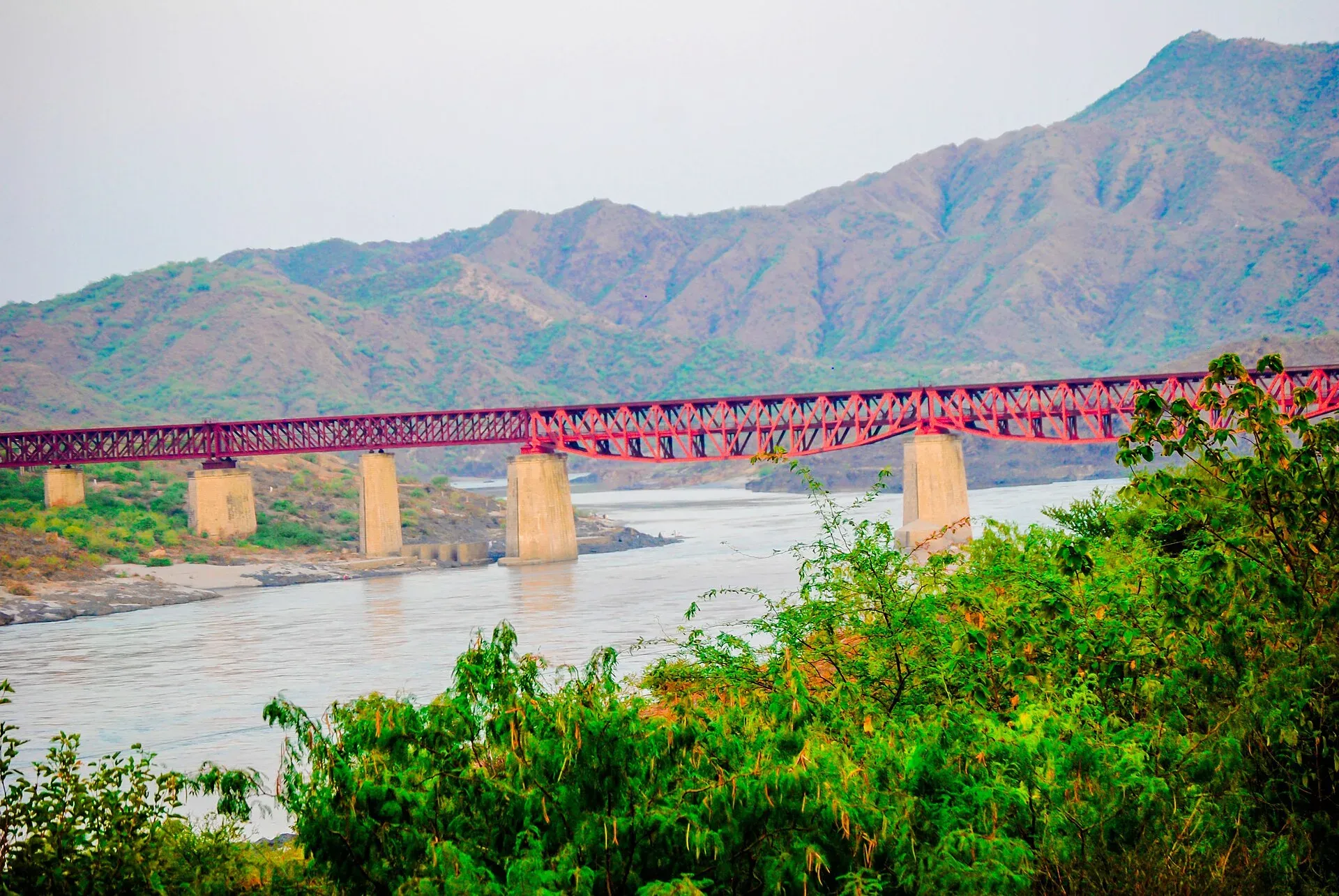
Photo: Prince Waqar Jalbai, with thanks · CC BY-SA 4.0 · via Wikimedia Commons · temporary stand-in photo

Attock Fort
The fort is about 1,600 m round, with eight bastions and six gates, including the Delhi, Lahori and Kabuli gates. It is a military base and is not open to visitors; it can be seen from outside. The Mughal caravanserai known as Begum Ki Sarai stands next to it. See Attock Fort.
What to see and do
- View the meeting of the rivers. The meeting point is close to the bridges near Attock Khurd; ask locally for the current best viewing spot.
- See the bridges from the bank, and the fort from outside.
- Day trip. Many people come from Islamabad or Rawalpindi. See Attock for the town.
When to visit
Floods turn the junction turbulent, so avoid the monsoon (July to September). October to April is calmer and cooler. Mornings are the most comfortable.
Where to stay and eat
Attock has basic hotels and eateries.
Good to know
- Bridges, the fort and the area around them are sensitive sites. Do not photograph military or bridge security posts and follow instructions.
- Do not go near the water's edge, especially when the river is high.
- Viewing points and access can change; ask locally.
Highlights
- Kabul River meets the Indus near Attock
- Different river colours side by side
- Historic crossing used by invaders and traders
- Attock Fort and old railway bridge nearby
Getting there
From Attock town it is about 24 km by road, roughly 22 minutes (OSRM routing). From Islamabad or Rawalpindi, Attock is about 80 km west (from Rawalpindi, per Wikipedia) on the Grand Trunk Road; then ask for Attock Khurd. A taxi or your own car is the simplest way.
Tips
- Go in the cooler months.
- Stay back from the bank.
- Do not photograph military sites or bridge guards.
- Combine with a view of Attock Fort.
Photos we still need: the confluence itself, showing the two colours of water. Send us yours
Sources and last checked
Last checked Confidence low7 sources4 still to check
- Last checked
- Method
- Desk research from published sources
- Confidence
- low
- Checked by
- trek.pk research team
Researched from published sources; not yet checked on the ground by our team. Spot something out of date? Report a mistake.
Sources
- Is joint management of Kabul River by Pakistan and Afghanistan possible? · International Water Management Institute (via The News) · checked
- Attock (Wikipedia) · Wikipedia · checked
- Attock Fort (existing trek.pk page) · trek.pk · checked
- OSRM road routing (driving distance and time from the city centre) · OpenStreetMap / OSRM · checked
- Attock Bridge · Wikipedia · checked
- Kabul River · Wikipedia · checked
- Attock Fort · Wikipedia · checked
Still to be checked on the ground (4)
- Exact confluence viewpoint location and public access (no opened source names one)
- Name 'Neelab' for the confluence (not found in Wikipedia's Attock, Attock Khurd or Kabul River articles)
- Which bridge gives the best view (Wikipedia describes the Old Attock Bridge but not views)
- Distance from Attock town: OSRM gives about 24 km (re-run 17 Nov 2026, same result); the map pin itself is still approximate
Nearby and related

Attock
District capital on the Grand Trunk Road near the Indus, about 86 km from Islamabad. A practical stop with the Mughal-era Attock Fort nearby.

Attock Fort
A Mughal fort on the Indus at Attock, built by Akbar in 1581-83 with six gates and eight bastions. It is run by the army and is not open to the public.

Indus River
Pakistan's greatest river, rising in Tibet and running about 3,180 km to the Arabian Sea. It crosses Gilgit-Baltistan, meets the Gilgit near Jaglot and the Kabul at Attock, and feeds the plains from Tarbela to the delta.

Kabul River
A river of about 700 km that rises in Afghanistan, enters Khyber Pakhtunkhwa near Peshawar, passes Charsadda and Nowshera, and joins the Indus near Attock. Not a visitor destination at present; see travel advice.