

Photo: Akbar Khan Niazi, with thanks · CC BY-SA 4.0 · via Wikimedia Commons · temporary stand-in photo

Indus River
Pakistan's greatest river, rising in Tibet and running about 3,180 km to the Arabian Sea. It crosses Gilgit-Baltistan, meets the Gilgit near Jaglot and the Kabul at Attock, and feeds the plains from Tarbela to the delta.
Overview
The Indus is the backbone of Pakistan. The length depends on the source. Wikipedia uses about 3,180 km (Himalayan Climate and Water Atlas, 2015) and notes that 2,880 km was widely used before; Britannica switched from the shorter to the longer figure in 2015. A 2011 Chinese remeasurement suggested about 3,600 km but was never published in full. The basin is about 1,120,000 sq km. The river starts in Tibet, flows through Ladakh, and enters Gilgit-Baltistan before running the full length of the country to the Arabian Sea near Karachi. Its average flow at the delta is about 5,533 cubic metres a second, with a very wide range: a recorded minimum of about 1,200 and a maximum of about 58,000.
The river is called Sindhu in Sanskrit and Tibetan, and the name is the root of "Sindh", "Hindu" and "India". Ladakhis and Tibetans call it the Senge Tsangpo.
Plan your visit
- Nearest town
- Skardu
- Getting there
The river can be reached at many points. Skardu has flights from Islamabad and a road from Gilgit; Jaglot is on the Karakoram Highway about 45 km from Gilgit; Chilas and Dasu are on the KKH; More
Best months
Apr – Jun, Sep – Oct
Course and tributaries
In Baltistan the Indus passes Skardu, where the Shigar River joins from the north. The Shyok joins near Keris, close to Skardu. Further downstream the Gilgit River meets the Indus near Jaglot, about 45 km south-east of Gilgit. Sources describe this as the point where the Karakoram, the Hindu Kush and the Himalaya come together; the Gilgit itself carries the Hunza, so much of the Karakoram's meltwater arrives here.
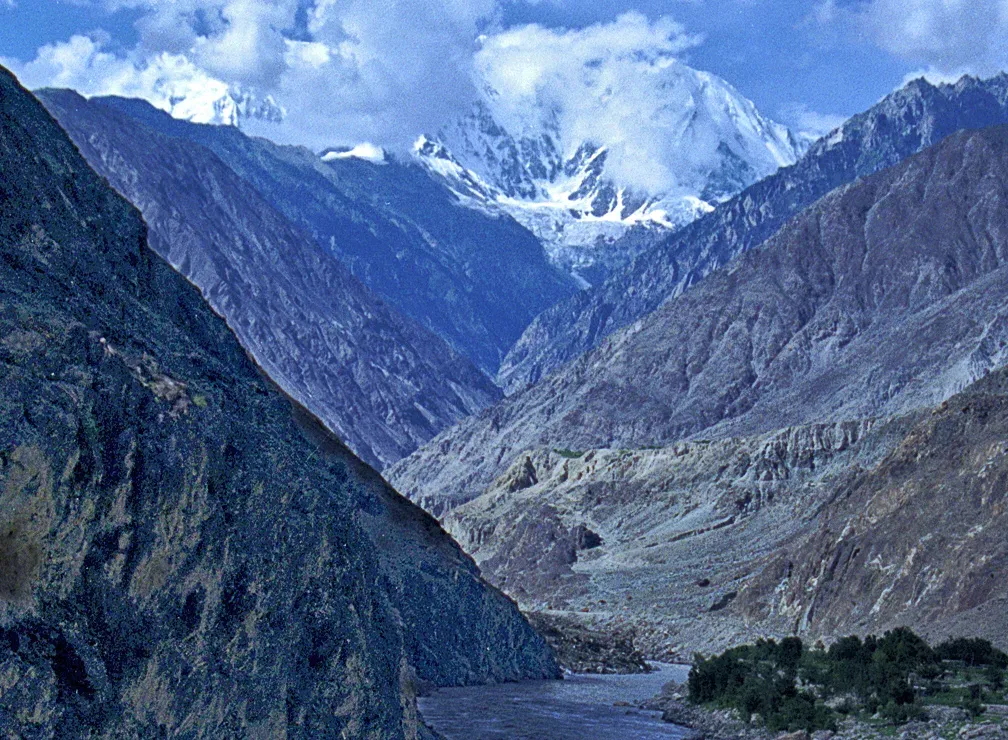
Photo: Heavyrunner, with thanks · CC BY-SA 3.0 · via Wikimedia Commons · temporary stand-in photo

Near Nanga Parbat the river cuts the Indus Gorge. Wikipedia gives its depth as 4,500 to 5,200 m, measured from the river to the surrounding summits, and calls it among the deepest canyons in the world. The river then passes Chilas and Dasu into Khyber Pakhtunkhwa and is held back by the Tarbela reservoir, about 80 km long. It reaches the Punjab plains at Kalabagh, where a dam has been proposed but is controversial. The Kabul joins at Attock; the Swat reaches the Indus through the Kabul. Other main tributaries listed by reference works are the Soan, Kurram, Gomal and Zhob. The Chenab, Jhelum, Ravi and Sutlej combine as the Panjnad, which meets the Indus at Mithankot. Below that the old name for the river was the Satnad.
In Sindh the river passes Sukkur and Hyderabad, runs under the Kotri Barrage and ends in a delta of marshes, creeks and mudflats south of Thatta.
Dams and barrages
- Tarbela Dam (completed 1976) is about 148 m high and 2,743 m long, with a reservoir about 80 km long and an installed capacity of 4,888 MW.
- Diamer-Bhasha (a planned 272 m dam about 40 km downstream of Chilas) and Dasu are under construction upstream of Tarbela. Wikipedia (edited October 2026) gives an estimated opening of 2028 for Diamer-Bhasha, though its own text implies about 2029, and for Dasu an estimate of December 2027 in the headline figure but 2029 in the text. Dates have moved before; check WAPDA for current progress.
- Barrages for irrigation include Chashma, Taunsa, Guddu (about 1,350 m long), Sukkur and Kotri (about 915 m long, supplying water to Karachi). The Sukkur Barrage supplies more than 20,000 sq km of farmland.
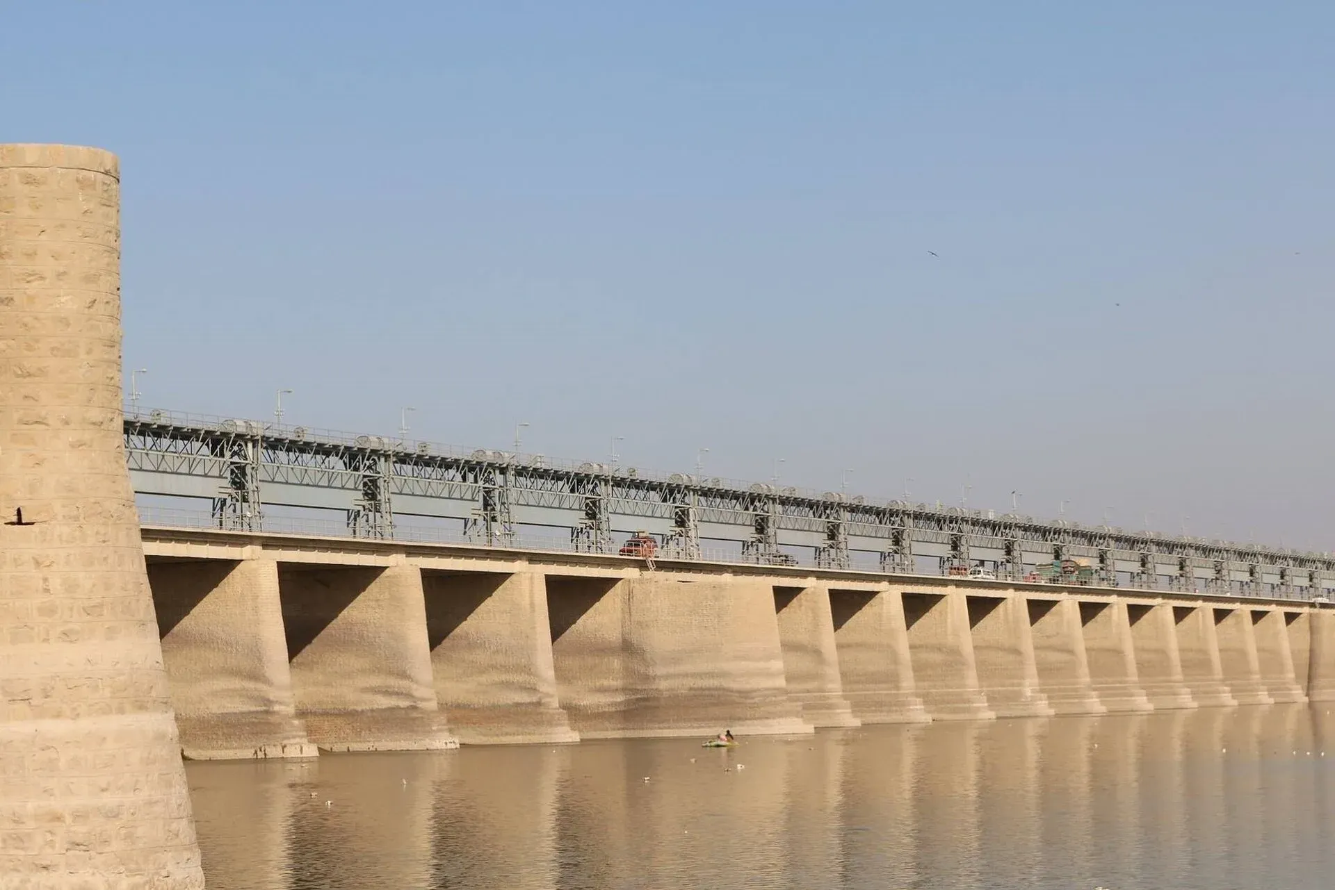
Photo: Jeetesh Maheshwari, with thanks · CC BY-SA 4.0 · via Wikimedia Commons · temporary stand-in photo

Irrigation and the farmland
The Indus Basin Irrigation System is described as the largest contiguous irrigation system developed in the past 140 years. Modern canal building began in 1850 under the East India Company, but canals are as old as the Indus Valley Civilisation. Punjab and Sindh grow most of Pakistan's wheat, cotton and sugarcane with this water. Lansdowne Bridge and Ayub Bridge link Rohri and Sukkur across the river; other major road bridges cross at Dadu-Moro, Thatta-Sujawal and Jhirk-Mula Katiar.
Fish and wildlife
The basin holds more than 180 freshwater fish species, 22 of which live nowhere else. The palla (Tenualosa ilisha), a sea-run fish, is a local delicacy, and Sukkur, Thatta and Kotri are the main fishing centres. Pomfret and prawns are found in the delta.
The Indus river dolphin is found only in this river. The IUCN lists it as Endangered. It survives in only about 690 km of the Indus, in five small groups separated by barrages; WWF puts the population at about 1,816. Two otter species, including the Sindh otter, also live in the basin. Less fresh water now reaches the sea: flow below Kotri was about 180 billion cubic metres a year originally and had fallen to about 33 billion by 2018, which threatens the delta.
What to see and do
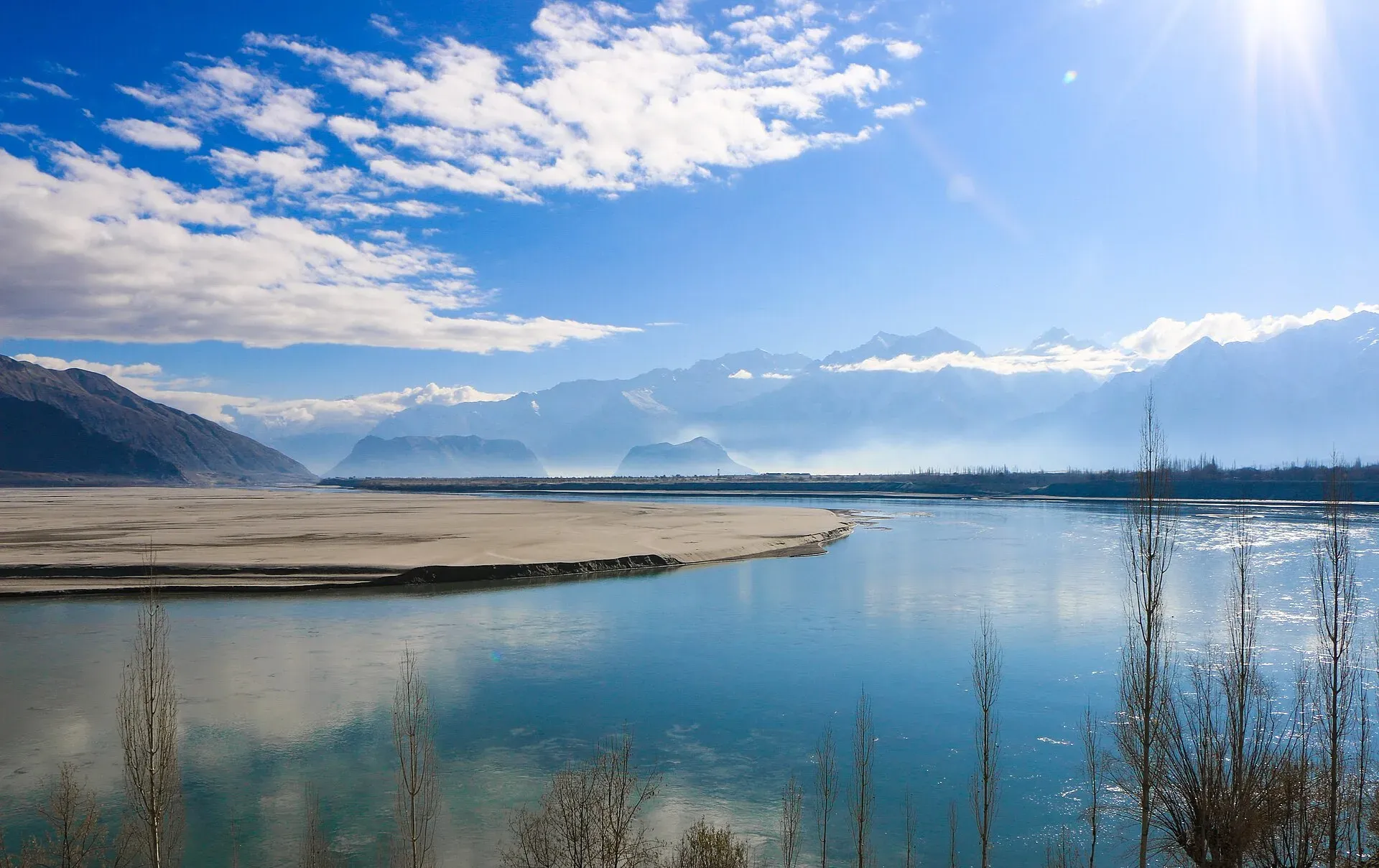
- Skardu and Jaglot. The wide sandy Indus beside Skardu is the easiest place to see the river from the Karakoram side. The Jaglot junction is a short stop for the confluence.
- Chilas. The river banks and nearby rocks hold thousands of carvings, from many periods; see the Chilas rock carvings page.
- Attock. The fort stands where the Kabul River joins the Indus.
- Dera Ismail Khan and the Punjab plains. The river here is wide and slow, with sandbars, ferries and fishing communities.
- Sukkur and the delta. The barrage, the island shrine of Sadhu Bela and the Keenjhar Lake area are in Sindh.
- Dolphin reserve and Taunsa. See the dolphin reserve and Taunsa pages; do not plan a sighting trip without checking security.
- Rafting. Operators advertise rafting on stretches in Gilgit-Baltistan and Khyber Pakhtunkhwa. Sources disagree on the best months and sections, and there is no known official list. Use a licensed operator and ask the tourism department.
Culture and heritage
The Indus Valley Civilisation grew beside it in the 3rd millennium BC. Harappa and Mohenjo-daro date to around 3300 BC at their earliest, with the major sites spanning about 2600 to 1900 BC. See the Indus civilisation route. Hindus honour the river; the Sindhu Darshan festival is held each June on its banks near Leh, in Indian-administered Ladakh.
When to visit
Upper stretches are best from April to October. The river is highest from late spring to the monsoon, when flows are muddy and fast. The Sindh plains are pleasant from November to February.
Floods
The Indus floods the banks in the July to September monsoon. In 2010 flooding began in July and the river burst its banks near Sukkur on 8 August; by September more than 2,000 people had died and more than a million homes were destroyed. Sindh was flooded again from mid-August 2011, with an estimated 434 deaths. Check NDMA and PMD alerts in July to September, and avoid camping on riverbanks.
Good to know
- Water sharing. Under the 1960 Indus Waters Treaty Pakistan receives about 84% of the system's water. Wikipedia records that India suspended the treaty on 23 April 2025. The status is disputed, and it does not affect travel.
- Ask the district administration or local police about current conditions before you go. Safety. For foreign visitors: the UK FCDO (updated 27 October 2026, checked 16 November 2026) advises against all travel on the KKH between Mansehra and Chilas, and against all but essential travel to Sindh north of and including Nawabshah. It does not advise against Gilgit-Baltistan generally. See the river crossings guide for crossing streams safely.
Highlights
- About 3,180 km from Tibet to the Arabian Sea
- Meets the Gilgit near Jaglot, where three great ranges join
- Tarbela Dam and a chain of irrigation barrages
- Home of the Endangered Indus river dolphin
- Cradle of the Indus Valley Civilisation
Getting there
The river can be reached at many points. Skardu has flights from Islamabad and a road from Gilgit; Jaglot is on the Karakoram Highway about 45 km from Gilgit; Chilas and Dasu are on the KKH; Attock is on the Grand Trunk Road and the motorway. Check road and security advice before using the KKH.
Tips
- Check NDMA and PMD flood alerts from July to September
- Keep clear of riverbanks and sandbars in high water
- Use a licensed operator for rafting
- Ask WAPDA or local offices about dam-site access before you travel
- Read FCDO advice for northern Sindh and the KKH first
Photos we still need: the Indus delta, and the river at Attock. Send us yours
Sources and last checked
Last checked Confidence medium9 sources2 still to check
- Last checked
- Method
- Desk research from published sources
- Confidence
- medium
- Checked by
- trek.pk research team
Researched from published sources; not yet checked on the ground by our team. Spot something out of date? Report a mistake.
Sources
- Indus River (Wikipedia) · Wikipedia · checked
- Gilgit River (Wikipedia) · Wikipedia · checked
- Jaglot (Wikipedia) · Wikipedia · checked
- Tarbela Dam (Wikipedia) · Wikipedia · checked
- Diamer-Bhasha Dam (Wikipedia) · Wikipedia · checked
- Indus river dolphin (Wikipedia) · Wikipedia · checked
- Pakistan Tourism Guide 2021 · Trade Development Authority of Pakistan (TDAP) · checked
- Pakistan travel advice (updated 27 October 2026) · UK Foreign, Commonwealth & Development Office · checked
- Dasu Dam (Wikipedia) · Wikipedia · checked
Still to be checked on the ground (2)
- Diamer-Bhasha and Dasu completion dates (Wikipedia estimates conflict; no WAPDA page opened)
- Rafting sections, season and operator licensing (no source opened)
Nearby and related

Skardu
The main town of Baltistan, where the Indus meets the Shigar river. Skardu is the base for the Deosai Plains, the Kachura and Satpara lakes, Shigar, and the K2 and Baltoro treks.

Gilgit
Gateway to Gilgit-Baltistan on the Karakoram Highway: a busy mountain town with the Kargah Buddha and the base for Hunza, Naltar and Skardu.

Chilas
Headquarters of Diamer on the Karakoram Highway and the Indus, with thousands of ancient rock carvings, views towards Nanga Parbat, and the road junctions for Fairy Meadows and Babusar Pass.
Chilas Rock Carvings
Thousands of rock carvings along the Indus near Chilas, from prehistoric hunting scenes to Buddhist stupas and inscriptions left by Silk Road travellers.

Dasu
The headquarters of Upper Kohistan District on the Karakoram Highway, beside the Indus. A rest and checkpoint stop between Besham and Chilas, and the site of a large dam project.

Attock Fort
A Mughal fort on the Indus at Attock, built by Akbar in 1581-83 with six gates and eight bastions. It is run by the army and is not open to the public.

Indus Dolphin Reserve (Sukkur-Guddu)
A river reserve on the Indus in northern Sindh between Guddu and Sukkur barrages, declared in 1974 and Ramsar site no. 1065 since 2001. Home to the largest group of the Endangered Indus river dolphin. Security advice applies.

Taunsa Barrage Wildlife Sanctuary
A Ramsar-listed Indus reservoir in south-west Punjab, notified in 1972 and designated in 1996 (site no. 817). A key winter site for waterfowl, bar-headed geese and part of the Indus river dolphin's range.

Moenjodaro
The ruins of a planned Indus Valley city built around 2500 BCE, with brick streets, drains and the Great Bath. A UNESCO World Heritage Site since 1980, about 30 km from Larkana in Sindh.
Sukkur
Sindh's third-largest city on the Indus, with the 1932 Sukkur Barrage, the 1889 Lansdowne Bridge, Masum Shah's Minaret and the river islands of Rohri.

Keenjhar Lake
Sindh's largest freshwater lake, about 36 km from Thatta and roughly 120 km from Karachi. A Ramsar site since 1976, with winter ducks, geese and flamingos and a shrine on an island.
Sukkur Barrage (Lloyd Barrage)
A 1932 barrage across the Indus at Sukkur, originally named Lloyd Barrage. About 2 km long, it feeds seven canals and waters a large part of Sindh.

Kotri Barrage (Ghulam Muhammad Barrage)
A barrage on the Indus between Jamshoro and Hyderabad, finished in 1955. It is the last major barrage before the river reaches the sea, and carries a road across the river.
Guddu Barrage
An Indus barrage near Kashmore on the Sindh-Punjab border, finished in 1962. It feeds four canals, cools a thermal power station and carries a road across the river.

Jinnah Barrage (Kalabagh)
A 1946 barrage across the Indus at Kalabagh in Mianwali district. It feeds the Thal Canal and has a 96 MW power station.
Ghazi-Barotha Hydropower Project
A 1,450 MW run-of-river power project on the Indus below Tarbela, with a barrage at Ghazi and a 52 km power channel. Completed in 2004. It is a working WAPDA site, not a visitor attraction.
Diamer-Bhasha Dam
A large dam under construction on the Indus, about 40 km downstream of Chilas. It is a construction site, closed to casual visitors, and lies on the Karakoram Highway section covered by FCDO advice.
Dasu Dam
A large hydropower dam under construction on the Indus near Dasu in Kohistan. It is a construction site for a 4,320 MW project and is not open to visitors.

Tarbela Dam
A huge earth-and-rockfill dam on the Indus, finished in 1976. It is a working WAPDA power and water site with limited public access, so plan on permission rather than a drop-in visit.

Jaglot Confluence (Three Giants)
A roadside stop at Jaglot on the Karakoram Highway, about 45 km from Gilgit, where the Gilgit River meets the Indus and three great ranges are said to meet.

Attock Kabul-Indus Confluence
Where the Kabul River meets the Indus near Attock Fort: a well-known river junction where the water from the two rivers can be seen running side by side in different colours.

Dera Ismail Khan
A historic Indus river city in southern Khyber Pakhtunkhwa where Saraiki and Pashtun cultures meet, near the 5,000-year-old Rehman Dheri mound. Check security advice before any visit.

Chashma Barrage
An Indus barrage in Mianwali district, completed in 1971, that irrigates land, controls floods and generates power. Its reservoir is a Ramsar wetland.

Indus Civilisation
Visit the great cities of the Indus Valley Civilisation: Harappa in Punjab, then Kot Diji and Mohenjo-daro in Sindh. Story, timeline, day plan, and current safety limits for northern Sindh.