

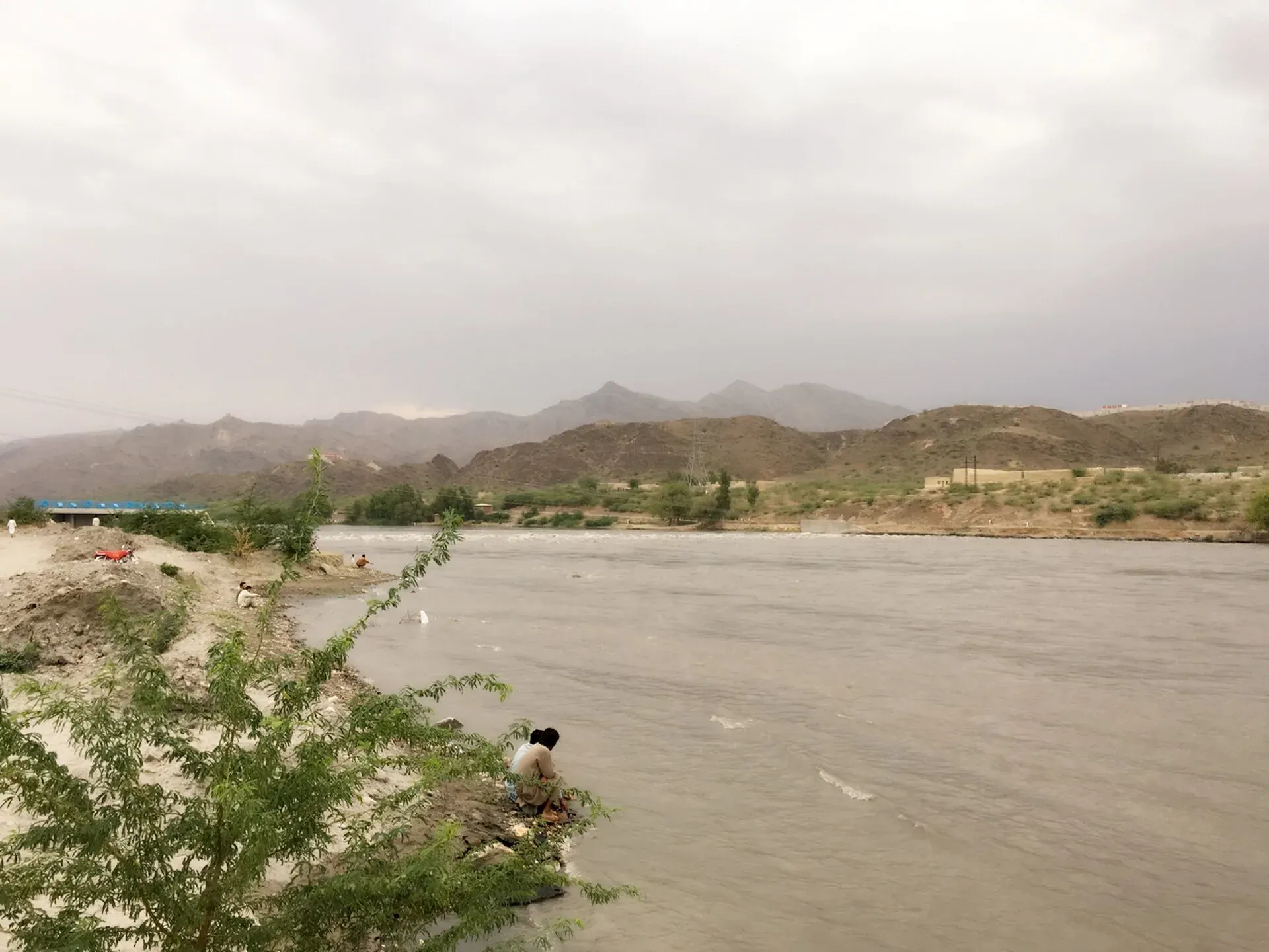
Photo: Syed533, with thanks · CC BY-SA 4.0 · via Wikimedia Commons · temporary stand-in photo

Kabul River
A river of about 700 km that rises in Afghanistan, enters Khyber Pakhtunkhwa near Peshawar, passes Charsadda and Nowshera, and joins the Indus near Attock. Not a visitor destination at present; see travel advice.
Overview
The Kabul River is about 700 km long. It rises in the Sanglakh range of the Hindu Kush in Maidan Wardak, Afghanistan, and flows east through Kabul and Jalalabad. It is little more than a trickle for much of the year but swells in summer with snowmelt. It enters Khyber Pakhtunkhwa about 25 km north of the Torkham border crossing, runs past Peshawar, Charsadda and Nowshera, and ends at the Indus near Attock. Its mean annual discharge near Nowshera is about 800 cubic metres a second.
Plan your visit
- Nearest town
- Nowshera
- Getting there
Peshawar, Charsadda and Nowshera are on the Grand Trunk Road and the Islamabad–Peshawar Motorway. Attock is the easiest place to see the confluence,. More
Best months
Nov – Mar
Names and history
Its Sanskrit name was Kubha and the Greeks called it the Cophen. Arrian used that name in his account of Alexander's campaigns, and the Life of Apollonius of Tyana describes a ford of the Cophen. The medieval scholar Al-Biruni called it the River of Ghorwand. The river gave its name to the city of Kabul. The valleys it waters, around Peshawar and Charsadda, were part of the old Gandhara region.
Course and tributaries
In Afghanistan the Chitral (Kunar) River joins east of Jalalabad. It is the Kabul's largest tributary, contributing over 288 cubic metres a second, but the Kabul name continues. In Pakistan the Swat River joins near Charsadda, adding over 280 cubic metres a second and bringing the Panjkora with it. The Bara River joins from the Peshawar side. The Kabul then crosses the Peshawar plain and enters the Indus near Attock.
Dams
Warsak Dam is in Mohmand district, about 20 to 30 km north-west of Peshawar. Upstream in Afghanistan are the Surobi (1957), Naghlu and Darunta dams. Reference works note heavy summer droughts in the river's Afghan section since the 1990s. The river crosses the border, so the flow reaching Pakistan depends partly on use upstream.
What to see and do
The Kabul is mainly a working river, serving irrigation canals and hydropower, and has no developed visitor route.
- Attock. The meeting of the Kabul and the Indus is best seen from the Attock Fort area. See Attock Fort and the Attock confluence.
- Peshawar and Nowshera. The river runs near both, but visitors usually come for the city sights. See Peshawar.
- Warsak. The area near Warsak Dam can be reached from Peshawar, but check access and security first.
When to visit
Winter and spring are more comfortable on the plains. July to September brings the heaviest flows and floods. There is no known season advice for visitors.
Good to know
- Ask the district administration or local police about current conditions before you go. Safety. For foreign visitors: the UK FCDO (updated 27 October 2026, checked 16 November 2026) advises against all travel to Peshawar, Charsadda, Mohmand, Khyber, Swat, Upper and Lower Dir and other KP districts, and against all travel within 10 miles of the Afghan border. It advises against all but essential travel to Nowshera and Malakand. KP emergency measures and Governor's Rule have applied since 11 October 2026. Read the live page; do not plan visits along most of this river.
- Floods are a real risk in monsoon. Check NDMA and PMD alerts.
- Do not swim in the river or camp on its banks. Wikipedia reports that untreated sewage entering the river in Kabul was linked to illness among families living along it in 2019.
- Water-sharing between Pakistan and Afghanistan is a matter for governments; it does not affect travellers.
Highlights
- About 700 km from the Hindu Kush to Attock
- Passes Peshawar, Charsadda and Nowshera
- Receives the Swat River near Charsadda
- Joins the Indus at Attock
- Warsak Dam is on the river near Peshawar
Getting there
Peshawar, Charsadda and Nowshera are on the Grand Trunk Road and the Islamabad–Peshawar Motorway. Attock is the easiest place to see the confluence,. Because of current FCDO advice, check with your operator and local authorities before travelling.
Tips
- Check the FCDO page before planning any visit
- View the Kabul–Indus meeting from Attock
- Avoid river edges during monsoon floods
- Do not swim or camp by the river
Photos we still need: the Kabul-Indus confluence at Attock. Send us yours
Sources and last checked
Last checked Confidence medium5 sources4 still to check
- Last checked
- Method
- Desk research from published sources
- Confidence
- medium
- Checked by
- trek.pk research team
Researched from published sources; not yet checked on the ground by our team. Spot something out of date? Report a mistake.
Sources
- Kabul River (Wikipedia) · Wikipedia · checked
- Swat River (Wikipedia) · Wikipedia · checked
- Indus River (Wikipedia) · Wikipedia · checked
- Pakistan travel advice (updated 27 October 2026) · UK Foreign, Commonwealth & Development Office · checked
- Warsak Dam · Wikipedia · checked
Still to be checked on the ground (4)
- Length within Pakistan (Wikipedia gives only the ~700 km total)
- Warsak access and security (Wikipedia gives location only; FCDO advises against all travel to Mohmand)
- Where the Bara joins the Kabul (Wikipedia lists it as a right-bank tributary, no location)
- Source elevation of the Kabul's headwaters differs (about 2,400 m and about 14,000 ft in the same article)
Nearby and related

Peshawar
Khyber Pakhtunkhwa's capital and one of South Asia's oldest living cities: the Gandhara museum, Qissa Khwani Bazaar, mosques and a strong food culture.

Charsadda
District headquarters about 29 km north of Peshawar on the plain of the Kabul and Swat rivers, and the site of Pushkalavati, an ancient capital of Gandhara.

Nowshera
A Grand Trunk Road and railway town on the Kabul River, about 43 km east of Peshawar, with a large cantonment. Mostly a stop on the way between Peshawar and Islamabad.

Attock
District capital on the Grand Trunk Road near the Indus, about 86 km from Islamabad. A practical stop with the Mughal-era Attock Fort nearby.

Attock Fort
A Mughal fort on the Indus at Attock, built by Akbar in 1581-83 with six gates and eight bastions. It is run by the army and is not open to the public.

Swat River
A perennial river of northern Khyber Pakhtunkhwa formed at Kalam by the Ushu and Gabral streams. It runs through the Swat Valley to the Kabul River near Charsadda. Travel advice currently warns against Swat.

Chitral River (Kunar)
A river of about 480 km that rises in the Hindu Kush of Chitral, flows past Chitral town, becomes the Kunar in Afghanistan, and joins the Kabul River east of Jalalabad.

Indus River
Pakistan's greatest river, rising in Tibet and running about 3,180 km to the Arabian Sea. It crosses Gilgit-Baltistan, meets the Gilgit near Jaglot and the Kabul at Attock, and feeds the plains from Tarbela to the delta.
Warsak Dam
A concrete dam on the Kabul River north-west of Peshawar, completed in 1960. It is a working power and irrigation site in an area the UK FCDO advises against visiting.