

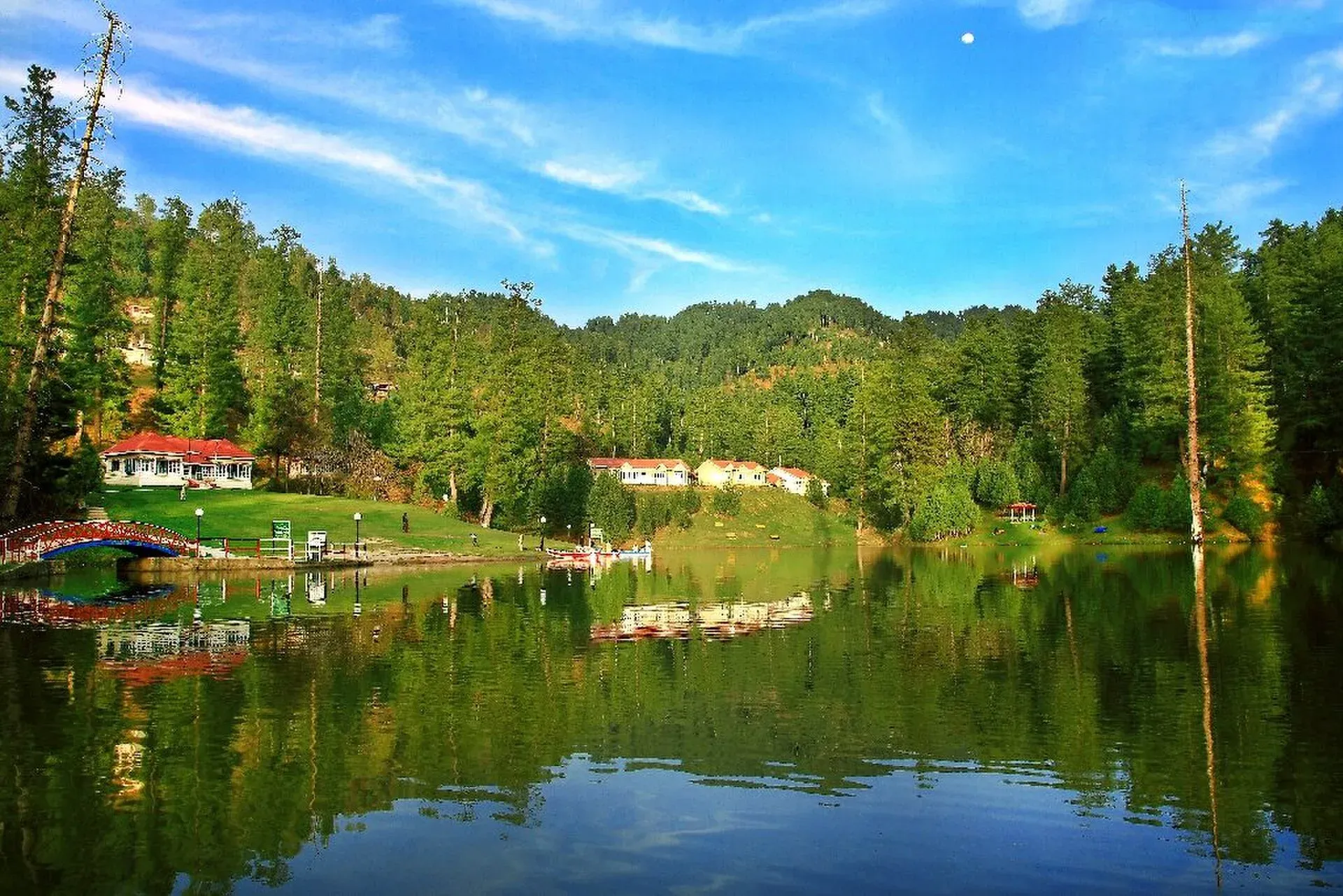
Photo: Khurram Naseer, with thanks · CC BY-SA 3.0 · via Wikimedia Commons · temporary stand-in photo

Banjosa Lake
A man-made lake at about 1,980 m in a pine forest, 18 km from Rawalakot in Poonch. It is reached by a paved road and freezes in winter.
Overview
Banjosa Lake is an artificial lake at about 1,981 m in Poonch District, Azad Kashmir, about 18 km from Rawalakot by a metalled road. Pine forest covers the slopes around it. It is mainly a leisure spot, not a wild one: there are rest houses, paths around the shore and boats.
Wikipedia describes it as a man-made lake and tourist resort, and says it was rebuilt by Shoukat Hussain, a contractor from Poonch District. No construction date is given, so none is stated here.
Plan your visit
- Nearest town
- Rawalakot
- Getting there
From Islamabad or Rawalpindi, drive to Rawalakot in Poonch (about 160 km from Rawalpindi per Wikipedia; More
Best months
Apr – Jun, Sep – Oct
- Banjosa Lake
- Related places nearby: Muzaffarabad, Rawalakot, Toli Pir National Park
Setting and climate
The lake is about 340 m higher than Rawalakot, which Wikipedia puts at 1,638 m. Rawalakot has a subtropical highland climate with four seasons: snow in December and January, and most of its roughly 508 mm of yearly rain between July and September. At the lake, summers are cool, about 16 to 25 degrees Celsius, and winters are cold, down to around minus 5, with snow in December and January. The lake freezes in winter, and people walk and skate on the ice. Check with local people before stepping on it.
Rawalakot and the area
Rawalakot is the district capital, in the Pir Panjal range, and a working town more than a resort. Gujjars are the largest group in the district, with Bakarwals, Kashmiris, Sayeds, Rajputs and Sudhans also living here. Pahari, Gujari and Hindko are widely spoken. The town was a centre of the 1955 Poonch uprising and was badly damaged in the 2005 earthquake. See Rawalakot for the town. Wikipedia lists Toli Pir among the nearby tourist places; see Toli Pir National Park.
On the lake
- Boating. Paddle boats are usually available in season.
- Walks. A path runs round the lake and into the forest.
- Winter ice. Skating and walking on the frozen lake are part of the winter visit.
- Bazaars. Chotta Gala and Banjosa bazaars, about 1 km away, have a few shops, hotels and rest houses.
Getting there
Rawalakot is about 120 km from Islamabad by Wikipedia's Rawalakot page, and about 160 km from Rawalpindi by its Banjosa page. The two figures are for different routes and starting points. Roads link Rawalakot with Rawalpindi through Goyain Nala and Tain, and a 1984 directory describes it as approachable from Rawalpindi via Kohala and Azad Pattan. Allow several hours depending on traffic and road work. OSRM models about 130 km and 1 hour 45 minutes from Islamabad, which is optimistic on mountain roads. From Rawalakot, Banjosa is about 18 km on a paved road, and local taxis and shared vans serve it.
When to visit
April to June and September to October are mild. Summer is cool, and winter brings snow and ice. The road is paved but winding and may be icy in winter.
Where to stay and eat
Wikipedia lists rest houses and huts run by the AJK Tourism and Archaeology Department, the Public Works Department and the Pearl Development Authority, plus a few hotels, guest houses and tuck shops. Book rest houses early for summer weekends and ask the AJK Tourism Department for current arrangements.
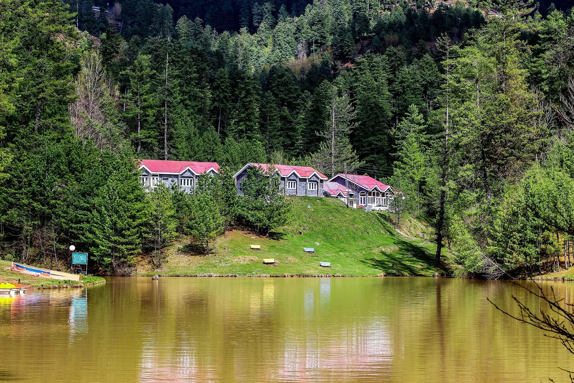
Photo: Obaid-ur-Rehman, with thanks · CC BY-SA 4.0 · via Wikimedia Commons · temporary stand-in photo

Good to know
- Fees: Any entry, parking or boating charges are set locally. Current fees will be added soon.
- Facilities: Limited. Bring cash.
Travel advice
Ask the district administration or local police about current conditions before you go. For foreign visitors: the UK FCDO advises against all but essential travel to Azad Jammu and Kashmir, and against all travel within 10 miles of the Line of Control (advice updated 27 October 2026, checked 16 November 2026). Read the live advice before you plan.
Highlights
- Pine-ringed lake at about 1,980 m
- Paved road from Rawalakot, 18 km
- Boating in summer; frozen in winter
- Rest houses run by AJK authorities
Tips
- Check road and snow reports in winter
- Book a rest house early for summer weekends
- Carry cash; card use is rare
- Check local advice before walking on ice
Facilities
- Rest houses
- Boating
- Shops at Banjosa bazaar
Photos we still need: paths and pine forest around the lake; lake frozen in winter. Send us yours
Sources and last checked
Last checked Confidence medium2 sources3 still to check
- Last checked
- Method
- Desk research from published sources
- Confidence
- medium
- Checked by
- trek.pk research team
Researched from published sources; not yet checked on the ground by our team. Spot something out of date? Report a mistake.
Sources
- Banjosa Lake · Wikipedia · checked
- Rawalakot · Wikipedia · checked
Still to be checked on the ground (3)
- Time from Islamabad by road: OSRM models about 130 km in 1 h 45 min; no source gives a real-world time
- Date of the lake's construction (Wikipedia says only that it was rebuilt by a Poonch contractor)
- Current rest-house booking arrangements (Wikipedia lists AJK Tourism, PWD and Pearl Development Authority rest houses; no booking details; ajktourism.gov.pk would not load, certificate expired)
Nearby and related

Muzaffarabad
The capital of Azad Jammu and Kashmir, at 737 m where the Neelum and Jhelum rivers meet. It is the gateway to the Neelum Valley and a rebuilt city after the 2005 earthquake.

Neelum Valley
A long, forested river valley in Azad Kashmir running north-east from Muzaffarabad to Sharda, Kel and Arang Kel. It runs close to the Line of Control, so check access before you go.

Rawalakot
The main town of Poonch district in Azad Kashmir, at about 1,640 m, and the usual base for Banjosa Lake and Toli Pir. Cool in summer, with snow in winter. FCDO advises against all but essential travel to AJK.
Toli Pir National Park
A rugged mountain park in the Rawalakot area of Azad Kashmir, rising from about 1,500 m to over 6,000 m by Wikipedia's account, with black bear and leopard.