

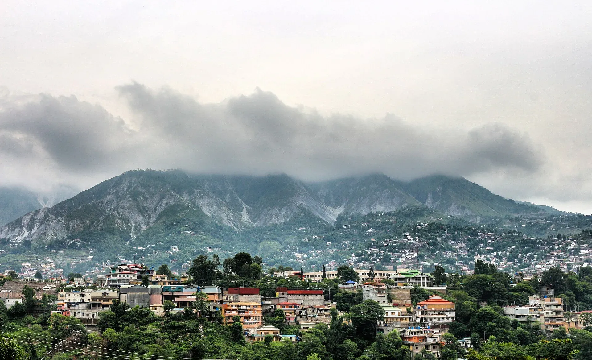
Photo: Fiaz3300, with thanks · CC BY-SA 4.0 · via Wikimedia Commons · temporary stand-in photo

Muzaffarabad
The capital of Azad Jammu and Kashmir, at 737 m where the Neelum and Jhelum rivers meet. It is the gateway to the Neelum Valley and a rebuilt city after the 2005 earthquake.
Overview
Muzaffarabad is the capital of Azad Jammu and Kashmir (AJK). It lies at about 737 m in a valley formed by the confluence of the Neelum and Jhelum rivers (Wikipedia). Most visitors pass through on the way to the Neelum Valley or on a day trip from Islamabad.
Sultan Muzaffar Khan, a chief of the Bomba tribe, founded the city in 1646 and built a fort beside the river to guard against Mughal incursions. Pashtun tribesmen and pro-Pakistan Kashmiri fighters took the town from the Jammu and Kashmir State Forces on 22 October 1947. The earthquake of October 2005 (magnitude 7.6) destroyed about half of its buildings, and most government buildings with them; rebuilding has been slow.
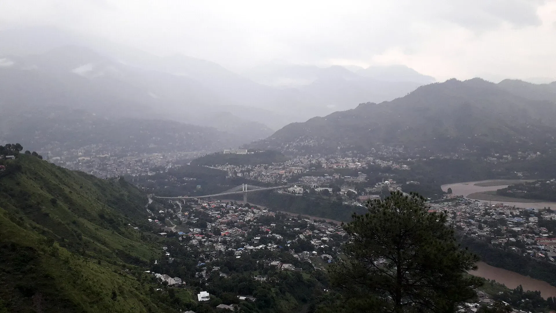
Photo: King Eliot, with thanks · CC BY-SA 4.0 · via Wikimedia Commons · temporary stand-in photo

On the 2023 census, AJK's planning department gives Muzaffarabad District a total of 703,661 people (AJK at a Glance 2025, table of district-wise population, Census 2023; 174,517 of them urban). There is no known separate 2023 figure for the city itself.
Plan your visit
- Getting there
Road: Islamabad about 129 km (OSRM, optimistic 1 h 30 min) via Kohala; Balakot about 41 km. Buses and vans from Rawalpindi; no railway or functional airport. More
Best months
Apr – Jun, Sep – Oct
- Muzaffarabad
- Related places nearby: Azad Jammu and Kashmir, Ratti Gali Lake, Machiara National Park, Balakot, Subri Lake, Cham Waterfall (Chinari), Pathika (Patikka), Neelum-Jhelum Hydropower Plant
What to see and do
- Red Fort (Muzaffarabad Fort): built in 1646 by Sultan Muzaffar Khan, who also founded the city. It stands on the riverbank. The Dogra rulers later reconstructed it, and Dogra forces left it abandoned in 1947.
- The river meeting point: walks and views at the Neelum and Jhelum confluence.
- Jalalabad Garden: a garden known for its tulips in season.
- Subri Lake: a viewpoint on the Jhelum River.
- Pir Chinasi: a hilltop shrine and viewpoint east of the city. Distances quoted vary from about 17 to 30 km, and Wikipedia gives a height of roughly 2,900 m, so check locally before setting out.
- The Neelum Valley road: paved to Kel, then rough to Taobat; see the route page.
- A rebuilt city: the 2005 earthquake destroyed about half of the city's buildings, and the city has been rebuilt since.
Bazaars, food and crafts
Kashmiri Bazaar is the central market. Wikivoyage lists carpets, woollen shawls, wood carving, papier-mache and rugs among the handicrafts, and walnuts, honey, apples, cherries and dried herbs among the local produce. Food to look for includes Kashmiri nan, kulcha (a flat bread snack), bakarkhani (a layered bread), goshtaba (meatballs in yoghurt gravy) and Kashmiri pink tea, along with chicken karahi. Ask what is freshly cooked.
Languages and people
Urdu is the official language. Pahari-Pothwari, Gojri, Kashmiri and Hindko are widely spoken; a 2020 provincial yearbook estimates the district's speakers at roughly half Pahari, 35 percent Gojri and 15 percent Kashmiri. The University of Azad Jammu and Kashmir, founded in 1980, has its main campus here.
- The Neelum Valley road: paved to Kel, then rough to Taobat; see the route page.
- A rebuilt city: the 2005 earthquake (magnitude 7.6) destroyed about half of the city's buildings, and the city has been rebuilt since.
Getting there
- Road: buses and minibuses from Islamabad take about 4 to 5 hours, according to Wikivoyage. Kohala is the entry checkpoint into Azad Kashmir, and the road has some rough, bumpy sections, so daylight driving is advised.
- Distance: Muzaffarabad is about 129 km from Islamabad (OSRM about 1 hour 30 minutes, optimistic). Traffic through Kohala and Dhirkot is slower in summer. Balakot is about 41 km away.
- Public transport: buses and vans run from Rawalpindi. There is no railway, and no functional airport (Wikipedia).
- Around town: taxis and rickshaws. Ask your hotel about transport to Kel and the upper valley.
When to visit
Spring and autumn are the most comfortable seasons. Summer is hot in the city: the record high is 46.5 C. The annual rainfall is about 1,243 mm, and July is the wettest month at 329 mm (Wikipedia, PMD data to 2009), so monsoon landslides are common. The upper Neelum Valley is best from June to October, and heavy snow closes upper roads from December to March (Dawn, 2023, via the Neelum route page).
Where to stay and eat
Hotels are mostly in the central city and along the river road, with simple guesthouses near the bus stations. Food is local; see the bazaar section above. The better hotels sell out around Eid. Book ahead.
Treks and day trips
Wikivoyage lists these day trips: Pattika (about 19 km up the Neelum Valley), Shaheed Gali (about 16 km west, at 1,640 m), Pir Chinasi, Dhani Waterfall (about 39 km north-east) and Chikar, a pine-forest hill station about 46 km away. Distances are as listed there and should be checked locally. Further up the Neelum road you reach Ratti Gali Lake by a link road. See the places listed below.
Safety and good to know
Ask the district administration or local police about current conditions before you go. For foreign visitors: the UK FCDO (updated 27 October 2026) advises against all but essential travel to AJK and against all travel within 10 miles of the Line of Control. Ask the district administration and your hotel about checkposts and permission, and carry your passport or national ID. Landslides and flash floods can close the roads.
Highlights
- Red Fort beside the river
- Gateway to the Neelum Valley
- Pir Chinasi viewpoint
- Rivers meeting at the city
Hotels, food, fuel and services in Muzaffarabad
Places to stay
- Neelum View Hotel,نیلم ویو ہوٹل مظفرآبادCall Neelum View Hotel,نیلم ویو ہوٹل مظفرآبادMap of Neelum View Hotel,نیلم ویو ہوٹل مظفرآباد in Google Maps
- LEADING CONTINENTAL HOTEL - MUZAFFARABAD AJKCall LEADING CONTINENTAL HOTEL - MUZAFFARABAD AJKMap of LEADING CONTINENTAL HOTEL - MUZAFFARABAD AJK in Google Maps
- KHUDADAD HOTEL & RESTAURANTCall KHUDADAD HOTEL & RESTAURANTMap of KHUDADAD HOTEL & RESTAURANT in Google Maps
- AJK Guest HouseCall AJK Guest HouseMap of AJK Guest House in Google Maps
- Peerchanasi Guest HouseCall Peerchanasi Guest HouseMap of Peerchanasi Guest House in Google Maps
- CITY TOP HOTEL & RESTAURANTCall CITY TOP HOTEL & RESTAURANTMap of CITY TOP HOTEL & RESTAURANT in Google Maps
Places to eat
- Tandoori Restaurant MuzaffarabadCall Tandoori Restaurant MuzaffarabadMap of Tandoori Restaurant Muzaffarabad in Google Maps
- Lala Latif HotelCall Lala Latif HotelMap of Lala Latif Hotel in Google Maps
- Neelum View RestaurantCall Neelum View RestaurantMap of Neelum View Restaurant in Google Maps
- Tourist Lodge Saran, PirchanasiCall Tourist Lodge Saran, PirchanasiMap of Tourist Lodge Saran, Pirchanasi in Google Maps
- Cafe Kashmir - A project by TandooriCall Cafe Kashmir - A project by TandooriMap of Cafe Kashmir - A project by Tandoori in Google Maps
- Farash Kabab ShopMap of Farash Kabab Shop in Google Maps
Essential services fuel stations, mechanics, ATMs, banks, pharmacies and hospitals and clinics
Fuel
- Khudadad Filling Station- Total Petrol StationCall Khudadad Filling Station- Total Petrol StationMap of Khudadad Filling Station- Total Petrol Station in Google Maps
- Chellah Petrol PumpMap of Chellah Petrol Pump in Google Maps
- USMAN Filling Station (PSO)Map of USMAN Filling Station (PSO) in Google Maps
- Baloch PetroleumMap of Baloch Petroleum in Google Maps
- River View Filling Station (PSO)Map of River View Filling Station (PSO) in Google Maps
- Petrol PumpMap of Petrol Pump in Google Maps
Mechanics and tyre shops
- Suzuki Muzaffarabad 7S - WorkshopCall Suzuki Muzaffarabad 7S - WorkshopMap of Suzuki Muzaffarabad 7S - Workshop in Google Maps
- SHAYAN AUTOS Genuine Bike Parts Sale and ServiceCall SHAYAN AUTOS Genuine Bike Parts Sale and ServiceMap of SHAYAN AUTOS Genuine Bike Parts Sale and Service in Google Maps
- Saad & Jawad Auto Workshop MuzaffarabadCall Saad & Jawad Auto Workshop MuzaffarabadMap of Saad & Jawad Auto Workshop Muzaffarabad in Google Maps
- Alkaram Tyre TradersCall Alkaram Tyre TradersMap of Alkaram Tyre Traders in Google Maps
- Chaudhry Tyre WorkshopMap of Chaudhry Tyre Workshop in Google Maps
- FALKI ENTERPRISES TYRES & WHEELS.Call FALKI ENTERPRISES TYRES & WHEELS.Map of FALKI ENTERPRISES TYRES & WHEELS. in Google Maps
ATMs
Banks and money exchange
- Meezan Bank - Madina Market BranchCall Meezan Bank - Madina Market BranchMap of Meezan Bank - Madina Market Branch in Google Maps
- National Bank Regional Office, Chatter Domail, MuzaffarabadMap of National Bank Regional Office, Chatter Domail, Muzaffarabad in Google Maps
- Allied Bank Limited Civil Sectt Branch Muzaffarabad 0032Call Allied Bank Limited Civil Sectt Branch Muzaffarabad 0032Map of Allied Bank Limited Civil Sectt Branch Muzaffarabad 0032 in Google Maps
- Dollar East MuzaffarabadCall Dollar East MuzaffarabadMap of Dollar East Muzaffarabad in Google Maps
- HBL Habib Bank Limited Chatter Domel BranchMap of HBL Habib Bank Limited Chatter Domel Branch in Google Maps
Pharmacies
- Ibrahim Medical StoreCall Ibrahim Medical StoreMap of Ibrahim Medical Store in Google Maps
- Khizar Medical StoreCall Khizar Medical StoreMap of Khizar Medical Store in Google Maps
- Ishtiaq medicoseCall Ishtiaq medicoseMap of Ishtiaq medicose in Google Maps
Hospitals and clinics
- Jinnah Dental HospitalMap of Jinnah Dental Hospital in Google Maps
- PIMA ALHAJRI HospitalCall PIMA ALHAJRI HospitalMap of PIMA ALHAJRI Hospital in Google Maps
- Civil HospitalCall Civil HospitalMap of Civil Hospital in Google Maps
- Muzaffarabad General HospitalCall Muzaffarabad General HospitalMap of Muzaffarabad General Hospital in Google Maps
- Al Shafa Mother and Child Health Care CenterCall Al Shafa Mother and Child Health Care CenterMap of Al Shafa Mother and Child Health Care Center in Google Maps
- Dr.Khalid Mahmood Orthopaedic SurgeonCall Dr.Khalid Mahmood Orthopaedic SurgeonMap of Dr.Khalid Mahmood Orthopaedic Surgeon in Google Maps
Listings come from Google Maps data and are unverified: phone numbers, opening months and prices may have changed. Report a problem · Own one of these? Claim it
Tips
- Read the FCDO advice for AJK before you plan.
- Carry your passport or national ID at checkposts.
- Buy a SIM in the city; coverage is poor in the upper valley.
- Leave early for the Neelum road.
Photos we still need: Kashmiri Bazaar or local food. Send us yours
Sources and last checked
Last checked Confidence medium7 sources3 still to check
- Last checked
- Method
- Desk research from published sources
- Confidence
- medium
- Checked by
- trek.pk research team
Researched from published sources; not yet checked on the ground by our team. Spot something out of date? Report a mistake.
Sources
- Muzaffarabad · Wikipedia · checked
- AJK at a Glance 2025 · Planning and Development Department, AJK · checked
- Pakistan travel advice (updated 27 October 2026) · UK Foreign, Commonwealth & Development Office · checked
- OSRM driving route service: distances and times measured 16 November 2026 (times are optimistic, without stops) · OSRM / OpenStreetMap · checked
- Pakistan Tourism Guide 2021 · TDAP Pakistan · checked
- Pir Chinasi · Wikipedia · checked
- Muzaffarabad · Wikivoyage · checked
Still to be checked on the ground (3)
- Pir Chinasi distance and height (Wikipedia stub only; no survey source)
- Current travel permissions for the Neelum road
- Pir Chinasi distance from the city (about 17 km on Wikivoyage, about 30 km on Wikipedia)
Nearby and related

Azad Jammu and Kashmir
A green, hilly region in the Himalayan foothills: Muzaffarabad, the Neelum and Leepa valleys, lakes and waterfalls. Visit with local advice on permission and the Line of Control.

Ratti Gali Lake
An alpine glacial lake at about 3,683 m above Dowarian in the Neelum Valley. Open in summer; the route is a rough jeep track and a walk, with strict vehicle rules since 2024.

Machiara National Park
A forested mountain park near Muzaffarabad, notified in 1996, covering about 334 square kilometres between the Neelum and Kaghan valleys. An Important Bird Area with western tragopan and musk deer.

Balakot
The gateway to the Kaghan Valley, on the Kunhar River in Mansehra District. Balakot was destroyed in the 2005 earthquake and is the last big town before Naran, Shogran and Siri Paye.
Subri Lake
A small lake about 8 km south-east of Muzaffarabad on the Chakothi road, said to have formed after a cloudburst in 1975. Little visitor information is available.
Cham Waterfall (Chinari)
A large waterfall near Chinari in Jhelum Valley, Azad Kashmir, described as one of the biggest in the state, about 51 km from Muzaffarabad. Near the Line of Control.
Pathika (Patikka)
A village and tehsil about 20 km from Muzaffarabad in Azad Kashmir. Wikipedia lists it among valleys, but there is little visitor information.
Neelum-Jhelum Hydropower Plant
A 969 MW plant that diverts the Neelum River through a 28.5 km tunnel to a powerhouse on the Jhelum, completed in 2018. It lies in Azad Kashmir; FCDO advises against all but essential travel there.

Neelum Valley
A 4-5 day road trip from Islamabad to Muzaffarabad and up the Neelum River by Athmuqam, Keran, Sharda and Kel, about 275 km, with a jeep track beyond Kel. Check current advice: the valley runs close to the Line of Control.