

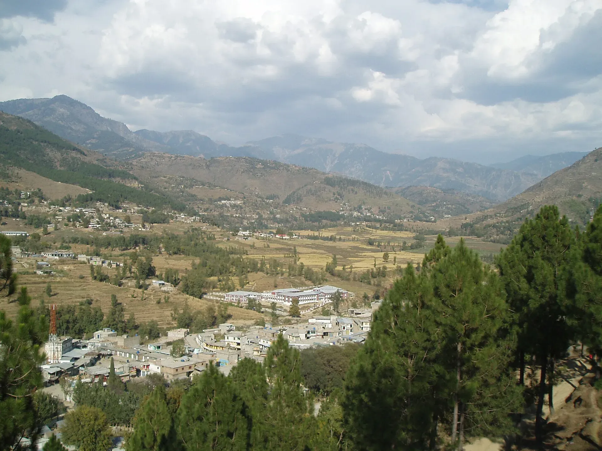
Photo: Zia Ullah Khan, with thanks · Public domain (CC0) · via Wikimedia Commons · temporary stand-in photo

Batagram
District headquarters on the Karakoram Highway side road, about 1,038 m up and about 75 km from Mansehra. A practical stop on the way to Besham and the Allai valley.
Overview
Batagram (also spelt Battagram) is the headquarters of Battagram District in Hazara, at about 1,038 m. Before 1955 the area was part of the historic Yaghistan, an independent territory. It merged into Pakistan in 1955 as a tehsil of Mansehra District, and became a district of its own in July 1993. Wikipedia's Battagram page still lists two tehsils, Battagram and Allai, but Allai was separated and made a district in its own right (January 2023 on the Allai District page; 2022 on the Battagram District page). The current district may therefore have only Battagram tehsil.
The town had 27,083 people in the 2017 census; there is no known 2023 town figure. The district had 335,984 people in the 2023 census, all rural, and it is not clear whether that is before or after Allai was split off.
Plan your visit
- Getting there
Road: about 73 km from Mansehra (OSRM about 1 h, optimistic) and about 56 km from Besham (about 40 min). Buses to Gilgit pass along the KKH. More
Best months
Apr – May, Sep – Oct
- Batagram
- Related places nearby: Mansehra, Besham, Allai Valley, Tikri Valley
People and language
The district's main groups are Gujjar and Pashtun (Swati, Akundkhel and Medakhel). In 2023 about 80 per cent spoke Pashto and 18 per cent Gujari, with small numbers of Hindko and Kohistani speakers. Literacy was 39.09 per cent overall and 23.34 per cent among women. Several schools were built with NGO and foreign funds to raise literacy.
The 2005 earthquake
The 8 October 2005 earthquake hit the district hard. More than 4,500 people were killed and about 35,000 injured in the area, according to Wikipedia. Many residents lost their homes, and as of 2009 reconstruction by NGOs and the Earthquake Reconstruction and Rehabilitation Authority was incomplete, with some people rebuilding their own homes.
What to see and do
Batagram is a stop rather than a destination. The Karakoram Highway passes the district on its way north to Besham, and travellers use the town to eat, fuel up and check road news. The district is green and hilly. Wikipedia names two notable sites in it: the Thakot Bridge over the Indus, and the village of Shingli Bala. See Thakot and Tikri. The Allai valley lies to the north-west.
On 22 August 2023 a chairlift in the Allai valley near Battagram failed when cables snapped, leaving six children and two adults stranded about 274 m above the ground. All eight were rescued the same day after roughly 14 to 15 hours, using army helicopters and local zipline help (Wikipedia, citing BBC, Reuters and Express Tribune). Do not use informal river crossings or ropeways.
Getting there
- From Mansehra: about 73 km, OSRM about 1 hour (optimistic). Wikipedia gives about 75 km from Mansehra city.
- From Besham: about 56 km, OSRM about 40 minutes.
- Buses on the Rawalpindi to Gilgit route use this highway. Ask at the Mansehra or Besham stand for local vans.
When to visit
The climate is humid subtropical, with an average of about 18.5 C and 1,427 mm of rain a year over about 103 wet days. June is the hottest month (about 27.9 C) and January the coldest (about 7.6 C). March and July are the wettest months. Spring and autumn are the best seasons. The monsoon brings landslides.
Where to stay and eat
Basic hotels and restaurants serve highway traffic. Mansehra and Besham have more choice.
Basic services
Hospitals, pharmacies, fuel stations and ATMs are normal in a district headquarters, but none is confirmed for this town from an official source. Ask at your hotel.
Safety and good to know
Ask the district administration or local police about current conditions before you go. For foreign visitors: the UK FCDO (updated 27 October 2026, checked 16 November 2026) advises against all travel on the Karakoram Highway between Mansehra and Chilas via Battagram, Besham City, Dasu and Sazin. This is government advice, not a closure. Read it, check road news with the police, and travel in daylight.
Highlights
- District headquarters in Hazara
- On the road between Mansehra and Besham
- Gateway to the Allai tehsil
Hotels, food, fuel and services in Batagram
Essential services fuel stations, ATMs, pharmacies and hospitals and clinics
Fuel
- PSO Filling Station, KuzabandaMap of PSO Filling Station, Kuzabanda in Google Maps
- Shahzada Filling Station, KuzabandaMap of Shahzada Filling Station, Kuzabanda in Google Maps
ATMs
- Bank Islami ATMMap of Bank Islami ATM in Google Maps
Pharmacies
- Salman Medical StoreCall Salman Medical StoreMap of Salman Medical Store in Google Maps
- Faisal Asad Medical StoreCall Faisal Asad Medical StoreMap of Faisal Asad Medical Store in Google Maps
Hospitals and clinics
- Faizan Medical Complex & Meternity HomeCall Faizan Medical Complex & Meternity HomeMap of Faizan Medical Complex & Meternity Home in Google Maps
- Rizwan General and Surgical HospitalMap of Rizwan General and Surgical Hospital in Google Maps
Listings come from Google Maps data and are unverified: phone numbers, opening months and prices may have changed. Report a problem · Own one of these? Claim it
Tips
- Read the FCDO advice on the Karakoram Highway before you go.
- Travel in daylight.
- Fuel and eat before heading north.
- Do not use informal ropeways or cable crossings.
Photos we still need: a street or bazaar scene in Battagram town. Send us yours
Sources and last checked
Last checked Confidence medium6 sources2 still to check
- Last checked
- Method
- Desk research from published sources
- Confidence
- medium
- Checked by
- trek.pk research team
Researched from published sources; not yet checked on the ground by our team. Spot something out of date? Report a mistake.
Sources
- Battagram · Wikipedia · checked
- Battagram District · Wikipedia · checked
- 2023 Battagram cable car incident · Wikipedia · checked
- Pakistan travel advice (updated 27 October 2026) · UK Foreign, Commonwealth & Development Office · checked
- OSRM driving route service: distances and times measured 16 November 2026 (times are optimistic, without stops) · OSRM / OpenStreetMap · checked
- Allai District · Wikipedia · checked
Still to be checked on the ground (2)
- Town-level 2023 population (2017 figure is 27,083; district 2023 figure unclear after the Allai split)
- Current hotels, fuel, ATMs and hospital (Wikipedia mentions only a DHQ hospital)
Nearby and related

Mansehra
The headquarters of Mansehra District in Hazara, famous for the Ashoka rock edicts near the city. A big market town and the usual stop before Balakot, Naran and the Karakoram Highway.

Besham
A busy Indus-side town and junction on the Karakoram Highway at about 613 m, long used as the first overnight stop from Islamabad towards Gilgit and Hunza.

Khyber Pakhtunkhwa
Mountains, Buddhist ruins and old bazaars in north-west Pakistan: Swat, Kaghan, Chitral, the Kalash valleys, the Khyber Pass and Peshawar.
Allai Valley
A rural valley in the Pakhli region of Khyber Pakhtunkhwa between the Indus and the Kaghan side ranges, in the Allai tehsil formerly part of Battagram. Not set up for tourism.
Tikri Valley
A town and valley south of Battagram, about 15 km from the district headquarters according to Wikipedia. A rural area with no confirmed visitor services.