

Photo: Muhammad Zahir, with thanks · CC BY-SA 3.0 · via Wikimedia Commons · temporary stand-in photo

Mansehra
The headquarters of Mansehra District in Hazara, famous for the Ashoka rock edicts near the city. A big market town and the usual stop before Balakot, Naran and the Karakoram Highway.
Overview
Mansehra is a city in the Hazara division and the headquarters of Mansehra District. Wikipedia describes it as the seventh most populous city in the province. The district was formed in 1976, and Battagram split off in 1993. The district had 1,797,177 people in the 2023 census (Wikipedia). Wikipedia gives the city 137,278 residents in the 2023 census (the census tables themselves were not opened).
Plan your visit
- Getting there
Road: about 130 km from Islamabad (OSRM about 1 h 40 min, optimistic), about 25 km from Abbottabad (about 25 min) and about 40 km from Balakot (about 30 min). Buses run from Rawalpindi. More
Best months
Apr – May, Sep – Oct
- Mansehra
- Related places nearby: Abbottabad, Balakot, Kaghan Valley (with Naran), Besham, Islamabad, Torghar District, Konsh Valley, Thakot, Oghi
History in brief
The area was part of the Gandhara kingdom and the Mauryan empire, and Ashoka governed it as a prince around 272 BCE. The Kushan ruler Kanishka reigned from nearby Purushapura, and Buddhist art flourished. The last great Gandharan dynasty, the Hindu Shahis, lost Peshawar to the Ghaznavids in 1001. The region was known as Pakhli and took the name Hazara after Timur's invasion in 1399. Hari Singh Nalwa conquered Hazara for the Sikhs in 1818 and founded Haripur. Mahan Singh Hazarawala later founded the modern town of Mansehra, after 1837. The British took Hazara after the First Anglo-Sikh War in 1846, and it moved from Punjab to the North-West Frontier Province in 1901. Mansehra became a district headquarters in October 1976.
What to see and do
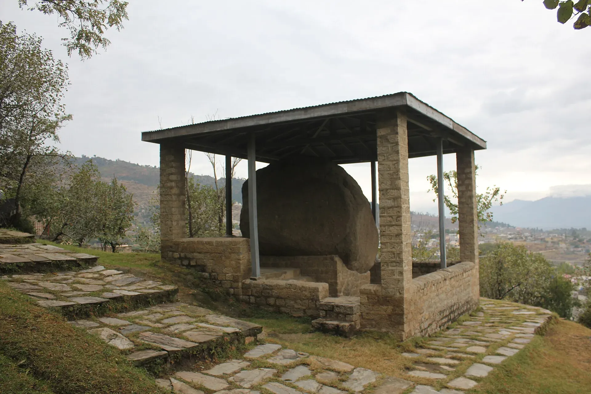
The main sight is the Mansehra Rock Edicts: three boulders near the city carved with fourteen edicts of the emperor Ashoka, in the Kharosthi script, dated to the middle of the 3rd century BCE (Wikipedia). They are among the earliest deciphered writing in the subcontinent, and the site is at the base of Bareri Hill. The edicts are cut into an outcrop near the Karakoram Highway, on the old Silk Route, with Abbottabad close by to the east. They discuss aspects of Ashoka's dharma (moral law). Wikipedia does not say which edicts are on which boulder. There is also an old Shiva temple in town, which hosts an annual Shivarathri festival. Hashri, a grass-cutting festival with dhol drumming, is also held each year and is linked to Zaman Khan Jahangiri Swati. The rocks are protected by the Department of Archaeology, which has put canopies over them, but weathering is fading the script (Wikipedia). The site has been on Pakistan's UNESCO tentative list since 2004. Ask locally about access and opening.
Mansehra is at about 1,088 m. Hindko is the main language (79 percent of residents in 2023), followed by Pashto (11 percent). Mansehra is also a market town and a base for the Kaghan Valley, Balakot and the road up to Naran.
Getting there
- From Islamabad: about 130 km, OSRM about 1 hour 40 minutes (optimistic).
- To Abbottabad: about 25 km, OSRM about 25 minutes.
- To Balakot: about 40 km, OSRM about 30 minutes.
- Buses and vans run from Rawalpindi, Peshawar and Abbottabad.
When to visit
Spring and autumn are comfortable. Parts of Hazara, including Mansehra, receive up to about 1,750 mm of rain a year, over half of it in the monsoon (Wikipedia, Khyber Pakhtunkhwa). Summers can be hot, and the monsoon brings landslides to the roads north.
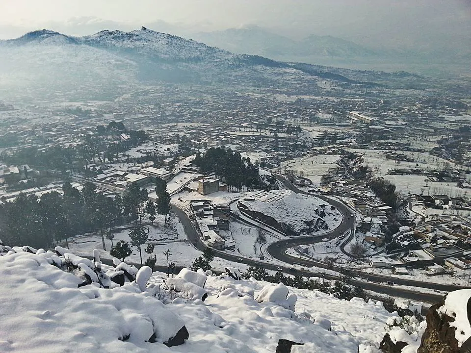
Photo: Usman Waheed, with thanks · CC BY-SA 4.0 · via Wikimedia Commons · temporary stand-in photo

Where to stay and eat
There are many hotels, restaurants and tea stalls. For Kaghan travel, most people stay in Balakot, Naran or Abbottabad.
Basic services
Mansehra is a large town, so a hospital, pharmacies, fuel and ATMs are likely. Hospitals, pharmacies, fuel stations and ATMs are normal in a district headquarters, but none has been confirmed for this town from an official source. Ask at your hotel, and use the business listings on this site.
Safety and good to know
Ask the district administration or local police about current conditions before you go. For foreign visitors: the UK FCDO (updated 27 October 2026, checked 16 November 2026) does not name Mansehra District, but advises against all travel on the Karakoram Highway between Mansehra and Chilas. This is government advice, not a closure. Read it, and check road news before you head north.
Highlights
- Ashoka rock edicts, 3rd century BCE
- Gateway to Balakot and the Kaghan Valley
- Major market town of Hazara
Hotels, food, fuel and services in Mansehra
Places to stay
- Hidden Hills Hotel & ResortCall Hidden Hills Hotel & ResortMap of Hidden Hills Hotel & Resort in Google Maps
- Jaba Towers Hotel MansehraCall Jaba Towers Hotel MansehraMap of Jaba Towers Hotel Mansehra in Google Maps
- RED ROSE HOTEL & RESORT MANSEHRACall RED ROSE HOTEL & RESORT MANSEHRAMap of RED ROSE HOTEL & RESORT MANSEHRA in Google Maps
- Sky Inn Hotel And MotelMap of Sky Inn Hotel And Motel in Google Maps
Places to eat
- BaithakCall BaithakMap of Baithak in Google Maps
- Food HutCall Food HutMap of Food Hut in Google Maps
- Balochi Sajji House mansehraCall Balochi Sajji House mansehraMap of Balochi Sajji House mansehra in Google Maps
- Sunny Sweets & BakersCall Sunny Sweets & BakersMap of Sunny Sweets & Bakers in Google Maps
- Bake HouseCall Bake HouseMap of Bake House in Google Maps
- Royal bakersCall Royal bakersMap of Royal bakers in Google Maps
Essential services fuel stations, mechanics, ATMs, pharmacies and hospitals and clinics
Fuel
- Attock Petrol PumpMap of Attock Petrol Pump in Google Maps
- Attock Petrol PumpCall Attock Petrol PumpMap of Attock Petrol Pump in Google Maps
- Nawaz Khan CNG StationMap of Nawaz Khan CNG Station in Google Maps
- Islamabad Gas StationMap of Islamabad Gas Station in Google Maps
- Kent CNG StationMap of Kent CNG Station in Google Maps
- PSO Petrol StationMap of PSO Petrol Station in Google Maps
Mechanics and tyre shops
- Tannan oil change, Wheel Alignment, balancing, Tunning & Battery shop 10 minute serviceCall Tannan oil change, Wheel Alignment, balancing, Tunning & Battery shop 10 minute serviceMap of Tannan oil change, Wheel Alignment, balancing, Tunning & Battery shop 10 minute service in Google Maps
- AZIZ AUTOSMap of AZIZ AUTOS in Google Maps
- M. Rafiqu AutosCall M. Rafiqu AutosMap of M. Rafiqu Autos in Google Maps
ATMs
- HBLMap of HBL in Google Maps
- NATIONAL BANK OF PAKISTANMap of NATIONAL BANK OF PAKISTAN in Google Maps
- Summit BankCall Summit BankMap of Summit Bank in Google Maps
- Muslim Commercial BankCall Muslim Commercial BankMap of Muslim Commercial Bank in Google Maps
- The Bank Of PunjabMap of The Bank Of Punjab in Google Maps
Pharmacies
- Bilal PlazaCall Bilal PlazaMap of Bilal Plaza in Google Maps
- Faisal Chemist 2Call Faisal Chemist 2Map of Faisal Chemist 2 in Google Maps
- Agha Jee MedicoseCall Agha Jee MedicoseMap of Agha Jee Medicose in Google Maps
- Mansehra Medical StoreCall Mansehra Medical StoreMap of Mansehra Medical Store in Google Maps
- Al madina medical store abbottabad road mansehraMap of Al madina medical store abbottabad road mansehra in Google Maps
- Hafiz medical storeCall Hafiz medical storeMap of Hafiz medical store in Google Maps
Hospitals and clinics
- Mehboob Charity Vision Eye and General HospitalCall Mehboob Charity Vision Eye and General HospitalMap of Mehboob Charity Vision Eye and General Hospital in Google Maps
- Irfan Neuro Psychiatry & General Hospital MansehraCall Irfan Neuro Psychiatry & General Hospital MansehraMap of Irfan Neuro Psychiatry & General Hospital Mansehra in Google Maps
- China Health CentreCall China Health CentreMap of China Health Centre in Google Maps
- Shifa Surgical CentreCall Shifa Surgical CentreMap of Shifa Surgical Centre in Google Maps
- Township MansehraCall Township MansehraMap of Township Mansehra in Google Maps
- JOHN's HEALTH CARE CENTER جوہنز ہیلتھ کئیر سنٹرCall JOHN's HEALTH CARE CENTER جوہنز ہیلتھ کئیر سنٹرMap of JOHN's HEALTH CARE CENTER جوہنز ہیلتھ کئیر سنٹر in Google Maps
Listings come from Google Maps data and are unverified: phone numbers, opening months and prices may have changed. Report a problem · Own one of these? Claim it
Tips
- Ask locally for the edicts site and opening times.
- Check the FCDO advice for the KKH north of Mansehra.
- Check road news before driving to Naran or Besham.
- Carry cash for smaller towns.
Photos we still need: Shiva temple at Mansehra; Mansehra bazaar. Send us yours
Sources and last checked
Last checked Confidence medium7 sources4 still to check
- Last checked
- Method
- Desk research from published sources
- Confidence
- medium
- Checked by
- trek.pk research team
Researched from published sources; not yet checked on the ground by our team. Spot something out of date? Report a mistake.
Sources
- Mansehra · Wikipedia · checked
- Mansehra District · Wikipedia · checked
- Pakistan travel advice (updated 27 October 2026) · UK Foreign, Commonwealth & Development Office · checked
- OSRM driving route service: distances and times measured 16 November 2026 (times are optimistic, without stops) · OSRM / OpenStreetMap · checked
- Mansehra Rock Edicts · Wikipedia · checked
- List of World Heritage Sites in Pakistan · Wikipedia · checked
- Khyber Pakhtunkhwa (Hazara climate) · Wikipedia · checked
Still to be checked on the ground (4)
- Site access, opening hours and any fee for the rock edicts (not covered in any opened source)
- Population: 137,278 is Wikipedia's 2023 city figure; PBS census tables not opened
- Hotels and services
- Wikipedia does not say which of the fourteen edicts are on which boulder, or give directions to the site; confirm on the ground
Nearby and related

Abbottabad
A cool, green cantonment city at about 1,256 m in Hazara, the military academy town and the main gateway to Nathia Gali, Thandiani, Ayubia National Park and the Kaghan Valley.

Balakot
The gateway to the Kaghan Valley, on the Kunhar River in Mansehra District. Balakot was destroyed in the 2005 earthquake and is the last big town before Naran, Shogran and Siri Paye.

Kaghan Valley (with Naran)
A 155 km Himalayan valley above Balakot along the Kunhar River, with Shogran, Naran, Saiful Muluk and Lulusar lakes, and the road to Babusar Pass. Open mainly from May to October.

Besham
A busy Indus-side town and junction on the Karakoram Highway at about 613 m, long used as the first overnight stop from Islamabad towards Gilgit and Hunza.

Islamabad
Pakistan's green, planned capital at the foot of the Margalla Hills: Faisal Mosque, hillside trails, cafes and the gateway to the north.

Khyber Pakhtunkhwa
Mountains, Buddhist ruins and old bazaars in north-west Pakistan: Swat, Kaghan, Chitral, the Kalash valleys, the Khyber Pass and Peshawar.

Torghar District
Torghar, once called Kala Dhaka or the Black Mountain, is a small rural district in Hazara, Khyber Pakhtunkhwa, with its headquarters at Judba. It has no developed visitor facilities. Not the same as the Torghar markhor conservancy in Balochistan.
Konsh Valley
A valley on the northern side of Mansehra District with Battal as its headquarters. The Karakoram Highway runs through it. Mostly a local farming area.
Thakot
A small Indus-side town in Battagram District, Khyber Pakhtunkhwa, at about 536 m. UK advice is against all travel on the Karakoram Highway between Mansehra and Chilas.
Oghi
The main town of the Agror Valley in Mansehra District, Khyber Pakhtunkhwa, once the seat of the Khan of Agror. Few visitor facilities.

Naran, Kaghan and Babusar
A 4-day summer road trip from Islamabad up the Kaghan valley to Naran, Saiful Muluk and Lulusar Lake, over Babusar Pass (4,173 m) to Chilas on the KKH.