

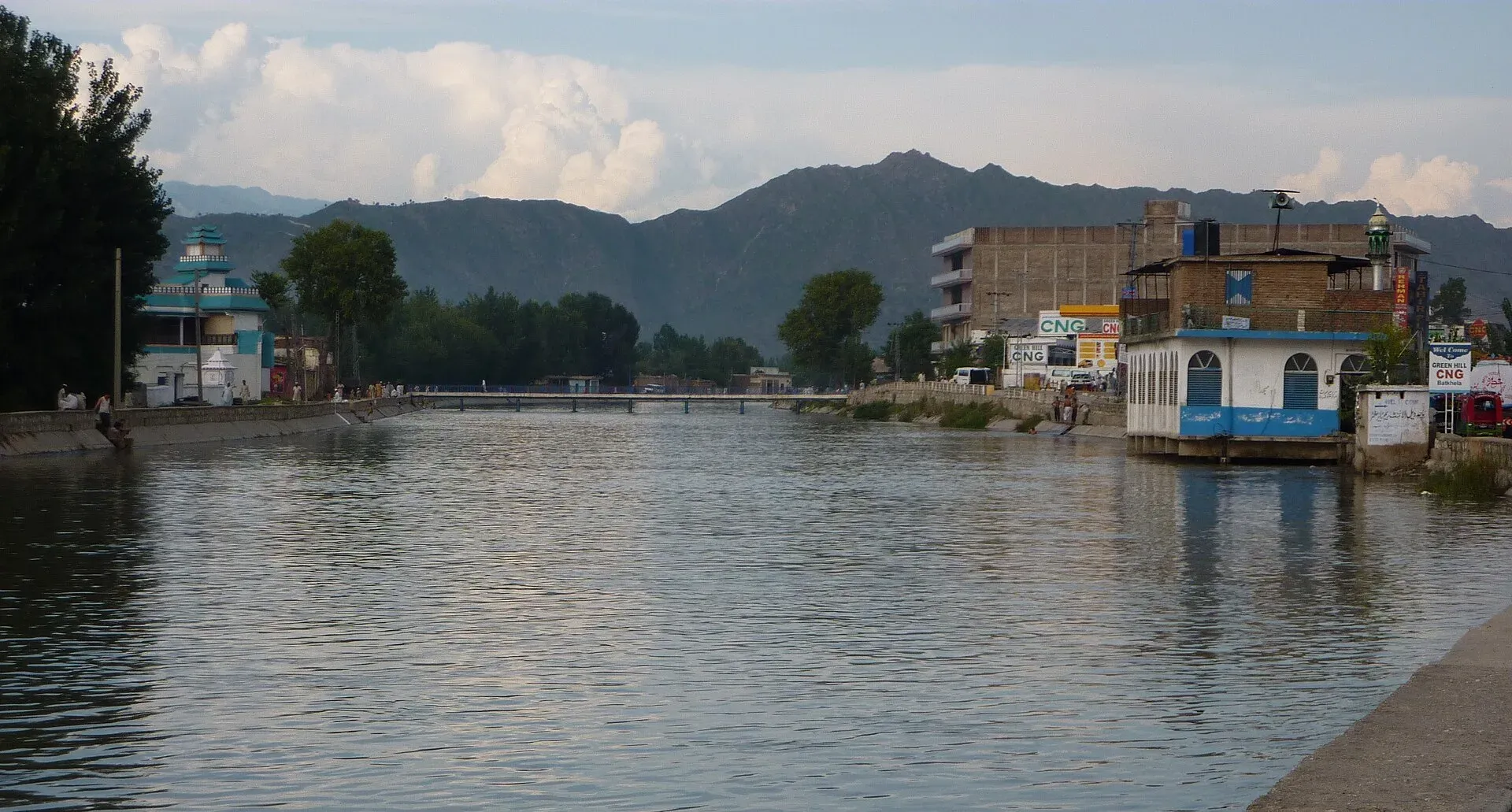
Photo: Dr. Ibrahim, with thanks · CC BY-SA 3.0 · via Wikimedia Commons · temporary stand-in photo

Batkhela
Headquarters of Malakand District on the N-45 road to Swat, known for a long bazaar and its canals. A busy trading town, mainly a stop on the way north.
Overview
Batkhela is the district headquarters of Malakand District in Khyber Pakhtunkhwa. The 2023 census counted 73,525 people, up from 68,200 in 2017. It stands at about 648 m on the N-45 road between the Malakand Pass and Swat, in a valley ringed by hills; Barcharai is the best known of them. A water canal runs beside the main road. Local police are called Levies.
Plan your visit
- Getting there
Road: about 139 km from Peshawar (OSRM about 1 h 45 min, optimistic) and about 50 km from Mingora (about 55 min), on the N-45. More
Best months
Mar – May, Oct – Nov
- Batkhela
- Related places nearby: Saidu Sharif, Swat Valley, Peshawar
History in brief
Local tradition links the area to the army of Mahmud of Ghazni: a commander named Pir Khushal is said to have attacked here, and many of his soldiers drowned in a marsh at Gheli. Survivors settled and influenced local culture and religion.
In the early 17th century the Yusufzai Pashtuns moved into Swat and made the Thana region their administrative base. The British invaded in March 1895 and set up the Malakand Agency. They built roads, forts, canals and the Jabban hydropower station. The Amandara Head Works, built in 1912, still irrigates land in Mardan, Swabi and Lower Dir. The first primary school opened in 1915.
The bazaar and local landmarks
Batkhela is a trading town. Its main bazaar is more than 4 km long, and Wikipedia calls it the longest bazaar in Asia (this is a local claim, attributed to a 2006 Pattan Development Organization report and a 1995 source). The canal alongside the N-45 runs through the town.
Other landmarks are the Amandara head works and the Jabban hydropower area, where a canal feeds a small dam. The Benton Tunnel, known locally as Tandail, is also listed. The district hospital is the Batkhela General Civil Headquarters Hospital.
Most people are Pashtun (over 95 per cent). Chakdara and Temargara lie to the north, Dargai and Mardan to the west, Barikot and Mingora to the east and Palai to the south. The ridge to the south, the Malakand Pass, is a historic frontier crossed by travellers going to Swat and Dir; see Malakand Pass.
Getting there
- From Peshawar: about 139 km, OSRM about 1 hour 45 minutes (optimistic, and the Malakand Pass road is slow).
- From Mingora (Swat): about 50 km, OSRM about 55 minutes.
- Buses and vans run on the N-45 between Peshawar, Dargai and Swat.
When to visit
Spring and autumn are comfortable. Summers are hot on the valley floor. Check road news in the monsoon.
Where to stay and eat
Expect simple hotels and many roadside restaurants. Most visitors sleep in Swat or Peshawar.
Basic services
Hospitals, pharmacies, fuel stations and ATMs are normal in a district headquarters, but none has been confirmed for this town from an official source. Ask at your hotel.
Safety and good to know
Ask the district administration or local police about current conditions before you go. For foreign visitors: the UK FCDO (updated 27 October 2026, checked 16 November 2026) advises against all but essential travel to Malakand, and against all travel on the N-45 from the north of the Mardan ring road to the edge of Chitral city, which includes this road. It also advises against all travel to Swat and to Upper and Lower Dir. This is government advice, not a closure. Read it in full, and check with local police and your hotel.
Highlights
- Headquarters of Malakand District
- Long bazaar beside a canal
- On the N-45 below the Malakand Pass
Hotels, food, fuel and services in Batkhela
Places to stay
- Fishing HutCall Fishing HutMap of Fishing Hut in Google Maps
- Dir HouseMap of Dir House in Google Maps
Places to eat
- Khurak MahalCall Khurak MahalMap of Khurak Mahal in Google Maps
- River Swat RestaurantCall River Swat RestaurantMap of River Swat Restaurant in Google Maps
- Shah Hakeem TikkaMap of Shah Hakeem Tikka in Google Maps
- Marina HotelCall Marina HotelMap of Marina Hotel in Google Maps
- Andaz Pizza Palace : Fast Food RestaurantCall Andaz Pizza Palace : Fast Food RestaurantMap of Andaz Pizza Palace : Fast Food Restaurant in Google Maps
- Badwan Chapli KababCall Badwan Chapli KababMap of Badwan Chapli Kabab in Google Maps
Essential services fuel stations, mechanics, ATMs, pharmacies and hospitals and clinics
Fuel
- Haji Nawab Filling Station - Attock PetroleumMap of Haji Nawab Filling Station - Attock Petroleum in Google Maps
- United 2 CNG StationMap of United 2 CNG Station in Google Maps
- Attock pump⛽Call Attock pump⛽Map of Attock pump⛽ in Google Maps
- Hayat Khan Filling Station | PSOCall Hayat Khan Filling Station | PSOMap of Hayat Khan Filling Station | PSO in Google Maps
- Tahir Filling Station (Attock Petroleum)Call Tahir Filling Station (Attock Petroleum)Map of Tahir Filling Station (Attock Petroleum) in Google Maps
- Bacha LPG Filling Station Pulsauki ChakdaraCall Bacha LPG Filling Station Pulsauki ChakdaraMap of Bacha LPG Filling Station Pulsauki Chakdara in Google Maps
Mechanics and tyre shops
- Noor Autos BatkhelaCall Noor Autos BatkhelaMap of Noor Autos Batkhela in Google Maps
- Car Repair Parts & Maintenace MarketMap of Car Repair Parts & Maintenace Market in Google Maps
ATMs
- Allied Bank LimitedCall Allied Bank LimitedMap of Allied Bank Limited in Google Maps
- Askari Bank ATMMap of Askari Bank ATM in Google Maps
- National Bank of Pakistan (NBP)Call National Bank of Pakistan (NBP)Map of National Bank of Pakistan (NBP) in Google Maps
Pharmacies
- Raheem PharmacyCall Raheem PharmacyMap of Raheem Pharmacy in Google Maps
- Rehman MedicosCall Rehman MedicosMap of Rehman Medicos in Google Maps
- Ever Green Medical StoreCall Ever Green Medical StoreMap of Ever Green Medical Store in Google Maps
Hospitals and clinics
- Gulrang International HospitalCall Gulrang International HospitalMap of Gulrang International Hospital in Google Maps
- Batkhela International HospitalCall Batkhela International HospitalMap of Batkhela International Hospital in Google Maps
- Waseem Medical ComplexCall Waseem Medical ComplexMap of Waseem Medical Complex in Google Maps
- Siraj Shaheed Hospital Batkhela LLPCall Siraj Shaheed Hospital Batkhela LLPMap of Siraj Shaheed Hospital Batkhela LLP in Google Maps
- Allen Homeo ClinicCall Allen Homeo ClinicMap of Allen Homeo Clinic in Google Maps
Listings come from Google Maps data and are unverified: phone numbers, opening months and prices may have changed. Report a problem · Own one of these? Claim it
Tips
- Read the FCDO advice for Malakand and the N-45 before you plan.
- Travel in daylight.
- Keep a copy of your passport and visa.
- Check road news before crossing the Malakand Pass.
Photos we still need: the main bazaar; the Amandara head works or Jabban area. Send us yours
Sources and last checked
Last checked Confidence medium4 sources2 still to check
- Last checked
- Method
- Desk research from published sources
- Confidence
- medium
- Checked by
- trek.pk research team
Researched from published sources; not yet checked on the ground by our team. Spot something out of date? Report a mistake.
Sources
- Batkhela · Wikipedia · checked
- Malakand District · Wikipedia · checked
- Pakistan travel advice (updated 27 October 2026) · UK Foreign, Commonwealth & Development Office · checked
- OSRM driving route service: distances and times measured 16 November 2026 (times are optimistic, without stops) · OSRM / OpenStreetMap · checked
Still to be checked on the ground (2)
- Current hotels, fuel and ATMs
- Pass road condition
Nearby and related

Saidu Sharif
The administrative town of Swat, joined to the bazaar city of Mingora, with the ancient Butkara stupa, the Swat Museum of Gandhara art, a Sufi shrine and the road into the Swat valley.

Swat Valley
A long green river valley in northern Khyber Pakhtunkhwa, with Gandhara Buddhist sites, orchards, hill towns and the road up to Kalam. Check the current security advice before you plan a trip.

Peshawar
Khyber Pakhtunkhwa's capital and one of South Asia's oldest living cities: the Gandhara museum, Qissa Khwani Bazaar, mosques and a strong food culture.

Khyber Pakhtunkhwa
Mountains, Buddhist ruins and old bazaars in north-west Pakistan: Swat, Kaghan, Chitral, the Kalash valleys, the Khyber Pass and Peshawar.